Map size in jpg-format: 1.24623MiB
Click to open in high resolution (open in new tab).
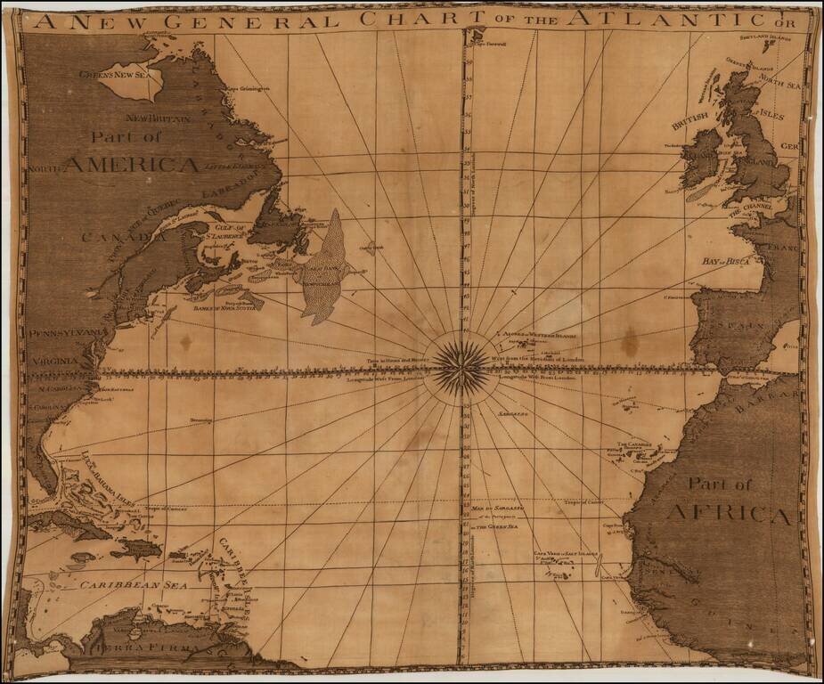
Unrecorded map of the Atlantic Ocean, printed on linen, likely published in London about 1780.
The title of the map and its style and nomenclature are very similar to the 1777 edition of Sayer & Bennett's A New General Chart of the Atlantic or Western Ocean and Adjacent Seas. Only the first edition of the map references "Green's New Sea.": http://www.gettyimages.com/detail/illustration/north-america-a-new-general-chart-of-the-atlantic-or-stock-graphic/114591721
We are not aware of the appearance of this name "Green's New Sea" on any other map. The reference to Green is almost certainly Braddock Mead (aka John Green), a troubled but brilliant mapmaker who produced some of Jefferys' finest maps. Cummings describes their collaboration in British Maps of Colonial America:
[Thomas Jefferys] was the leading British chart and mapmaker of his day, and his work contributed toward making London the 'universal centre of cartographic progress.' An engraver as well as a publisher, he turned out an impressive number of maps and charts…. With William Faden, his successor, he produced the most considerable body of North American maps published commercially in the century. The genius behind Jefferys in his shop was a brilliant man who at this time went by the alias of John Green…. Green had a number of marked characteristics as a cartographer. One was his ability to collect, to analyze the value of, and to use a wide variety of sources; these he acknowledged scrupulously on the maps he designed…. Another outstanding characteristic was his intelligent compilation and careful evaluation of reports on latitudes and longitudes used in the construction of his maps… (p. 45)For an interesting account of Mead's scandalous life, see Cummings, pp. 45-47.
We have been unable to locate any information regarding the map or its maker. Even its style is unique for the period.
If you are a student, write to us in telegram: @antiquemaps and indicate what material you need and for what work you need a map in high detail. We are ready to provide material on special terms. For students only!


