![[Persia and the Middle East]](/map/small/63394kb.jpg)
Interesting circa 1930 map of Turkey, Iran, and the Middle East, in Ottoman Turkish. The map has insets of the Middle East and Iran, northern Greece, and elsewhere.
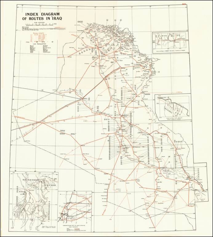
A detailed map of Iraq, produced shortly after the country's independence in 1932. The map shows routes, runways, and military installments, and was likely used in part for military purposes. Three insets detail bridges and routes in specific areas and...
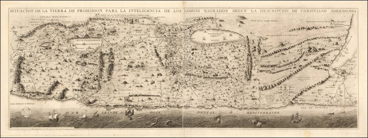
Rare Spanish Edition Rare separately issued Spanish edition of Christian Van Adrichom's map of the Holy Land, first published in Cologne in 1584. Little is known about this finely engraved Spanish edition of Van Adrichom's map. While Spanish editions...
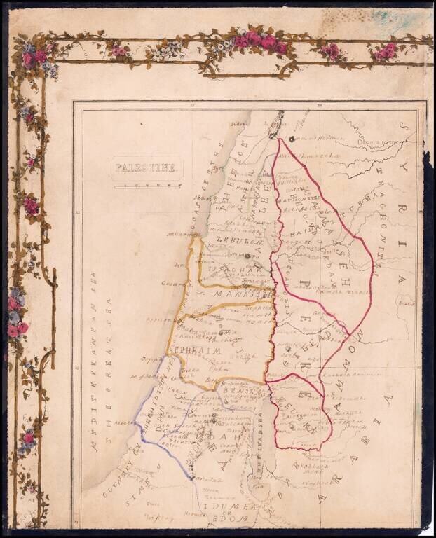
Hand Drawn Antique Map of Palestine / Holy Land Detailed map of Palestine, divided by the Tribes of Israel, with a partial decorative border.
![[An Irgun Modified Map of Palestine and the Middle East]](/map/small/68844.jpg)
The Irgun Repurposes a British Arabic Language Broadside To Warn Against The British-Arab "Conspiracy" Color-lithographed map of the Middle East as one great Arab kingdom, with the Royal Navy and British merchant vessels sailing in the Red Sea and...
![[Manuscript Map of Nile River Expedition in 1855]](/map/small/61011.jpg)
Hand Drawn Antique Map of the Nile from the Cataracts to Alexandria Detailed map of the Nile River from Alexandria to the Cataracts and the Nubia-Egypt border, illustrating the travels of an English expedition up and down the Nile and from January 12,...
![[Christian Conquest and Fortification of Djerba in 1560] Aviso Del Successo Del Arm'ata De Christiani che si truova in Barberia, & della presa del Gerbi diretta al. S. Comendator Cambiano dal S. Paulo de la gesia Comedator; et secretario del R.S. gran Ma](/map/small/61878.jpg)
Rare Broadside Showing the Fortifications of Djerba After the Christian Victory in 1560 Rare broadside plan of walled fortifications on Djerba, published shortly after the successful taking of the island by a multi-national Christian force in early...
Interesting map of the Region being explored by the British in the second half of the 18th Century, with many up to date discoveries and place names.
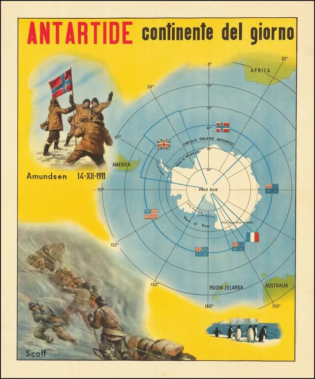
The Race for The South Pole Fine large, early twentieth-century Italian image illustrating the race for the South Pole and a map of Antarctica. The map depicts the race for the South Pole, where explorers from various nations sought to be the first...
![[Early French Engaving: Title Page] Repertorium in Lecturas Iasonis. Index Ordinae Elementario Digesus in Commentaria Iasonis Mayni Mediolanesis . . . M.D. XLIX.](/map/small/31927.jpg)
Finely illustrated title page from this early French book on the commentaries of Giasone del Maino, published in Lyon, by Jean Pullon in 1549. The title page is printed in red and black within a woodcut border, and with a woodcut of Maino with his...
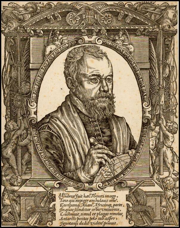
Rare early portrait of Andre Thevet, showing Thevet measuring a globe. André de Thevet (1516 - November 23, 1590) was a French Franciscan priest, explorer, cosmographer and writer who travelled to Brazil in the 16th century. He described the country,...

Fine copper plate engraving portrait of the famous geographer Petrus Bertius (1565 -1629). Bertius became famous as geographer with his editions of Ptolemy’s Geographia (first edition 1618-19 at Jodocus Hondius the younger) and with his pocket...
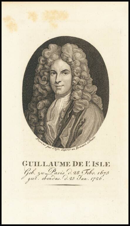
Finely engraved portrait of Guillaume de L'Isle (1675-1726), a cartographic prodigy who drew his first map aged nine. De L'Isle was elected to the French Academie Royale des Sciences at 27 and at 38 he became the first "Premier Geographe du Roi",...
![[General George Washington]](/map/small/62386.jpg)
Striking full length portrait of a uniformed General George Washington, standing atop a hillside, with a battle scene from the American Revolutionary War raging on either side. Drawn from an unknown source. Handwriting on the verso suggests that it...
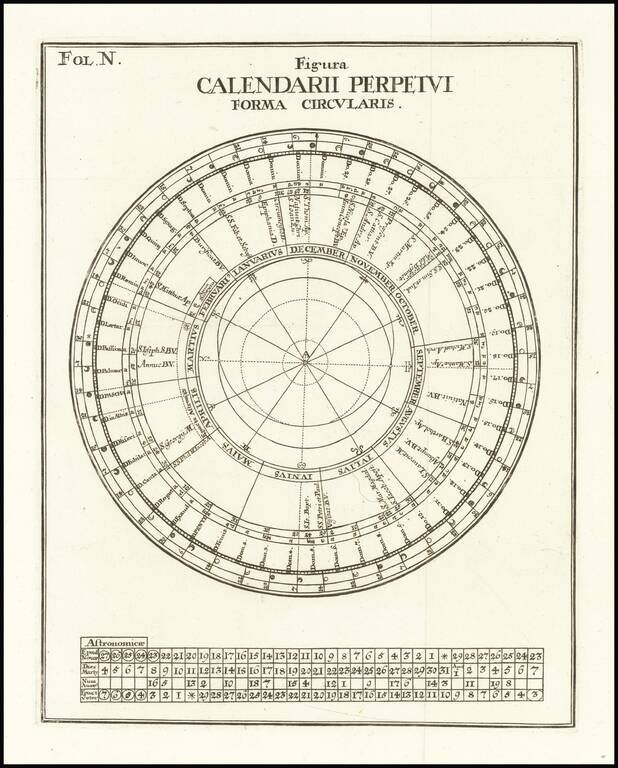
Fine Example of a Perpetual Calendar Circular figure showing a perpetual calendar, which was used to calculate future dates and events. The concentric circles of the diagram contain important information for figuring time, including zodiac signs,...