Map size in jpg-format: 55.8737MiB
Click to open in high resolution (open in new tab).

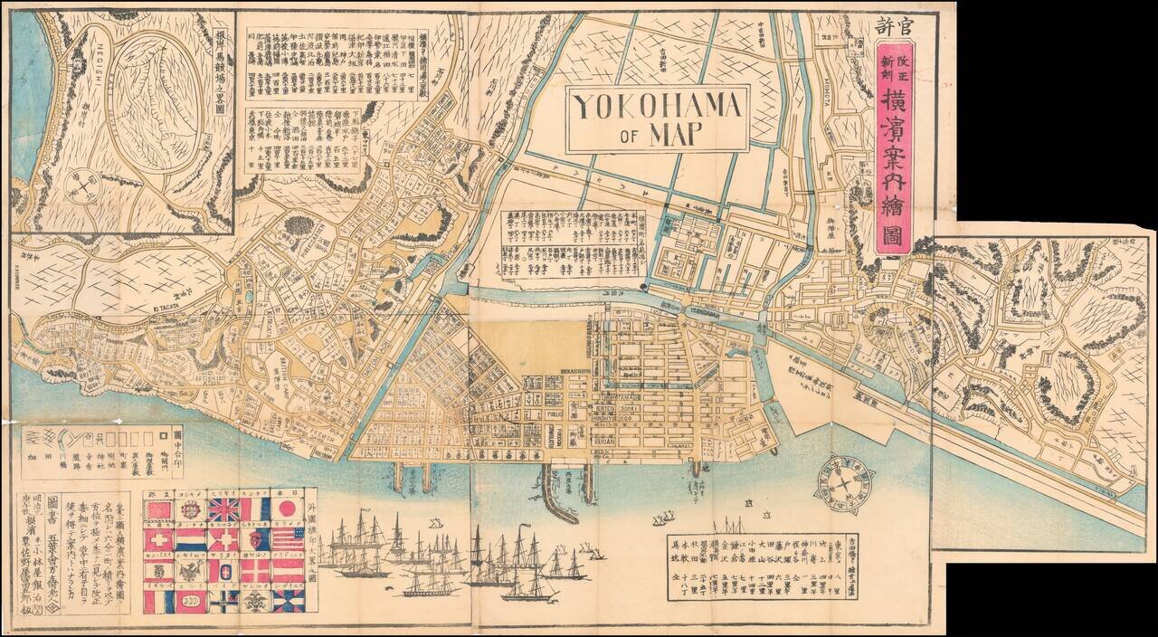
Wonderful Richly Illustrated Map of Yokohama, Featuring Flags of Foreign Nations and a Wonderful Malapropism "Yokohama of Map".
Color woodblock map of the trading port of Yokohama, highlighting trade with foreign nations that flourished under the Meiji Restoration.
The map shows foreign consulates, British and French “camps” and legations, and the Negishi raceground. The U.S. flag is one of those featured in the inset at lower left.
A foldout shows the eastward development of the city.
If you are a student, write to us in telegram: @antiquemaps and indicate what material you need and for what work you need a map in high detail. We are ready to provide material on special terms. For students only!
![[First Map of the American Continent] Tavola dell' isole nuove, le quali son nominate occidentali, & indiane per diversi rispetti.](/map/small/67312.jpg)

![[English Edition!] Maris Pacifici quod vulgo Mar del Zud](/map/small/71000.jpg)