logo

1972. Київ Ілюстрована Схема (Illustrated Map of Kiev)

  • Київ Ілюстрована Схема (Illustrated Map of Kiev)

Київ Ілюстрована Схема (Illustrated Map of Kiev) information:

Year of creation: 
Resolution size (pixels): 
 3427x2318 px
Disk Size: 
 1.98221MiB
Number of pages: 
 1
Place: 
 Kiev
Author: 

Print information. Print size (Width x height in inches):
Printing at 72 dpi 
  47.6 х 32.19
Printing at 150 dpi 
 22.85 х 15.45
Printing at 300 dpi 
 11.42 х 7.73

An example of detailing the file of this map of in a printable high-resolution:

Click to open in high resolution (open in new tab).
Attention! this is just the central piece (central area 960x960 px) of the map file!
This is an example, so that you can see and study the level of detail of a given map. The entire Map will be fully available after payment!

Київ Ілюстрована Схема (Illustrated Map of Kiev)

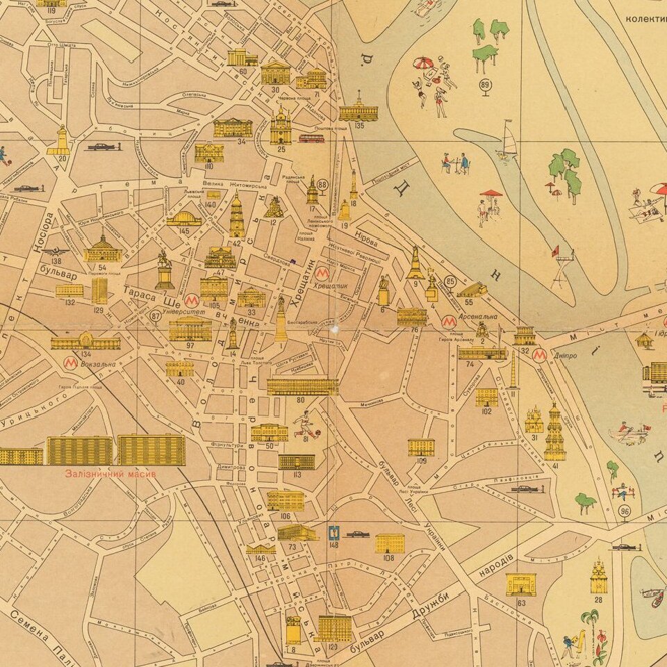
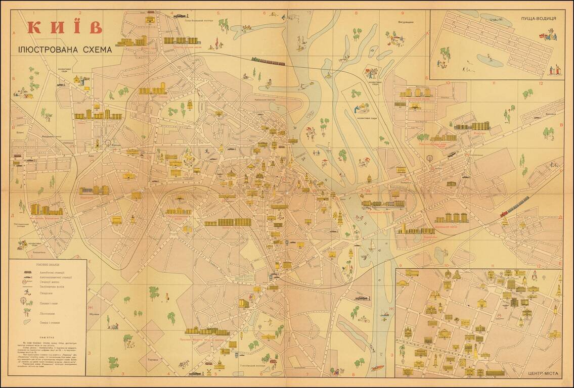
Attractive illustrated Soviet-era map of Kiev, with text in Ukrainian, especially highlighting areas of interest to tourists.

The inset at the lower right shows the "ЦЕНТР МІCТА" (Downtown), the inset at upper right shows "ПУЩА-ВОДИЦЯ" -- the Pushcha-Vodytsia neighborhood and resort area.

  • Автобусні станції (Bus station)
  • Автозаправочні станчії (Service station)
  • станчії метро (Metro station)
  • Залізнична колія (Railway)
  • Стадіони (Stadium)
  • Лісопарки (Forest park)
  • Парки і сади (Parks and gardens)
  • Озера і ставки (Lakes and ponds)

The map also illustrates a large number of housing estates (масив) and monuments.

The map is dated on verso.

The back of the map includes detailed keys in Russian, Ukrainian, English, German, and French.


Special conditions for students!

If you are a student, write to us in telegram: @antiquemaps and indicate what material you need and for what work you need a map in high detail. We are ready to provide material on special terms. For students only!

Item information:

Year of creation:
Size:
3427x2318 px
Disk:
1.98221MiB
Number of pages:
1
Place:
Kiev
Author:
Anonymous.
$14.99

Related item