![[Imperial & Coachella Valley Advertising Map -- Valerie Jean Date Shop]](/map/small/69651.jpg)
Interesting advertising map, promoting Valerie Jean's Date Shop, the first retail establishment to sell dates produced in the Coachella Valley, beginning in about 1935. The map is also of note for its location of Hilton's Art Studio, the workshop of...
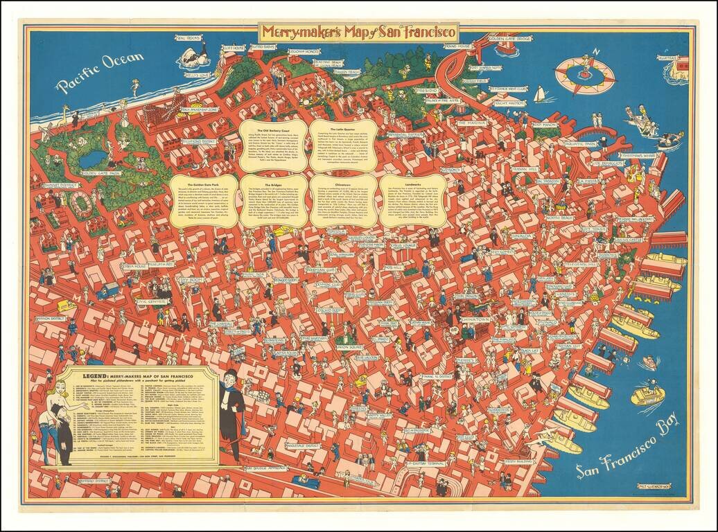
A Pilot for Pixilated Philanderers with a Penchant for Getting Pickled Scarce map of San Francisco, intended for tourists, sailors and other revelers. The map includes a guide noting Restaurants (including Joe Di Maggios), Foreign Atmosphere...
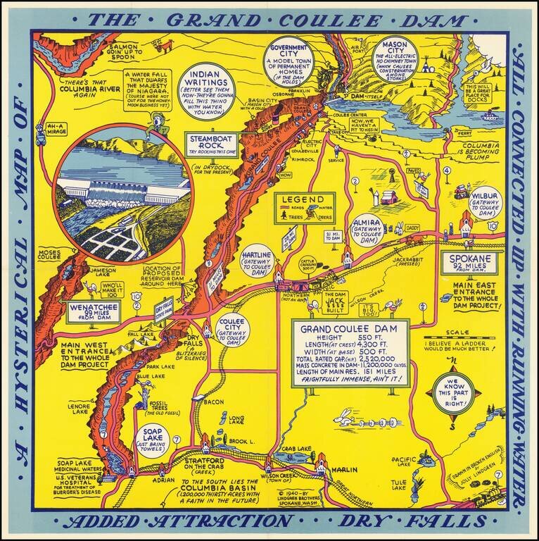
Second of two whimsical maps of Grand Coulee Dam, published by the Lindgren Brothers, "Drawn In Broken English by Jolly Lindgren," this comic pictorial map is full of puns and comic vignettes related to Grand Coulee Dam. The Lindgren Brothers issued a...
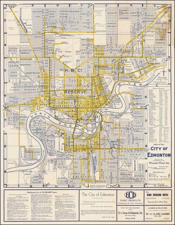
"Edmonton Possesses The Finest Site of any City in the British Empire" -- Sir John Foster Frazer Fine early plan of Edmonton, published in Edmonton by the Mundy Map Company. The center of town is dominated by a large area noted as "Hudson Bay...
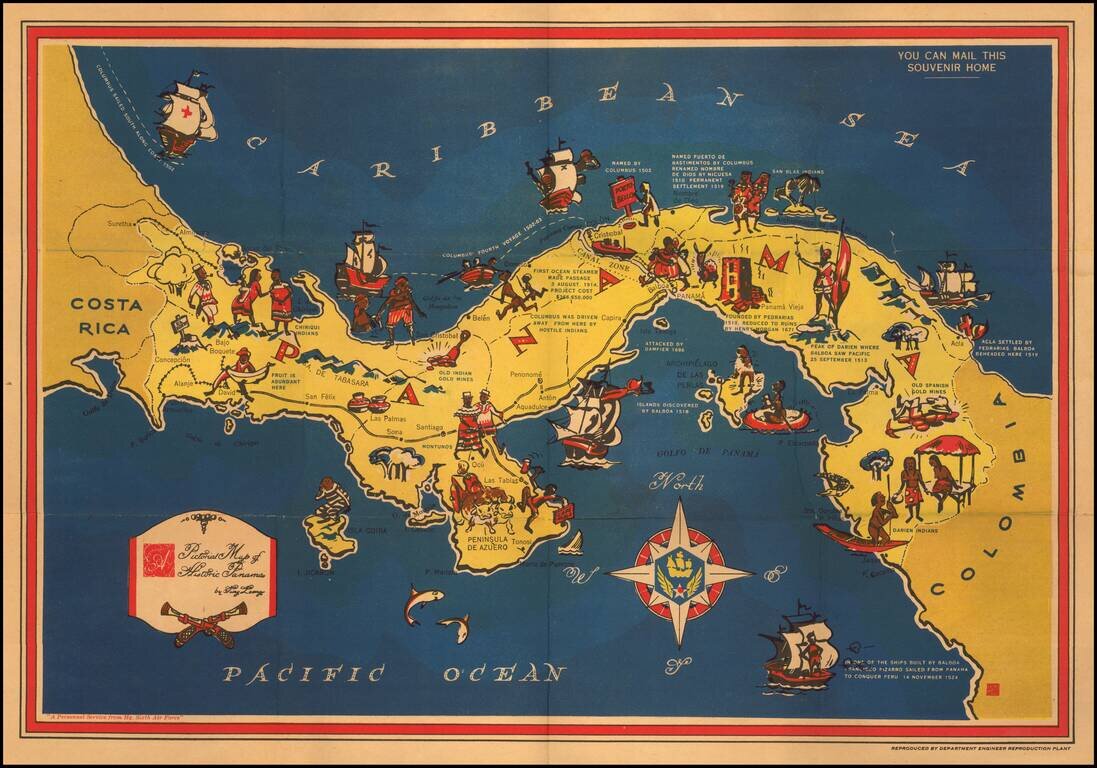
Decorative pictorial map of Panama, published by the Panama Mobile Force and Security Command. A striking map of Panama with historical notes and pictographs of people and events. At the bottom left, the note "A Personnel Service from Hq. Sixth Air...
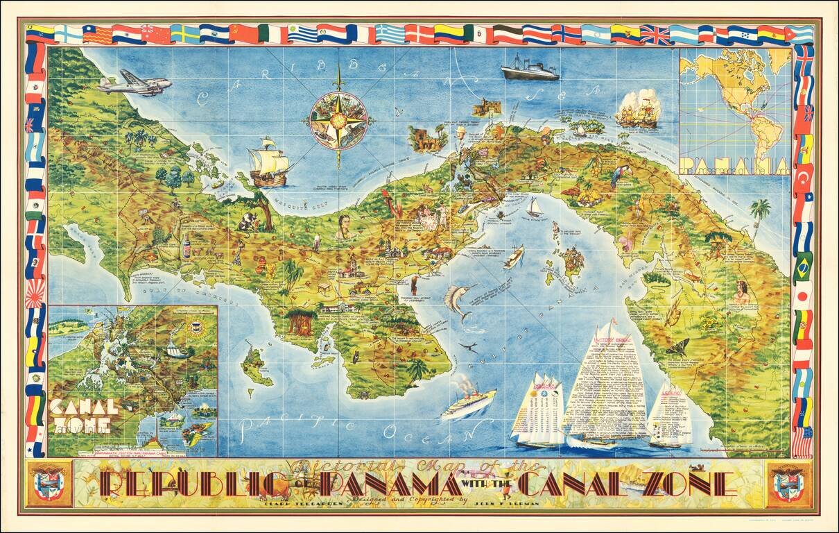
Striking large decorative map of Panama. Includes two insets: "Canal Zone and Vicinity" and "Panama The Crossroads of the World". Rich coloring, striking flag border, a particularly sophisticated example of a pictorial map. "'With a partner in the...
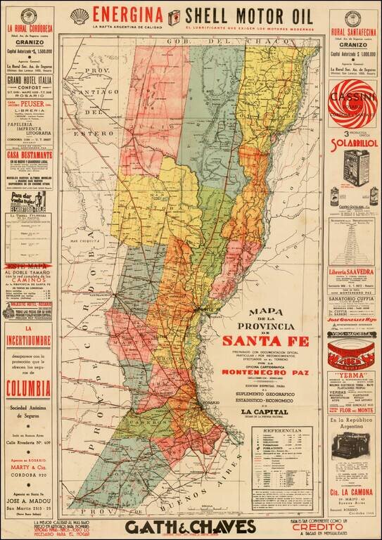
Fascinating map of the Province of Santa Fe, Argentina, centered on the capital city of Rosario. Surrounded by advertising.
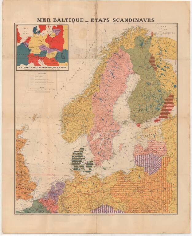
Large format map of the Theater of War in 1940, published in Paris. The inset map shows the German Confederation as it will appear in 1950, based upon a public German document from 1904. The areas identified in Striped regions have already been taken...
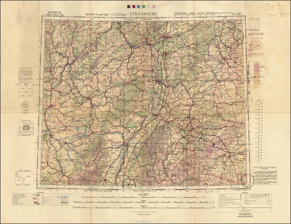
A Wall of Flak Batteries Leading into Germany. Detailed WWII air navigation map of the area around Strasbourg, published by the British War Office. The map is noteworthy for the manuscript circles highlighting the flak batteries stationed in major...
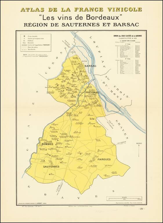
A nice example of one of the Bordeaux regional maps from Louis Larmat's important atlas of the French Wine Country Atlas De La France Vinicole -- Les Vins de Bordeaux. The map focuses on a small region around Pregnaic, twenty miles upriver from...
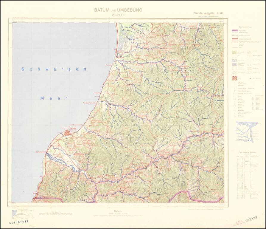
Four-sheet color-printed topographical map of the Adjarian Autonomous Soviet Socialist Republic and neighboring regions, prepared for strategic use by the General Staff of the German Army. The map is based on a 1917 German General Staff map. The area...
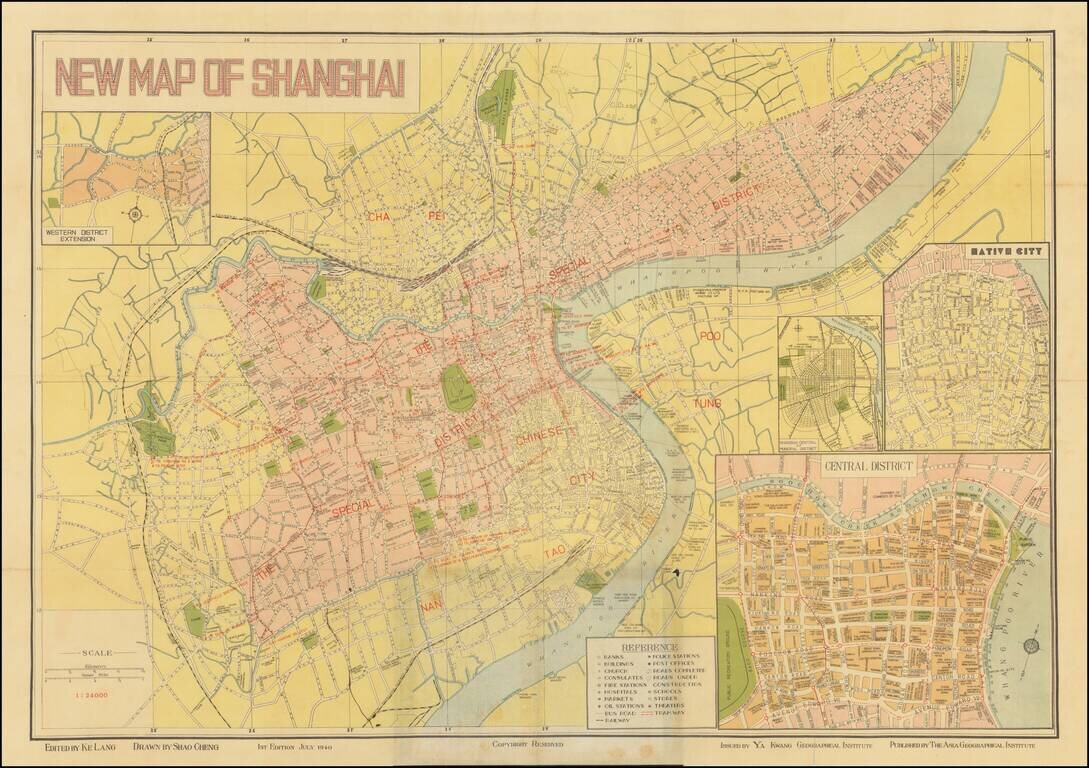
Detailed map of Shanghai, published in Shanghai by Ya Kwang Geographical Institute, drawn by Shao Cheng and edited by Ke Lang. Includes 4 inset maps: Shanghai Central of Municipal District Native City Central District Western District Extension...
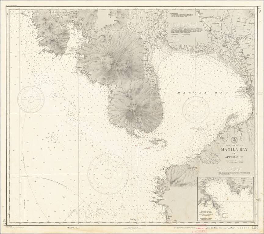
"RESTRICTED" World War II Map of Manila. Detailed chart U.S. Coast and Geodetic Survey (Philippine Divison) of Manila Bay, including Corregidor Island, originally published before the Japanese takeover during the early stages of the Second World War...