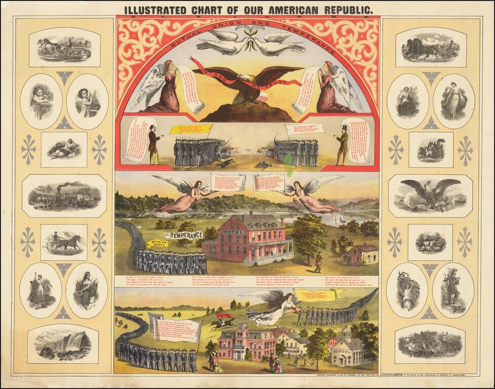
Fine chromolithographic image combining five color printed vignettes related to American patriotism, union, and temperance. The top vignette shows two angels kneeling before a bald eagle holding a banner and two doves overhead. The second scene shows...
![[The Carlo Naya Facsimile of the Fra Mauro Mappa Mundi]](/map/small/64812.jpg)
Life-Size 1873 Photograph of the Fra Mauro Map of the World. Seven-foot by seven-foot hand-colored photograph of the ca. 1450 Fra Mauro Mappamundi, the greatest medieval map of the world, published by Carlo Naya in Venice in 1873. This life-size...
![[The Carlo Naya Facsimile of the Fra Mauro Mappa Mundi]](/map/small/64813.jpg)
Life-Size 1873 Photograph of the Fra Mauro Map of the World. Seven-foot by seven-foot photograph of the ca. 1450 Fra Mauro Mappamundi, the greatest medieval map of the world, published by Carlo Naya in Venice in 1873. This life-size photograph of the...
![[The Carlo Naya Facsimile of the Fra Mauro Mappa Mundi]](/map/small/64919.jpg)
Life-Size 1873 Photograph of the Fra Mauro Map of the World. Seven-foot by seven-foot hand-colored photograph of the ca. 1450 Fra Mauro Mappamundi, the greatest medieval map of the world, published by Carlo Naya in Venice in 1873. This life-size...
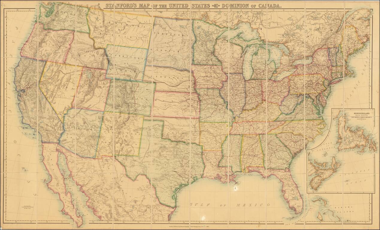
Remarkable large format map of the United States, showing the US immediately after the completion of the first transcontinental railroad. Stanford's map of the United States has a long and interesting history. First published by Rogers & Johnston...
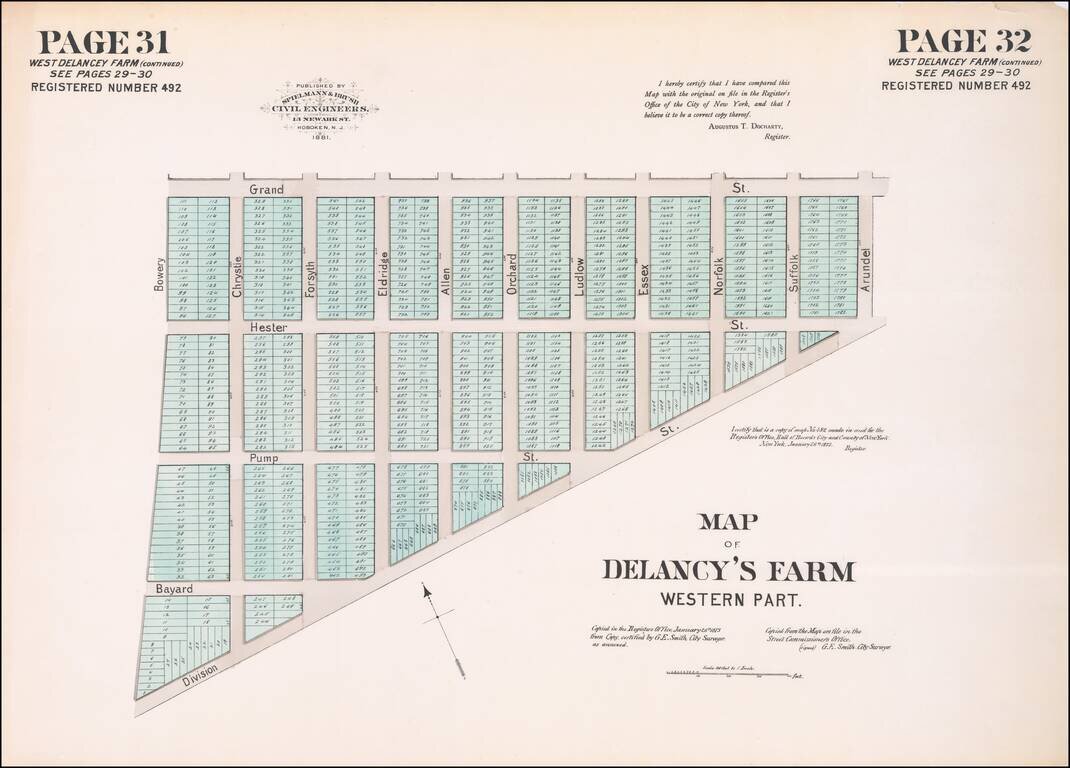
Hand-colored lithographed map of part of Chinatown, New York City, published by Spielmann & Brush in their very rare atlas Certified Copies of Original Maps of Property in New York City (1881). The last copy of that atlas was on the market with a...
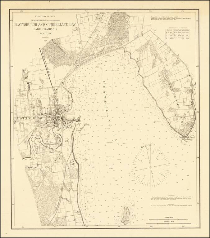
Separately Published Example on Heavy Paper Detailed sea chart of the area around Plattsburgh, published by the Coast Survey. The map extends from Cumberland Head to Crab Island and includes a detailed plan of Plattsburgh, along with the surrounding...
![[Map Letterhead] Office of the Ohio Falls Car Company. Jeffersonville, Ind. . . .](/map/small/59325.jpg)
Business letter on written on stationary with a marvelous birdseye view masthead for the Ohio Falls Company of Jeffersonville, Indiana. The Ohio Falls Car & Locomotive Company was founded at Jeffersonville, Indiana, June 1, 1864. It was likely...
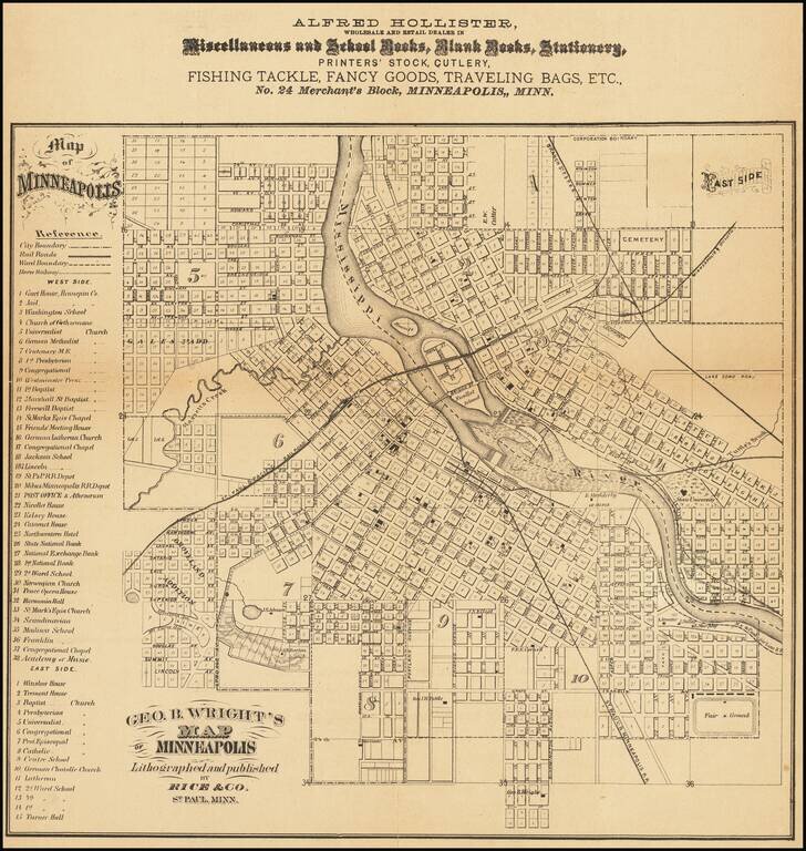
Rare Early Map of Minneapolis The Year After Annexation of St. Anthony Detailed map of Minneapolis, published by Rice and promoting Alfred Hollister, Wholesale Dealers in Miscellaneous and School Books, Blank Books, Stationery, Printers' Stock,...
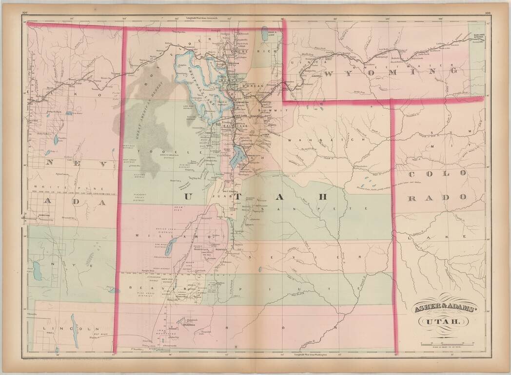
One of the earliest obtainable maps of Utah Territory. Asher & Adams map of Utah is among the earliest map of Utah Territory in its modern configuration to appear in a commercial atlas. The focus of the map is the railroad and related detail...
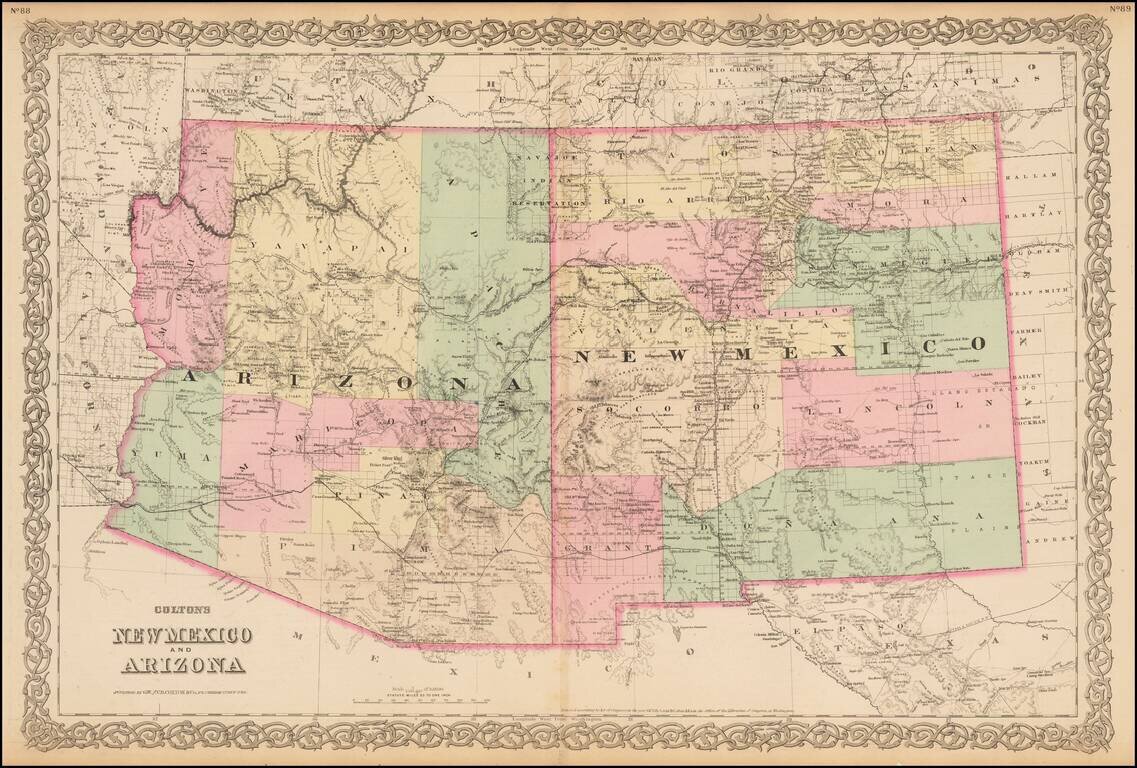
Gorgeous large format map of Arizona and New Mexico. Shows the proposed routes of a number of early railroads through the region, including the Southern Pacific, Atchison Topeka & Santa Fe, etc., along with the route of the Denver & Rio...
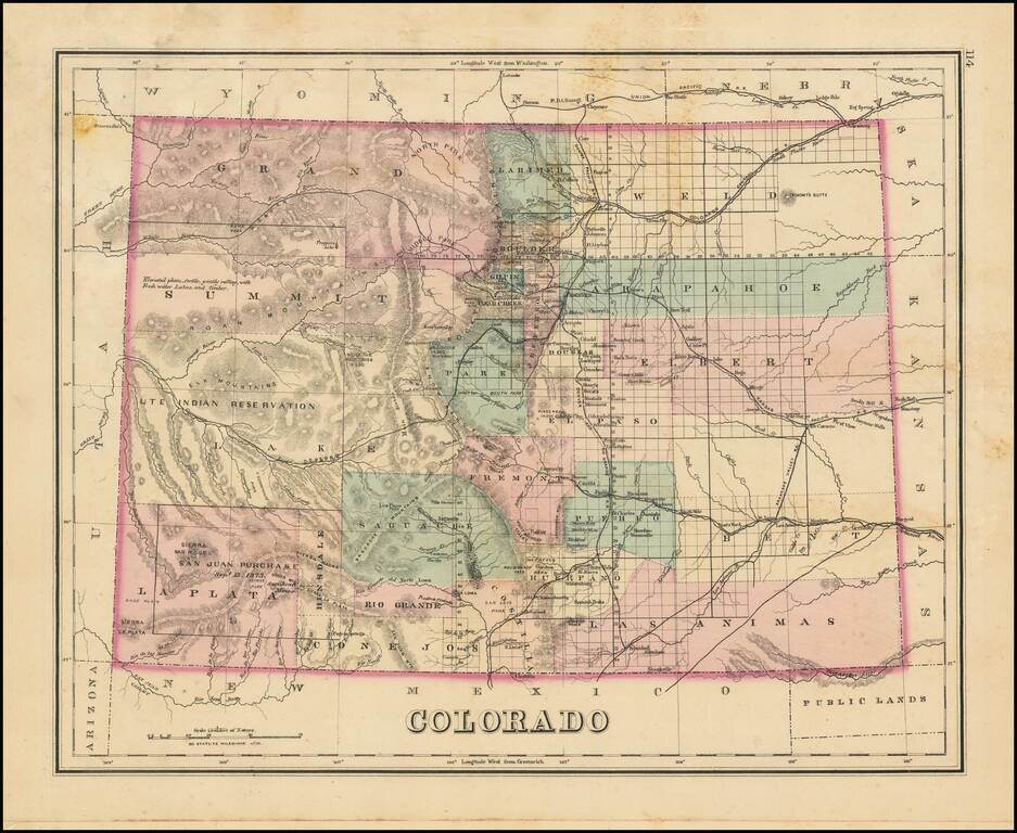
Interesting early map of Colorado, colored by counties. Shows towns, rivers, lakes, roads, mountains, and other details. In Southwestern Colorado, there is still no evidence of the coming mining boom which would be centered in areas such as...
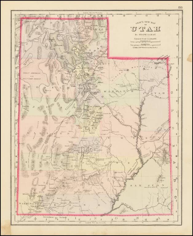
The First Atlas Map of Utah Territory in its Modern Configuration. Historically important early map of Utah, published by OW Gray. The map is colored by counties and showing early roads, rivers, mountains, railroads, mines, Indians, forts, etc....
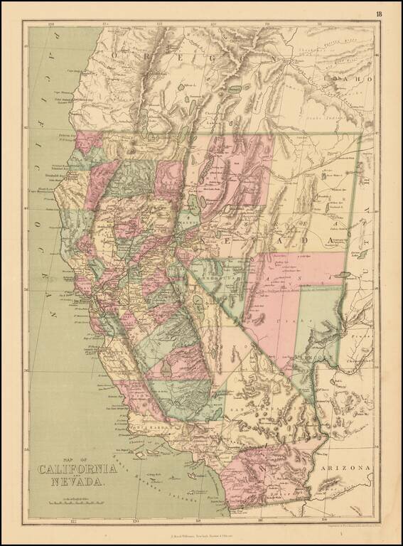
Detailed map of California and Nevada, colored by counties, published by J. David Williams in New York. The map shows towns, railroads, islands, rivers, mountains, roads, springs, sinks and a host of other details. Pre-dates the formation of Orange,...
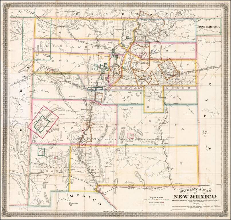
One of the Earliest Separately Published Maps of New Mexico Territory Detailed early map of New Mexico, prepared by the engineer and surveyor William Raymond Morley is generally acknowledged to be the first map to show only the territory of New...
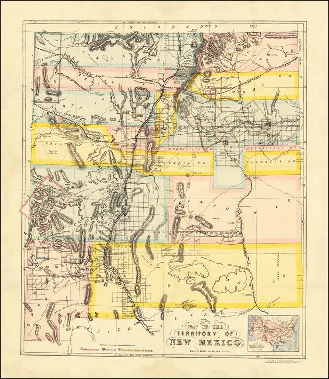
British Land Speculation in New Mexico? Rare early map of New Mexico Territory, lithographed in London by Whiteman, Hicks & Whiteman. New Mexico is colored showing early counties, with the earliest proposed railroads illustrated, including a line...