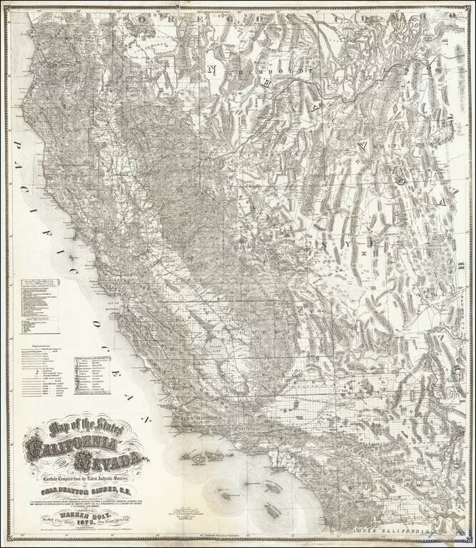
First state of this fine large format map of California and Nevada by Charles Drayton Gibbes, probably the best and most authoritative map of the region published in the 1870s. Charles Gibbes first issued his large format map of California and Nevada...
![Map of Cuba [with] Jamaica](/map/small/28682.jpg)
Nice detailed maps of Cuba and Jamaica, colored by departments and parishes. Shows roads, rivers, lakes, mountains, towns, bays, islands and many other details. From J David Williams rare People's Pictorial Atlas.
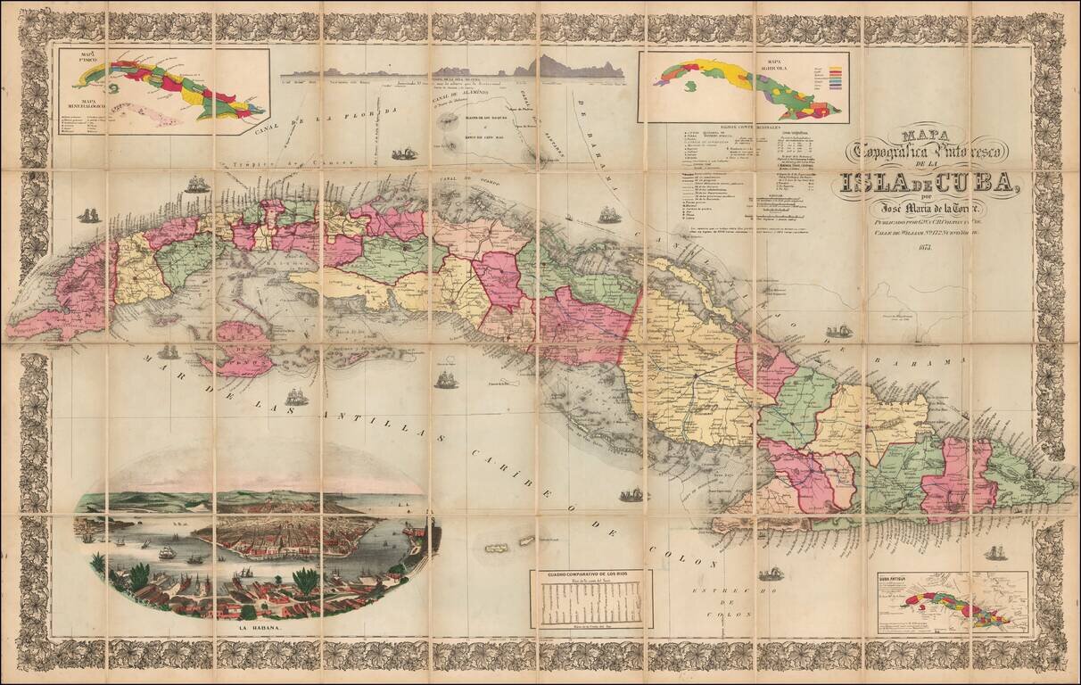
Rare Large Map of Cuba by Jose Maria de la Torre Striking large format map of Cuba, with a decorative chromolithographic view of La Haban (Havana), published in New York City by GW & CB Colton. The map includes 3 smaller maps showing...
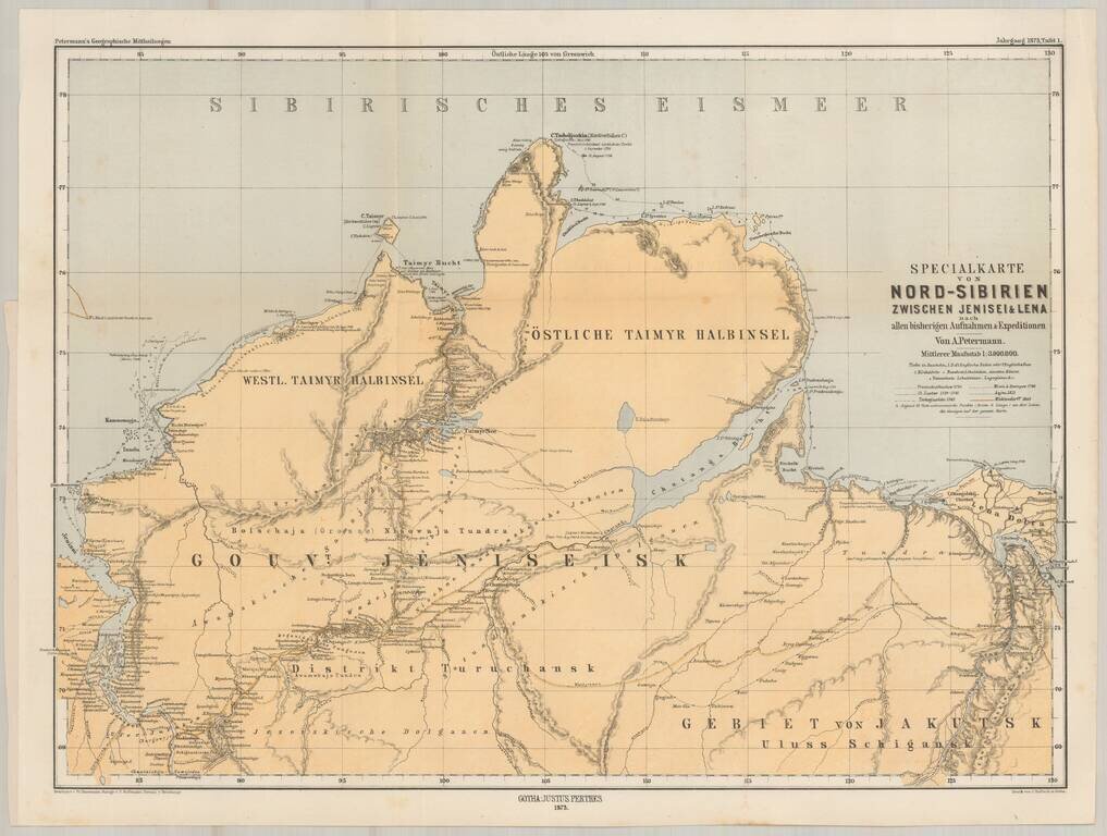
Finely detailed map of Asian Russia and Western Siberia, illustrating Russian Exploration in the reigon. The map is based upon earlier maps by Faden and other mapmakers, and illustrates the explorations and routes of the following explorers of the...
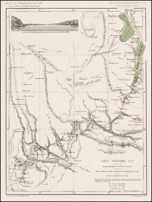
Detailed map of the route from Yun-nan to Poi Eul and southward, from l'Exploration de l'Indo-Chine, dirigée par Doudart de Lagrée. Highly detailed route map, with vignette of Tchin-Kiang.
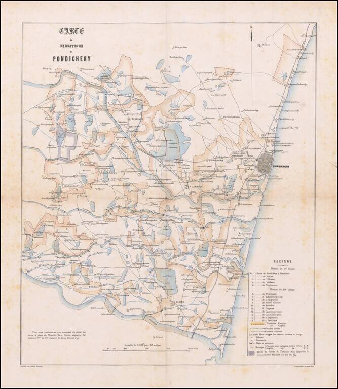
Detailed French Manuscript Map on Linen Showing French and English areas in the Territory of Puducherry Finely-executed manuscript map of the territory of Pondicherry, now known as Puducherry. The city, until 1954, was a French colonial outpost. This...
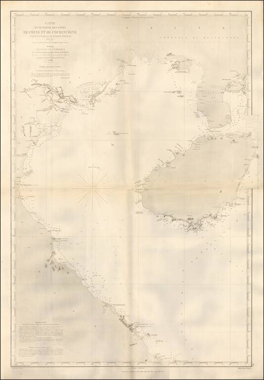
Detailed coastal chart of the Southern Coastline of China and the Coast of Vietnam, south to the Da Nang area, published in Paris by the French Depot de la Marine. The chart was apparently used in the 1870s, shortly after French obtained Territorial...
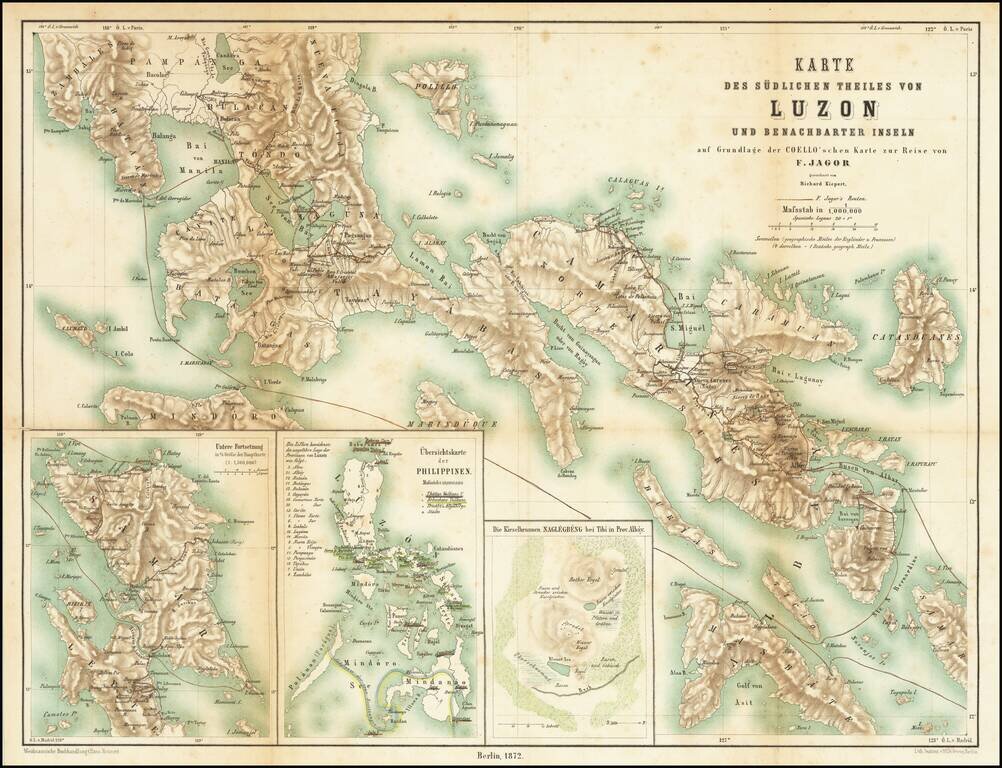
First edition of this classic book on the Philippines Fedor Jagor was perhaps the most meticulous observer of Philippine life and customs. Jagor was a German ethnologist, naturalist and explorer who traveled throughout Asia in the second half of the...
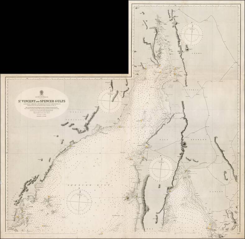
Northern sheet of this scarce working sea chart of St. Vincent and Spencer Gulfs on South Australia, published by the British Admiralty. The chart starts near Port Augusta and extends southeast to Adelaide and southwest to Port Lincoln. It includes...