Map size in jpg-format: 52.8588MiB
Click to open in high resolution (open in new tab).
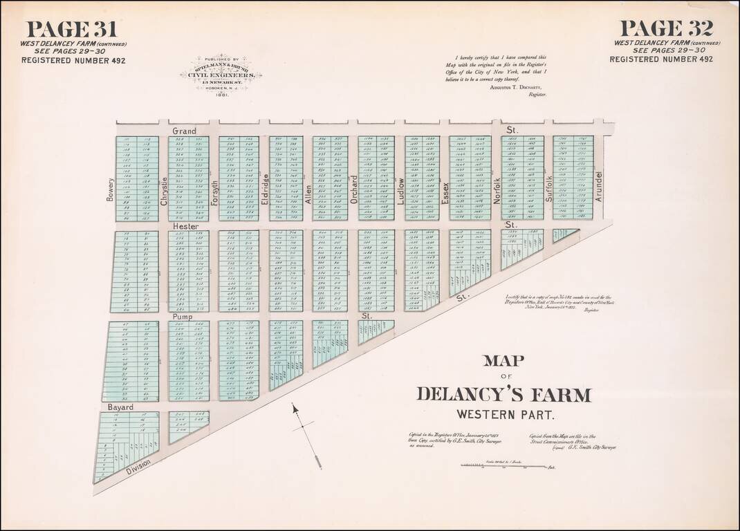
Hand-colored lithographed map of part of Chinatown, New York City, published by Spielmann & Brush in their very rare atlas Certified Copies of Original Maps of Property in New York City (1881). The last copy of that atlas was on the market with a New York City bookdealer for $12,500.
The map shows old streets and plots. The area shown is bounded by modern-day Division Street, Grand Street, and the Bowery.
Significant changes have been made to the layout of the neighborhood.
If you are a student, write to us in telegram: @antiquemaps and indicate what material you need and for what work you need a map in high detail. We are ready to provide material on special terms. For students only!

![[Charles Lindbergh] Spirit of St. Louis](/map/small/69234.jpg)
![[Charles Lindbergh / New York to Paris View] Spirit of St. Louis](/map/small/69235.jpg)