Map size in jpg-format: 1.58022MiB
Click to open in high resolution (open in new tab).
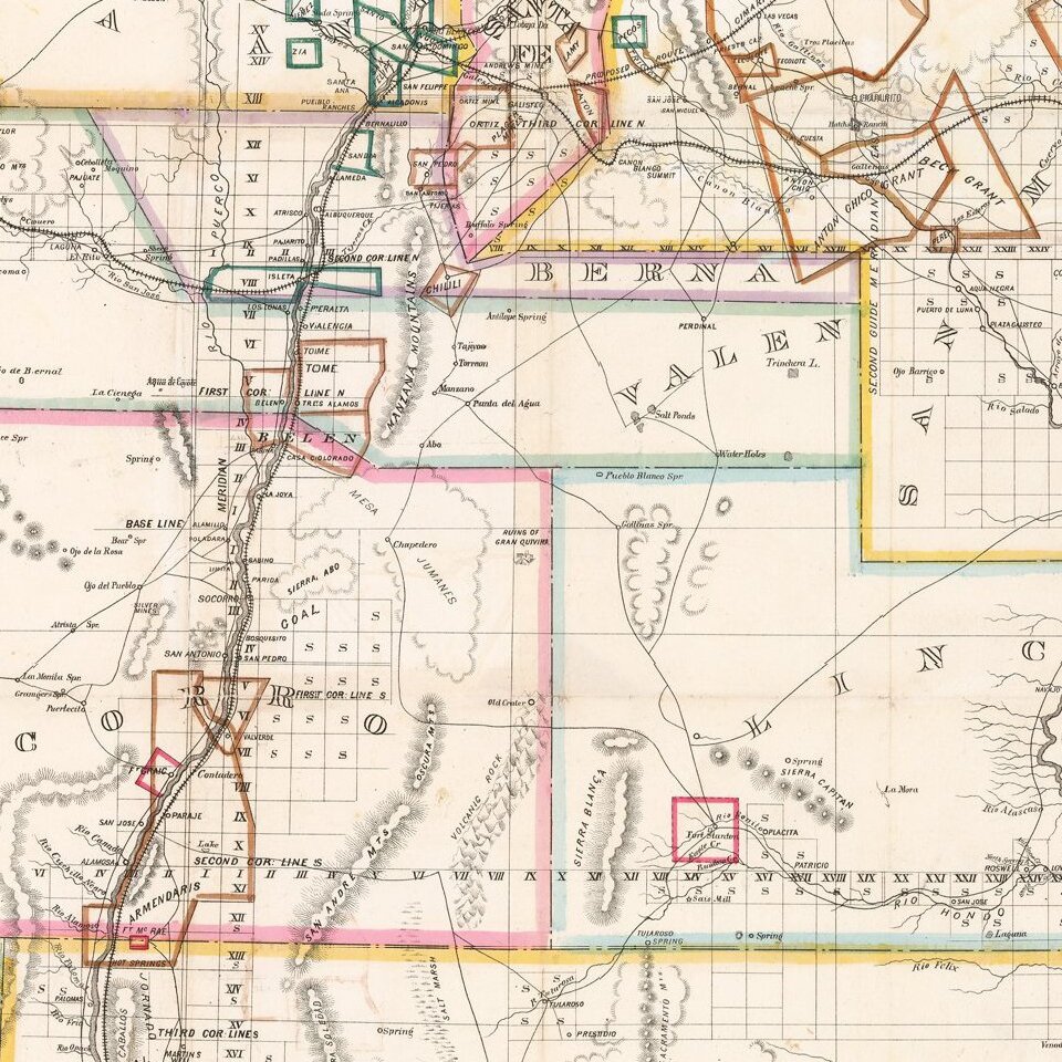
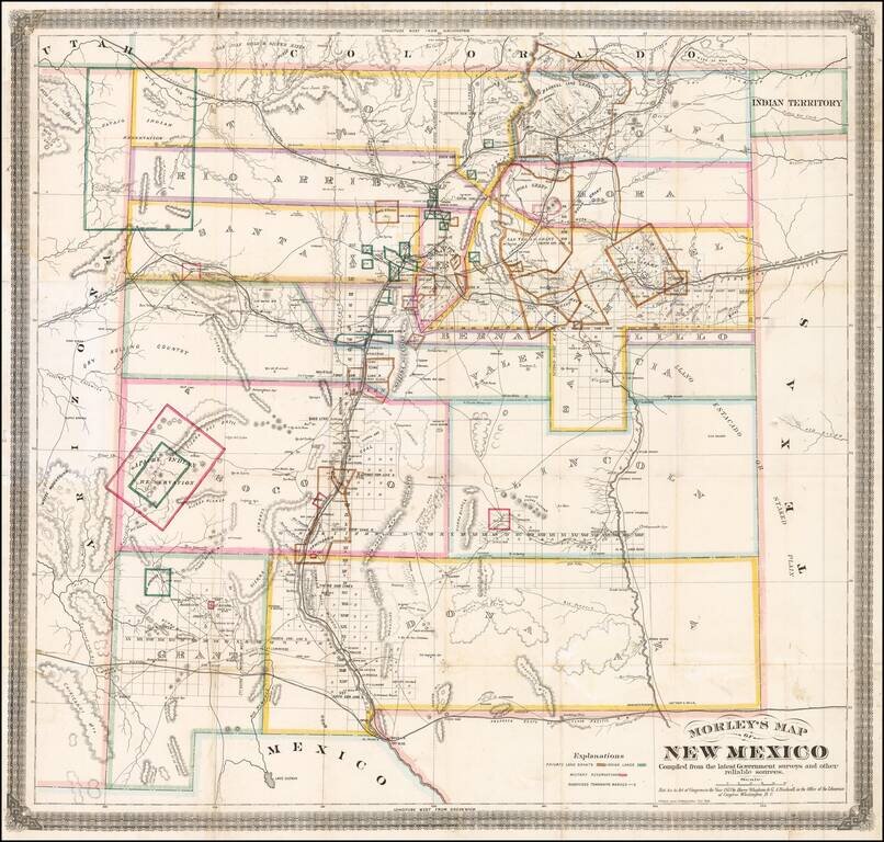
One of the Earliest Separately Published Maps of New Mexico Territory
Detailed early map of New Mexico, prepared by the engineer and surveyor William Raymond Morley is generally acknowledged to be the first map to show only the territory of New Mexico.
It is without doubt one of the most important maps of New Mexico and is an invaluable record of the boundaries of private land grants, military and Indian reservations, public surveys, and proposed railroads, it also records New Mexico geography, paying particular attention to the valleys of the Rio Grande and the Pecos, the mountains and the dry rolling country.
The gathering of topographic data for the map and its publication by Morley & Co. in Cimarron, New Mexico, was likely a result of the Atchison, Topeka and the Santa Fe Railway's plan to build the first railroad line into New Mexico Territory in 1873. Morley was retained to located the best route from Granada, Colorado, to Cimarron. The plan was spurred on by Henry Strong, president of the ATSF, and Dutch investors interested in the Maxwell Land Grant, where gold was found in 1866, not far from Cimarron. The Panic of 1873 ended the plan.
Morley's map does not show the projected rail line for the ATSF. Six years later, the railroad made the controversial decision to complete its connection into New Mexico via the town of Lamy, rather than the Santa Fe capital. In 1873, Morley published his map privately, copies of which were given to each subscriber for The Cimarron News & Press by Morley & Co. in 1875, according to a note found by Streeter, and also distributed for sale by all Booksellers in New Mexico, Colorado, and Kansas. The map thus became an important tool for the settlement and early development of the New Mexico.
If you are a student, write to us in telegram: @antiquemaps and indicate what material you need and for what work you need a map in high detail. We are ready to provide material on special terms. For students only!
![Mexique par Th. Duvotenay…1843 [Republic of Texas]](/map/small/67925.jpg)
