logo

1873. Plattsburgh and Cumberland Bay Lake Champlain New York 1873

  • Plattsburgh and Cumberland Bay Lake Champlain New York 1873

Plattsburgh and Cumberland Bay Lake Champlain New York 1873 information:

Year of creation: 
Resolution size (pixels): 
 12593x14301 px
Disk Size: 
 32.8154MiB
Number of pages: 
 1
Place: 
 
Author: 

Print information. Print size (Width x height in inches):
Printing at 72 dpi 
  174.9 х 198.63
Printing at 150 dpi 
 83.95 х 95.34
Printing at 300 dpi 
 41.98 х 47.67

An example of detailing the file of this map of in a printable high-resolution:

Click to open in high resolution (open in new tab).
Attention! this is just the central piece (central area 960x960 px) of the map file!
This is an example, so that you can see and study the level of detail of a given map. The entire Map will be fully available after payment!

Plattsburgh and Cumberland Bay Lake Champlain New York 1873

Separately Published Example on Heavy Paper

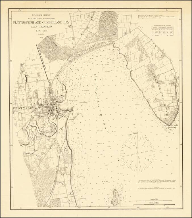
Detailed sea chart of the area around Plattsburgh, published by the Coast Survey.

The map extends from Cumberland Head to Crab Island and includes a detailed plan of Plattsburgh, along with the surrounding roads, railroads, topographical features, etc.

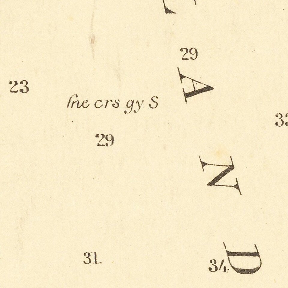
Includes extensive soundings.


Special conditions for students!

If you are a student, write to us in telegram: @antiquemaps and indicate what material you need and for what work you need a map in high detail. We are ready to provide material on special terms. For students only!

Item information:

Year of creation:
Size:
12593x14301 px
Disk:
32.8154MiB
Number of pages:
1
Place:

Author:
U.S. Coast Survey.
$14.99

Related item