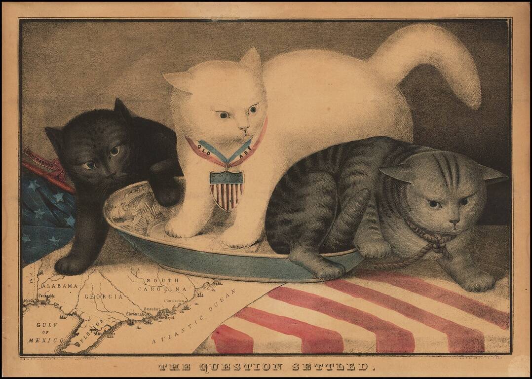
Rare Allegorical Civil War Broadside Fascinating allegorical broadside, showing 3 cats in a milk saucer, superimposed over a map of the South. The center white cat, Old Abe, is a reference to Abraham Lincoln. To the right, the gray cat represents...
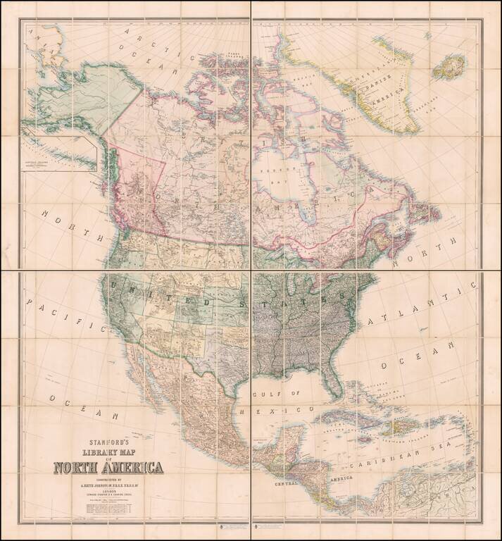
Colored To Show The Slave & Confederate States and Territories Fine 4-sheet map of North America, published in London by Edward Stanford. One of the best large format maps of North America published in London during the Civil War. The map is...
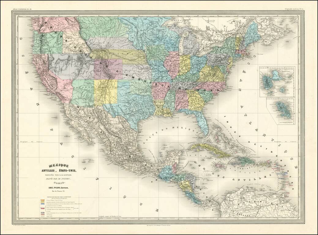
A Fascinating French convolute of Shoshone, Idaho & Montana Territories. Finely colored large format map of the United States, depicting the evolution of the Western Territories, as they were created in the 1860s. Includes marvelous ephemeral...
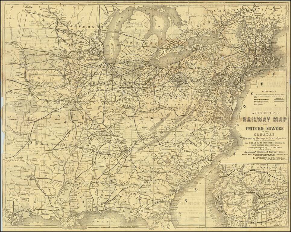
Detailed railroad map of the United States, with an large inset of the Western States. Shows all railways in operation and in progress, as well as stations, etc. The verso includes extensive advertising.
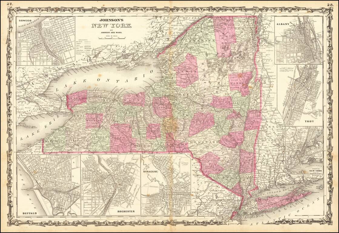
Nice detailed map of the State of New York, colored by counties and showing excellent regional details. Large inset maps of Albany, Troy, New York, Buffalo, Rochester, Syracuse, and Oswego. Decorative border. From an early edition of Johnson's Family...
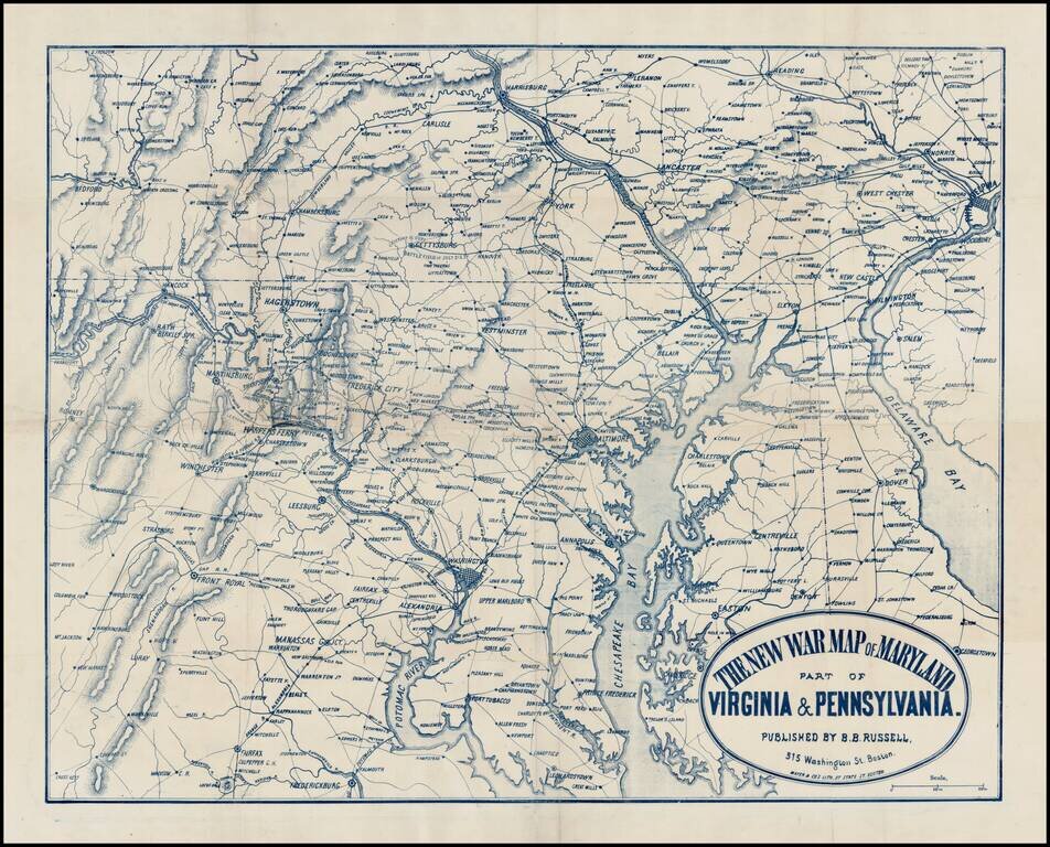
Rare separately issued map of the Mid-Atlantic theater of the American Civil War, published in Boston by Mayer & Co. The map extends south to Fredericksburg and Fairfax and north to Harrisburg and Reading and East to Philadelphia and Delaware Bay,...
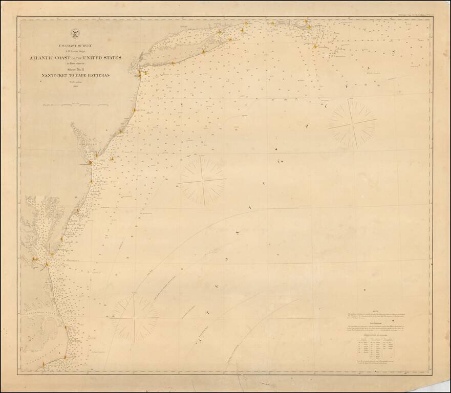
Rare separately issued coastal chart of the Coast of the United States, from Nantucket to Cape Hatteras. Includes lighthouses, soundings, place names, notes and sailing directions. The present example is published on thick paper and was never folded,...
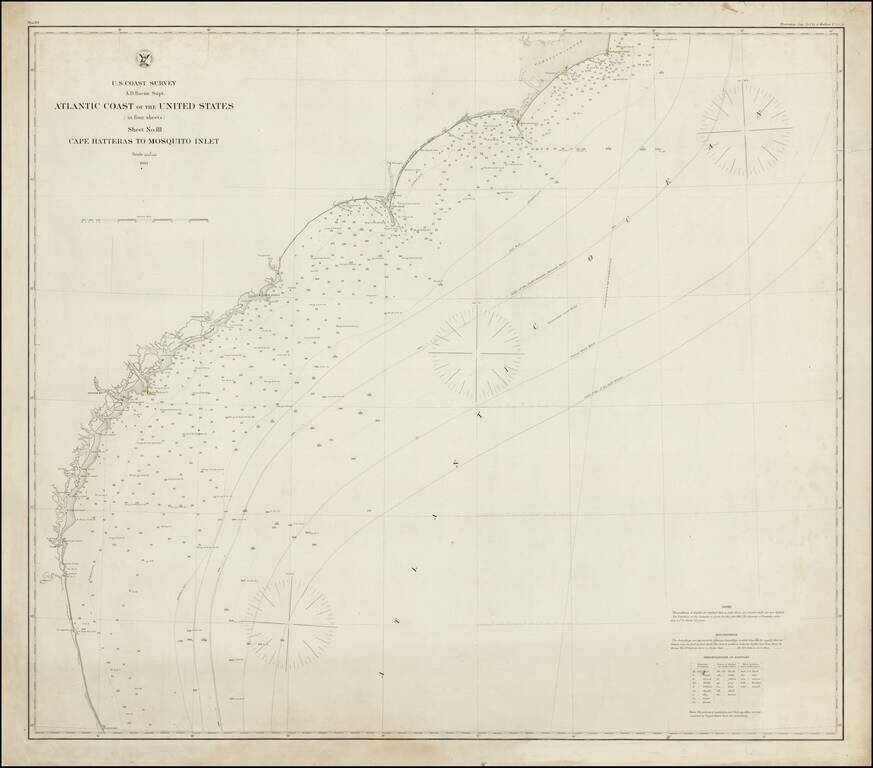
Rare separately issued coastal chart of Southeastern Coast of the United States, from Cape Hatteras to Mosquito Inlet in Florida. Includes lighthouses, soundings, place names, notes and sailing directions. The present example is published on thick...
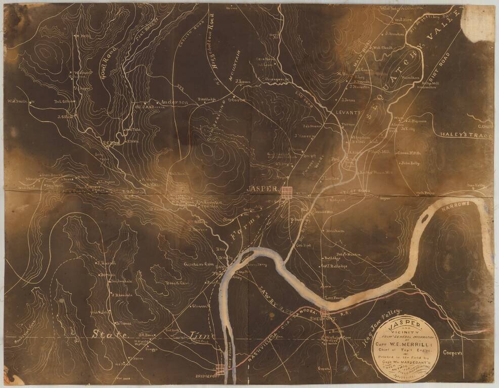
Early Photography & Battlefield Mapmaking Technology! Very rare and important Union Civil War "black map" or "sun map," printed in the field with a photographic process utilizing a mobile laboratory and darkroom. The map is centered on Jasper,...
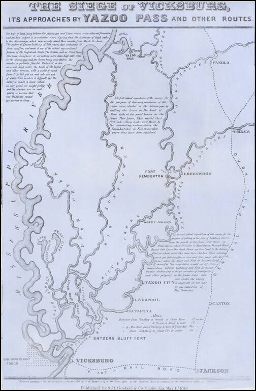
Rare broadside map of the Siege of Vicksburg, printed in Mobile, Alabama. The map was drawn by T.S. Hardee, lithographed W.R. Robertson in Mobile, Alabama and published by S.H. Goetzel & Co. The map shows the location of the Union and Confederate...
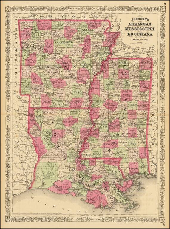
Highly detailed map of Louisiana, Mississippi and Arkansas, published by Johnson & Ward. The map is hand colored by counties and parishes and showing the extent of the state surveys to date. Includes towns, railroads, forts, post offices, roads,...
Fine uncut, unfolded example of the second edition of this rare Civil War map was created by the United States Coast Survey in 1863, under the direction of A.D. Bache. This exceptionally detailed map was prepared specifically by the US Coast Survey...
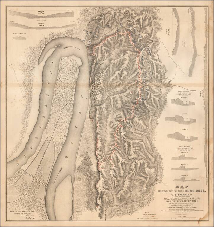
Detailed map of the Siege of Vicksburg, drawn by Charles Spangenberg. The present map is the printed version of a manuscript field map drawn by Spangenberg and dated August 20, 1863, the original of which is held by the Library of Congress....
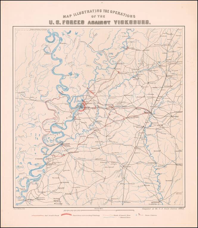
The Vicksburg Campaign Rare separately published map of the area around Vicksburg, Mississippi, showing the military operations of the Union and Confederate Armies. The map was compiled by in the offices of the United States Coast Survey, which at...
![[Siege of Vicksburg -- Manuscript Battle Map / Field Sketch]](/map/small/62795.jpg)
Hand Drawn During The Siege of Vicksburg Detailed hand drawn map / field sketch showing troop positions during the siege of Vicksburg, during the American Civil War. The map locates troop positions, Rebel Works, topographical features, bridges and...
![[Manuscript Civil War Map signed by G.K. Warren] Map of Field Occupation of Army of the Potomac. Prepared by order of Gen. Hooker from reconnaisances made under Capt. R.S. Williamson, Lt. N. Bowen, Gen. D.P. Woodbury and others. Sent from Top'l Eng'rs o](/map/small/42063.jpg)
Hand Drawn Field Map of the Theater of War in Virginia Signed By One of America's Most Important Government Surveyors For The Explorations of the West The second known example of Governor Kemble Warren's magnificent large-scale manuscript map of the...