Map size in jpg-format: 88.8148MiB
Click to open in high resolution (open in new tab).
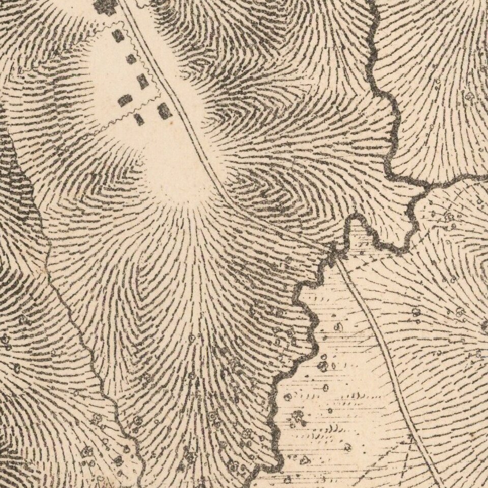
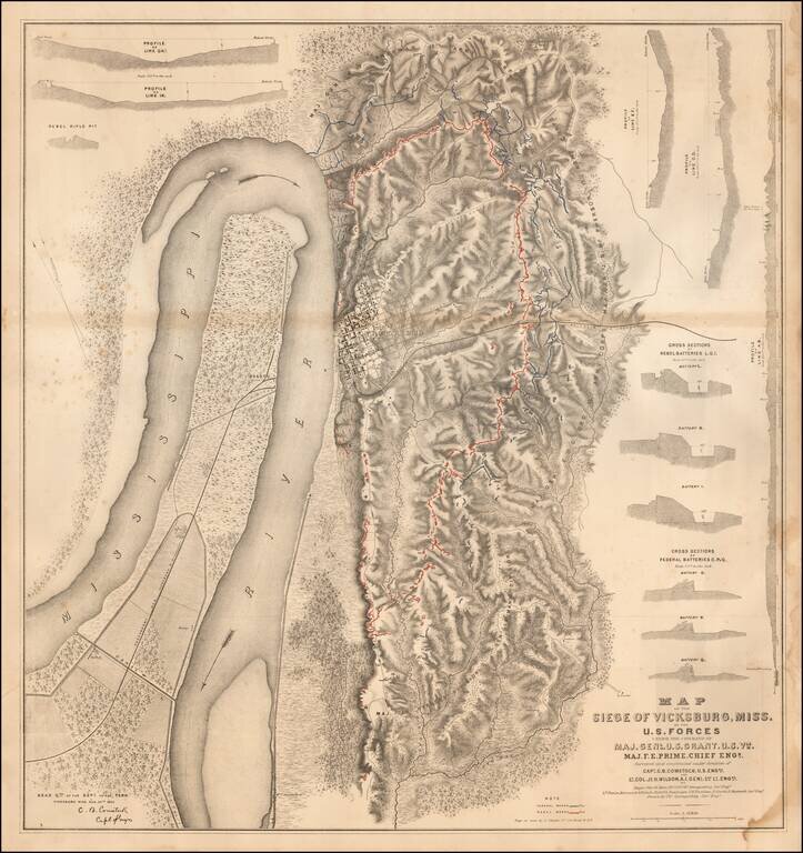
Detailed map of the Siege of Vicksburg, drawn by Charles Spangenberg.
The present map is the printed version of a manuscript field map drawn by Spangenberg and dated August 20, 1863, the original of which is held by the Library of Congress. memory.loc.gov/cgi-bin/query/h
The map is an attractive, highly detailed black and white map showing the topography around Vicksburg, with five profiles, six cross sections of batteries and one cross section of a "rebel rifle pit." Illustrated in Stephenson, this is one of the most striking of the Union War maps.
If you are a student, write to us in telegram: @antiquemaps and indicate what material you need and for what work you need a map in high detail. We are ready to provide material on special terms. For students only!
![The Coast of West Florida and Louisiana . . . [with] The Peninsula and Gulf of Florida or Channel of Bahama with the Bahama Islands . . .](/map/small/38977.jpg)
![The Coast of West Florida and Louisiana . . . [with] The Peninsula and Gulf of Florida or Channel of Bahama with the Bahama Islands . . .](/map/small/66344.jpg)
