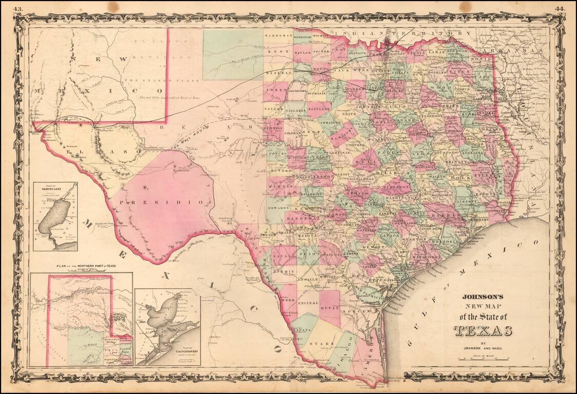
A striking large format map of Texas, published by Johnson & Ward. The map is colored by counties, with large insets of the northern panhandle, Galveston and Sabine Lake. The map reflects the relative expansion of the Counties of Texas, with more...
![[Arizona below New Mexico] Mexique d'apres le grand Atlas Dresse Par A.H. Dufour Grave par ch Dyonet Pubie par A. Le Chevalier . . . 1863](/map/small/64395.jpg)
Scarce map of Mexico and the American Southwest, etc., published in Paris. The map provides nice detail in Texas and along the Rio Grande, with emphasis on the roads and towns. The French Colony In Texas (Col. Francaise) is shown, along with a number...
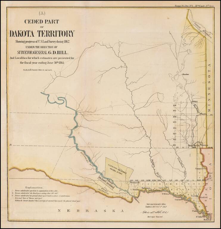
Interesting early map of part of Dakota Territory. The map is focused on the township surveys and the various Indian reserves along the Missouri River, including the Yankton Reserve, Ft. Randall Military Reserve and Ponka Reserve, along with an Indian...
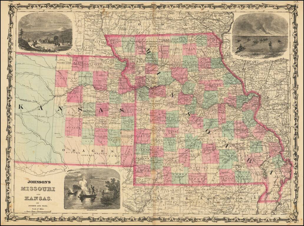
Decorative map of Missouri and Kansas, colored by counties, published by Johnson & Ward. Includes large decorative vignettes of a fire on the prairie with horse mounted Indians, the Santa Fe Trail and spear fishing Indians. Shows towns, counties,...
![New Map of the State of California and Nevada Territory Exhibiting the Rivers, Lakes, Bays and Islands, with the principal Towns, Roads, Railroads and Transit Routes to the Silver Mining Districts of Nevada Territory. . . 1863 [Pocket Map]](/map/small/37306.jpg)
Fine example of Ransom & Doolittle's rare pocket map of California & Nevada Territory, published in San Francsico by Warren Holt and focusing on the routes into Nevada and the recently-discovered mining regions. One of the most interesting and...
![[Salt Lake City] La Nouvelle Jerusalem, ou La Grande Ville du Lac Sale (Amerique) . . .](/map/small/63205.jpg)
Large panoramic view of Salt Lake City, which appeared in a French Newspaper in 1863.
![(Nothern Half) [Bancroft's Map of the Pacific States]](/map/small/54924.jpg)
Previously Unkown 1863-64 Second State. "Bancroft's, in scope, was probably the most important map yet produced by a publisher of the Pacific coast." - Streeter (TMW 1061) Two northern sheets of an engraved proof of the previously-unknown 1863 second...
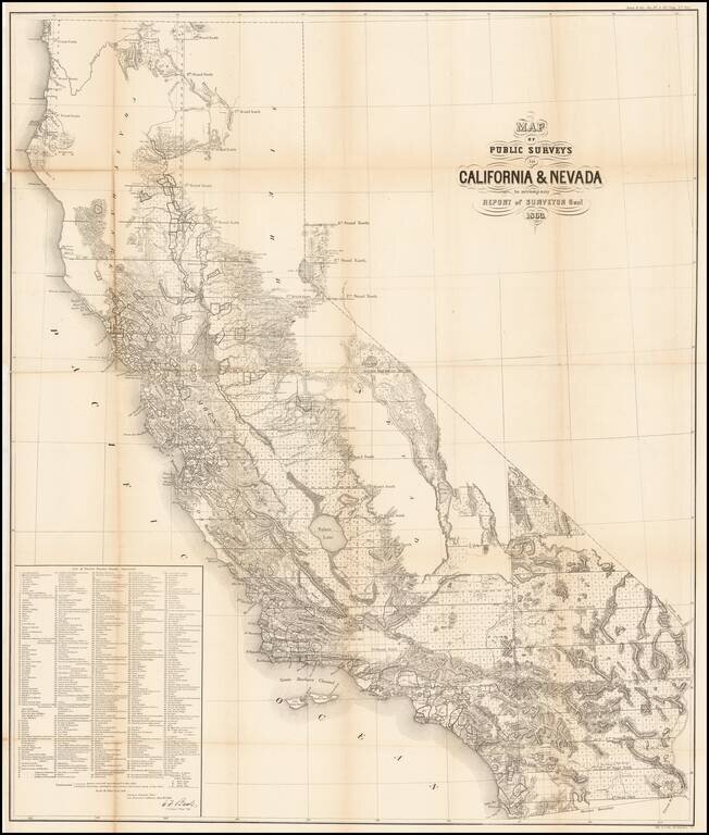
Remarkable large format map of California (along with some information in the Lake Tahoe area of Nevada), reporting the extent of the Land Office Surveys through 1863. The most notable feature is the list of 433 private land grants for which final...
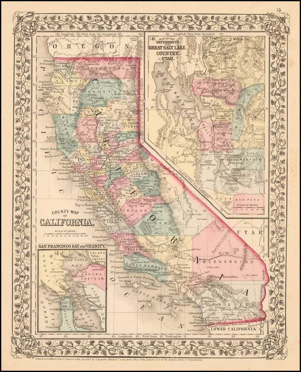
Fine early example of Mitchell's map of California, colored by county. Shows towns, railroads, roads, mountains, lakes, dry lakes, rivers, forts, etc. Insets of San Francisco Bay and the area around Salt Lake, with counties. Decorative border....
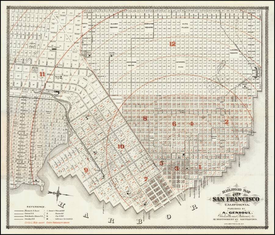
First state of "one of the rarest maps of the City of San Francisco" and one of the earliest printed in the city. The map shows the city in remarkable detail. Rumsey notes: Norris: "Very scarce railroad map of San Francisco." Streeter purchased the...
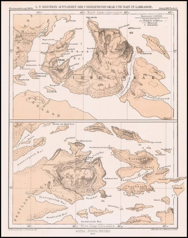
Detailed map of a portion of Labrador, published by Augustus Peterman. Includes Petermann's report on the region.
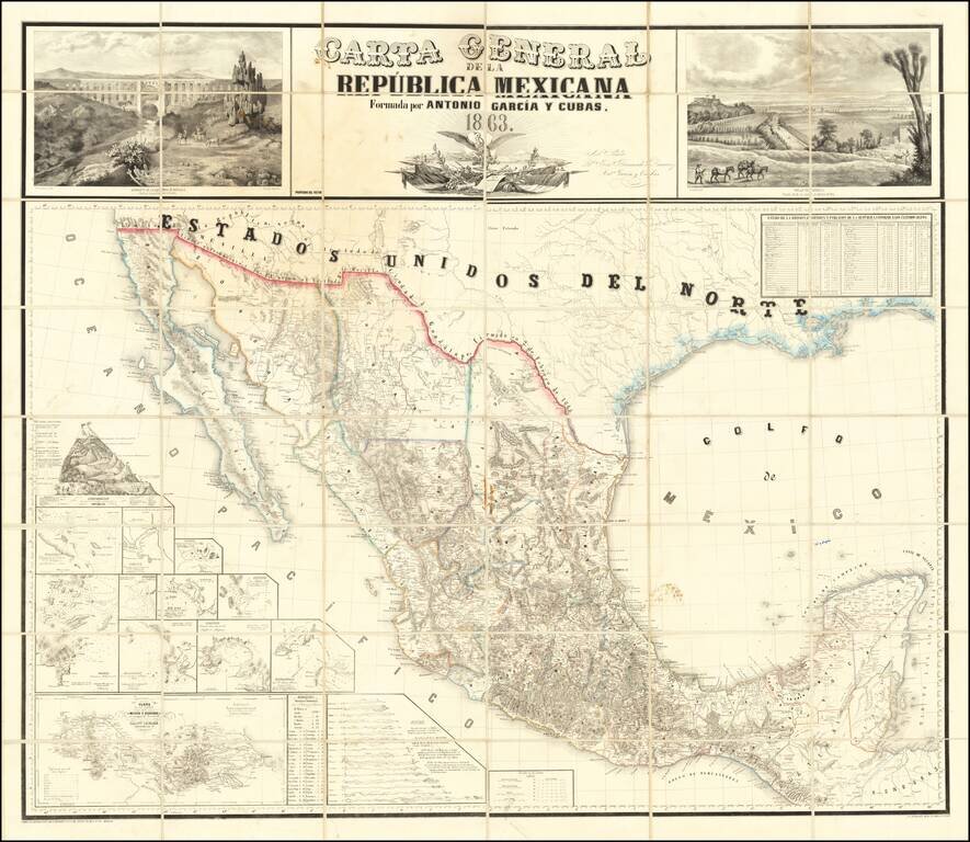
The First Wall Map of The Mexican Republic Published in Mexico Fine example of the first official map of Mexico published in Mexico from indigenous surveys. Antonio Garcia y Cubas' map of Mexico is the first official map of Mexico, printed in Mexico...
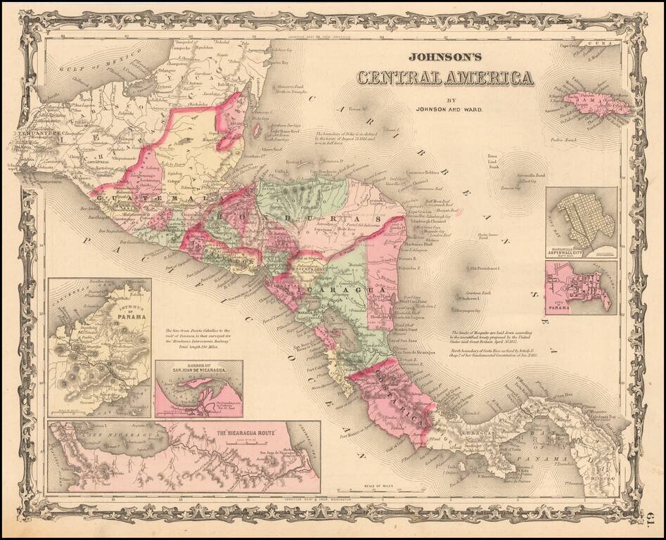
Detailed map of Central America, colored by provinces. Includes towns, roads, rivers, lakes, mountains, islands, etc. Includes insets showing the Isthmus of Panama, Harbor of San Juan De Nicaragua, The Nicaragua Rute, Manzanilla I. Aspinwall City Navy...
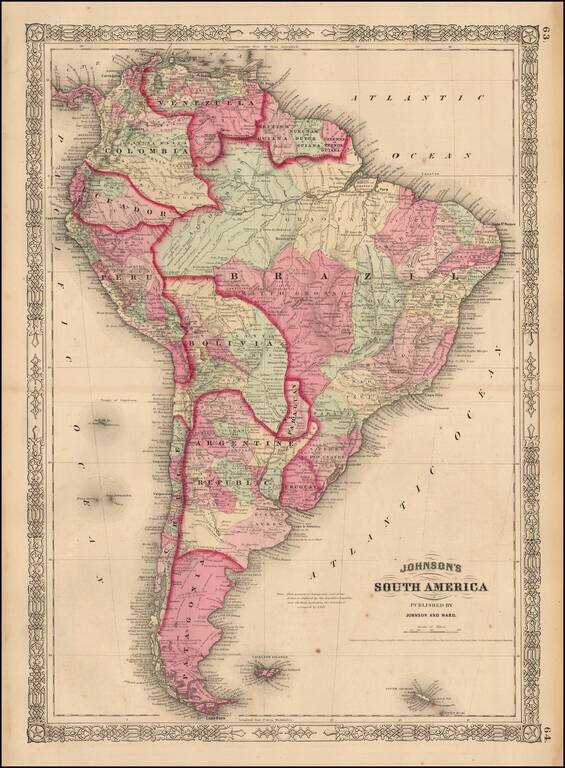
Attractive map of South America, colored by country or state. Extends south to the South Shetland Islands and north to the Gulf of Mexico. Includes notes of numerous 18th century voygages, including Columbus, inset of Cape Horn and other interesting...
![[Ten Kingdoms of the Roman Empire]](/map/small/69498.jpg)
Interesting map of ten regions controlled by the Roman Empire, published for Benjamin Wills Newton. The caption on the map notes: The coloured part of this Map is intended to suggest the probable Territorial Arrangements That Will Be Found in the...
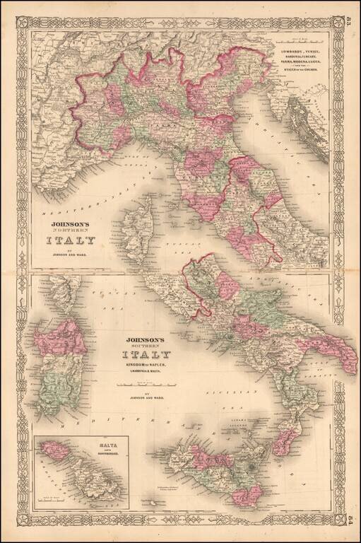
Interesting map of Italy, which appeared in the later editions of Johnson's New Family Atlas of the World. Shows early railroads, among other details.