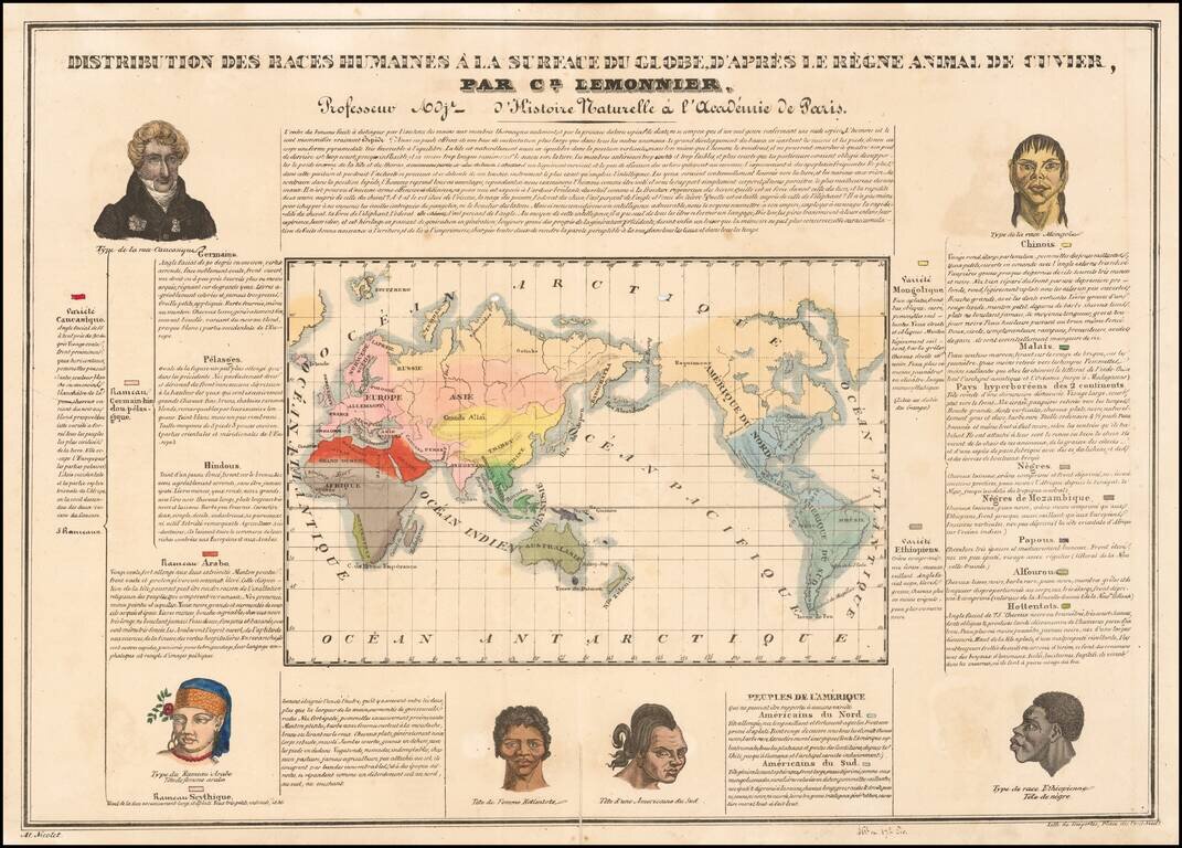
A Graphic Adaptation of George's Cuvier's Le Regne Animal To The Human Race Rare Ethnographic Map of the World, illustrating the distribution of human races by Louis-Ceran Lemonnier, based upon the methods set forth in Georges Cuvier's Le Regne...
![[Republic of Texas] The Flags of The Principal Nations In the World . . . 1837](/map/small/69791.jpg)
Rare hand-colored flag chart, including the maritime ensign of the Republic of Texas by Hinman and Dutton. The chart includes 98 flags of the world, including national flags, along with merchant, naval and city state flags. Several ensigns of...
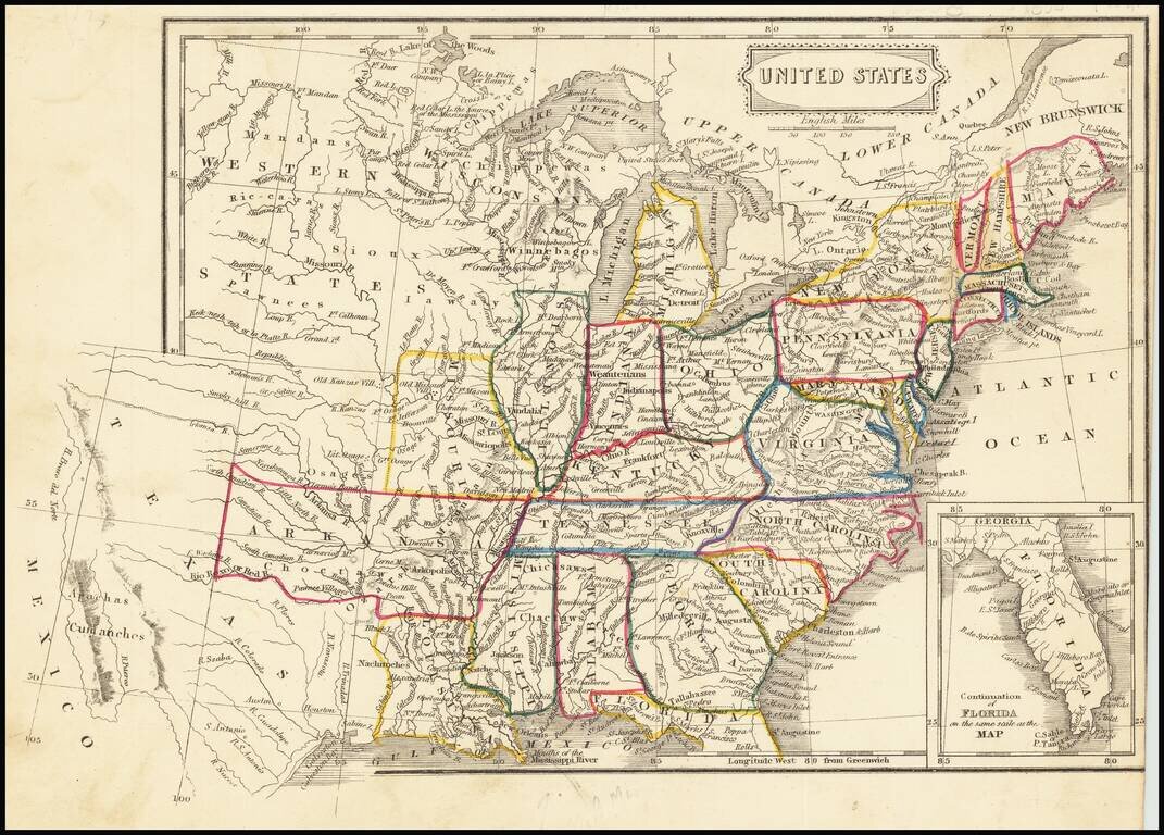
Fascinating map of the United States and Texas, published about the time Texas became a Republic. The map names "Wisconsan", suggesting the map was published about the time Wisconsin was becoming a Territory. In Texas, the Houston and Austin are...
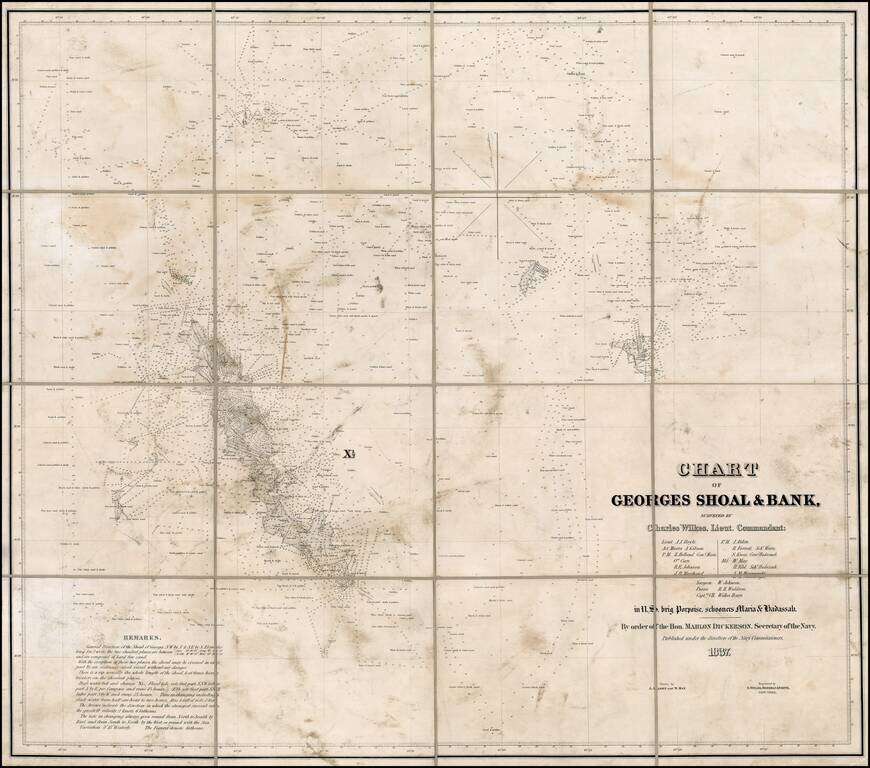
Rare chart of Charles Wilkes' final command prior to embarking upon his famous Expedition in 1838. The first recorded contact with George's Shoal was by Giovanni da Verrazzano, a Florentine navigator, who sailed in 1524 under the flag of France in an...
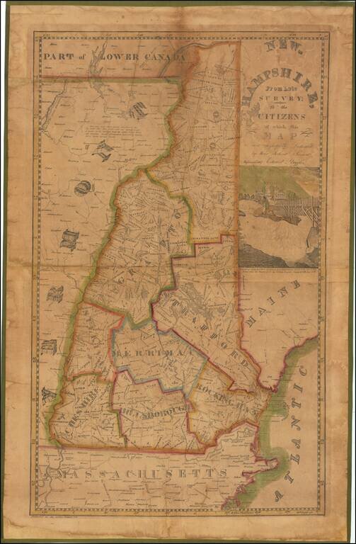
A New Hampshire Rarity—Ruggles’ Pirated Carrigain Map Rare, early wall map of New Hampshire by Edward Ruggles, pirated from the 1816 map by Philip Carrigain, “New Hampshire by Recent Survey.” This is the 1837 "Improved" edition; the first...
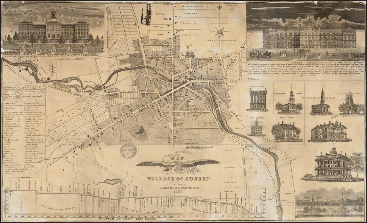
Rare early map of Auburn, New York. A plan of the village is in the map's center, with large views of the Theological Seminary and the State Prison on the left and right corners. Nine views of public buildings are on the right, some of which have...
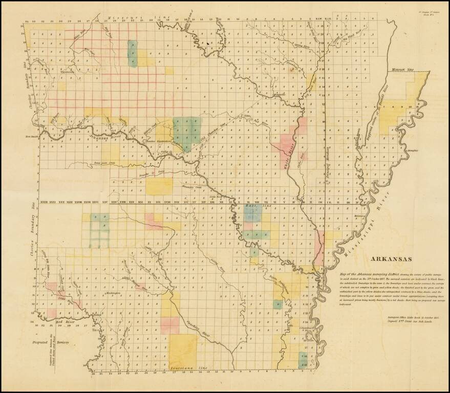
Early General Land Office Survey map of Arkansas, published in 1837. The map shows the extent of the public surveys in Arkansas with the following symbols. The various symbols and surveys reflect completed surveys, surveys contracted but not yet...
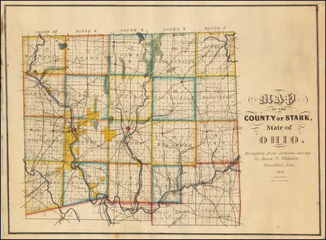
Rare Early Map of Stark County, Ohio -- One of the Earliest Obtainable Ohio County Maps. James C. Whitaker was apparently a local map maker, who was then active in Massillon, Ohio.The following article appeared in the January 25, 1936 edition of the...
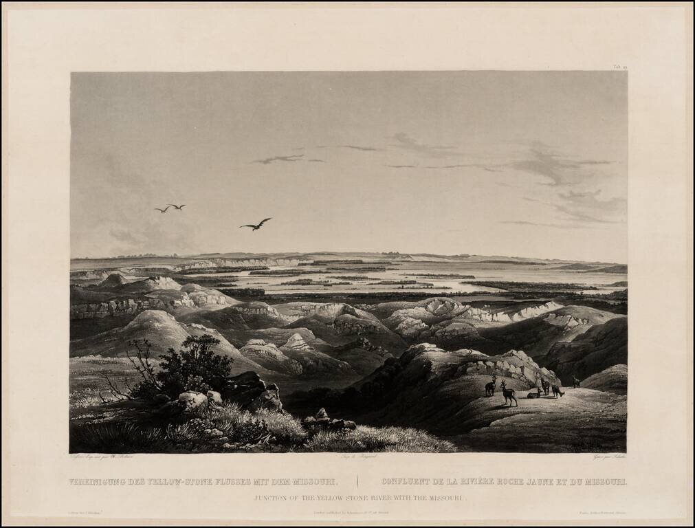
Finely executed view of the Junction of the Missouri and Yellowstone Rivers, from Maximilian, Prince of Wied's Travels in the Interior of North America, during the years 1832-1834, including blindstamp. The view provides a fine image of the confluence...
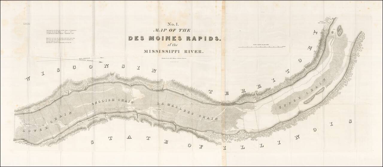
Finely detailed map of the section of the Mississippi River, showing the Des Moines Rapids in the area of Fort Des Moines, based upon the surveys of Lieutenant Robert E. Lee of the US Corps of Engineers. The Des Moines Rapids was one of two major...
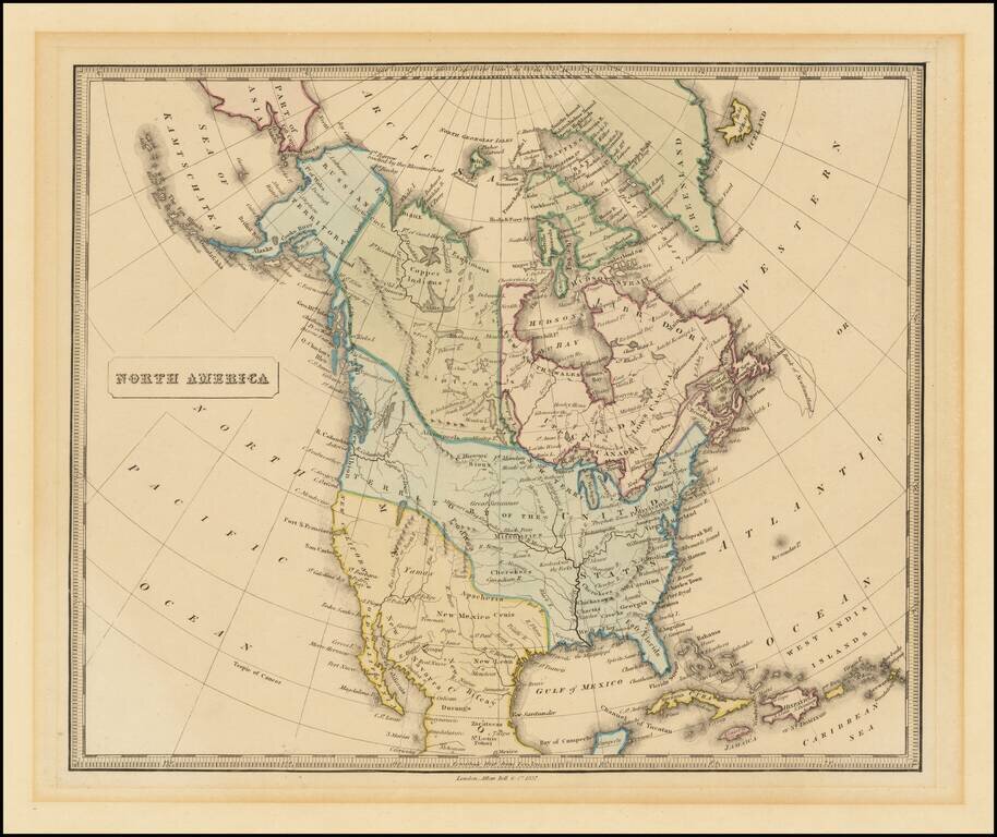
Attractive engraved map of North America, published by Allan Bell & Co. in London in 1837. The map favors the American claims to the Oregon Territory, stretching well into present-day British Columbia. The map is fairly outdated for when it was...
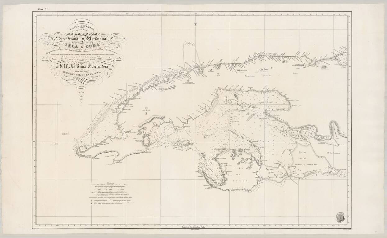
Fine Spanish Sea Chart of Western Cuba. Scarce and highly detailed chart of Cuba from official Spanish sources. Spanish maps of the Caribbean are quite scarce, even in the 19th Century. Extends from Cape San Antonio at the western tip of the island...
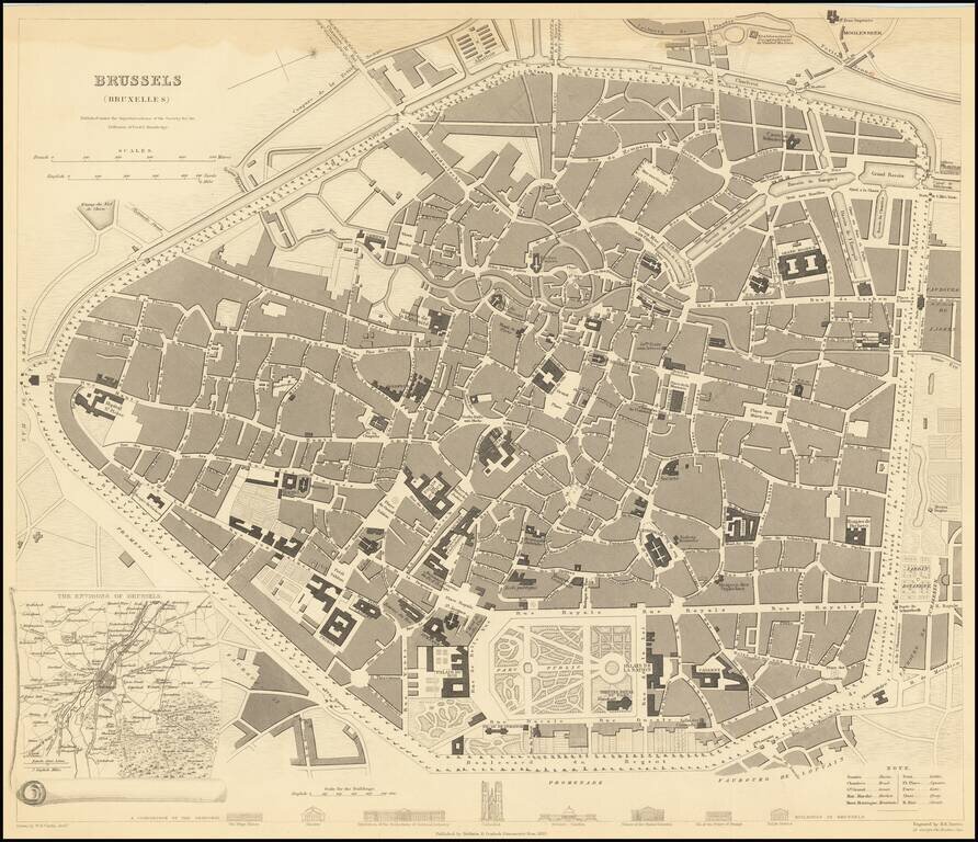
A highly detailed town plan of Brussels, with profile views of eight principal buildings and a smaller inset of the environs of the city. This is one of the best-detailed published maps of Brussels available in a commercial 19th-century atlas. The map...
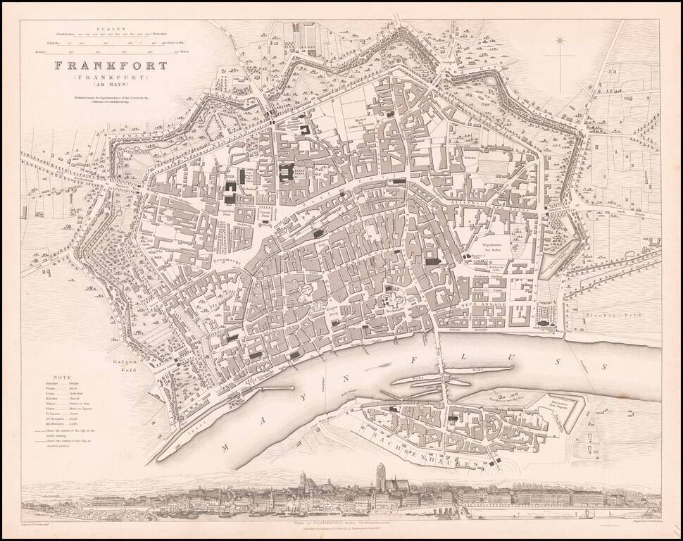
Striking plan of Frankfurt, with a large panoramic birdseye view of the town from Sachenhausen. One of the best 19th Century English town plans to appear in a commercial atlas.
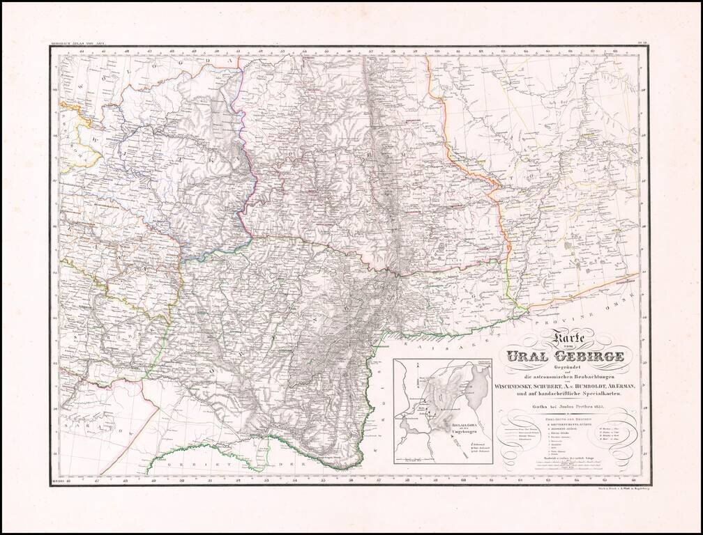
Rare and highly detailed map of the Ural region, with a large inset of the Bjelaja Gora area. The map shows post roads, government roads, district roads, mountains, rivers, lakes, towns, boundaries and a host of other details. There are very few maps...
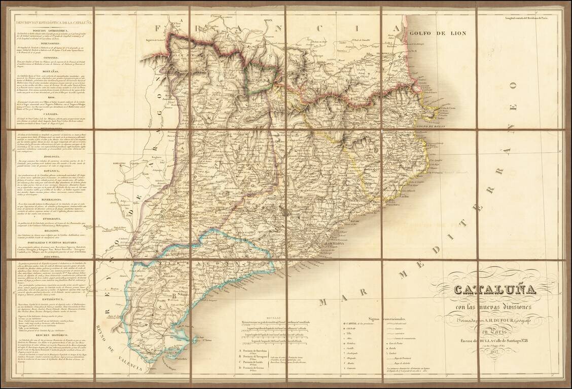
Finely executed map of Cataluña, published in Paris by A.H Dufour. The map is exceptionally detailed, showing roads, towns, rivers, mountains, forts, and a host of church related places and many other details. The location of battles, combat and...