Map size in jpg-format: 73.3025MiB
Click to open in high resolution (open in new tab).
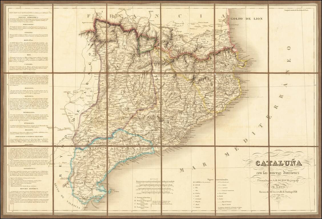
Finely executed map of Cataluña, published in Paris by A.H Dufour.
The map is exceptionally detailed, showing roads, towns, rivers, mountains, forts, and a host of church related places and many other details.
The location of battles, combat and post offices is also noted.
Includes an extensive statistical description at the right.
If you are a student, write to us in telegram: @antiquemaps and indicate what material you need and for what work you need a map in high detail. We are ready to provide material on special terms. For students only!
![(Pro-Spanish Republic Political Broadside) [Lift The Embargo Against The Spanish Republic] President Roosevelt says . . .](/map/small/50218.jpg)

