Map size in jpg-format: 8908830B
Click to open in high resolution (open in new tab).
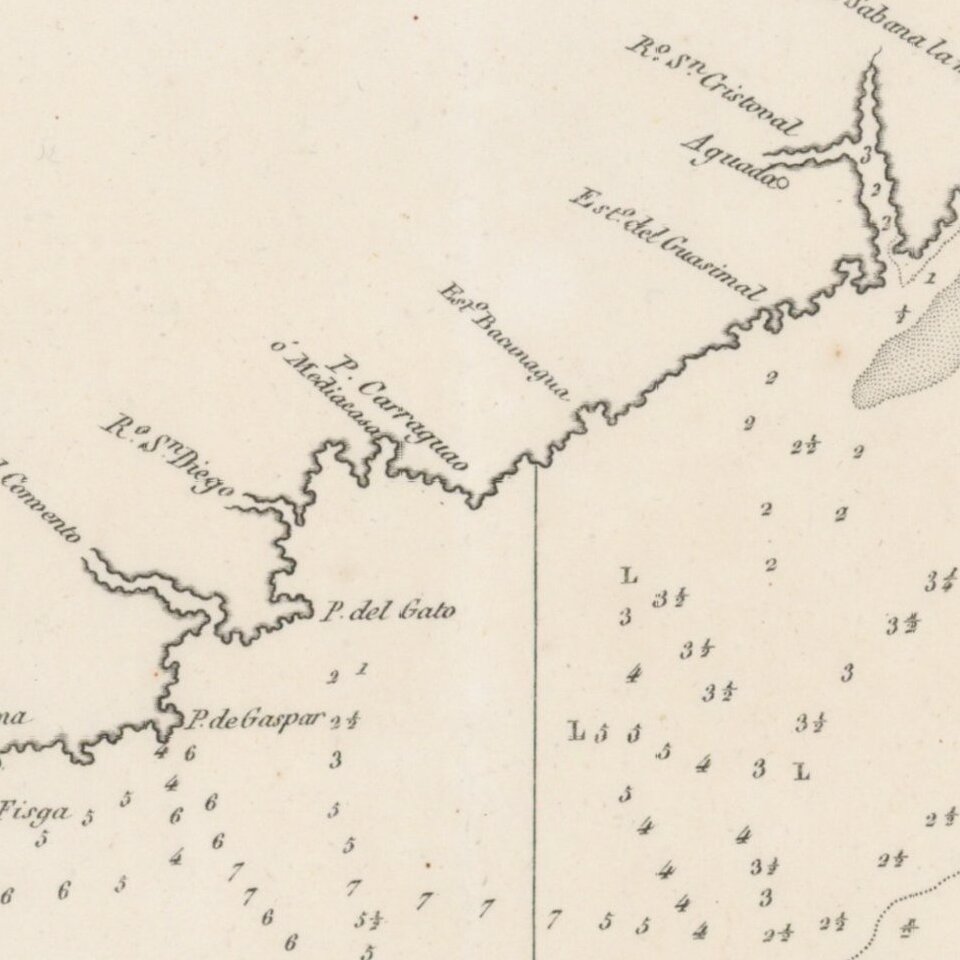
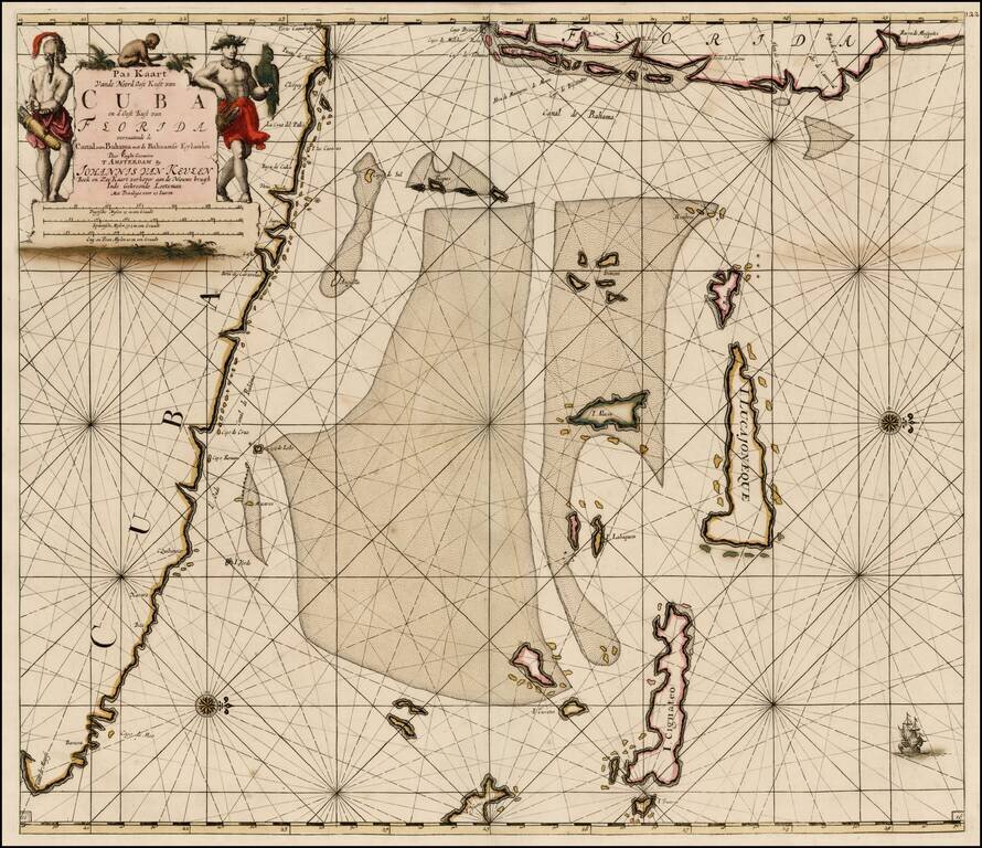
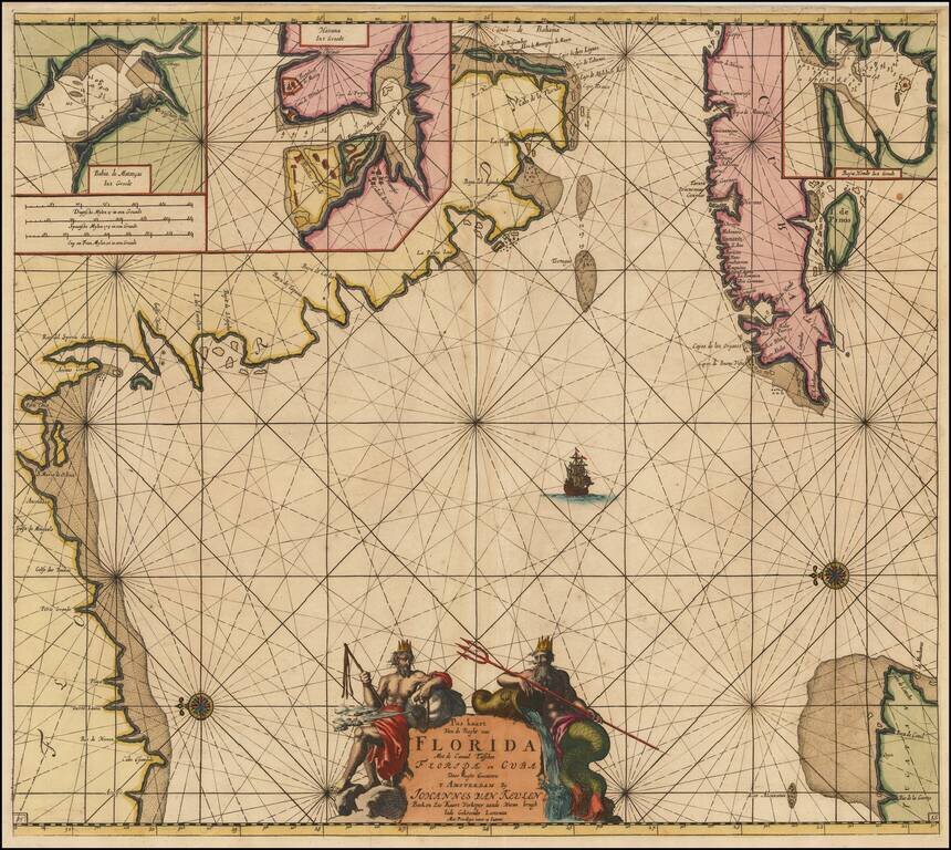
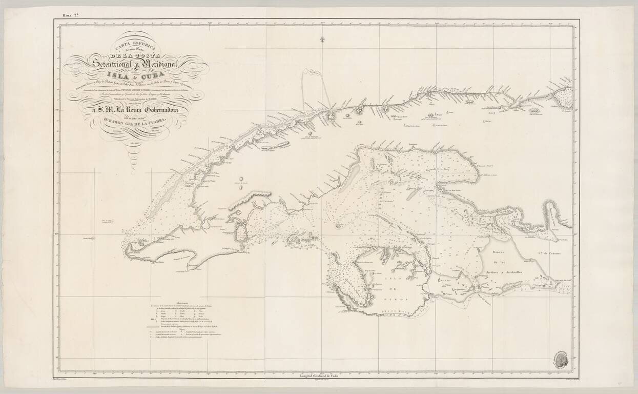
Fine Spanish Sea Chart of Western Cuba.
Scarce and highly detailed chart of Cuba from official Spanish sources.
Spanish maps of the Caribbean are quite scarce, even in the 19th Century. Extends from Cape San Antonio at the western tip of the island to the Rio Siguagua and Cape Piedras in the Northeast and Ensendada de Cochinas in the Southeast. Includes Havana.
The Dirección de Hidrografía, or the Directorate of Hydrographic Works, was established in 1797. Its roots were in the Casa de Contratación, founded in 1503 in Sevilla, which housed all the charts of the Spanish Empire and oversaw the creation and maintenance of the padrón real, the official master chart. The Casa, now in Cadiz, was shuttered in 1790, but Spain still needed a hydrographic body. In response, the Dirección was created in 1797. One of its first projects was the publication of charts from the Malaspina Expedition (1789-1794). The Dirección oversaw not only publication, but also surveying. The Dirección was abolished in the early twentieth century, when their work was distributed to other organizations.
If you are a student, write to us in telegram: @antiquemaps and indicate what material you need and for what work you need a map in high detail. We are ready to provide material on special terms. For students only!