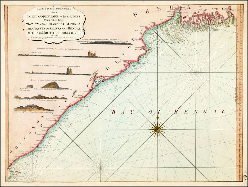
Detailed sea chart of the coast of India, from the mouths of the Ganges Rivers in the northeast to Point Gordeware in the south west. Includes numerous sailing channels and soundings, along with smaller islands and several profile views. One of the...
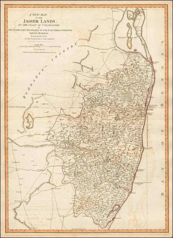
Detailed map of the coastal region of India centered on Madras and Fort St. George (Chennai), extending north to Erikans Lake (Pulicat Lake) and south to Cheeyer Tank and Allumparva (Cheyyur), one of a series of maps of India prepared by James Rennell...
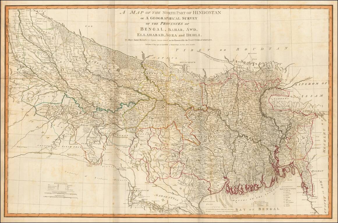
Fine example of James Rennell's highly detailed map of northern India, based upon his survey work while Surveyor General of the East Indian Company. The map is exceptionally detailed and includes roads, towns, mountains, rivers and a host of other...
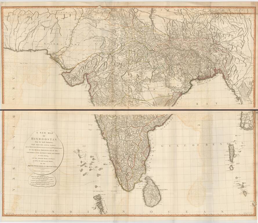
Superb large format map of India and Sri Lanka, based on the surveys of James Rennell, and published by Laurie & Whittle. The map is exceptionally detailed and includes roads, towns, mountains, rivers and a host of other details. It was one of the...
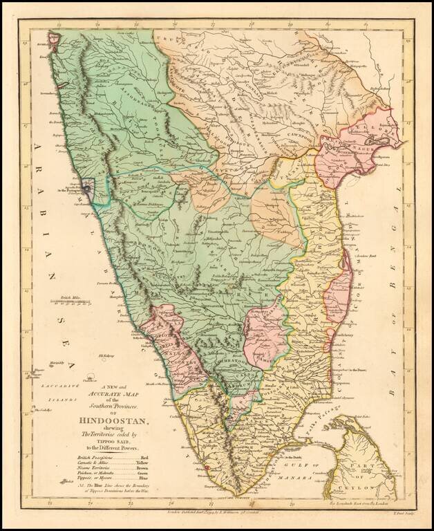
Delightful regional map of the Southern part of India and Ceylon, with nice details. Robert Wilkinson was active in London as a cartographic publisher from 1785 to 1825. He produced a number of nice works, including a General Atlas and a re-issuance...
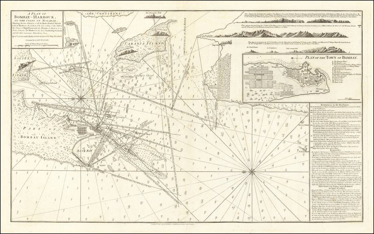
The First Modern Chart of Mumbai (Bombay) Harbor Fine example of the second edition of William Nichelson's charting of Bombay Harbor, published in 1794 by Laurie & Whittle. The second edition notes that it is "Correct by Capt. Watson". The map...
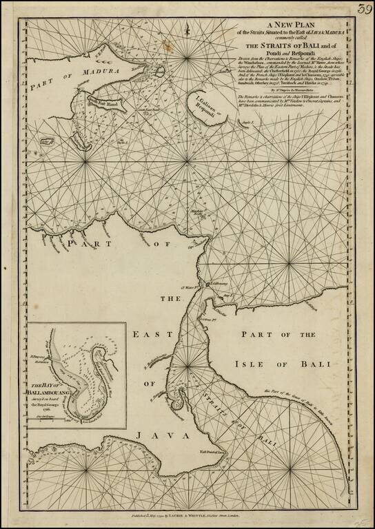
Scarce sea chart of the Straits of Bali and part of Madura, with a large inset of the Bay of Ballambouang, showing the narrow channel between the Isand of Bali and East Java. Includes extensive details and soundings. The northeastern part of Borneo is...
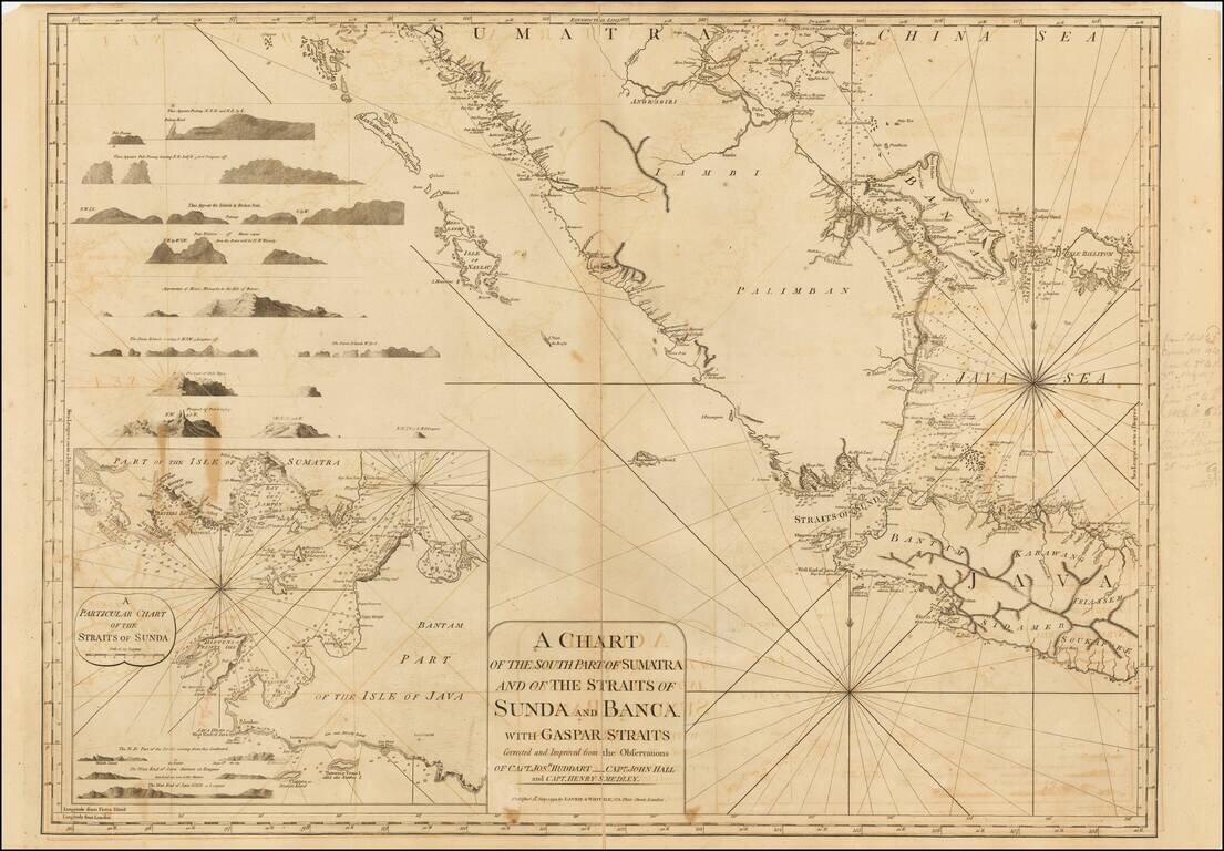
Detailed sea chart the southern part of Sumatra, western Java and neigbhoring islands, with a large inset of the Straits of Sunda. The present example includes some pencil notes showing sailing directions and mentioning Hendrick Rock. Includes numerous...
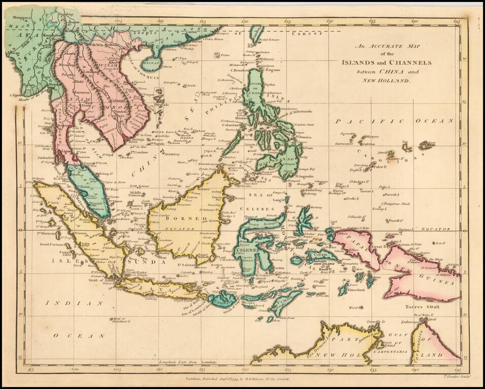
Highly detailed map of Southeast Asia, covering the region between Formosa and Hainan islands in the North and Australia in the South. Excellent detail in the Philippines and South East Asia. Robert Wilkinson was active in London as a cartographic...
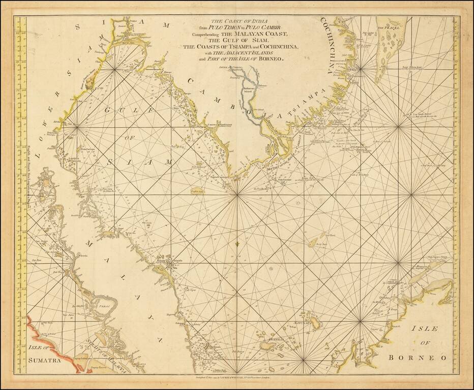
Scarce sea chart of Thailand, Malaysia and a portion of the Straits of Malacca, Cambodia and Vietnam, from Laurie & Whittle's East India Pilot. Includes extensive details and soundings. The northeastern part of Borneo is also shown. The focus of...
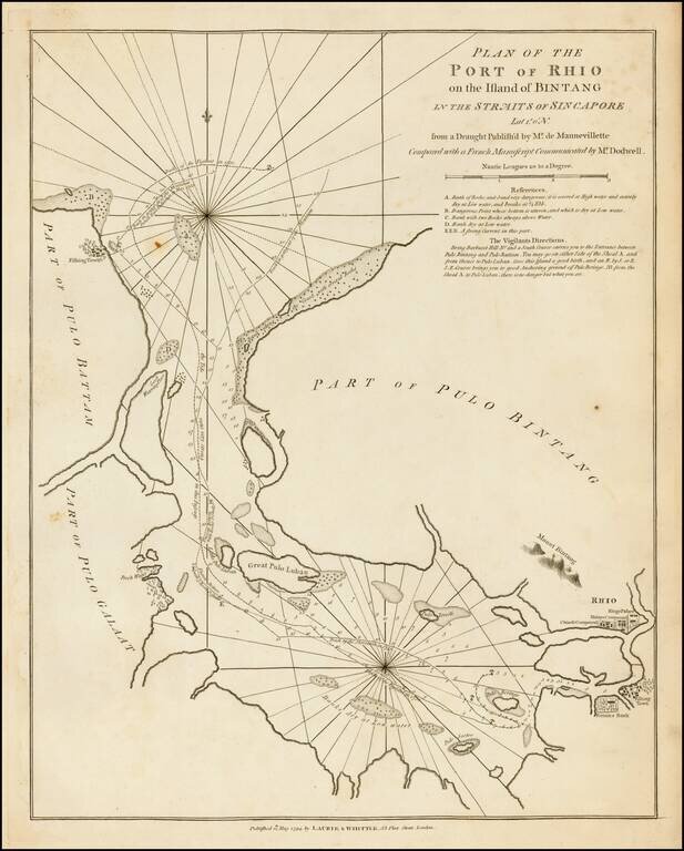
A fine large format 18th-century sea chart of Bintan and Batam Islands, Indonesia, located on the Singapore Straits, published by the firm of Laurie & Whittle. Bintan Island (formerly known as Bintang) and the adjacent island of Batam (Bataam) are...
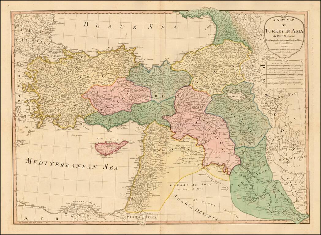
Double-page engraved map of Asia Minor, showing Cyprus, the eastern Mediterranean, and much of the Middle East. The map has old outline hand-color. D'Anville is credited as the source of the map. Laurie & Whittle Robert Laurie (ca. 1755-1836)...
![Egypt called in the Country Missir by Monsr. D'Anville of the Royal Academy of Belles Lettres, & of that of Siciences [sic] of Petersburg Secretary to H.S.H. the Duke of Orleans. MDCCLXV.](/map/small/49130.jpg)
Fascinating engraved map of the Nile north from Aswan, with extensive labeling of the sites along the river. Laurie & Whittle credit D'Anville as the source for the map. Expeditions further down the Nile did not proceed successfully until the 19th...
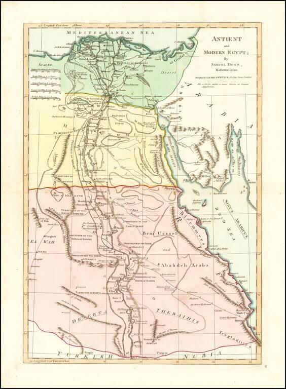
Interesting map extending from the mouth of the Nile and Nile River Valley (extending to the Assuan and the Cataract) to the Red Sea. Includes both ancient and modern names, including Troglodictica, Theaidis, El Way, Heptanomi, Thebais, etc. A number...
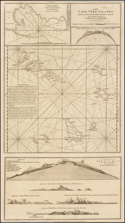
A finely detailed chart of the Cape Verde Islands off the Coast of Africa, which appeared in a later edition of the West India Atlas. This sheet of sea charts details the Cape Verde Islands. First settled by the Portuguese in 1462, it soon became a...

Finely executed portrait of John Smith, teacher of Mathematics and Navigation.