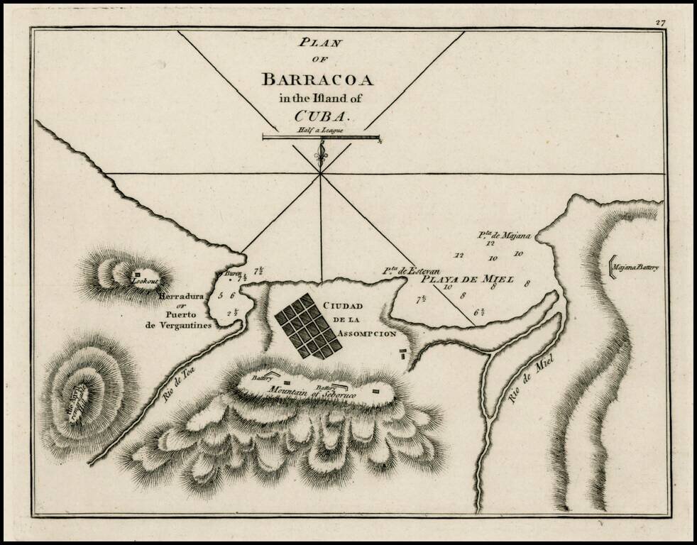
Rare early plan of Barracoa, first published by Sayer & Bennett, one of the earliest obtainable English Plans of the harbor. Includes a town plan of Ciudad de la Assompcion (sic), detailed charting of the harbor, Battery positions, look out, etc.,...
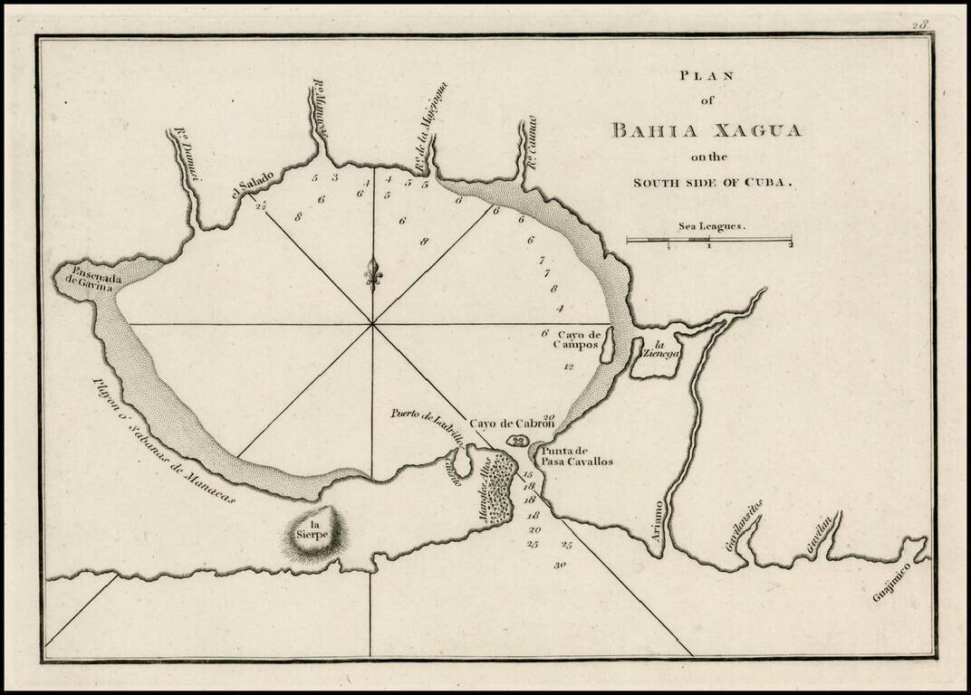
Rare early plan of the Harbor of Xagua, first published by Sayer & Bennett, one of the earliest obtainable English Plans of the harbor. Includes a plan of the harbor, small islands, lagoons,, soundings, and place names.
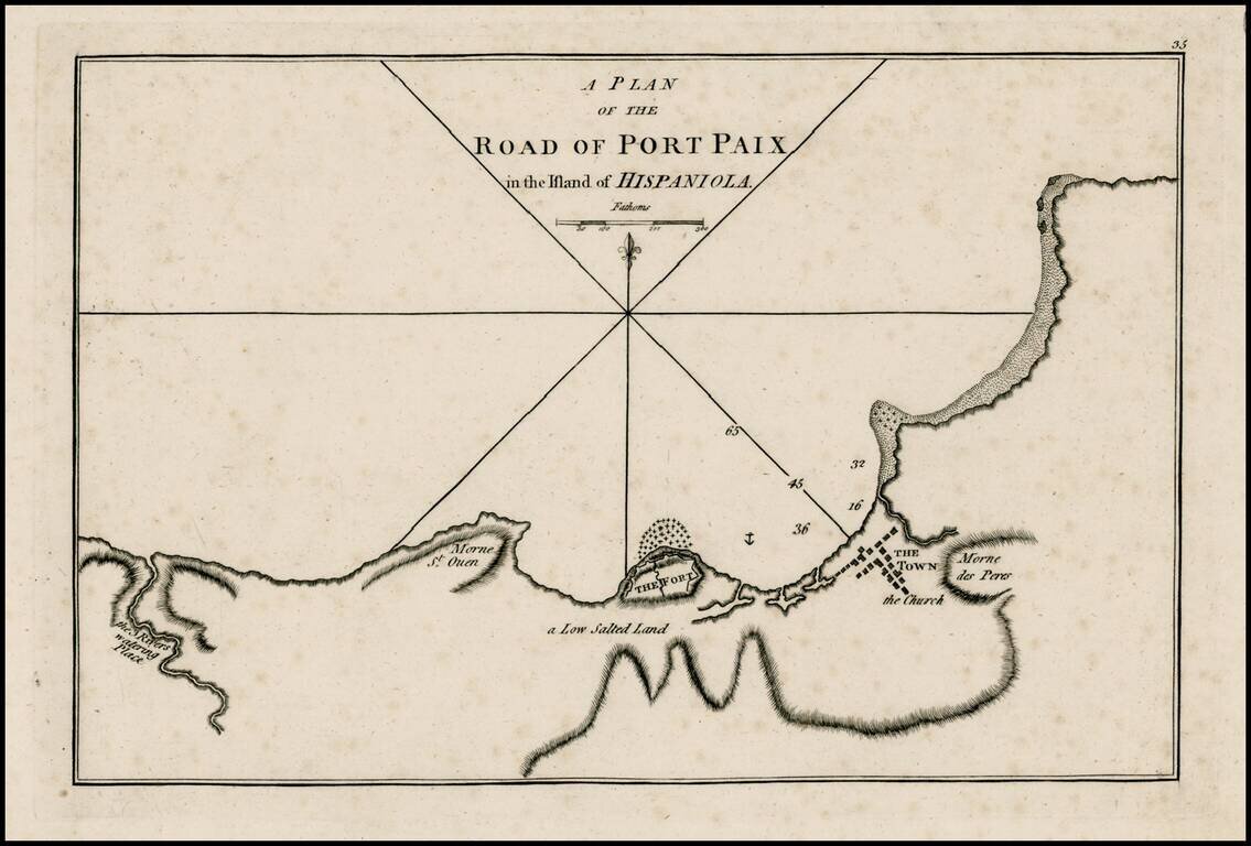
Rare early plan of Port Paix, first published by Sayer & Bennett, one of the earliest obtainable English Plans of the harbor. Includes a detailed charting of the harbor, fort and town, with soundings and anchorages, and place names.
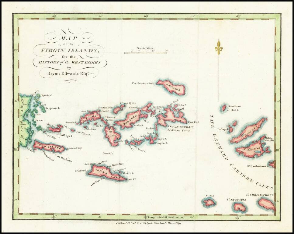
18th Century Map of the Virgin Islands Detailed map of the Virgin Islands, published in London by Brian Edwards. Extends from the east coast of Puerto Rico to St. Barts, centered on Tortola, St. Johns, Saint Croix and Virgin Gorda. There are very...
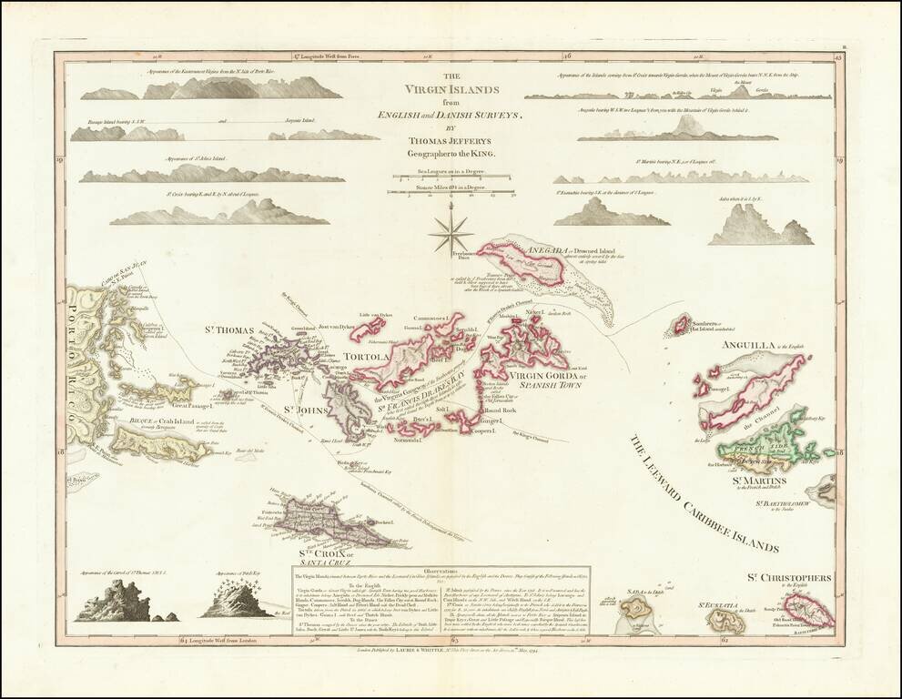
Fine full color example of Thomas Jefferys' highly sought after map of the Virgin Islands, from The West-India Atlas. Jefferys map is one of the earliest separately issued maps of the Virgin Islands and the earliest obtainable large format map to...
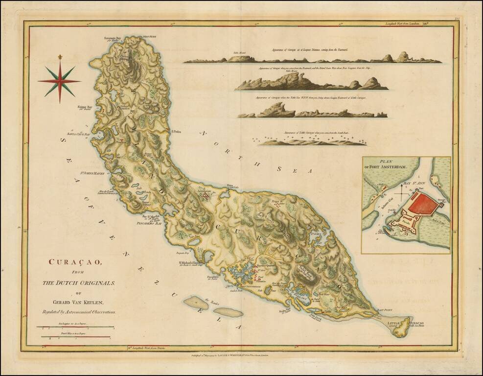
Nice example of Laurie & Whittle's map of Curacao. Includes numerous profile views and a large inset of Fort Amsterdam.
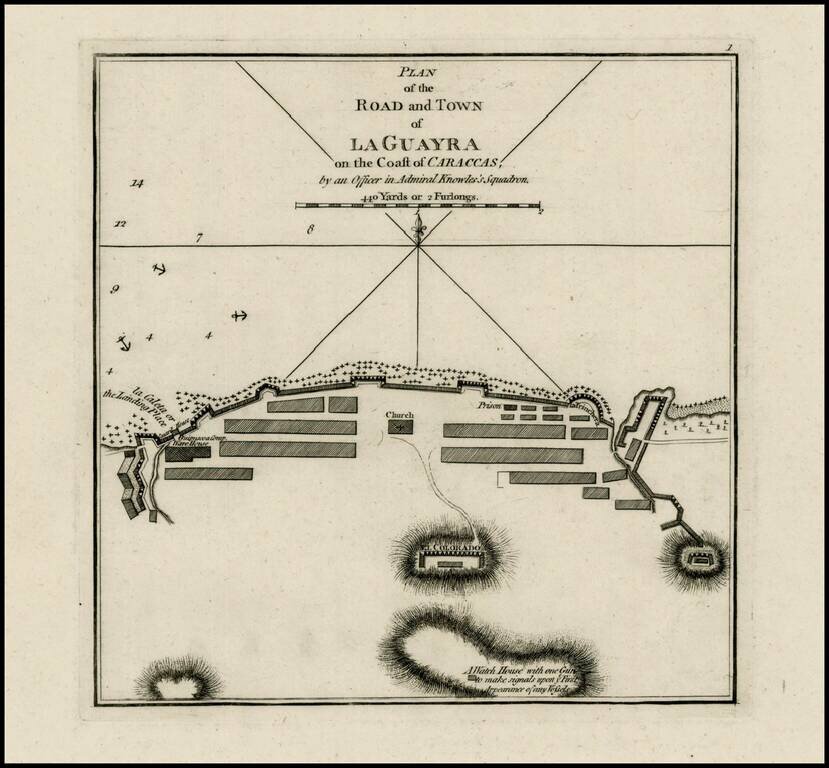
Rare plan of the harbor and town of Guayra in Venezuela, published by Laurie & Whittle. The plan shows soundings, "the Landing Place" a Warehouse, Church, prison, walled fortifications, the watch house, and other details. The map was the site of...
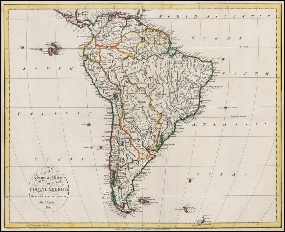
Nice example of Russell's map of South America, on the eve of its Century of Revolution.
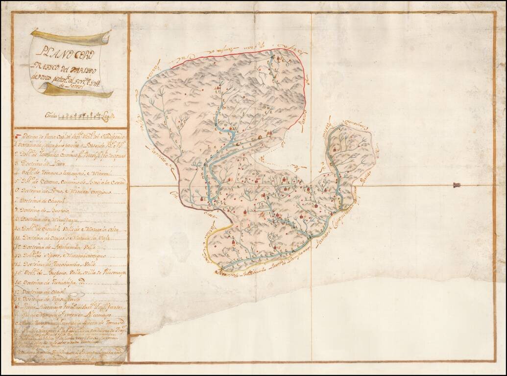
Finely Executed Spanish Colonial Government Survey Manuscript Map of the Porco District of the Mining Region of Potosi in Bolivia Remarkably detailed manuscript map of the Porco district, part of Potosi, one of the richest mining regions in the world,...
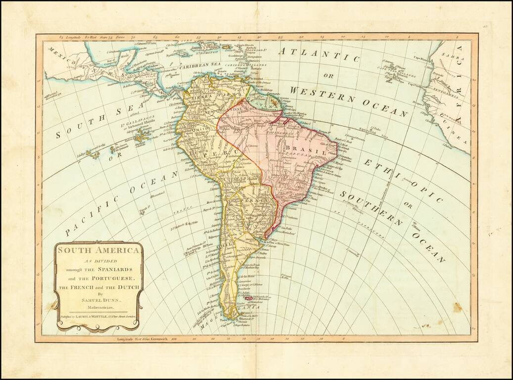
From Dunn's New Atlas or Mundane System of Geography, published by Laurie & Whittle. The map shows South America on the eve of several decades of Revolution and Independence from Spain and Portugal.
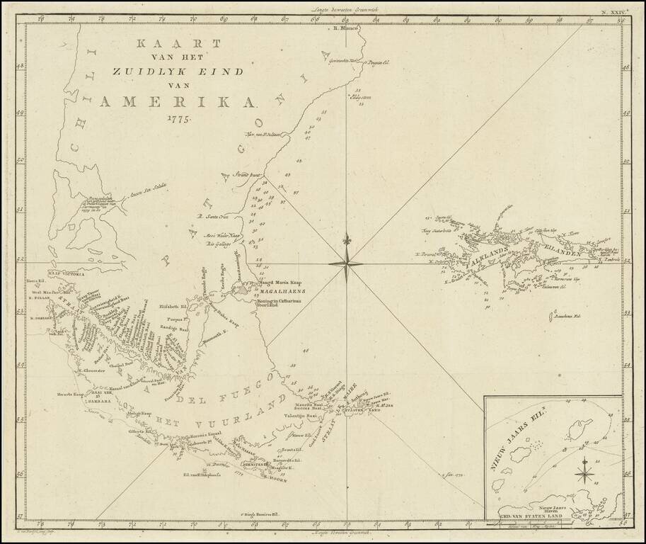
Scarce map of the sourthern part of South America, focusing on Cook's tracks around the Cape Horn and Tierra del Fuego in 1775. From a Dutch edition of the Official Account of Cook's Expedition.
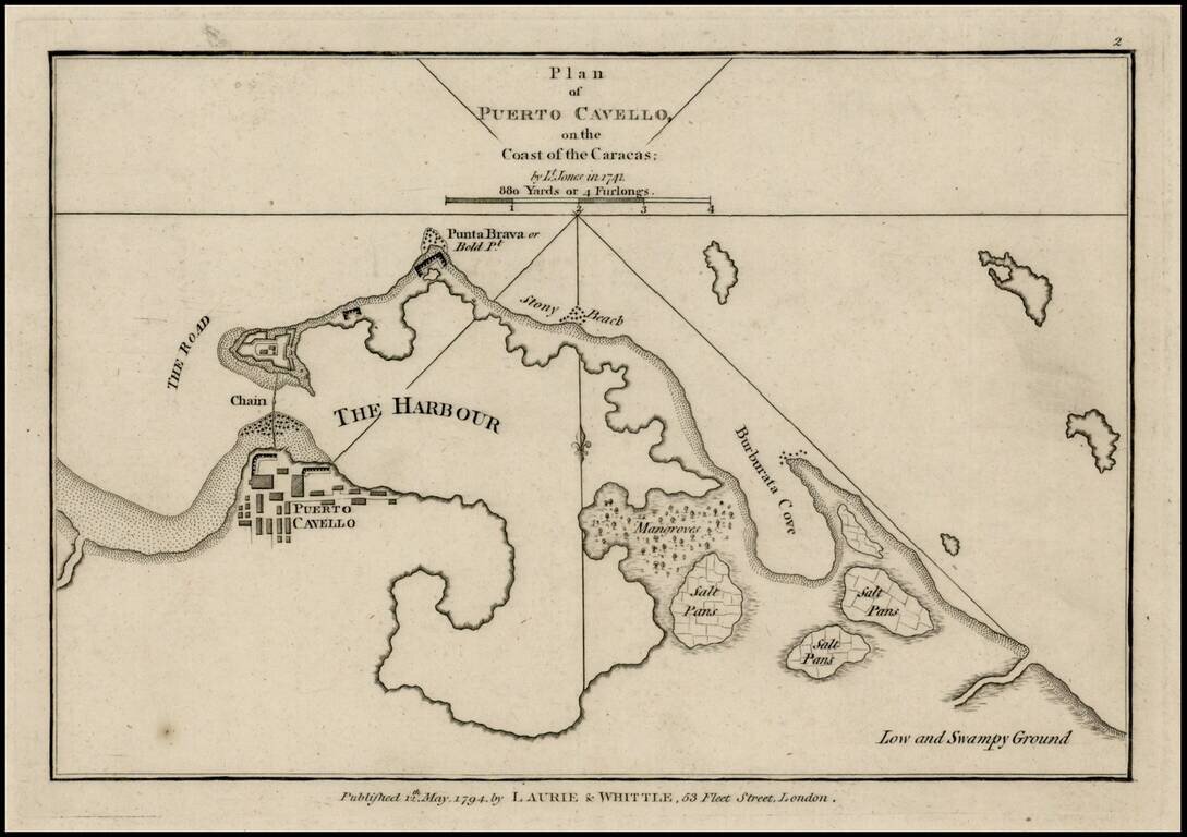
Rare plan of Puerto Cavello, Venezuela, first published by Sayer & Bennett. Includes a town plan, detailed charting of the harbor, with soundings and anchorages, forts, islands and other details. One of the earliest obtainable English language...

Unusual Eighteenth-Century Map of Solar Eclipses over Europe Rare, separately-issued map showing the solar eclipses of 1715, 1724, 1737, 1748 and 1764, including the famous 1715 Halley’s Eclipse, named for the pioneer of eclipse mapping, astronomer...
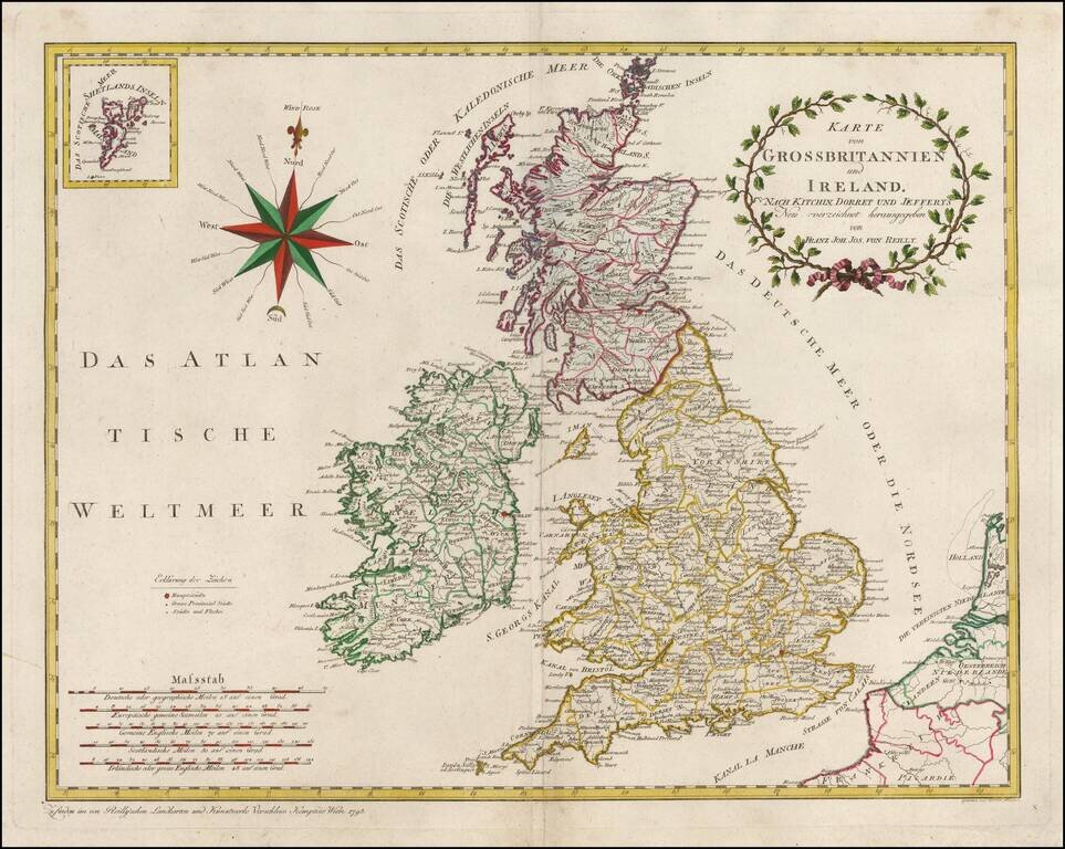
An attractive large sized map of Great Britain, including an inset map of the Shetland Islands in the upper left-hand corner. Includes a decorative title cartouche in the upper right-hand corner. Franz Johann Josef von Reilly (Vienna 18 august 1766 -...
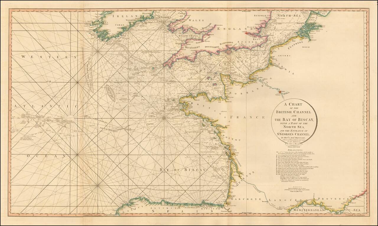
Striking 2 sheet chart of the English Channel, Bay of Biscaya, etc. The chart includes a number of coastal details, soundings, rhumb lines, etc. In addition, the routes of several historically important voyages are shown.
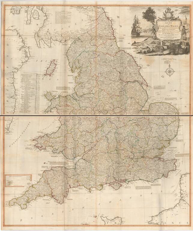
Fine large format map of England and Wales, published by Laurie & Whttle, based upon an earlier map by Thomas Kitchin. The map is updated to incorporate all British Canals through 1792. A number of annotations are shown along the coastlines,...