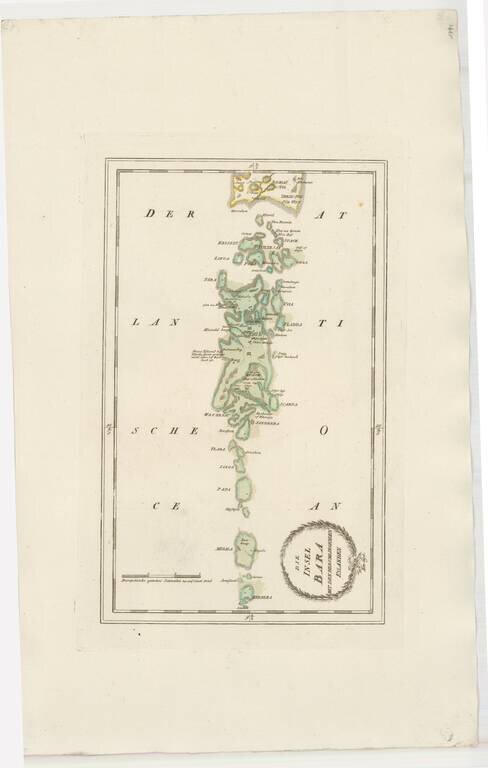
Striking map of Barra and some of the other Western Scottish Islands, from Von Reilly's remarkable atlas. The map extends as far south as Bernera (Barra Head) and Megala (Mingulay), also showing Papa (Pabbay), Linga (Lingeigh), Flada (Flodday),...
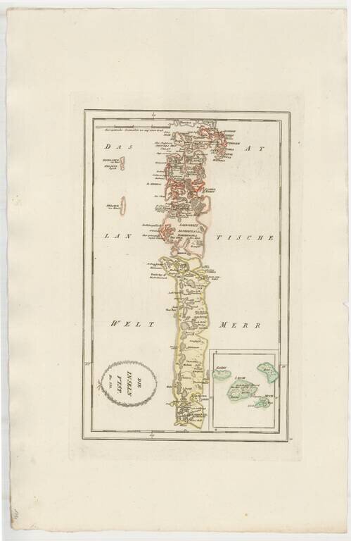
Striking map of Uist, other western Scotish Islands, from Von Reilly's remarkable atlas. Extends north to Harries (Harris) Island and south the the southernmost tip of South Uist Island.
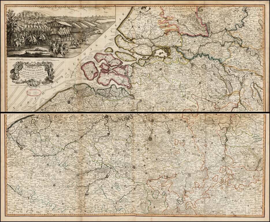
Scarce large format map of the southern part of the Low Countries, published by Laurie & Whittle in 1794. Above the decorative cartouche is a large (9" x 20") and beautifully rendered battle scene that may be the Battle of Flushing. Filled with...
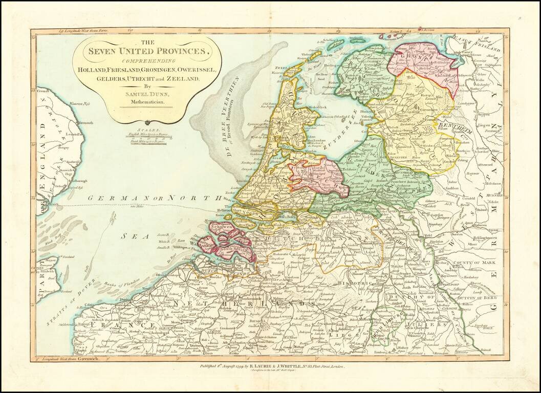
Nice detailed map of the Low Countries, colored by provinces. From Dunn's New Atlas or Mundane System of Geography.
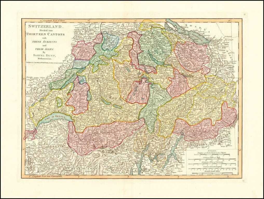
Detailed double-page engraved map of Switzerland, divided into Cantons, etc.
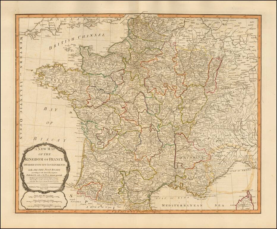
Handsome double-page engraved map of Napoleonic France, by one of the best English mapmaking firms of the period. Laurie & Whittle Robert Laurie (ca. 1755-1836) and James Whittle (1757-1818) formed their Fleet Street, London-based firm upon the...
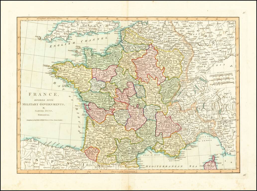
Detailed map of France, divided into its provinces. From Dunn's New Atlas or Mundane System of Geography.
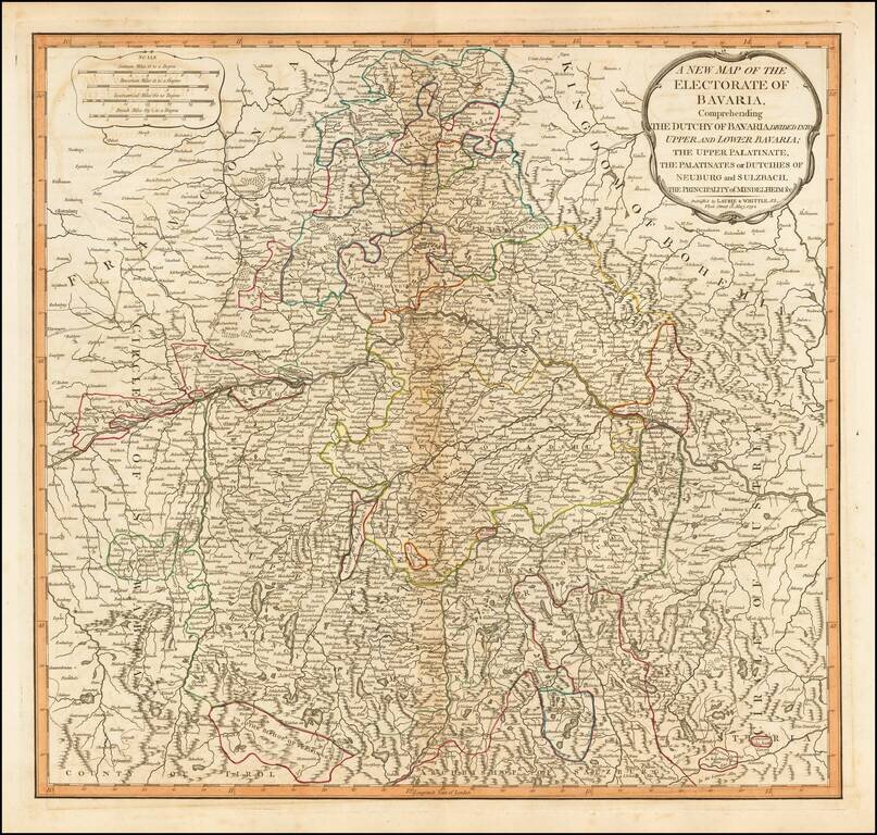
Detailed map of Bavaria, in present-day Germany, by the esteemed English mapmaking firm of Laurie & Whittle. The map highlights the political divisions and subdivisions of Bavaria in attractive original hand-color. Laurie & Whittle Robert...
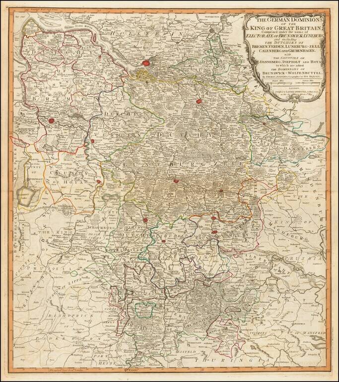
Fine engraved map of the territory in the west of Germany that constituted some of the inherited lands of George III. The chief cities on the map are Hamburg, Bremen, and Hanover, although many others are also shown. Laurie & Whittle Robert...
Detailed map of the dismembered parts of Poland and the Baltic Region, extending from Prussia in the West to Smolensk in the East. Divided by regions. Highly detailed.
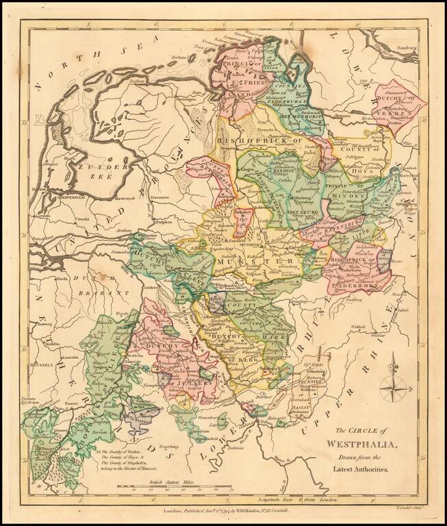
Detailed map of Westphalia, spanning from the Bishoprick of Liege to Friesland and Verden. Divided by regions, which are individually colored.
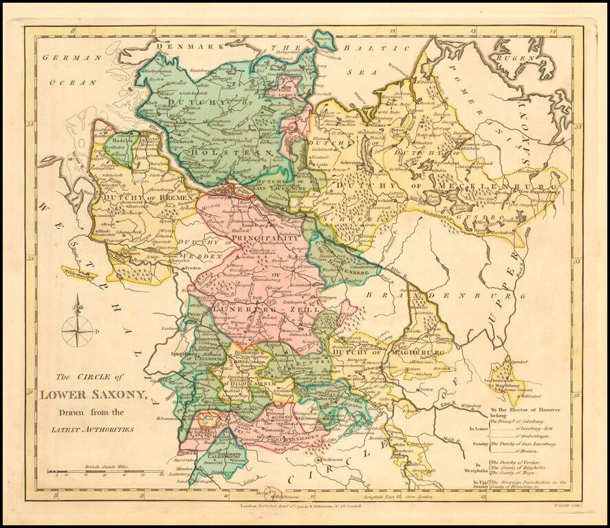
An interesting regional map, showing the Dutchys of Bremen, Holstein, Mecklenberg, Schwerin, Gustro, Magdeburg, Verden, Saxe Launberg, the County of Dannenberg, a group of southern Principalities including Calenburg, Grubenhagen, Haaberstadt,...
An interesting regional map showing the Dutchys of Bremen, Holstein, Mecklenberg, Schwerin, Gustro, Magdeburg, Verden, Saxe Launberg, the County of Dannenberg, a group of southern Principalities including Calenburg, Grubenhagen, Haaberstadt,...
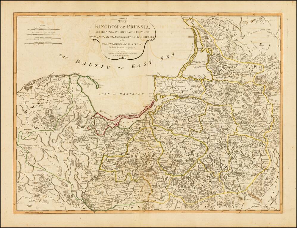
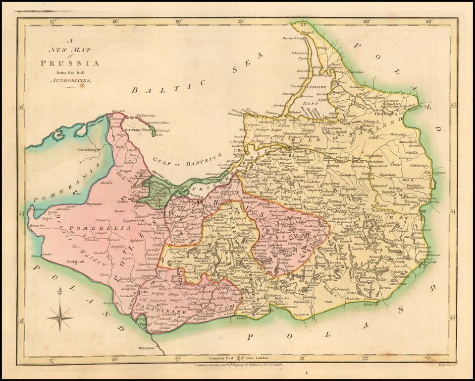
Strking full color example of this fine map of Prussia and Polish Prussia, following the Polish Dismemberment. Includes a significant section of modern Lithuania.
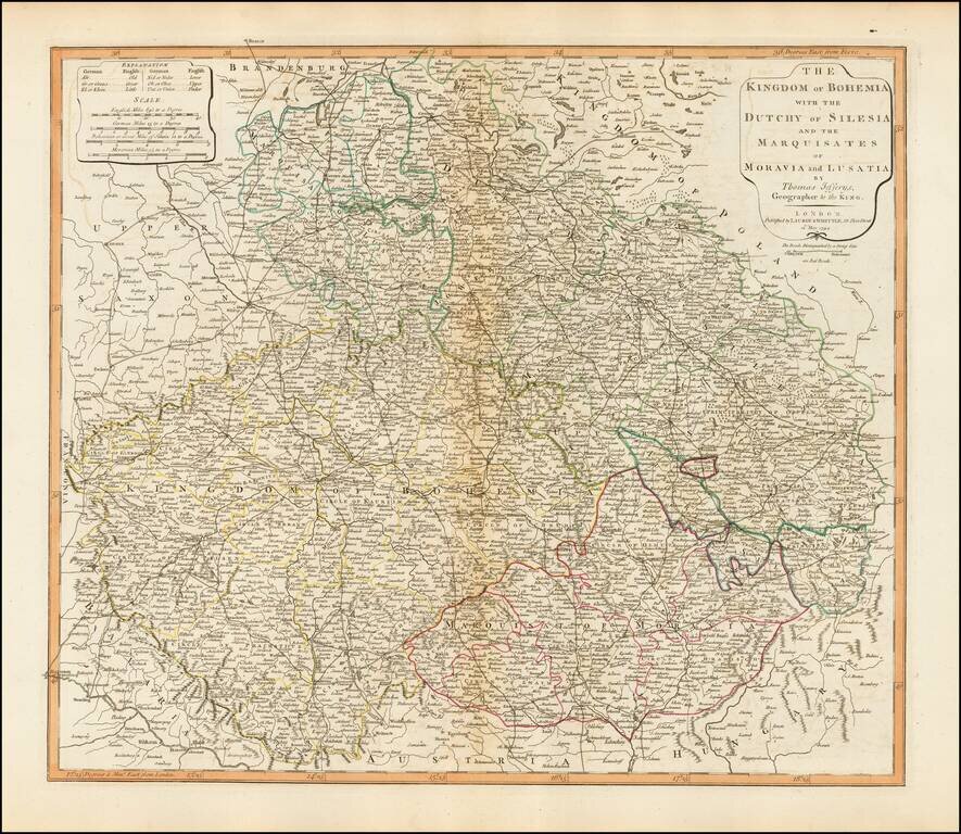
Detailed map of Bohemia, Moravia, Silesia and Lusatia, published in London by Laurie & Whittle. The map incorporates the modern day Czech Republic, Slovakia and the southern part of Poland.
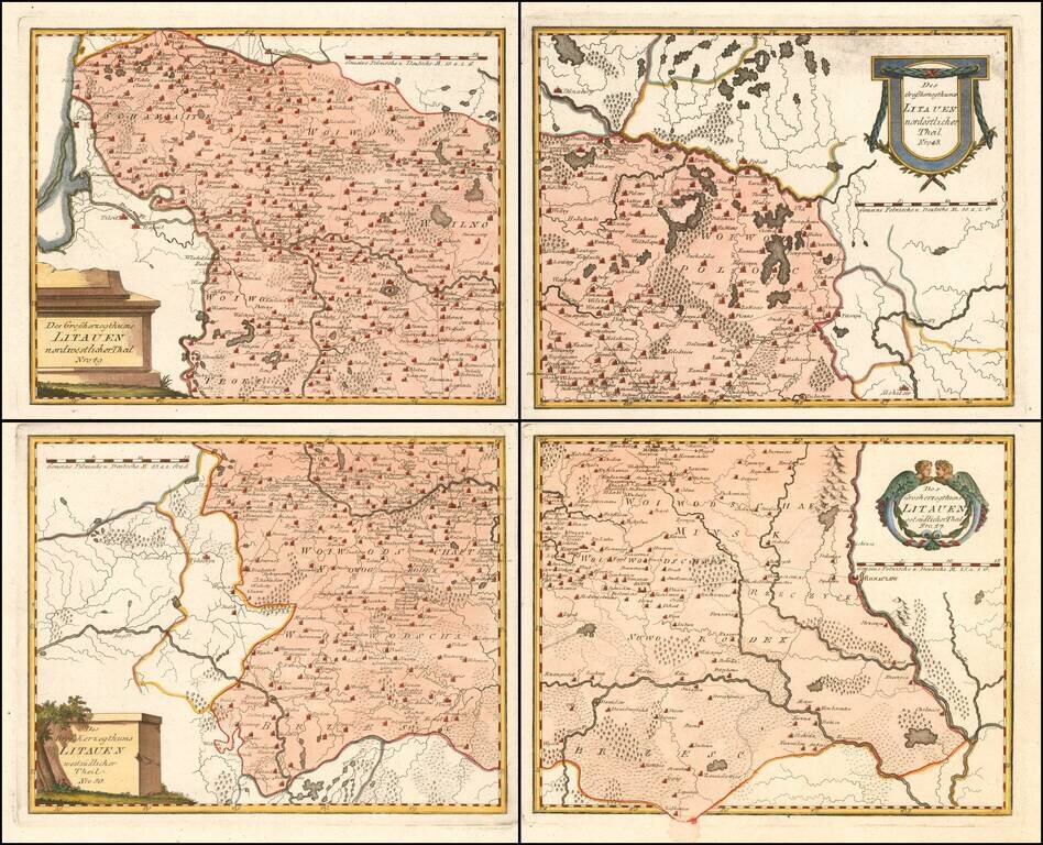
Scarce 4-sheet regional map of Lithuania, published by Von Reilly, The map shows region bounded by the Dnieper, Dwina and Wilia Rivers and including Mohilow, Polock, and Braslaw. Shows rivers, roads, towns, castles, forests, lakes and a host of other...