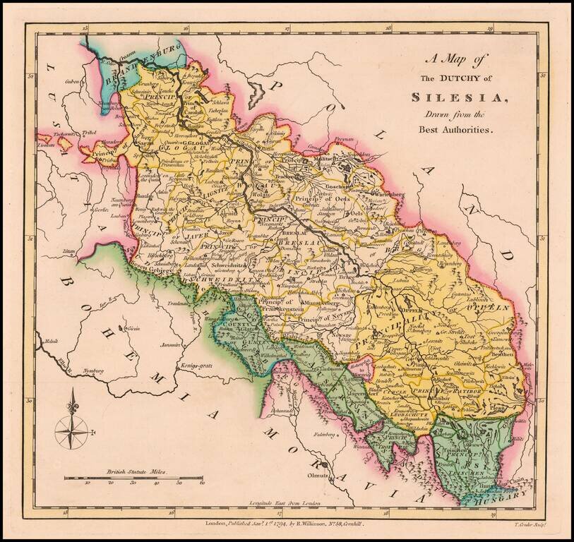
Scarce 18th Century English language map of Silesia, showing the region on either side of the Oder River. Includes Principalities of Glogau, Wolau, Lignitz, Oels, Breslau, Javer, Schweidnitz, Brieg, Oppeln, Neysze Trahenberg Sagan, Carolath,...
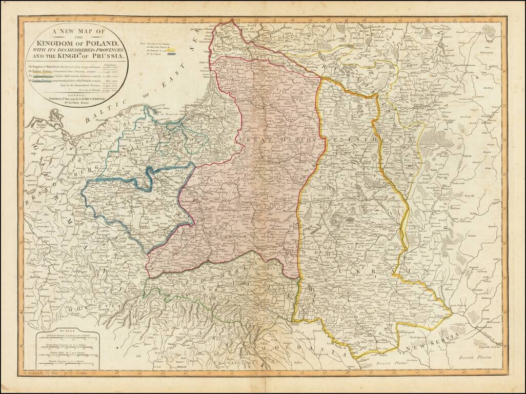
Striking full color example of this fine map of Poland, showing the provinces stripped from the control of Poland at the end of the 18th Century. The table notes the population of Poland before dismemberment (14,260,000), the populations of the...
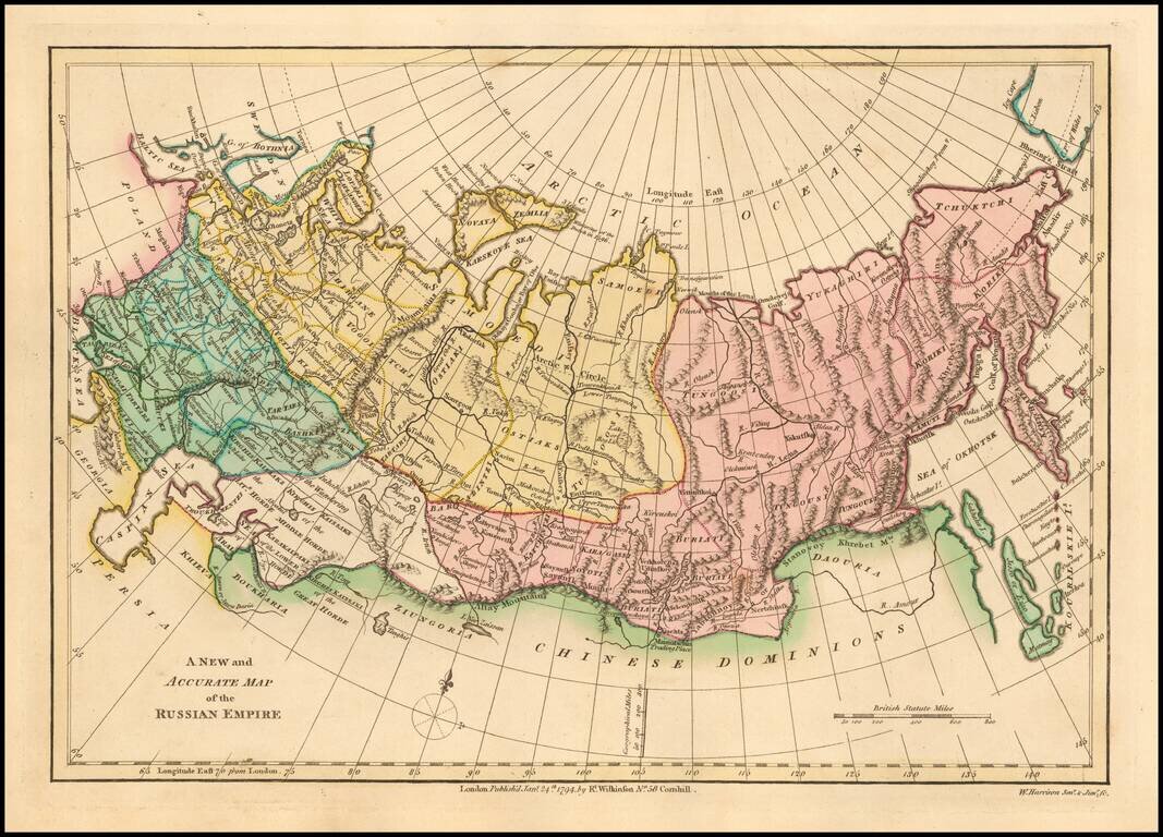
Interesting map of the Russian Empire, extending from the Baltic and the Caspian Seas in the West to the Bering Straits, Kamtchatka and the Sea of Okhotsk in the East. Shows towns, rivers, mountains, lakes, etc. Striking original wash colors. Robert...
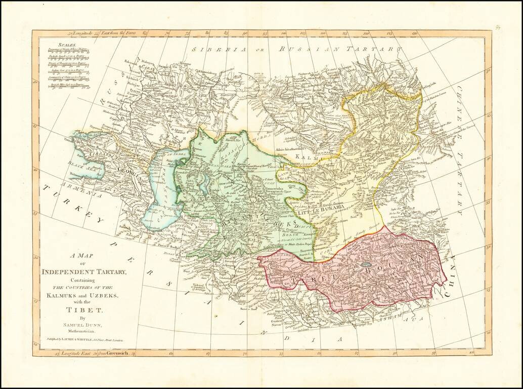
Detailed regional map, extending from European Russia and the Caspian Sea to Chinese Tartary. Nice detail in Tibet, Bukaria, and the Mountainous regions of western China. From Dunn's New Atlas or Mundane System of Geography.
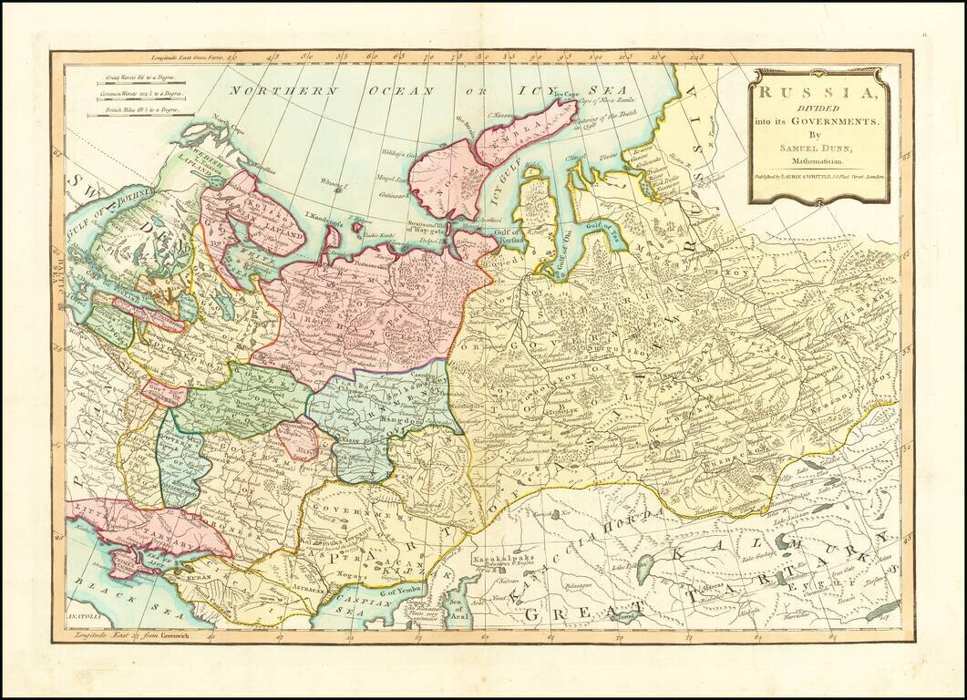
Finely colored map of Russia and its political divisions. Includes towns, mountains, rivers, lakes, islands, etc. From Dunn's New Atlas or Mundane System of Geography.
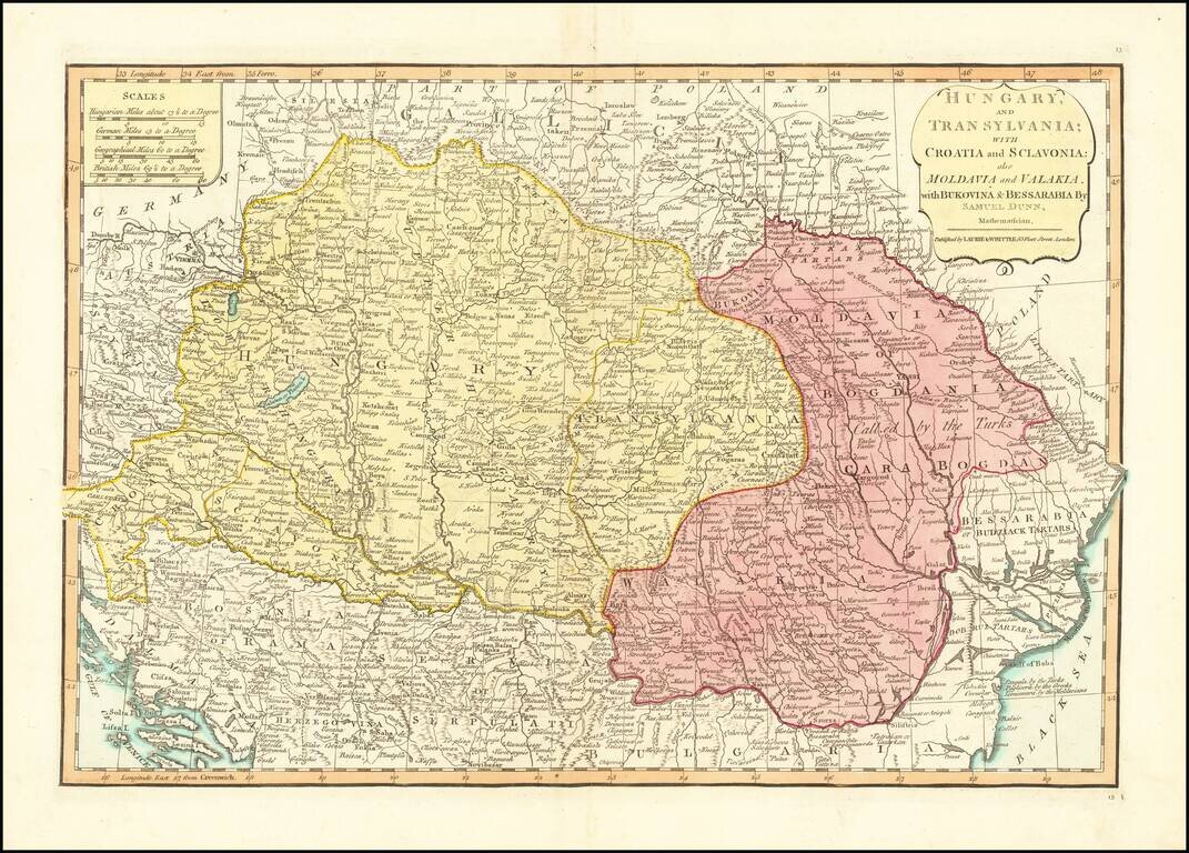
Detailed engraved map of the Balkans and Hungary, by one of the most important mapmaking firms of the end of the 18th century: Laurie & Whittle. The map shows Croatia, Serbia, Bosnia, Slovenia and the region extending east to Romania and the Black...
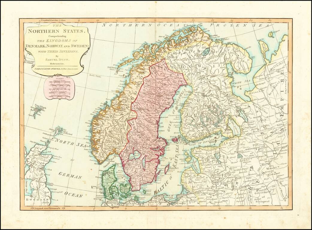
Detailed regional map of Scandinavia and the Baltic Sea, colored by Political divisions. Includes towns, mountains, rivers, lakes, islands, etc. From Dunn's New Atlas or Mundane System of Geography.
![A New Map of Turkey in Europe Divided into All Its Provinces; With the Adjacent Countries of Europe and Asia . . . 1794 [shows Cyprus]](/map/small/49114.jpg)
Striking map of the eastern Mediterranean, Greece, Turkey & Cyprus, bounded by Cyprus and the Mediterranean, the Black Sea, the Adriatic and Crete, centered on Greece and Turkey. Laurie & Whittle credit as sources maps published by the...
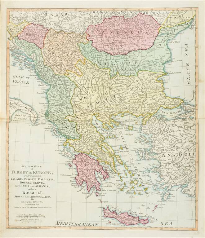
Detailed map of Greece and environs from Crete and the Mediterranean to the Black Sea and the Balkans, centered on Roum-Ili. From Dunn's New Atlas or Mundane System of Geography.
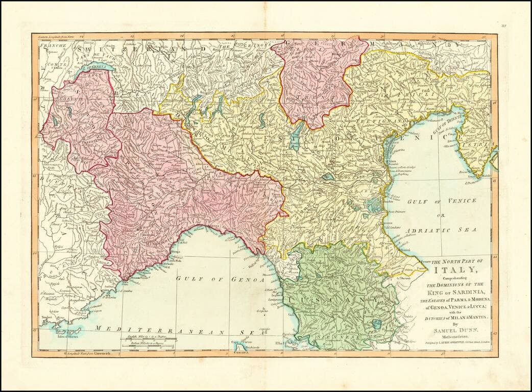
Detailed regional map of Northern Italy. Excellent detail. From Dunn's New Atlas or Mundane System of Geography.
![Spain and Portugal, with Their General Divisions . . . [Balaeric Islands]](/map/small/65193.jpg)
Detailed late 18th Century map of the Iberian Peninsula and contiguous islands. Scarce English language map of the region. From Dunn's New Atlas or Mundane System of Geography.
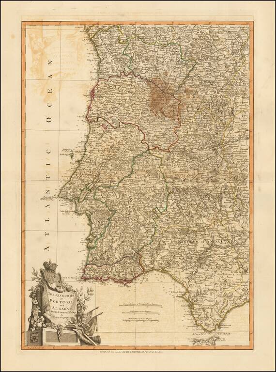
Beautiful double-page engraved map of Portugal, encompassing the Straits of Gibraltar, by John Lodge. The map features an elaborate cartouche in the lower left corner with the coats of arms of Portugal and Algarve. Algarve was a nominal kingdom in the...
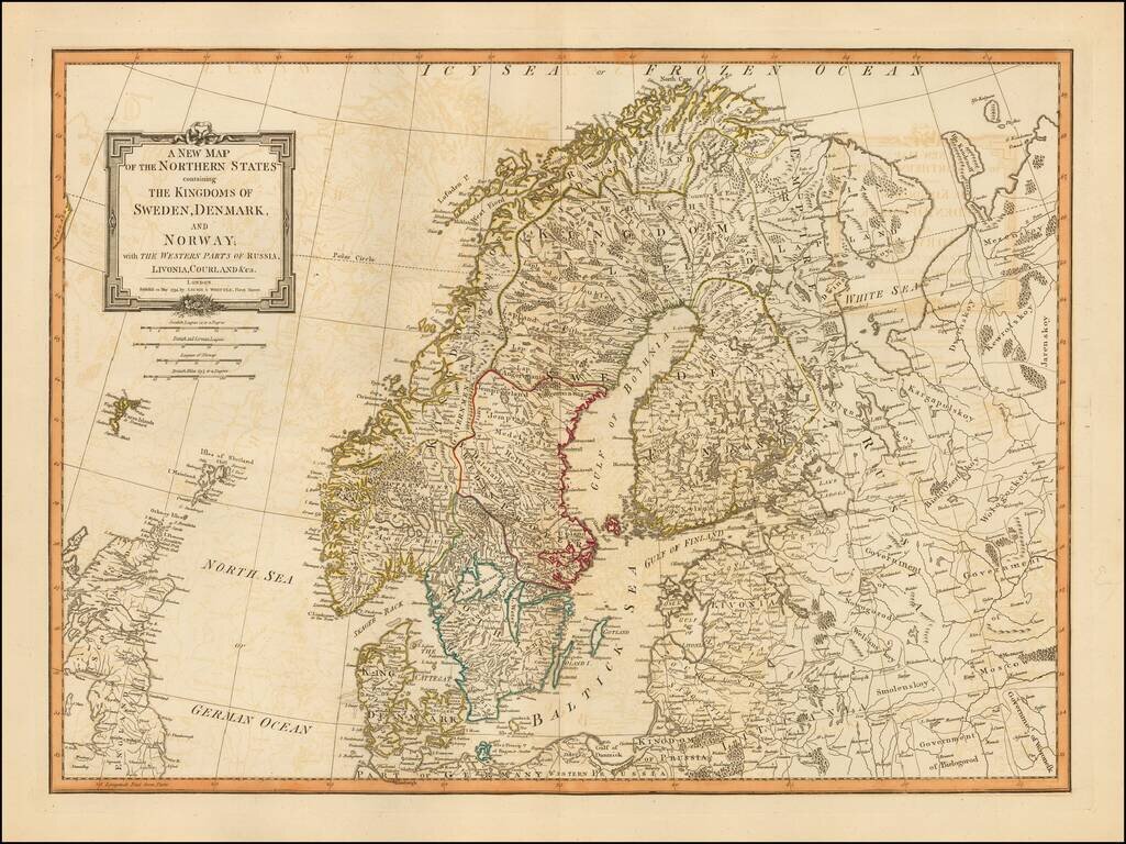
Detailed map of Scandinavia and the Baltic Region, published in London, by Laurie & Whittle. Laurie & Whittle Robert Laurie (ca. 1755-1836) and James Whittle (1757-1818) formed their Fleet Street, London-based firm upon the 1794 death of...

Fine Large Map of Corsica from the late 18th Century Detailed large format map of Corsica. Includes highly detailed topographical details, including mountains, roads, rivers, bays, and other details. Text note in the lower right corner. Laurie &...
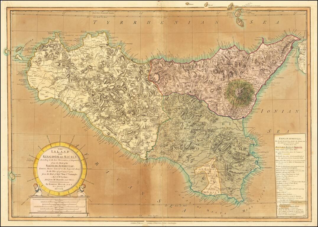
Old color example of this detailed map of Sicily by Robert Mylne, which appeared in Laurie & Whittle atlases in the 1790s. Mylne's map is a fine compilation of the most important cartographical sources of the time, including the maps of Austrian...
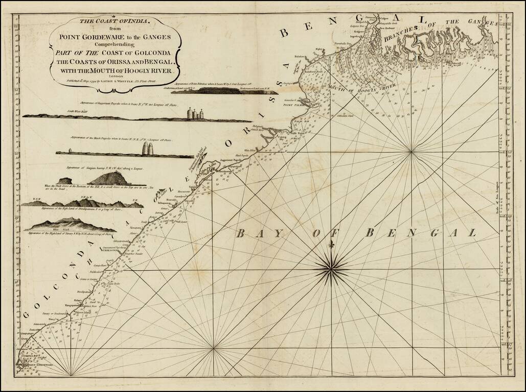
Detailed sea chart of the coast of India, from the mouths of the Ganges Rivers in the northeast to Point Gordeware in the south west. Includes numerous sailing channels and soundings, along with smaller islands and several profile views. One of the...