logo

1794. A New and Accurate Map of the Southern Provinces of Hindoostan, shewing The Territories ceded by Tippoo Saib to the Different Powers.

  • A New and Accurate Map of the Southern Provinces of Hindoostan, shewing The Territories ceded by Tippoo Saib to the Different Powers.

A New and Accurate Map of the Southern Provinces of Hindoostan, shewing The Territories ceded by Tippoo Saib to the Different Powers. information:

Year of creation: 
Resolution size (pixels): 
 5977x7305 px
Disk Size: 
 7.77151MiB
Number of pages: 
 1
Place: 
 London
Author: 

Print information. Print size (Width x height in inches):
Printing at 72 dpi 
  83.01 х 101.46
Printing at 150 dpi 
 39.85 х 48.7
Printing at 300 dpi 
 19.92 х 24.35

An example of detailing the file of this map of in a printable high-resolution:

Click to open in high resolution (open in new tab).
Attention! this is just the central piece (central area 960x960 px) of the map file!
This is an example, so that you can see and study the level of detail of a given map. The entire Map will be fully available after payment!

A New and Accurate Map of the Southern Provinces of Hindoostan, shewing The Territories ceded by Tippoo Saib to the Different Powers.

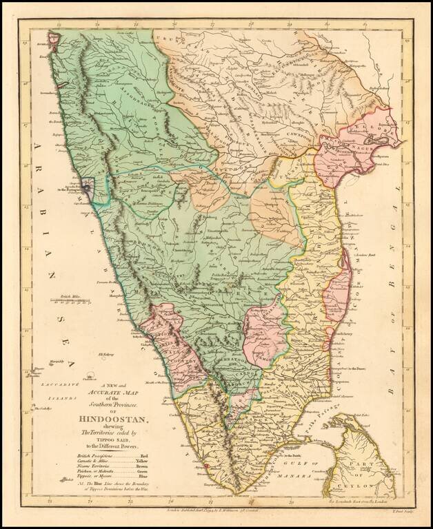
Delightful regional map of the Southern part of India and Ceylon, with nice details.

Robert Wilkinson was active in London as a cartographic publisher from 1785 to 1825. He produced a number of nice works, including a General Atlas and a re-issuance of Bowen & Kitchen's English Atlas, along with excellent large format separate maps.


Special conditions for students!

If you are a student, write to us in telegram: @antiquemaps and indicate what material you need and for what work you need a map in high detail. We are ready to provide material on special terms. For students only!

Item information:

Year of creation:
Size:
5977x7305 px
Disk:
7.77151MiB
Number of pages:
1
Place:
London
Author:
Robert Wilkinson.
$14.99

Related item