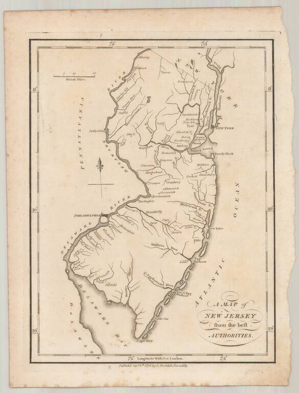
Rare example of John Stockdale's map of New Jersey from the London edition of Morse's Geography. This map is quite possibly the first English language map of New Jersey published following the conclusion of the American Revolution and one of only a...
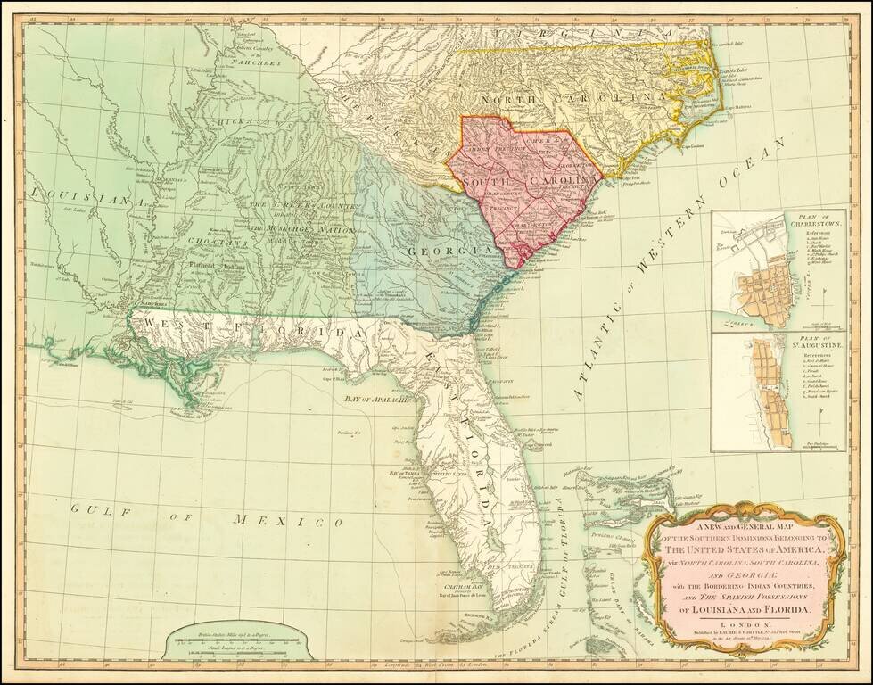
A Fine 18th Century Map of the Southern United States & Florida with Early Plans of Charleston and St. Augustine Laurie & Whittle's edition of this scarce map of the Southern States and Florida, originally compiled by Bernard Romans for the...
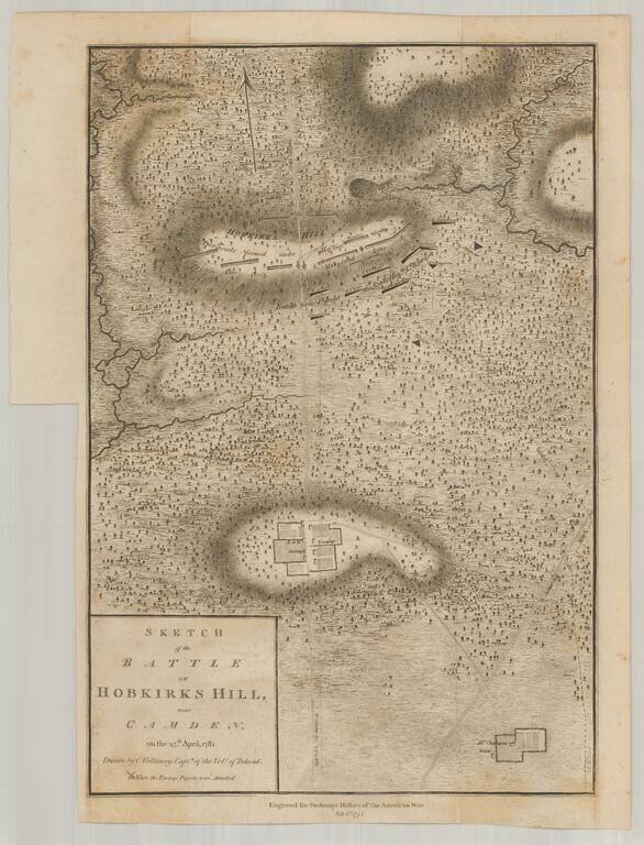
Scarce example of Faden's Revolutionary War battle map drawn by Vallancey, a British Captain. The map shows the position of the troops of the Lord Rawdon versus Nathanial Greene. Noted on the map are Log Town (destroy'd) and Mr. Charleston's burnt...
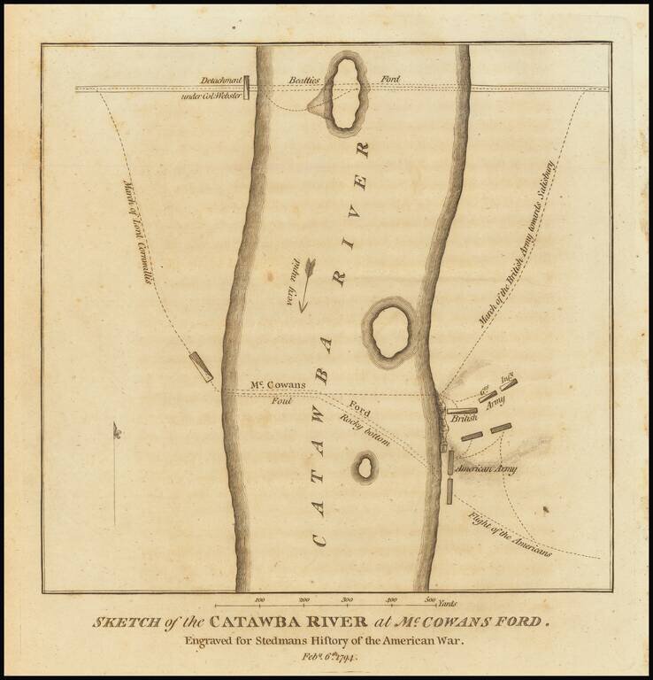
Detailed Revolutionary War battle plan, showing Lord Cornwallis' march crossing the Catawba River at McCown's Ford (now Cowan's Ford) and on towards Salisbury, along with the position of the Americans and their subsequent flight. Above the main...
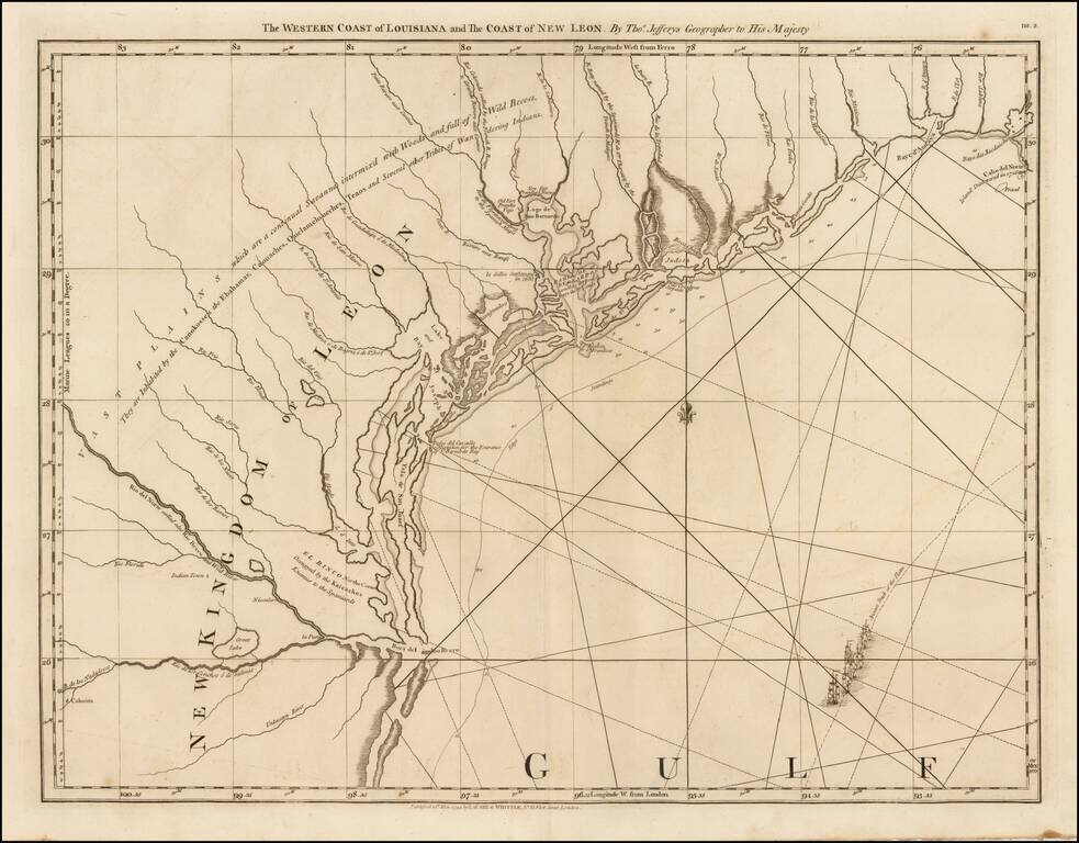
The First Map of the Texas Coastline Second state of this highly sought after map of Texas, which includes the Robert Sayer imprint. This is the first map to focus on the Texas coastline. and the only 18th century map of the Texas coast. An...

Fine map of the northern part of North America, intended to illustrate the probability of a water course from Hudson's Bay to the Northwest Coast, across the interior of North America. The map was prepared to illustrate the report of Meares expedition...

First edition of Carey's map of Cook's Discoveries in the Pacific and Hearne's discoveries west of the Hudson, in search of the Arctic Sea. This is one of the earliest appearances of a Cook map to be published in America. Excellent conjectural NW...
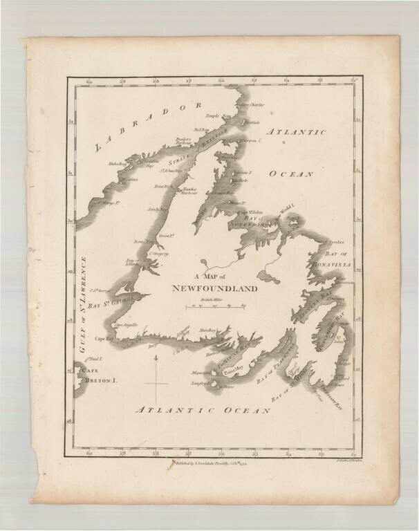
Scarce early map of Newfoundland, which first appeared in Samuel Morse's Universal Geography in 1794.
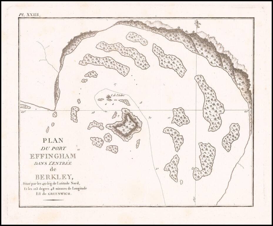
Detailed map of Port Effingham, likely on the present-day Effingham Island, previously known as Village Island in British Columbia, part of the Broken group of islands.
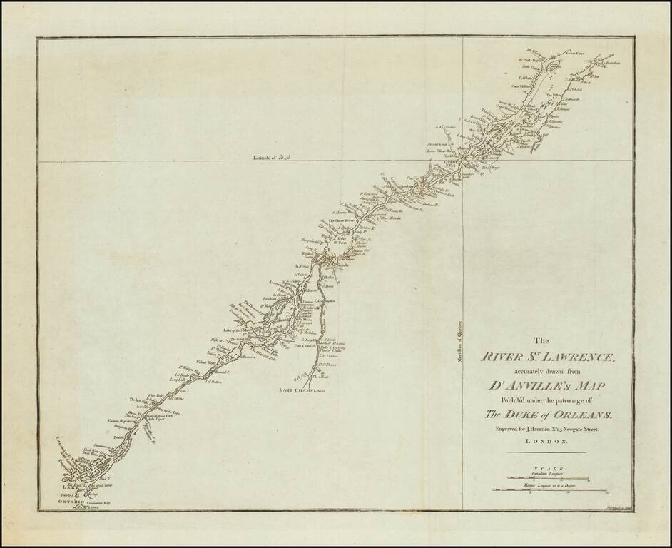
A rare English map of the St. Lawrence River, extending from Lake Ontario and Thousand Islands to just north of Quebec and Orleans Island. The chart shows channels, islands, shoals, waterfalls, rocks, and rapids in the river. Also shows towns, forts...
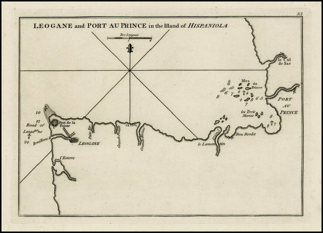
Rare plan of the coast of Haiti, from Port Au Prince to Leogane first published by Sayer & Bennett. Includes a detailed charting of the harbor, with soundings and anchorages, forts, islands and other details. One of the earliest obtainable...
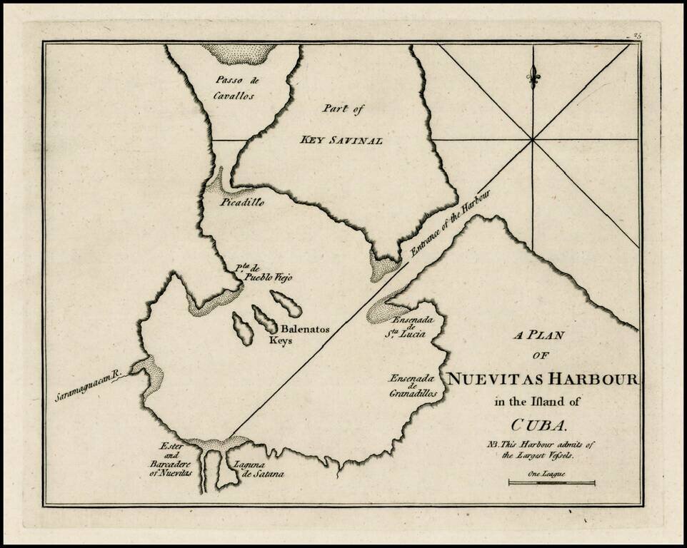
Rare early plan of the harbor at Nuevitas, Cuba, published by Sayer & Bennett, one of the earliest obtainable English Plans of the harbor. Includes a detailed charting of the harbor, with soundings and anchorages, and place names. A note indicates...
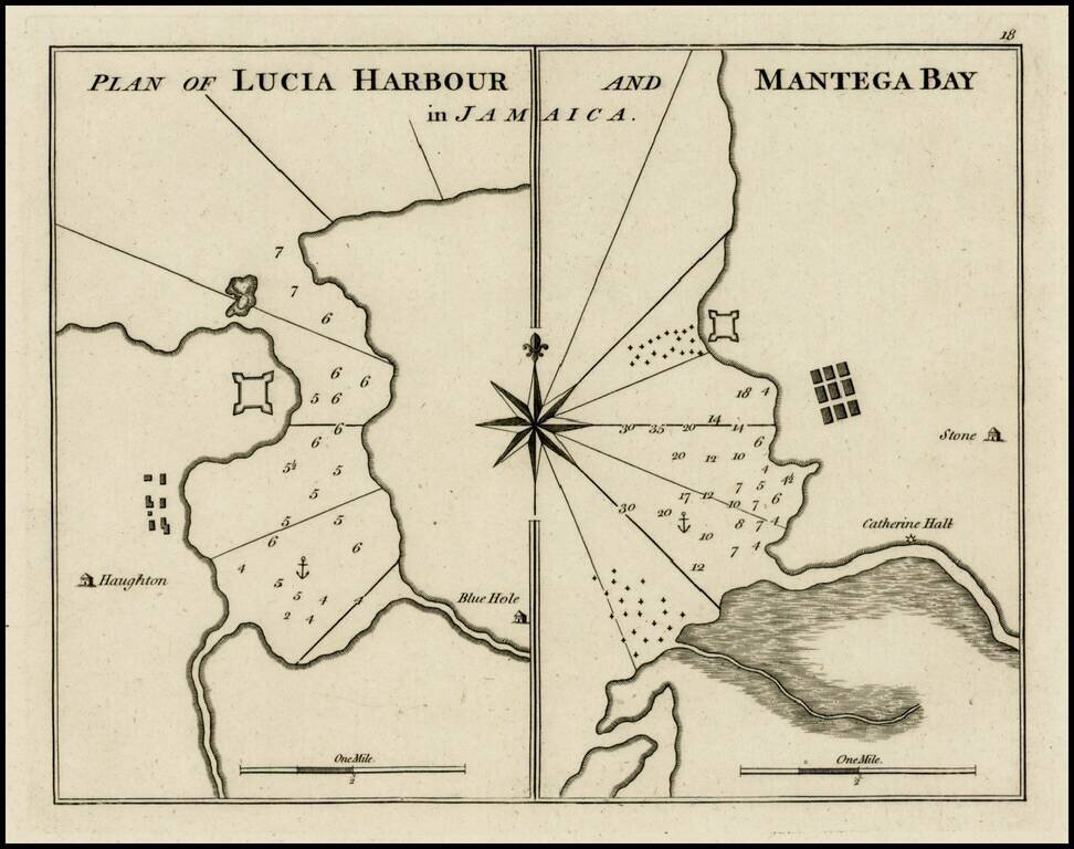
Rare early plan of Lucia Harbor and Mantega, published by Sayer & Bennett, one of the earliest obtainable English Plans of the harbor. Includes a detailed charting of the harbor and Bay, with soundings and anchorages, and place names.
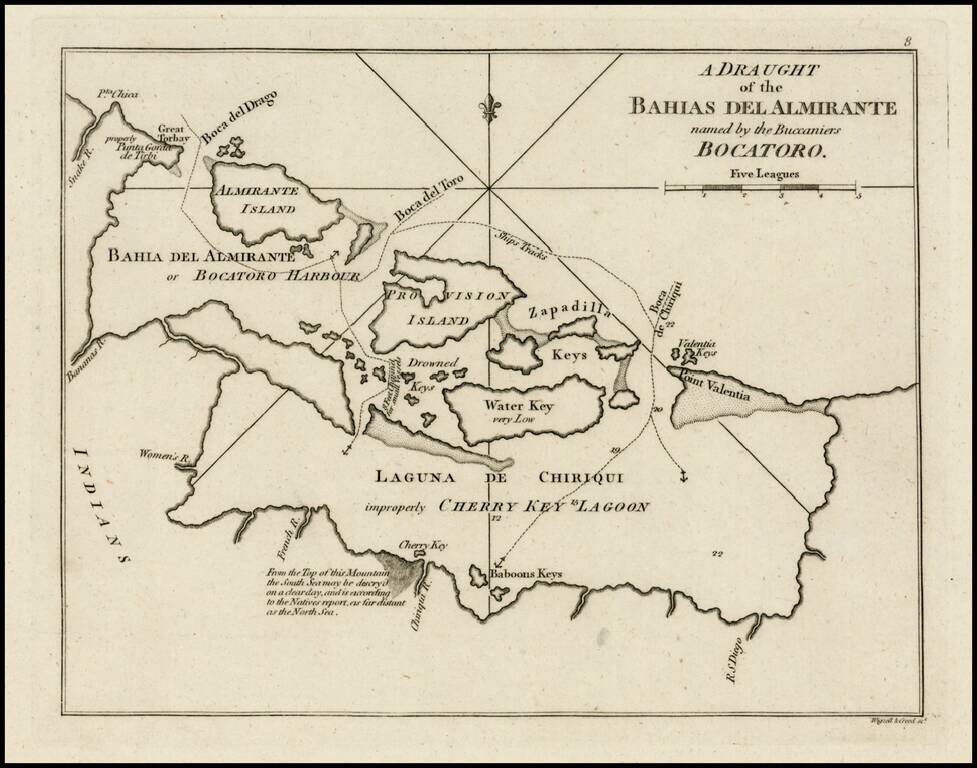
Rare early plan of the region around Bahia Del Almirante or Bocatoro Harbor, published by Sayer & Bennett, one of the earliest obtainable English Plans of the harbor. Includes a detailed charting of the bay, with soundings and anchorages, and...
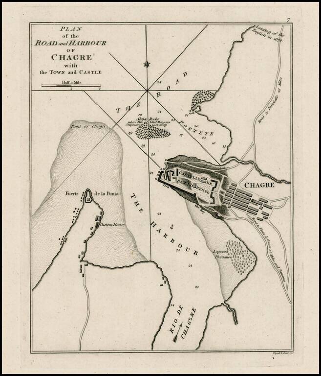
Rare plan of Chagres Harbor. The map includes a plan of the Castello del San Lorenzo, town plan, roads, customes house and other features. One of the earliest obtainable plans of the harbor.
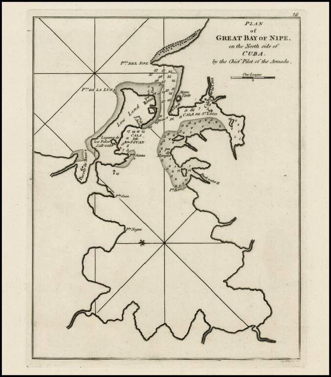
Rare early plan of Bahia de Nipe, Cuba, published by Sayer & Bennett, one of the earliest obtainable English Plans of the harbor. Includes a detailed charting of the harbor, with soundings and anchorages, and place names.