logo

1794. Kaart van het Zuidlijk Eind van Amerika 1775

  • Kaart van het Zuidlijk Eind van Amerika 1775

Kaart van het Zuidlijk Eind van Amerika 1775 information:

Year of creation: 
Resolution size (pixels): 
 12120x10190 px
Disk Size: 
 27.9816MiB
Number of pages: 
 1
Place: 
 Amsterdam
Author: 

Print information. Print size (Width x height in inches):
Printing at 72 dpi 
  168.33 х 141.53
Printing at 150 dpi 
 80.8 х 67.93
Printing at 300 dpi 
 40.4 х 33.97

An example of detailing the file of this map of in a printable high-resolution:

Click to open in high resolution (open in new tab).
Attention! this is just the central piece (central area 960x960 px) of the map file!
This is an example, so that you can see and study the level of detail of a given map. The entire Map will be fully available after payment!

Kaart van het Zuidlijk Eind van Amerika 1775

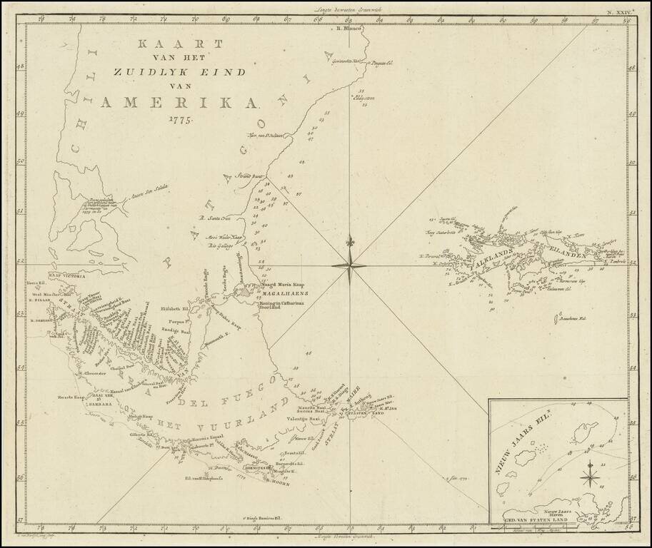
Scarce map of the sourthern part of South America, focusing on Cook's tracks around the Cape Horn and Tierra del Fuego in 1775.

From a Dutch edition of the Official Account of Cook's Expedition.


Special conditions for students!

If you are a student, write to us in telegram: @antiquemaps and indicate what material you need and for what work you need a map in high detail. We are ready to provide material on special terms. For students only!

Item information:

Year of creation:
Size:
12120x10190 px
Disk:
27.9816MiB
Number of pages:
1
Place:
Amsterdam
Author:
James Cook.
$14.99

Related item