Map size in jpg-format: 592107B
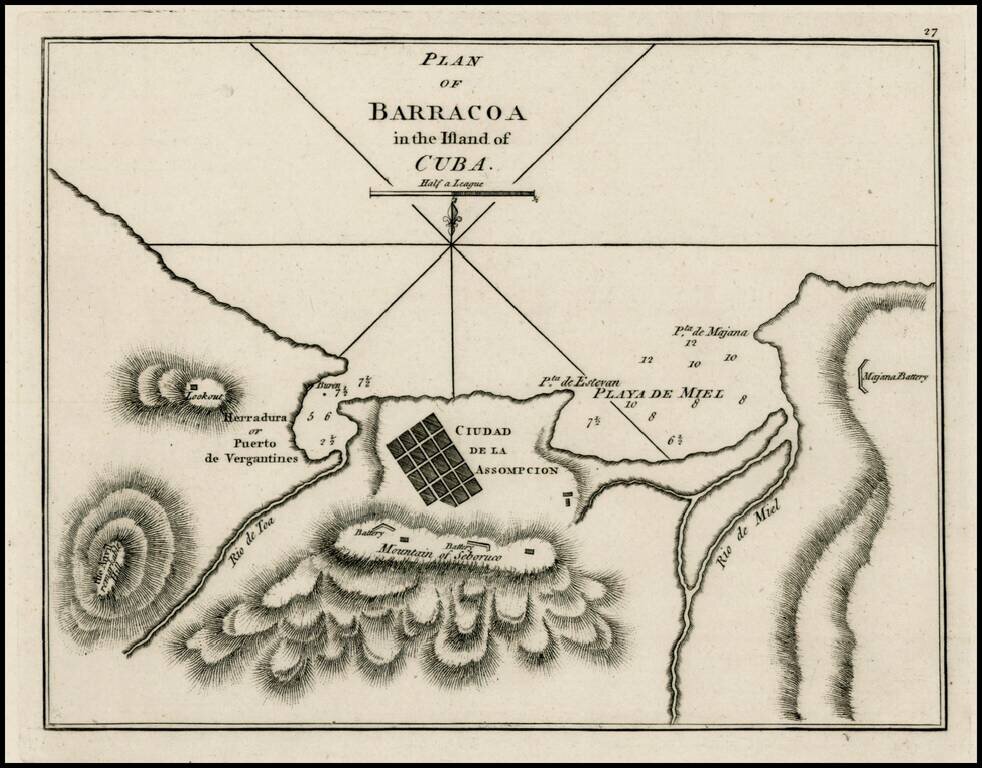
Rare early plan of Barracoa, first published by Sayer & Bennett, one of the earliest obtainable English Plans of the harbor.
Includes a town plan of Ciudad de la Assompcion (sic), detailed charting of the harbor, Battery positions, look out, etc., with soundings and anchorages, and place names.
Sayer & Bennett refers to the partnership of Robert Sayer (ca. 1724-1794) and John Bennett (fl. 1760-d.1787), which lasted between 1774 and 1783. Bennett had been Sayer’s apprentice. The pair specialized in American atlases, based on the work of Thomas Jefferys, who plates had been acquired by Sayer when Jefferys went bankrupt in 1766. They also began publishing navigational charts in the 1780s and quickly became the largest supplier of British charts in the trade. However, in 1783 Bennett lost control of his mental faculties and the partnership dissolved as a result. Sayer’s business was later passed to his employees, Robert Laurie and James Whittle.
If you are a student, write to us in telegram: @antiquemaps and indicate what material you need and for what work you need a map in high detail. We are ready to provide material on special terms. For students only!