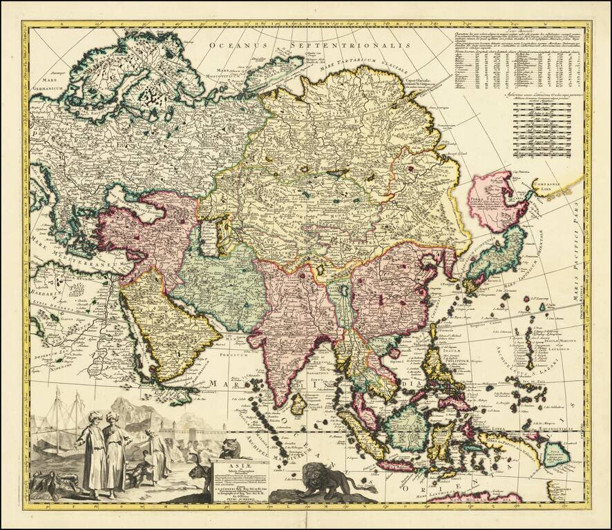
Scarce of map of Asia, published in Amsterdam. The map bears the additional names of Peter Schenk and Nicholas Visscher. The northeast coastline is shown with Witsen's information on Siberia. Hokkaido and Honshu (Terra Yedso) are joined together by a...
![Carte Particuliere d'une Partie d'Asie ou sont Les Isles D'Andemaon, Ceylan, Les Maldives . . . [with] Partie Occidentale d'une D'Asie ou sont les Isles De Zocotora De l'Amirante . . .](/map/small/66433.jpg)
Fine Chart of the Indian Ocean from the Mortier issue of the Neptune Francois Striking old-color example of the first edition of Pierre Mortier's fine, two-sheet map of the Indian Ocean and contiguous regions, first published in 1700. Both were...
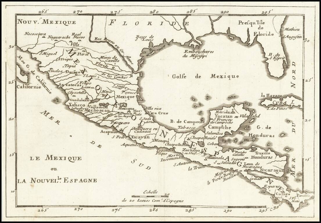
Rare map of Florida, the Gulf Coast, Texas, Central America and the Caribbean. Florida extends to the Rio Grande River. Only a few settlements shown in Florida and none on the Gulf Coast, apparently pre-dating New Orleans. Reminiscent of De Fer's map...
![Carte Particuliere De La Caroline Dresse sur les Memoires le plus Nouveaux Par Le Sieur S[anson] . . .](/map/small/58997.jpg)
A good example of Mortier's highly detailed map of the area around Charleston, South Carolina (founded 1669), the earliest obtainable map of South Carolina printed outside of England. Covens & Mortier's map is based upon surveys and manuscript...
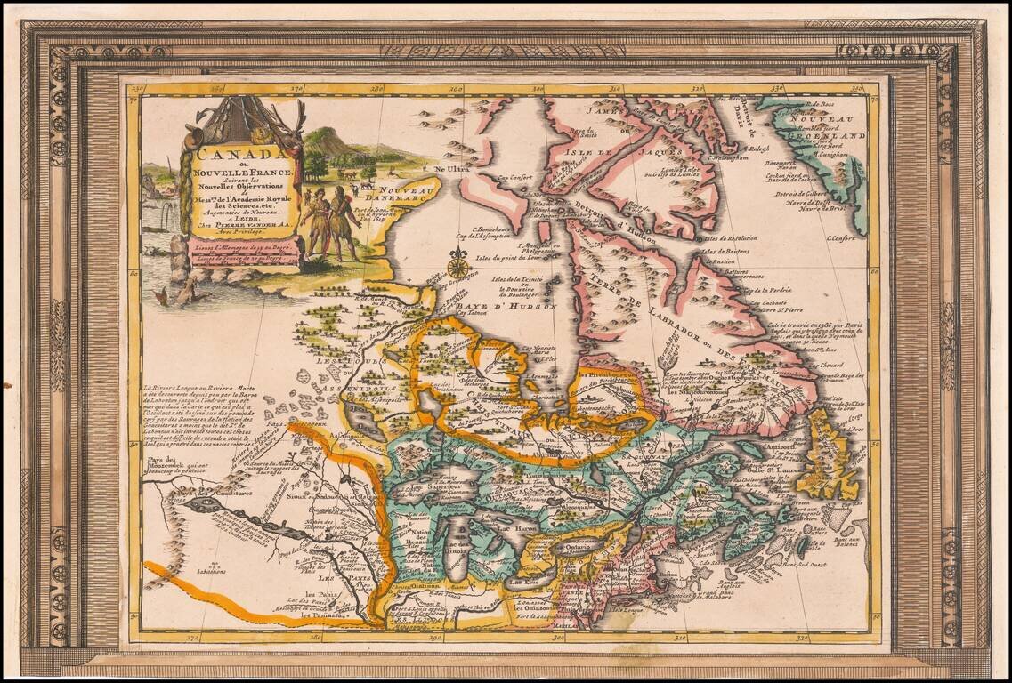
Decorative example of Vander Aa's map of Canada and the Great Lakes. Nice example, with the picture frame border, which appeared in Vander Aa's Nouvelle Theatre Du Monde, published in 1713. The map extends south to the Chesapeake and west to the...
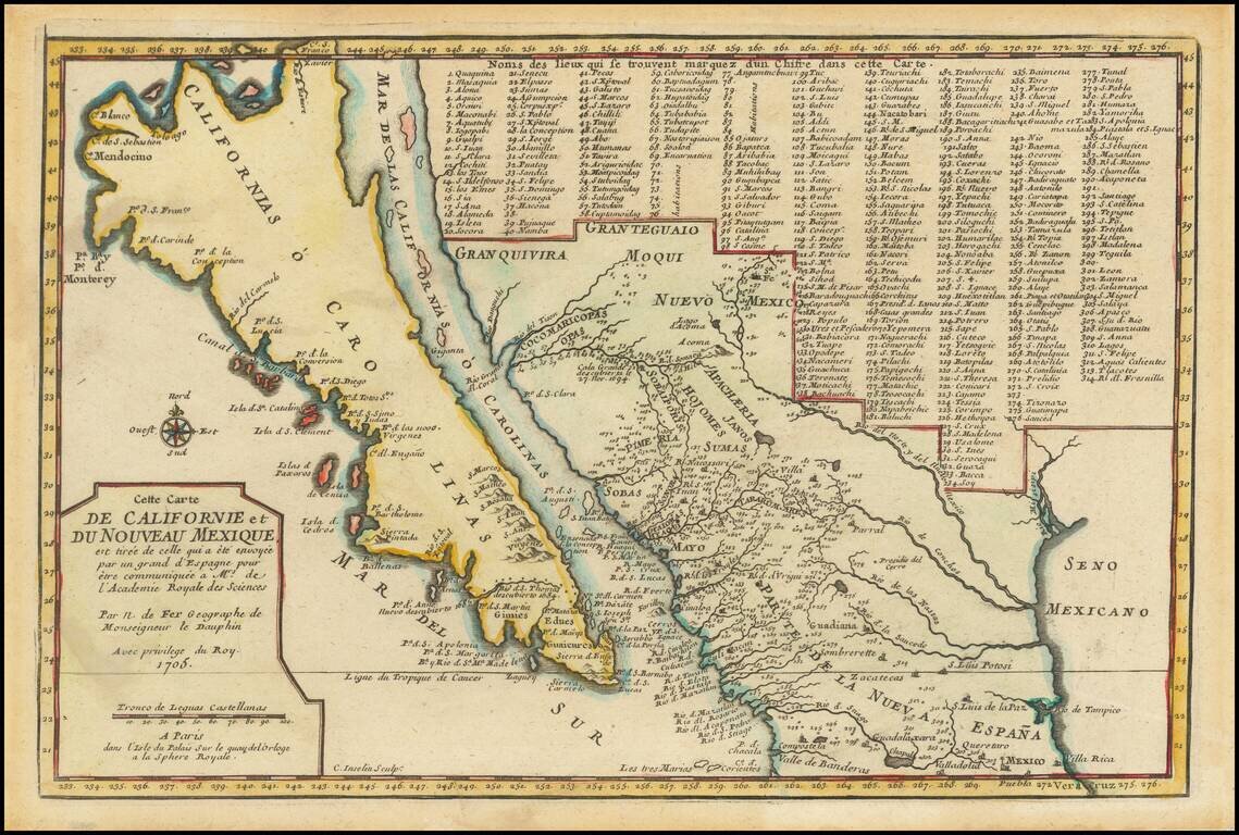
De Fer’s Map of the Southwest Based Upon the Earliest Reports of Father Kino -- One of the Few Regional Maps to Show the Island of California Scarce second state of De Fer's map of California, bearing the date 1705. This is one of a select few...
![L'Amerique Septentrionale [Unrecorded map showing California as an Island]](/map/small/70283.jpg)
Unrecorded map of North America, showing California as an island, with a very curious shape. A close study of the lower part of California suggests a knowledge of De L'Isle's 1700 map of North America, which was one of the first maps to show...
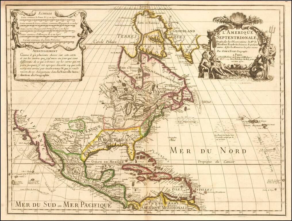
De L’Isle’s Foundational Map of North America, with Milestone Depictions of the Mapping of the Mississippi and California This is a striking example of De L'Isle's highly important map of North America. It is the first to correctly place the mouth...
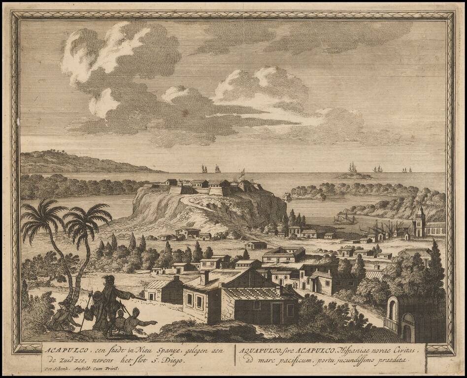
Rare early view of Acapulco, engraved by Schenk.
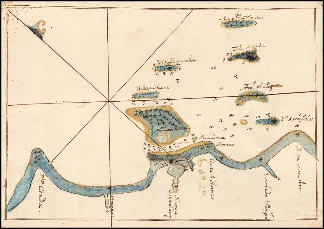
Fine Manuscript Chart of the Waters Around Veracruz, Mexico, including the Fortress of San Juan de Ulúa Nice manuscript chart of the waters surrounding the important port of Veracruz, Mexico. This chart was found laid in loosely in a Spanish edition...
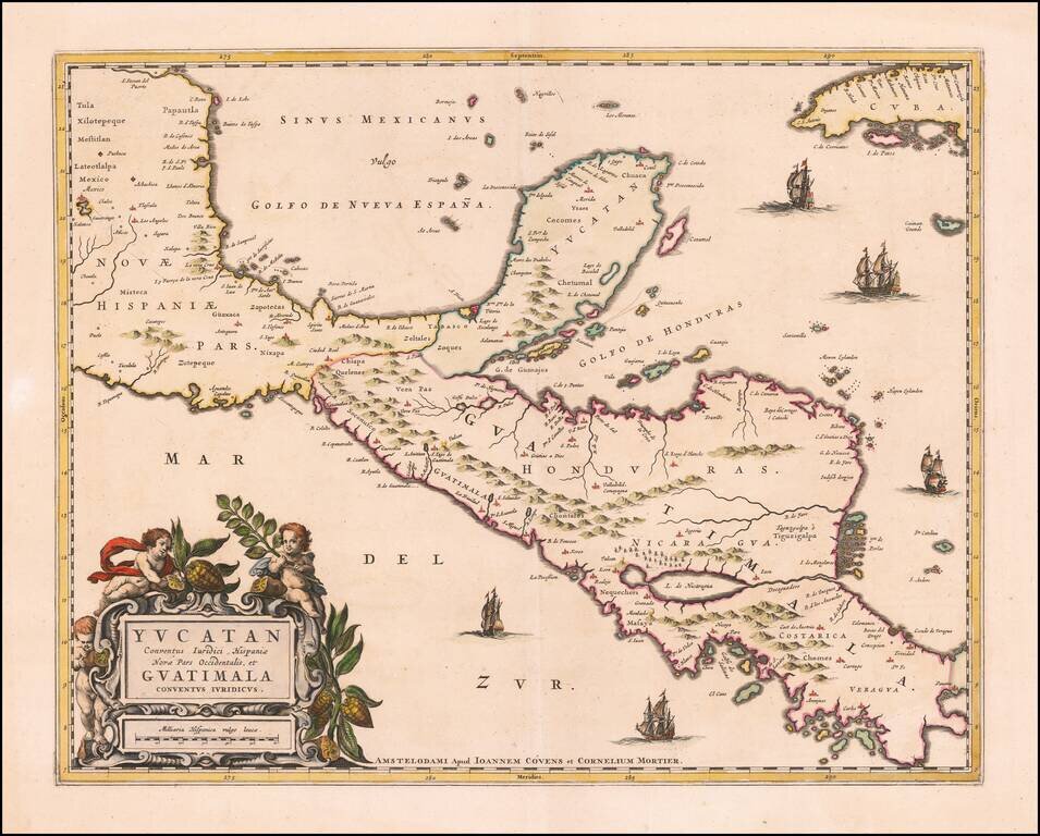
Rare example of Covens & Mortier's map of the Yucatan Peninsula. First issued by Joannes Blaeu, this edition is very rare on the market. This is one of the earliest Dutch maps to focus on the region centered on the Yucatan Peninsula. Includes...
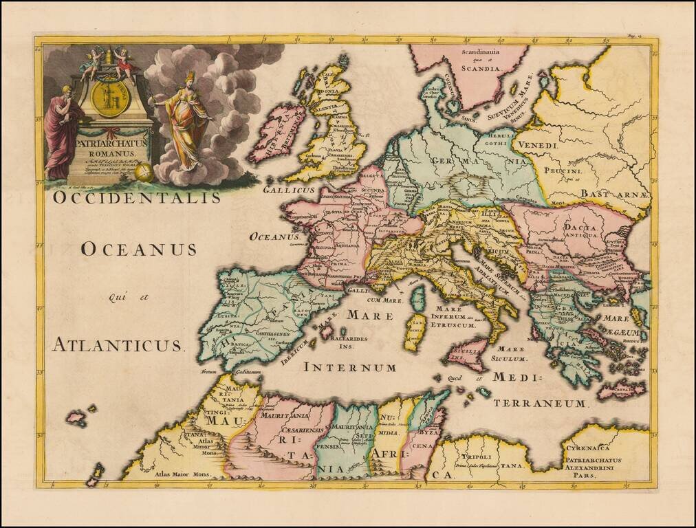
Fine example of Francois Halma's map of the Roman Empire. The map shows regional sub-divisions within the Roman Empire. A striking example of this decorative map.

Striking map of the continent of Europe from Nicholas de Fer's L'Atlas Curieux ou le Monde. This example is the first state, dated 1700. The map shows large German and huge Polish Empires, bordering Turkey in Europe. Iceland and Greenland are depicted...
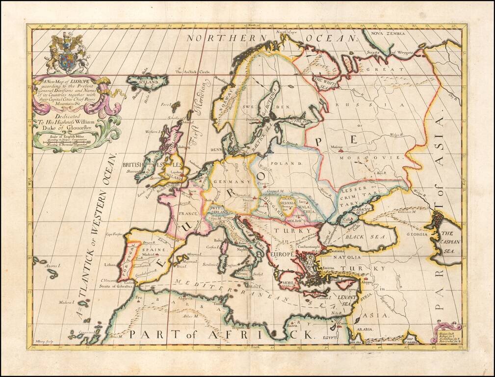
Decorative map of Europe at the beginning of the 18th Century. This map was part of an atlas dedicated to the Duke of Glocester, who was then attending school in Oxford.
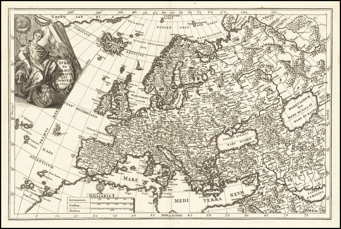
Decorative map Europe, Iceland and part of Greenland, with sea monsters and land creatures in the sea and on land. Large decorative cartouche and characters. Scherer's Atlas Novus was a 7 volume compendium which demonstrated his unique style and...
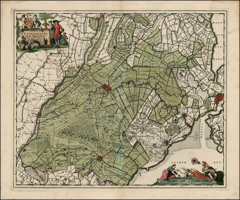
Fine old color example of Allard's map, showing Amsterdam, Utrecht, Amersfoot, etc. Includes 2 decorative cartouches. Double thick paper and wide margins.