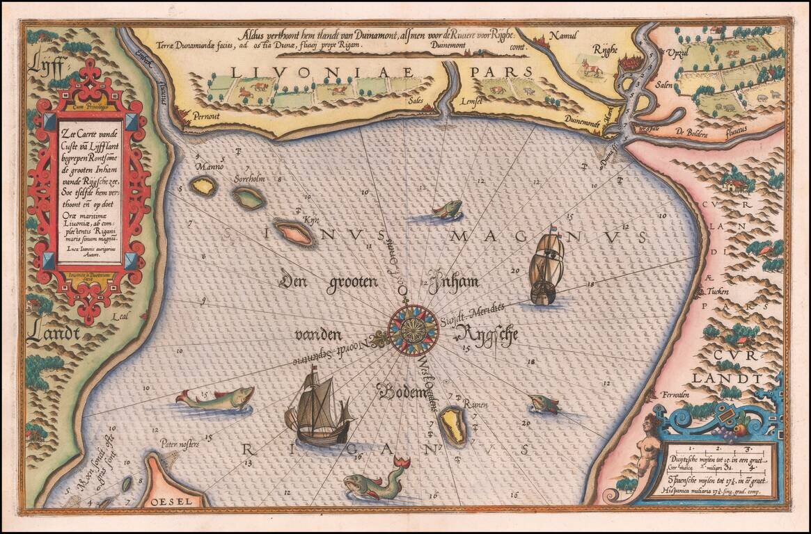
Striking example of Wagenhaer's map of the coast of Latvia, including the area around Riga and part of Curland. Includes sea monsters, sailing ships, compass rose, decorative cartouche, anchorages and soundings. Wagenhaer was a Dutch pilot who...
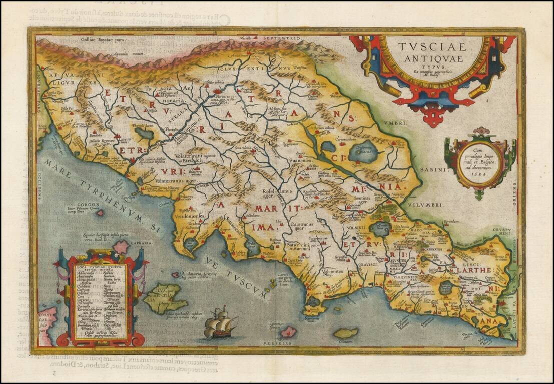
Fine early map of the Etruscan regions of Italy, centered on Florence and the Arno River, which first appeared in 1584, and was revised in a second plate (the present example) starting in 1595. A number of islands shown off the coast. Includes a...
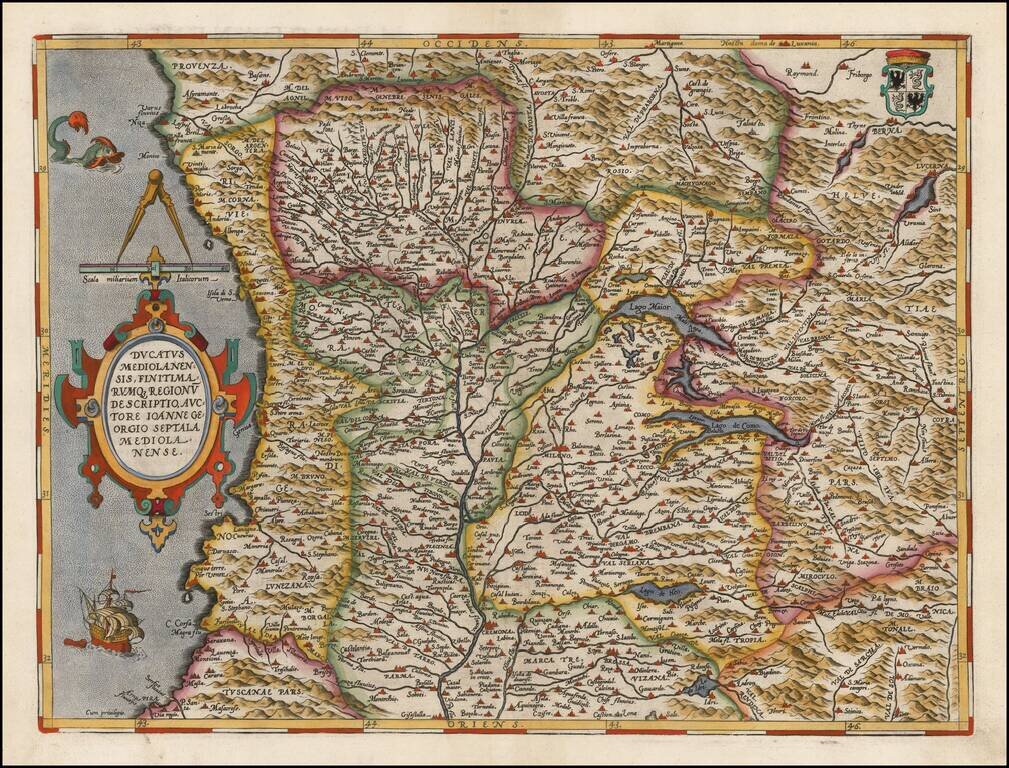
Gorgeous regional map of Italy, centered on Genoa, Lago Maior and Lago Como, and including Milan, Parma, Cremona, Bergamo, Nice, Monaco, etc. Includes a decorative cartouche, sailing ship, sea monster and coat of arms. From Ortelius' Theatrum Orbis...
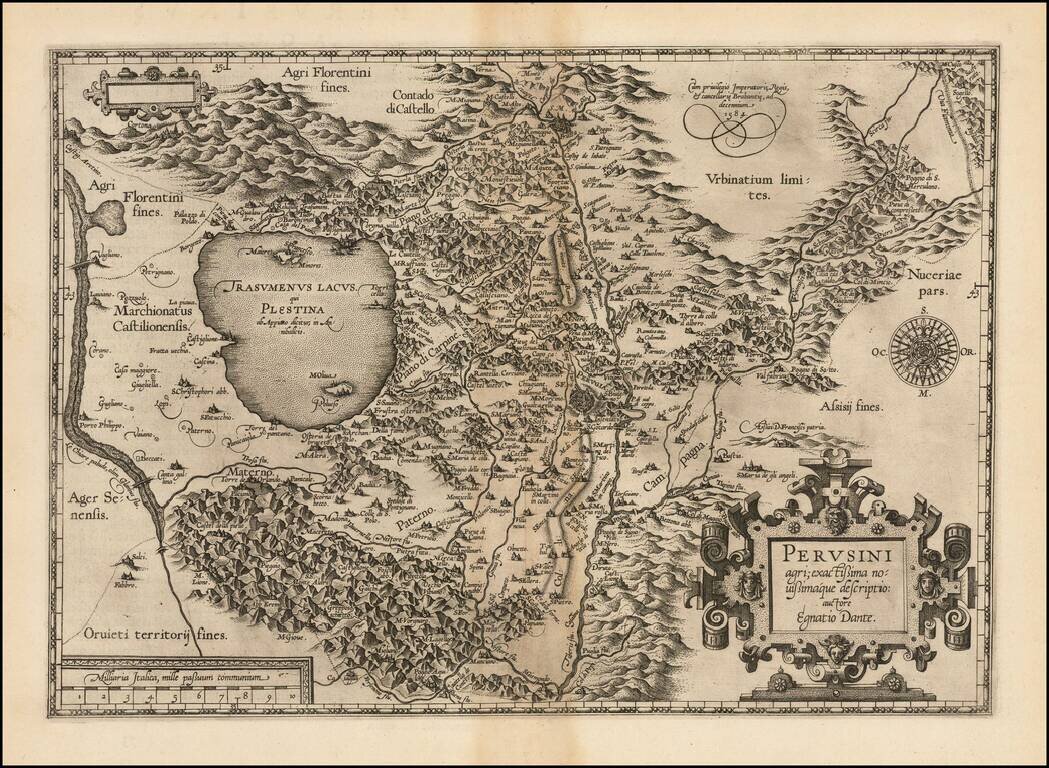
First state of Ortelius' decorative regional map of Italy, centered on Perugia, from Ortelius' Theatrum Orbis Terrarum, the first modern atlas of the world. The map is based upon Egnatio Danti's 1580 Perugia map, engraved by Mario Cartaro (Meurer p....
![Larii Lacus Vulgo Comensis Descriptio . . . [and] Terretorii Romani Descrip. [and] Fori Iulii Vulgo Frivli Typus](/map/small/64715.jpg)
Nice full color example of Ortelius' maps of Lake Como, the region around Rome and the region around the Upper Adriatic, centered on Udinese, from his Theatrum Orbis Terrarum, the first modern atlas of the world. A nice full color example with wide...
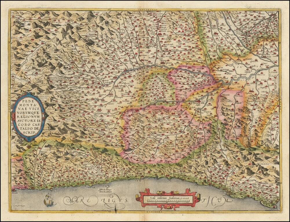
Finely colored example of this detailed map of the Piedmont region, from Santa Margarita, Genoa and Monaco to Milan, centered on Turin, from Ortelius' Theatrum Orbis Terrarum, the first modern atlas of the world. Two cartouches and ship at sea.
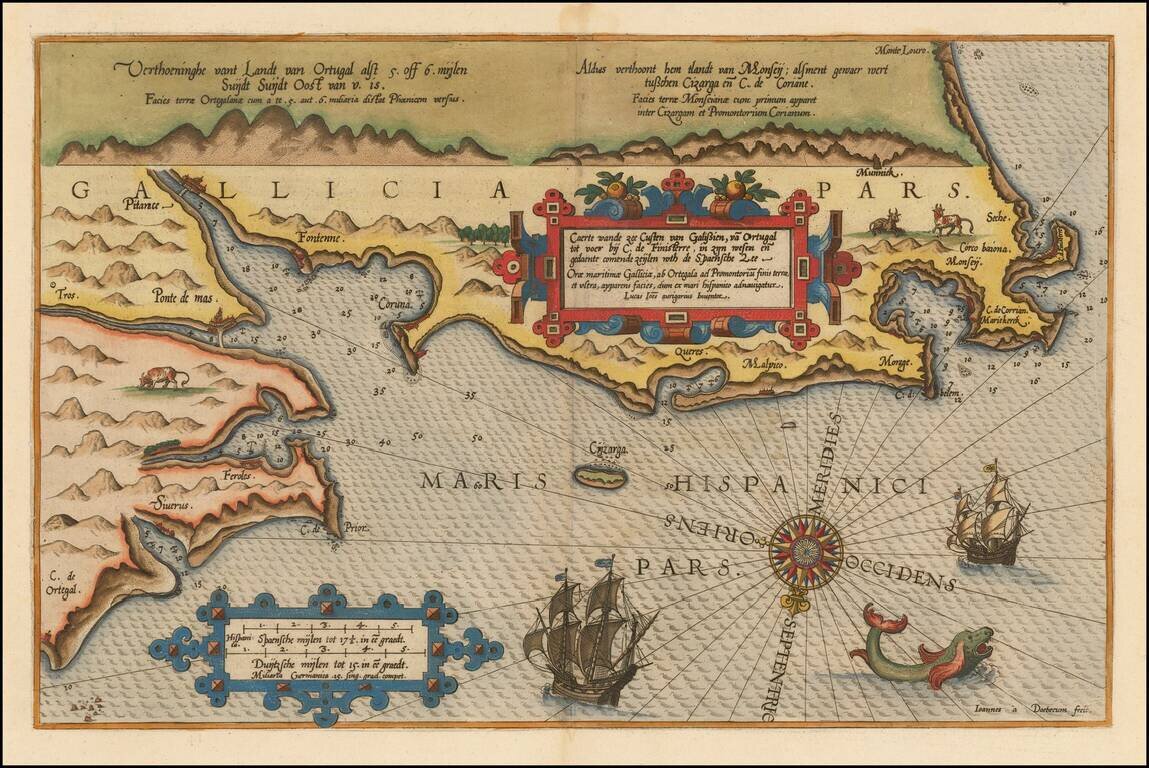
Beautifully hand-colored example of Waghenaer's map of the Galician Coastline, from Cape de Ortegal in the east, to Monte Louro and Cape Finisterre in the west, centered on Coruna, Malpica de Brigantinos and Ferrol. Lucas Waghenaer was a Dutch pilot...
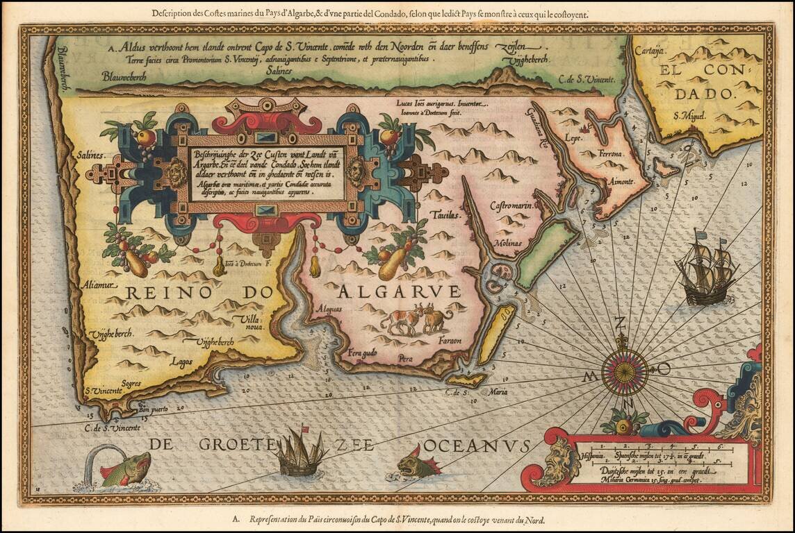
Striking full color example of Wagenhaer's map of the Algarve coastline, extending from just north of Sines in Portugal and the Lagos area to the Rio de Piedras area in Spain. Wagenhaer was a Dutch pilot who produced the first set of effective...
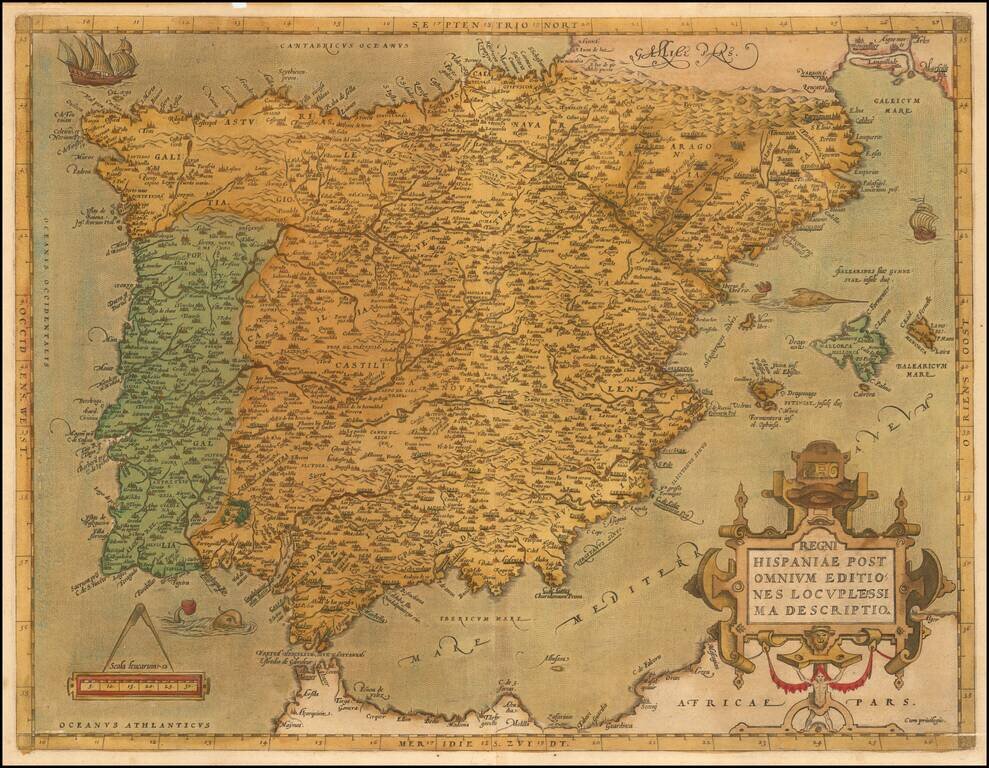
Ortelius’ Detailed Map of the Iberian Peninsula from the World’s First Modern Atlas Striking example of Abraham Ortelius' map of the Iberian Peninsula, from his influential Theatrum Orbis Terrarum, the first modern atlas of the world. The map is...
![Hispalensis Conventus Delineatio [Andalusia]](/map/small/60160mp2.jpg)
Gorgeous map of Andalusia, extending from Las Sierras de Ronda to Corduba and Sierra Morena to El Cerro and Aroche to Castromarin and Lepe, centered on Sevilla, with the Bay of Cadiz at the lower center. Three cartouches and a naval battle are shown,...
![Chinae, olim Sinarum regionis nova descriptio auctore Ludovico Georgio . . . 1584 [First State]](/map/small/71224.jpg)
First State of Ortelius' Map of China Old color example of the scarce first state of Ortelius' map of China, the first western map of China. Ortelius' map of China is taken directly from reports of the Portuguese mapmaker Luis Jorge de Barbuda...
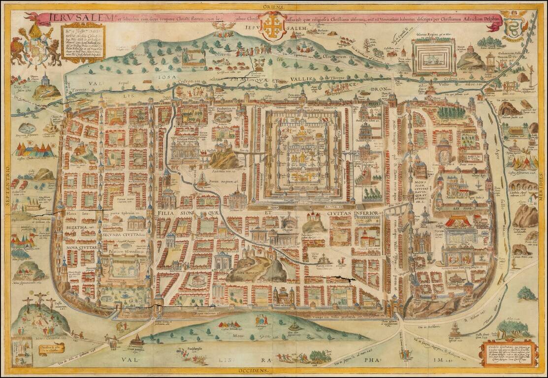
Decorative hand-colored example of Christan Van Adrichom's plan of ancient Jerusalem and its suburbs at the time of Jesus Christ, which was later copied by a number of early mapmakers for their works on the Holy Land. The plan was originally issued in...
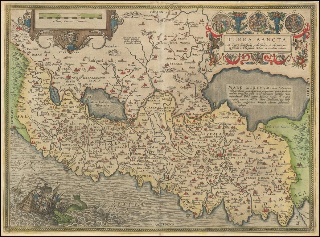
Abraham Ortelius's Modern Map of the Holy Land The most modern of Ortelius' maps of the Holy Land, which first appeared in Ortelius' Theatrum Orbis Terrarum in 1584. The map is based on a 9 sheet map of Palestine by Christian Sgrothen (Christian...
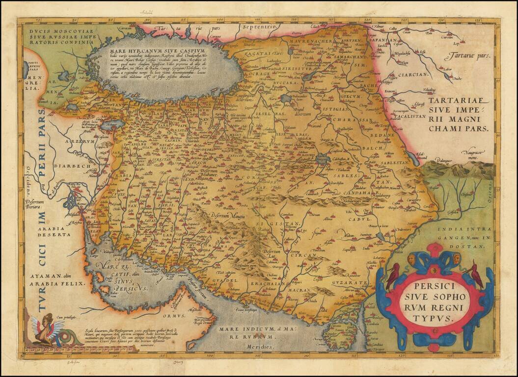
Fine Ortelius Map of Persia from the World’s First Modern Atlas Highly-influential and beautifully-detailed map of Persia from Abraham Ortelius' Theatrum Orbis Terrarum, the first modern atlas of the world. The map shows the Persian Gulf and the...
![[Ortelius Portrait] Spectandum dedit Ortelius mortalib. orben, Orbi spectandum Galleus Ortelium](/map/small/68810.jpg)
Finely colored example of the portrait of Abraham Ortelius, which was engraved by Philip Galle and first appeared in the 1579 edition of his Theatrum Orbis Terrarum, the first modern Atlas. The text translates as follows: "By looking, Ortelius gave to...