Map size in jpg-format: 1.23973MiB
Click to open in high resolution (open in new tab).
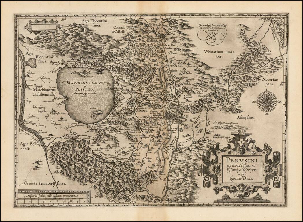
First state of Ortelius' decorative regional map of Italy, centered on Perugia, from Ortelius' Theatrum Orbis Terrarum, the first modern atlas of the world.
The map is based upon Egnatio Danti's 1580 Perugia map, engraved by Mario Cartaro (Meurer p. 136-137).
If you are a student, write to us in telegram: @antiquemaps and indicate what material you need and for what work you need a map in high detail. We are ready to provide material on special terms. For students only!


