
![The Theatre of War in North America, with the Roads and a Table of the Distances [with] A Compendious Account of the British Colonies in North-America.](/map/small/43988.jpg)
Nice example of the rare first state of Sayer & Bennett's Broadside Map and Account of the War in North America, one of the first widely distributed news accounts of the American Revolution in Great Britain. Following a brief peace attempt between...
![[Revolutionary War Broadside Map] Allgemeine Charte von Nord America als den Sitz des Krieges zwischen den Konigl. Engl. Truppen u:den Provinzialen](/map/small/43232.jpg)
Rare, Early German Broadside Map of the North American British Colonies—First State! First state of an remarkably rare German broadside map showing the British colonies in North America, one of the earliest separately-issued broadside maps of the...
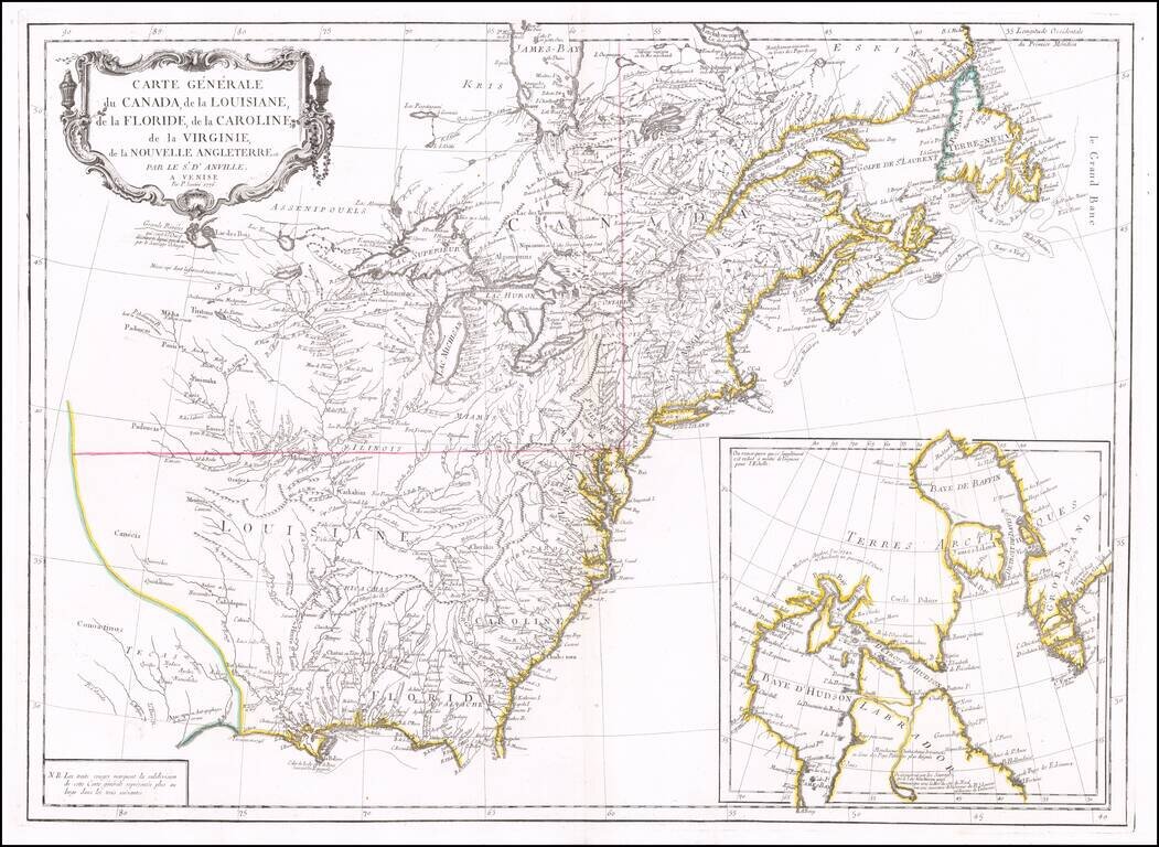
Second edition of Santini's map of the British & French Colonies in North America, based upon D'Anville's seminal map of 1746. The map provides a highy detailed treatment of Great Lakes and Mississippi Valley, on the eve of the American...
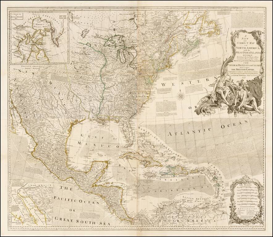
First "Pownall" edition of this influential wall map of North America, issued shortly after the commencement of the Revolutionary War in 1777, and including the revisions compiled by Governor George Pownall. Originally issued separately by Bowen &...
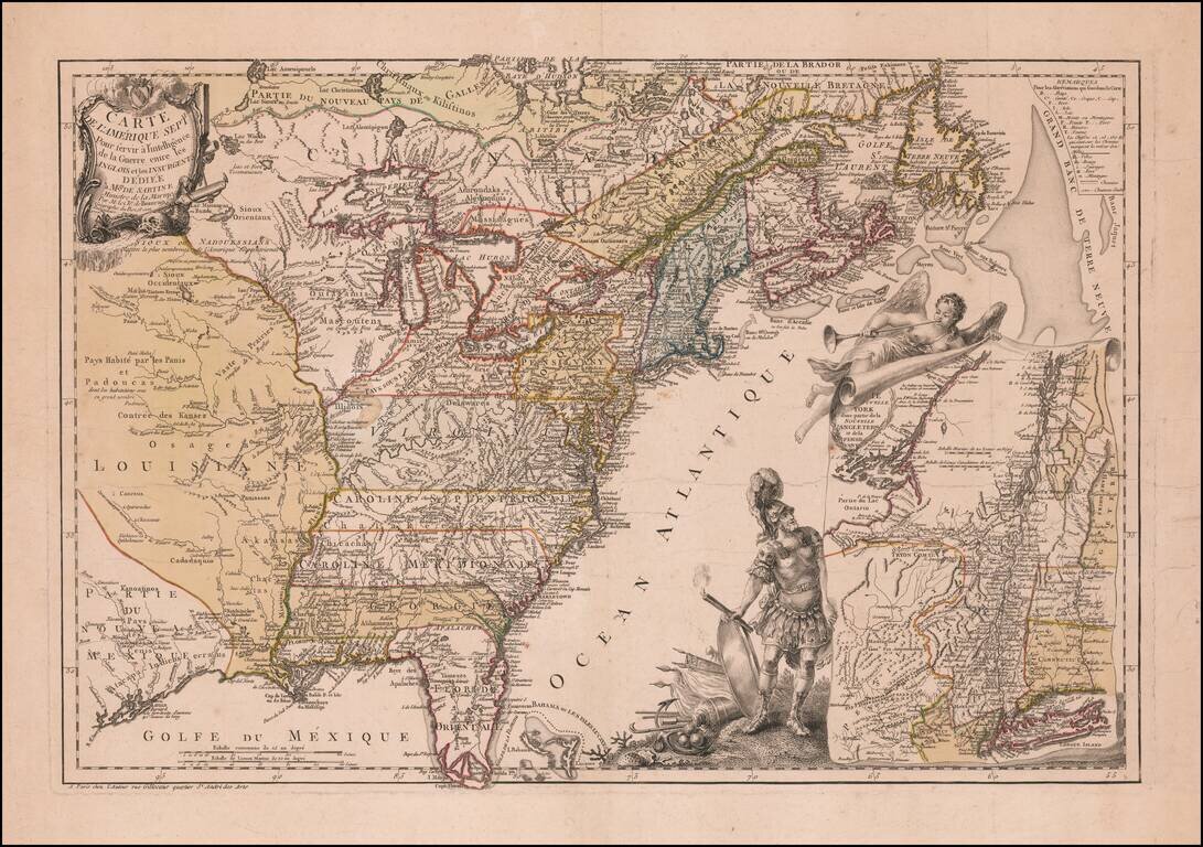
Mars, the God of War, Witnessing Fame's Proclamation of the Birth of the United States Fine example of Beaurain's important map of The 13 Colonies and the contiguous part of French Louisiana and Florida, one of the earliest maps published in Europe to...
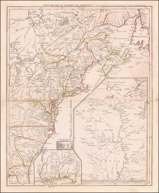
Antique Map of The Theater of The American Revolution on the Eve of the French Joining the War Coming the year after the creation of the United States and signing of the Declaration of Independence, this antique map illustrates the British Colonies...
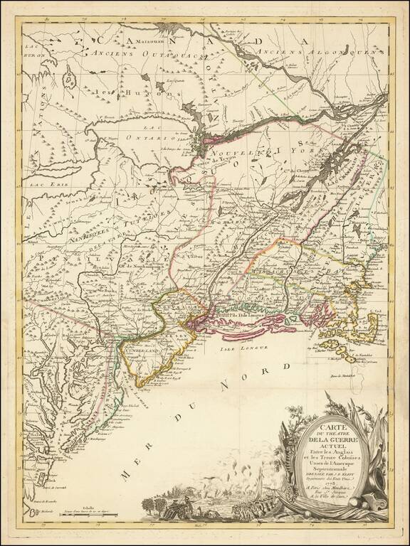
Nice example of J. B. Eliot's map of the United States, generally regarded as the earliest map to include the title "United States'' on a printed map. Eliot's map, which is drawn from American sources not previously utilized on any printed map, is...
![[United States] Il Canada Le Colonie Inglesi Con La Luigiana E Florida di nuova Projezione . . . 1778](/map/small/65888.jpg)
Striking map of the United States and Canada, which includes references to the Upper and Lower English Colonies of Louisiana. One of the very few maps we have seen from the period which treat the regions east of the Mississippi as being Upper or...
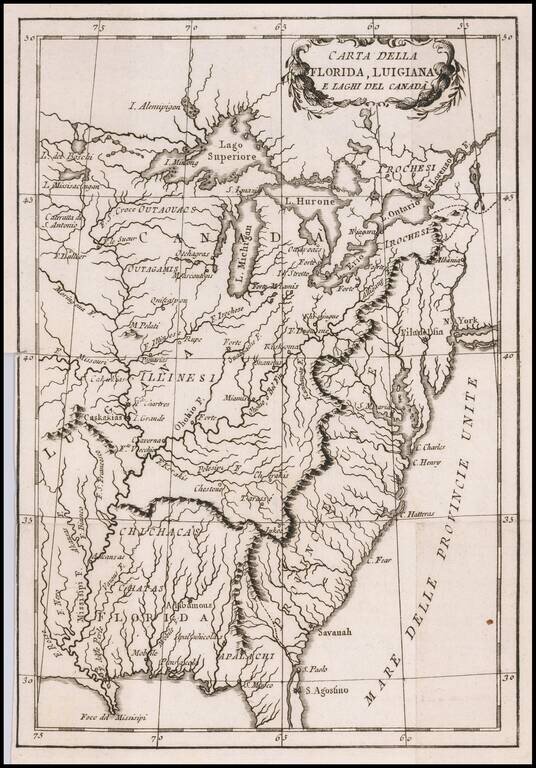
Albany called Albania! Rare Italian map of the United States, Florida, Louisiana and Canada, which appears to have been issued during the American Revolutionary War. The US is called Province Unite, with Albany, New York called Albania. The city (or...
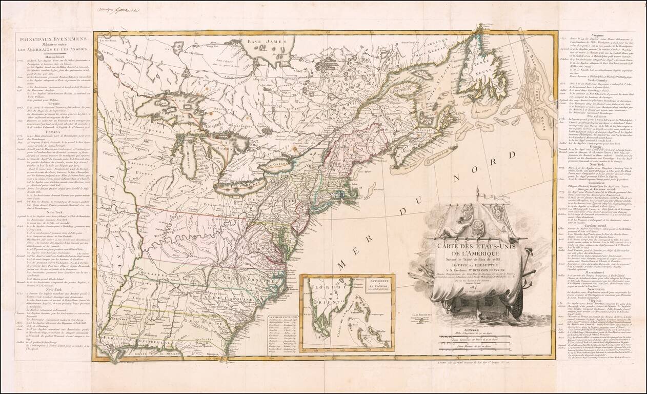
Dedicated to Benjamin Franklin -- The First Map of The United States Published After Ratification of the Treaty of Paris Lattre's map of the United States appeared in June 1784, just two months after the United States gained official independence...
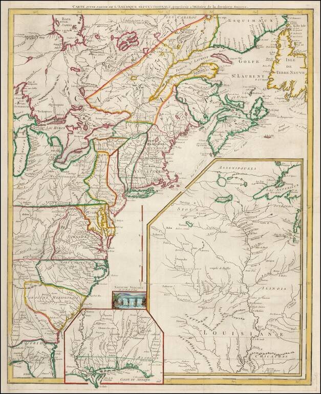
Fine example of this highly detailed set of maps illustrating the British Colonies in North America at the conclusion of the American Revolution, published by Soules in his Histoire des Troubles de Amerique Anglaise. The primary map shows the British...
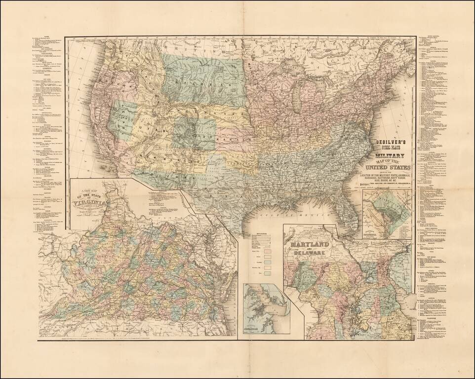
Rare Civil War era map of the United States, published in Philadelphia by Charles Desilver. The map includes inset maps of Washington D.C., Virginia, Maryland and Delaware, and the Vicinity of Annapolis. Includes a list of all the Military Forts and...
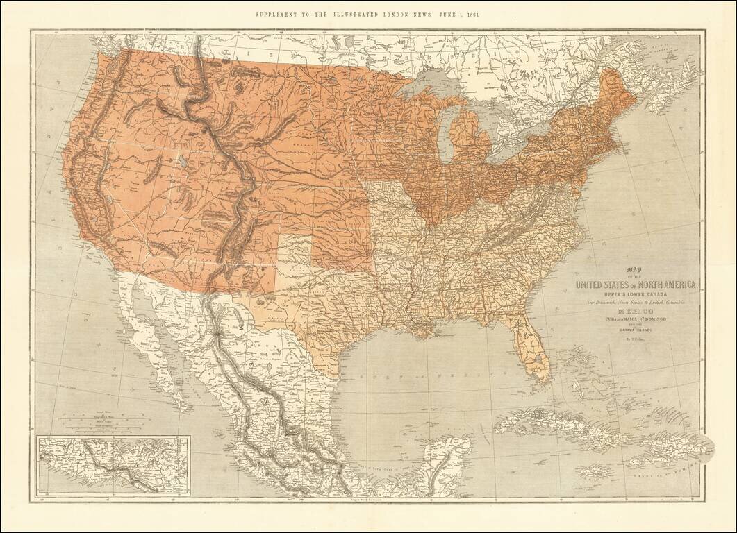
This is a scarce map of the United States, issued as a supplement to the Illustrated London News in 1861. The map is well detailed and shows the US split according to slave and free states. The map was clearly prepared in anticipation of the Civil War,...
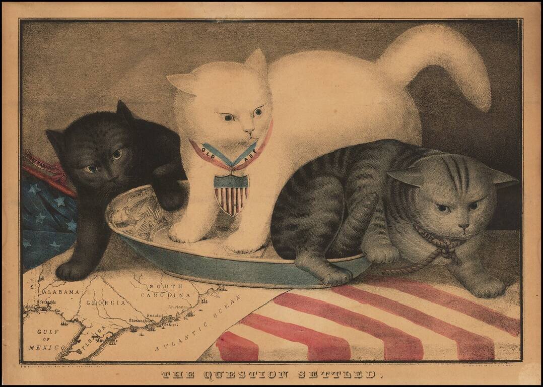
Rare Allegorical Civil War Broadside Fascinating allegorical broadside, showing 3 cats in a milk saucer, superimposed over a map of the South. The center white cat, Old Abe, is a reference to Abraham Lincoln. To the right, the gray cat represents...
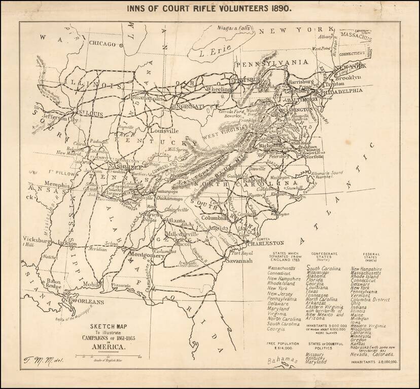
Published for the Inns of Court Regiment--Fighting Lawyers & Judges--By A Future Military Science Expert Unusual separately published map of the United States, illustrating the "Campaigns of 1861-1865 in America," published by the Court of Rifle...
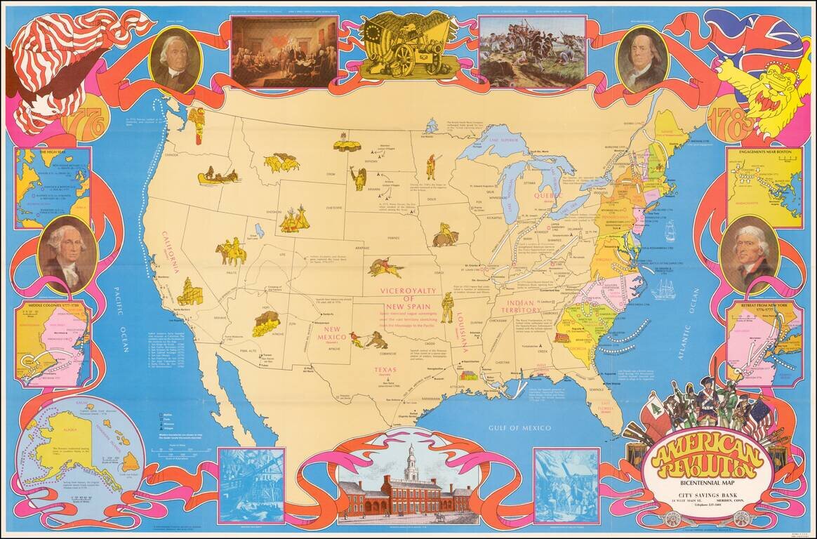
Fine large format map of the United States, featuring vignettes of historical events during the American Revolution and a 1970s style art motif. In addition to Revolutionary War related facts, the map shows information on the California Missions, the...