Map size in jpg-format: 1565070B
Click to open in high resolution (open in new tab).
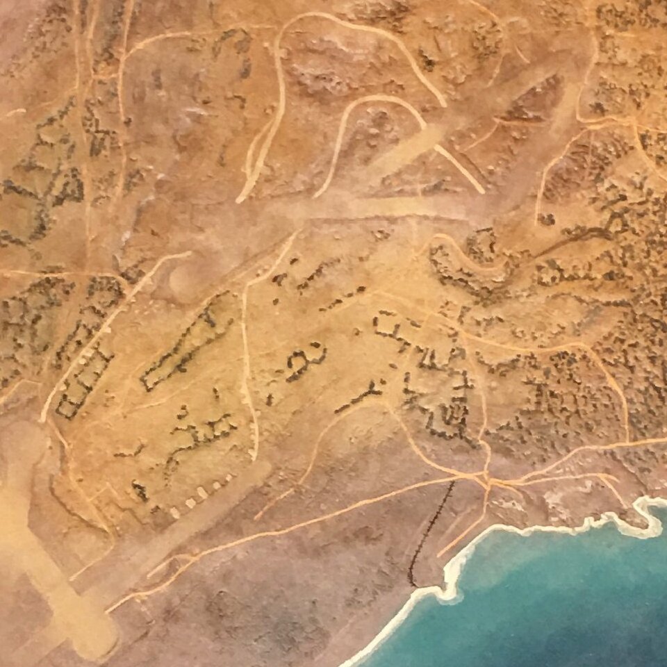
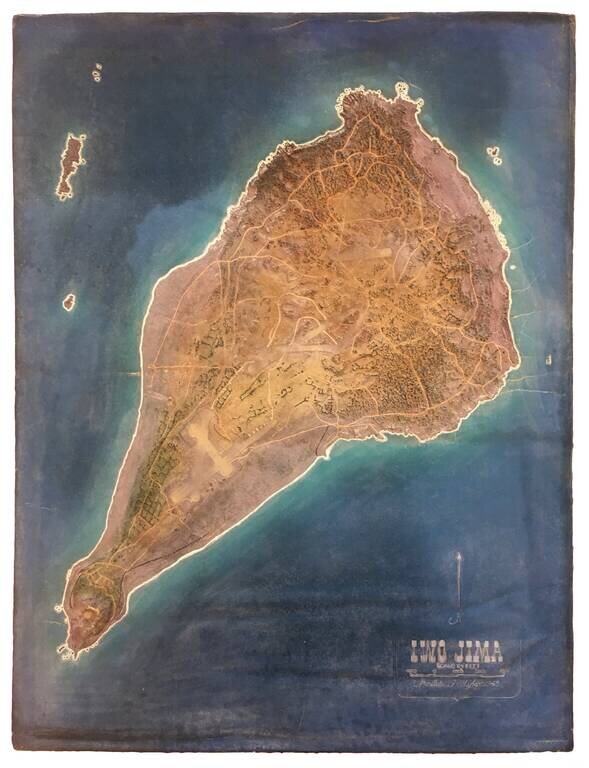
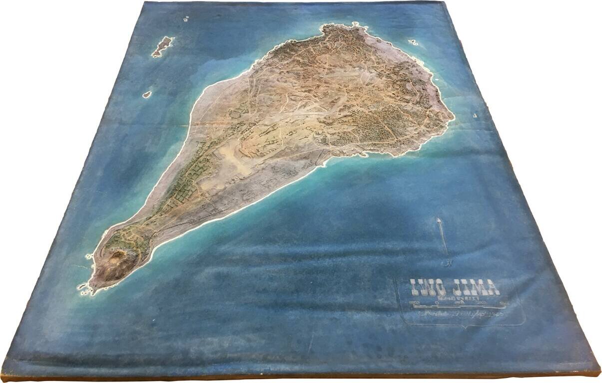
Exceptionally Rare U.S. Military Terrain Model of Iwo Jima, Made in 1945.
Foam and rubber terrain model map of Iwo Jima, probably made by the U.S. Navy Reserve group "Building 14", Hawaii, which was in charge of military model making in the Pacific.
This model is dated September 1945, and so was made either in the closing days of the War or shortly after V-J Day. Though the Battle of Iwo Jima had technically concluded five months earlier, the process of transforming Iwo Jima into a forward B-29 base and of quelling all guerilla action continued for months afterward; indeed, the last two Japanese holdouts on Iwo Jima surrendered in 1949.
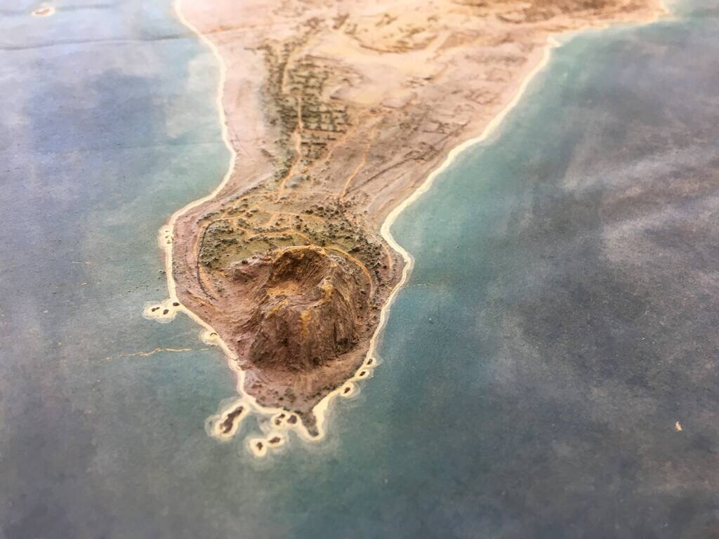
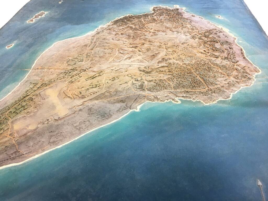
The model prominently features the three Japanese airfields on the island, as well as Mount Sirabachi, where Joel Rosenthal took one of the most famous photos of the War, of the raising of the flat by six Marines.
Mapping Iwo Jima
World War II terrain maps are very scarce on the market. We have located one other terrain map of Iwo Jima that was prepared in 1944-'45. An example sold at Bonham's in 2015 for $11,250. It was quite a bit larger than our own, though the condition was quite a bit more deteriorated. There is another terrain model of Iwo Jima at the International Museum of World War II.
Terrain Model Project
3D terrain modeling became a central focus of United States military mapmaking during the Second World War. The utility of these models in planning for bombing raids, ground assaults, and post-capture infrastructure development had been established by the British during World War I, and during the Second World War, they passed their know-how onto the United States. The U.S. military established several model-making workshops, first on the East Coast, then in Hawaii as the war in the Pacific became the focus. The production of the models was extremely time-consuming, with each one being meticulously hand-painted to match aerial photos. Many models were prepared for D-Day, the largest of which would have stretched an astounding 45 x 65 feet when pieced together.
Production of 3D terrain models is given a good overview at the following website: http://www.terrainmodels.com/war.html
The terrain maps of Iwo Jima were taken aboard vessels that participated in the invasion and were used to acquaint Marines, sailors, and airmen with their target.
The model was probably partially made by pantograph and finished by hand. See the following link for more background information: http://www.terrainmodels.com/pantograph.html
The present model was probably produced in "Building 14" the U.S. Navy Reserve workshop in Hawaii.
The Battle of Iwo Jima
Iwo Jima, whose name translates as "Sulfur Island", was an important midway point between South Pacific bomber bases that were already in the hands of the Allies and the Japanese home islands. 700 miles from Tokyo and 350 from the nearest U.S. airbase, with a central plain suitable for building large runways, American planners viewed it as a valuable target. The battle for the island was among the bloodiest of the Pacific Theater of the Second World War. In total, 6,800 U.S. Marines lost their lives and 26,000 were wounded, while a staggering 18,000 Japanese defenders died.
If you are a student, write to us in telegram: @antiquemaps and indicate what material you need and for what work you need a map in high detail. We are ready to provide material on special terms. For students only!
![[First Map of the American Continent] Tavola dell' isole nuove, le quali son nominate occidentali, & indiane per diversi rispetti.](/map/small/67312.jpg)

![[English Edition!] Maris Pacifici quod vulgo Mar del Zud](/map/small/71000.jpg)