Map size in jpg-format: 2.9687MiB
Click to open in high resolution (open in new tab).
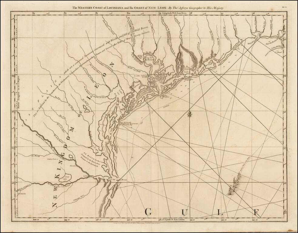
The First Map of the Texas Coastline
Second state of this highly sought after map of Texas, which includes the Robert Sayer imprint.
This is the first map to focus on the Texas coastline. and the only 18th century map of the Texas coast.
An essential map for Texas collectors.
If you are a student, write to us in telegram: @antiquemaps and indicate what material you need and for what work you need a map in high detail. We are ready to provide material on special terms. For students only!


