Map size in jpg-format: 4.71762MiB
Click to open in high resolution (open in new tab).
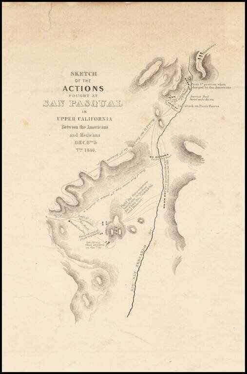
Nice example of Emory's map of the Battle of San Pasqual, in North San Diego County, one of the earliest military battles fought in Upper California.
The Battle of San was fought during the Mexican-American War in what is now the San Pasqual of San Diego County, California. On December 6 and December 7, 1846, General Stephen W. Kearny's US Army column, along with a smaller force of Marines, suffered defeat at the hands of the Californios and their Presidial Lancers, led by General Don Andrés Pico. General Kearny had orders to assume command of U.S. forces in California, but before entering Alta California from Santa Fe, Kearny sent back 200 of his 300 mounted dragoons after hearing from messenger Kit Carson that all of California had already been captured by Robert F. Stockton and John C. Frémont.
After an 850-mile march across the Sonora Desert, Kearny reached California. There they met up with Captain Archibald Gillespie of the U.S. Marines, who brought a message from Stockton and his small force of 36 men and a small howitzer which had recently been driven out of Los Angeles. The total American forces amounted to about 179. A charge was initiated while Kearny's force was still three quarters of a mile from Pico's encampment. About forty of the best mounted officers and men got far ahead of the main body of the force. The mules pulling Kearny's howitzers bolted, taking one of the guns with them.
Pico's force was already mounted and easily managed to remain ahead of the pursuing Americans on their weary mules. The Americans did not know the terrain and the Californios did. A second separation developed until about twenty-eight Americans including Kearny were in the forefront of the charge. As the American attack drew close to a Kumeyaay revillage, the Californios wheeled back and fired their few firearms. One of their first shots killed Captain Johnson, but the Americans continued on and returned fire. The Californios retreated, and the Americans pursued. Captain Benjamin D. Moore ordered a second charge.
When the Californios reversed, they were able to confront Captain Moore and his forces alone. He was quickly surrounded and killed. Other Americans caught up with the action, but their weapons misfired and many of them were wounded or killed by Californios' using lances. Some were pulled from their horses by the Californios' lariats and then lanced. Both Captain Gillespie and General Kearny were wounded. Captain Henry Turner temporarily took command and organized a defensive position, which permitted the rest of the command to catch up with the battered lead.
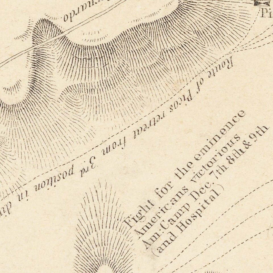
After setting up a defensive perimeter, the Americans sent Kit Carson, an escort and Indian guide to appeal for reinforcements from the American fleet anchored in San Diego Bay. Under the cover of darkness, Carson and his team reached the American fleet. The badly beaten and demoralized American forces, fearing another attack by the Californios and not waiting for Carson's return, probably withdrew a few hours later under darkness. The US forces traveled to San Diego and united with the American fleet there.
If you are a student, write to us in telegram: @antiquemaps and indicate what material you need and for what work you need a map in high detail. We are ready to provide material on special terms. For students only!


