
Rare old maps of the United States.
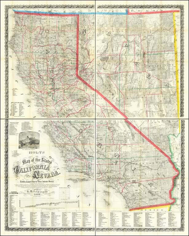
Mapping California and Nevada's Changing Watertable. Rare Late 1888 Edition of the Holt & Linton Map. Warren & Linton's rare and important antique map of California and Nevada, here in the late and substantially modified edition of 1888. In...
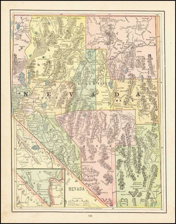
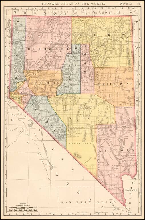
Detailed map of Nevada, colored by Counties, showing Indian Reservations, forts, Military Reserves, mines, forests, towns, railroads, railroad stations, post offices, rivers, forts and other places of interest. A nice late 19th Century map, printed...
![[California & Nevada] California and Nevada Northern Half / California and Nevada Southern Half](/map/small/69248.jpg)
Remarkable large 2 sheet Railroad Map of California & Nevada, published by George Cram. Includes a list of about 20 Railroads, including some very rare names, including: Carson & Colorado RR Chino Valley RR Coronado RR (Narrow Gauge...
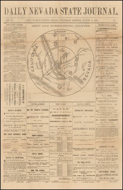
Scarce newspaper map of the area centered on Reno, Nevada, from the Daily Nevada State Journal, published in Reno, Nevada. The map is centered on Reno and shows Virginia City, Lake Tahoe, Truckee, Carson, Bodie, Aurora, Wadsworth, Susanville, Big...
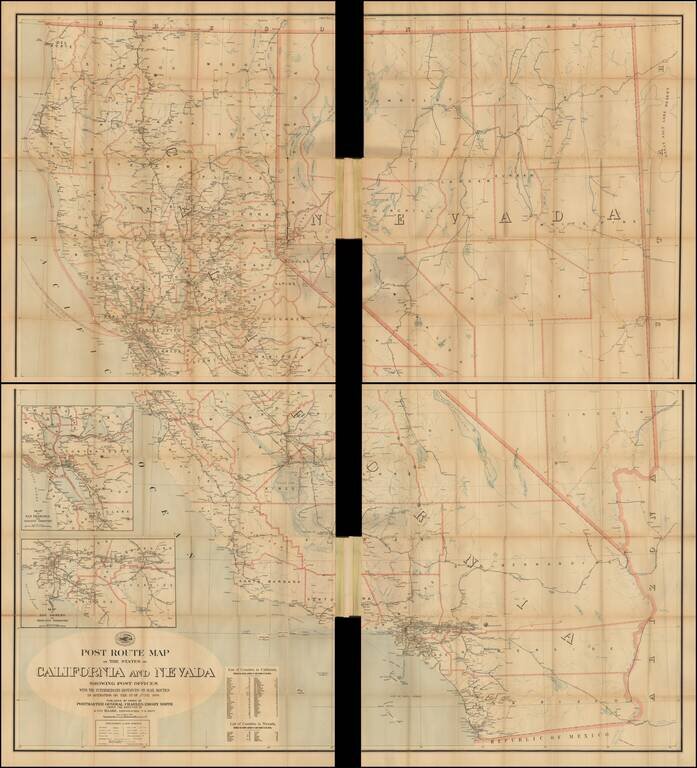
Official 1899 Postal Route Map for California and Nevada Scarce and remarkably detailed late 19th Century Postal map of Nevada and California, issued by the United States Post Office. Includes a large inset of the Los Angeles Basin and the Bay...
Large format detailed map of Nevada, showing towns, rivers, railroads, mountains, lakes, etc. Beautifully colored with many statistics. From Rand Mc Nally & Co's Business Atlas.
Large format detailed map of Nevada, published by George Cram. The map shows towns, rivers, railroads, mountains, lakes, etc.
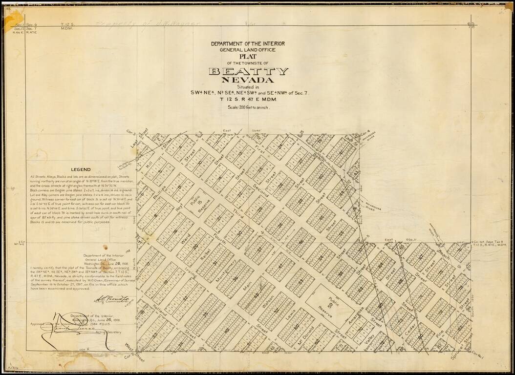
Detailed plan of Beatty, Nevada, one of the primary Nevada mining boom towns in the first part of the 20th Century, published by General Land Office. The present map is one of the earliest obtainable maps of the City, which had been laid out only a...
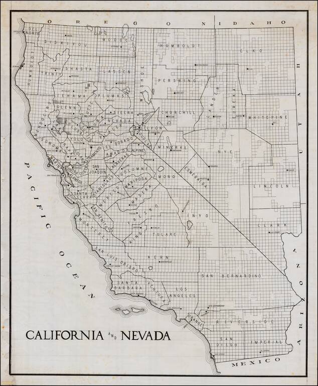
Early manuscript draft of a large format map of California and Nevada. The county configurations would appear to be circa 1908-1909, based upon shape of Glenn County. The guidelines in the title and other places are visible.
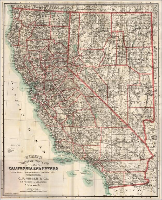
Fine large format map of California and Nevada, published in 1910 by C. F. Weber & Company, one of California's leading mapmakers at the beginning of the 20th Century. The detail of the map is quite good, especially in the mining regions of...
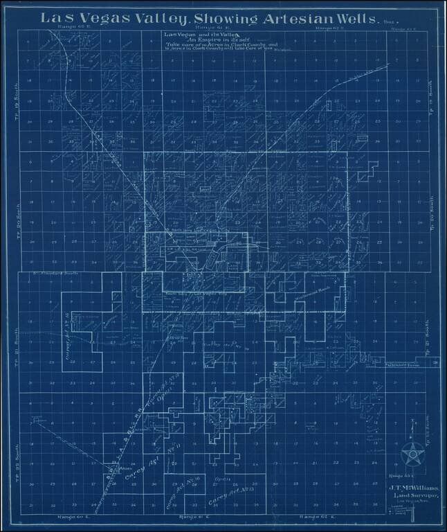
"Las Vegas and its Valley -- An Empire in its's Self" -- JT McWilliams Map of Las Vegas and Vicinity Rare early cadastral map of Las Vegas, Nevada, drawn by "J.T. McWilliams, Land Surveyor, La Vegas, Nev.", one of the two earliest real estate...
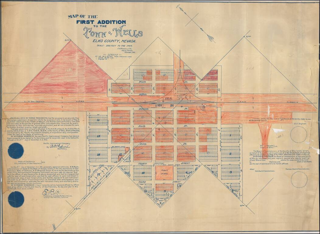
Early certified copy of the detailed map of an early addition to the town of Wells, Nevada, surveyed by F.H. Russell, Civil Engineer. The map shows the newly planned subsdivision on either side of the Central Pacific Railroad Depot and Warehouse. A...
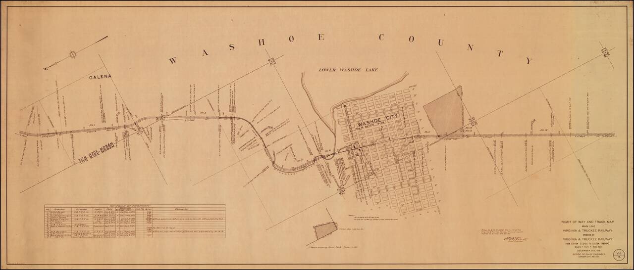
An Early Western Town Destroyed By The Arrival of the Railroad Interesting map of the area around Washoe City, published by the Virginia & Truckee Railway. Now nearly a ghost town, Washoe City was founded in 1860 as a lumbering camp for Virginia...
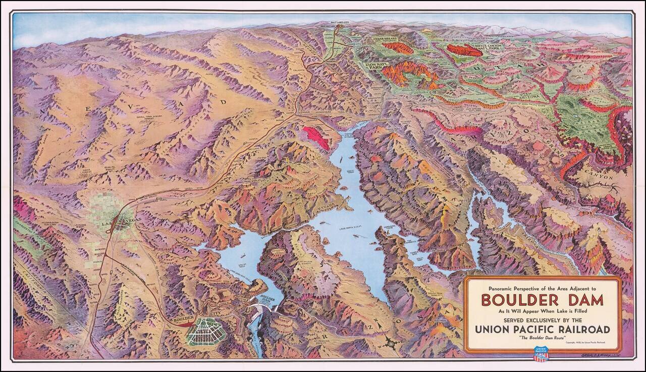
Boulder Dam & Environs Striking panoramic view of the Nevada, Utah, and Arizona desert, from Las Vegas to the Grand Canyon, published by the Union Pacific Railroad. The map extends east to the Union Pacific Grand Canyon Lodge on the north rim of...
![A Hysterical Map Of Lake Tahoe Wild and Woolly Nevada With Its Wide Open Places [With Original Envelope!]](/map/small/68358.jpg)
Hysterical Tahoe With Original Mailing Envelope! Fine example of this rare pictorial map of Lake Tahoe, "Drawn in Broken English by Jolly Lindgren." This comic pictorial map is full of puns and comic vignettes related to Lake Tahoe. The Legend...
![Las Vegas Fun Tour Map [on sheet with:] Las Vegas City Fun Map](/map/small/69008.jpg)
Rare vintage pictorial map of Las Vegas and the Las Vegas Region printed front-to-back on a 1947 promotional pamphlet for the city. The main map features the region around Las Vegas in George Ramsey's characteristic red, yellow, blue, and green color...