
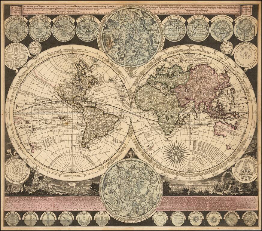
Visually Striking Double Hemisphere Map of the World Fine example of Adam Freidrich Zürner's complex and informative double hemisphere map of the world, artfully embellished with a multitude of decorative scenes and projections of celestial bodies....
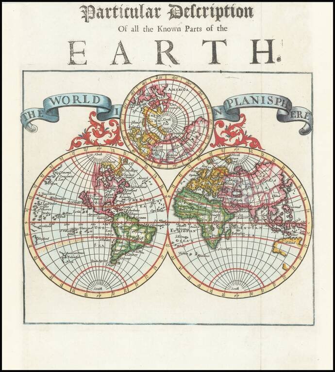
Very attractive double-hemisphere map with California depicted as an island. Decorative banner contains title. In the center of the banner there is a smaller sphere showing the North Pole. This map shows a number of place names along with the names of...
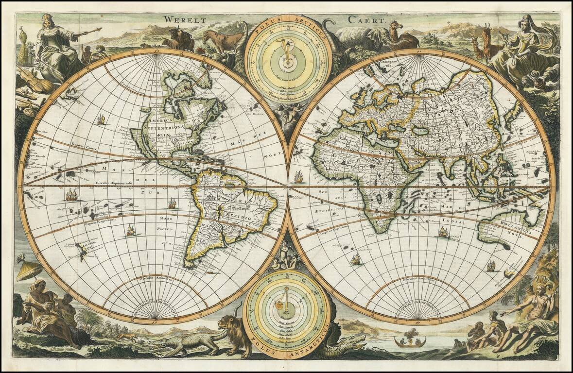
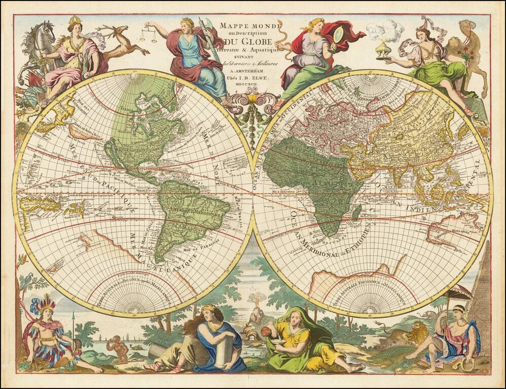
Decorative double hemisphere map of the World, showing California as an Island, with the Continents represented in the female form. The map is based upon Visscher's earlier Bible maps. There are a number of variants with subtle changes, issued in the...
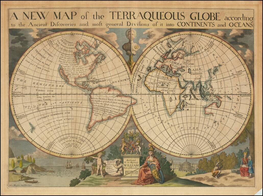
Decorative double hemisphere map of the World, dedicated to William, Duke of Glouchester. This map shows California as an Island, an incomplete New Holland attached to N. Guinea, partial New Zealand Coast line and no Southern Continent. Extensive...
![[Proietio Optica Hemisphaerii Polaris Arctici]](/map/small/59287.jpg)
Unusual World map on a North Polar projection, with a highly enlarged depiction of Greenland and Iceland and celestial model in the upper right. The map shows California as an Island and a potential NW Passage and also a possible continuous landmass...
Decorative double hemisphere map of the World, published by one of Paris's leading mapmakers, Nicolas De Fer in 1700. In the west, the map shows California as an Island, the Northwest Passage, an interesting misprojection of the Great Lakes, and the...
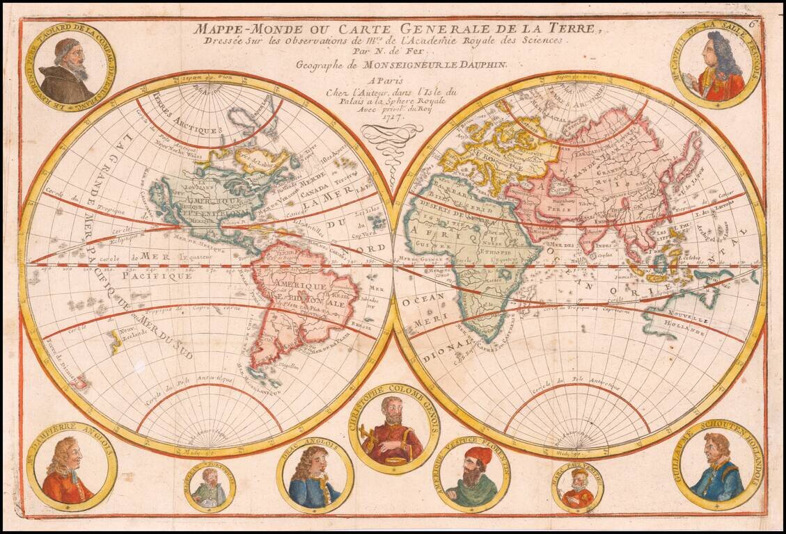
An Unusual Treatment of Australia and the Unknown Southern Continent Decorative world map, showing California as an island, the tracks of several explorers around the world and Celestial images of the sun Kircher and the moon by Cassini. The map...
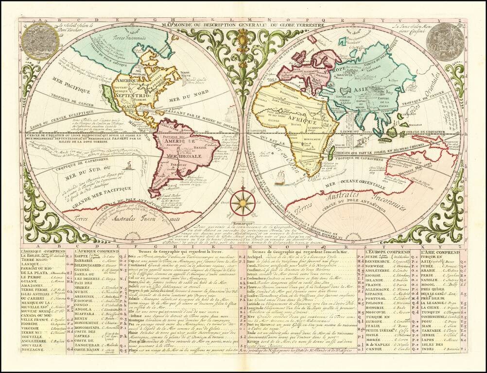
Hubert Jaillot's World Map Re-Issued At the End of the 18th Century Scarce Dutch decorative double hemisphere map of the World one of the most unique and decorative world maps of the period. By the end of the 17th Century, Paris was supplanting...
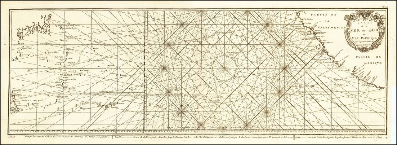
Impressive Chart of the Pacific Ocean Depicting a Thrilling Circumnavigation Dynamic chart of the mid-Pacific Ocean from the French-edition of Anson’s bestselling voyage account. It includes voyage tracks of Anson’s Centurion and the ship he...
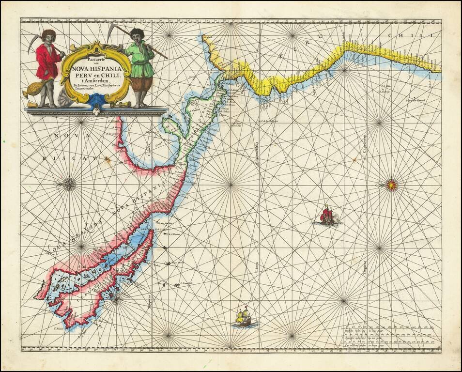
Rare Golden Age Dutch Sea Chart of the Island of California and Western Pacific Rare Johannes Van Loon sea chart of the Western Pacific. The map appeared in the first edition of Van Loon's Zee Atlas. It derives from Doncker's map of the Western...
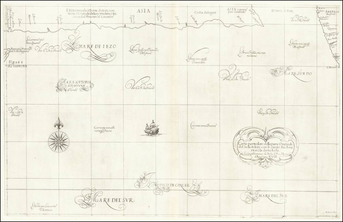
Fascinating map of the southern coast of Japan (Terra Iezo) and the Northwest Coast of America north of Cape Mendocino (including Quivira), from Dudley's Dell'Arcano del Mare. The map shows one of the great cartographic myths of the period, the...
![Representation du Cours ordinaire des Vents de Traverse qui regnent les Cotes dans la grande Mer Du Sud [California as an Island]](/map/small/54744.jpg)
Interesting map charging the course of the trade winds in the Pacific Ocean, published by Bellin in the Histoire Generale de Voyages, based upon the obseravations of Dampier. California is shown as an island. An odd piece of the southern hemisphere...
![Amerique Septentrionale divisee en Ses Principales parties . . . . 1692 [California as an Island]](/map/small/69862.jpg)
Jaillot’s Impressive Map of North America, with California as an Island Fine, dark impression of Jaillot's striking, large-format map of North America, showing California as an island. The map, printed in a wide-format, shows all that was then...
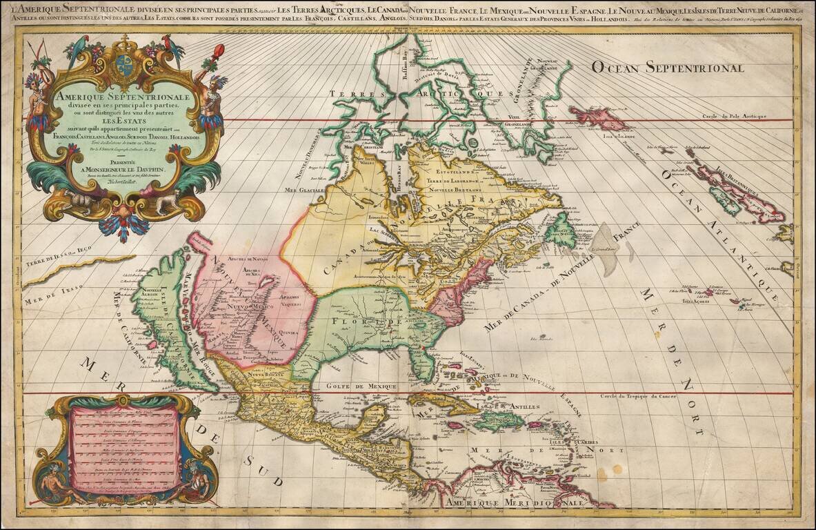
Jaillot’s Impressive Map of North America, with California as an Island Fine, dark impression of Jaillot's striking, large-format map of North America, showing California as an island. The map, printed in a wide-format, shows all that was then...
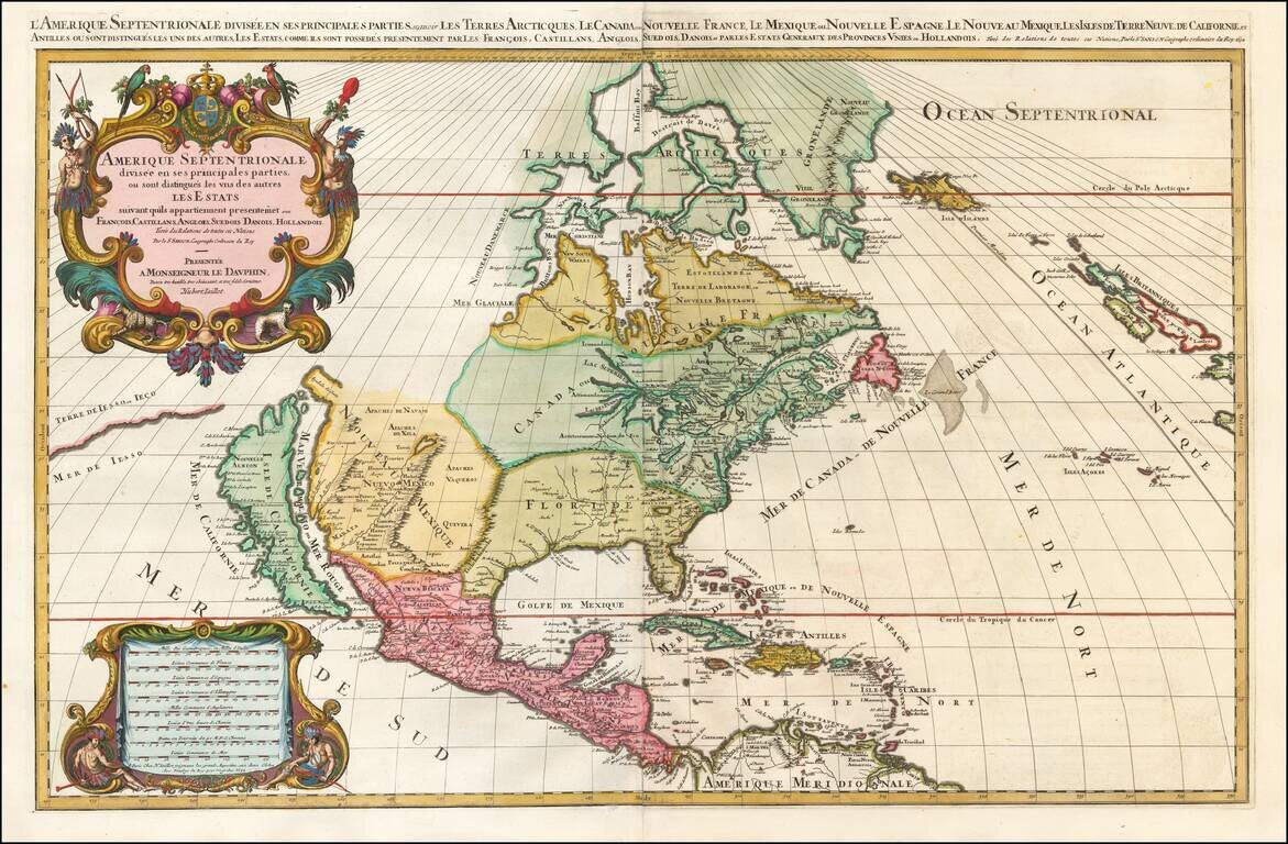
Jaillot’s Impressive Map of North America, with California as an Island Fine, dark impression of Jaillot's striking, large-format map of North America, showing California as an island. The map, printed in a wide-format, shows all that was then...
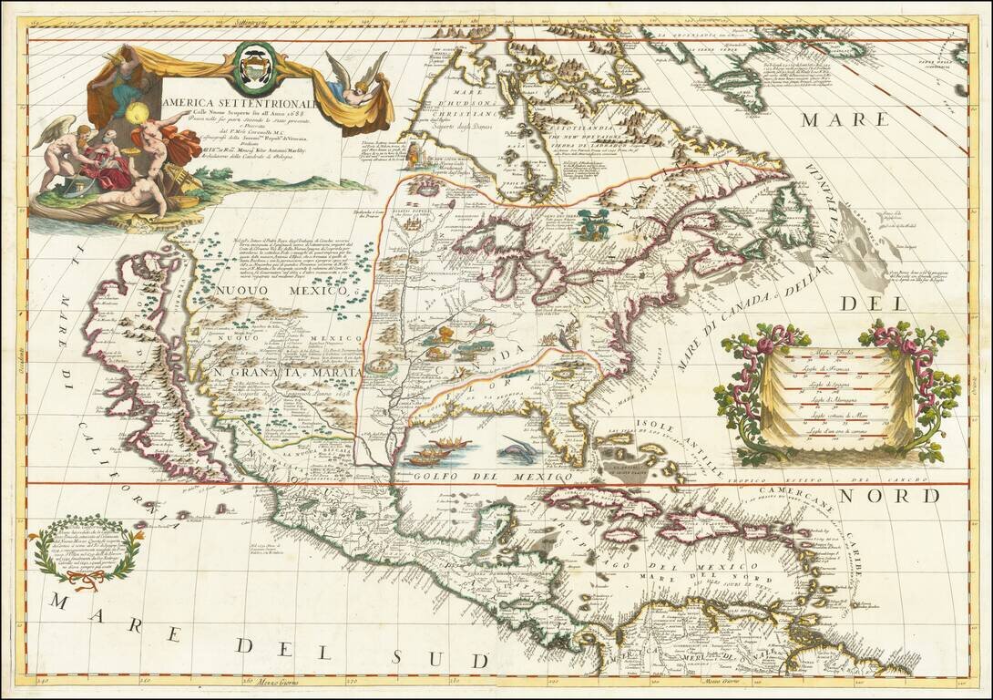
Landmark Map of North America by Coronelli with California as an Island Fine example of Coronelli's cornerstone map of North America, one of the most influential maps of the continent published in the late seventeenth century. The map is...