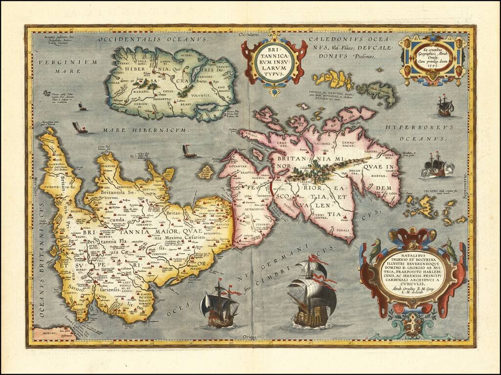
Notable Atlas Map of the British Isles, From the First Modern Atlas Scarce, fine map of the British Isles, from Ortelius' ground-breaking atlas, Theatrum Orbis Terrarum. Oriented to the west, the British Isles are shown as if on their side. The...
"This is the most advanced Latin edition of the Theatrum published by Vrients." - Koeman (Ort 36) [A6, including engraved title page], [B6], [C6], [D4], and 118 double-page engraved maps all of which with Latin text on verso. This copy is complete...

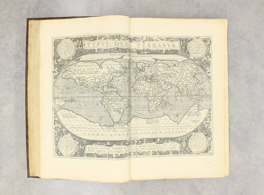
The First Modern Atlas of the World [39] preliminary text leaves (including engraved title), 166 hand-colored double-page engraved maps (lacking 10 preliminary sheets of text (A6, B1-6, D3-5), 3 maps and 2 plates (Piedmont, Parma and Plaisance,...
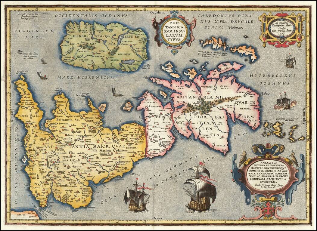
Notable Atlas Map of the British Isles, From the First Modern Atlas Scarce, fine map of the British Isles, from Ortelius' ground-breaking atlas, Theatrum Orbis Terrarum. Oriented to the west, the British Isles are shown as if on their side. The...
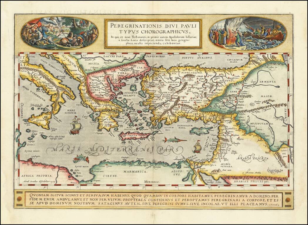
A gorgeous example of Ortelius' map of the travels of St. Paul the Apostle through the Mediterranean, extending west to Italy and east to the Euphrates, including parts of the Red Sea and the Black Sea. Several sailing ships and sea monsters in the...
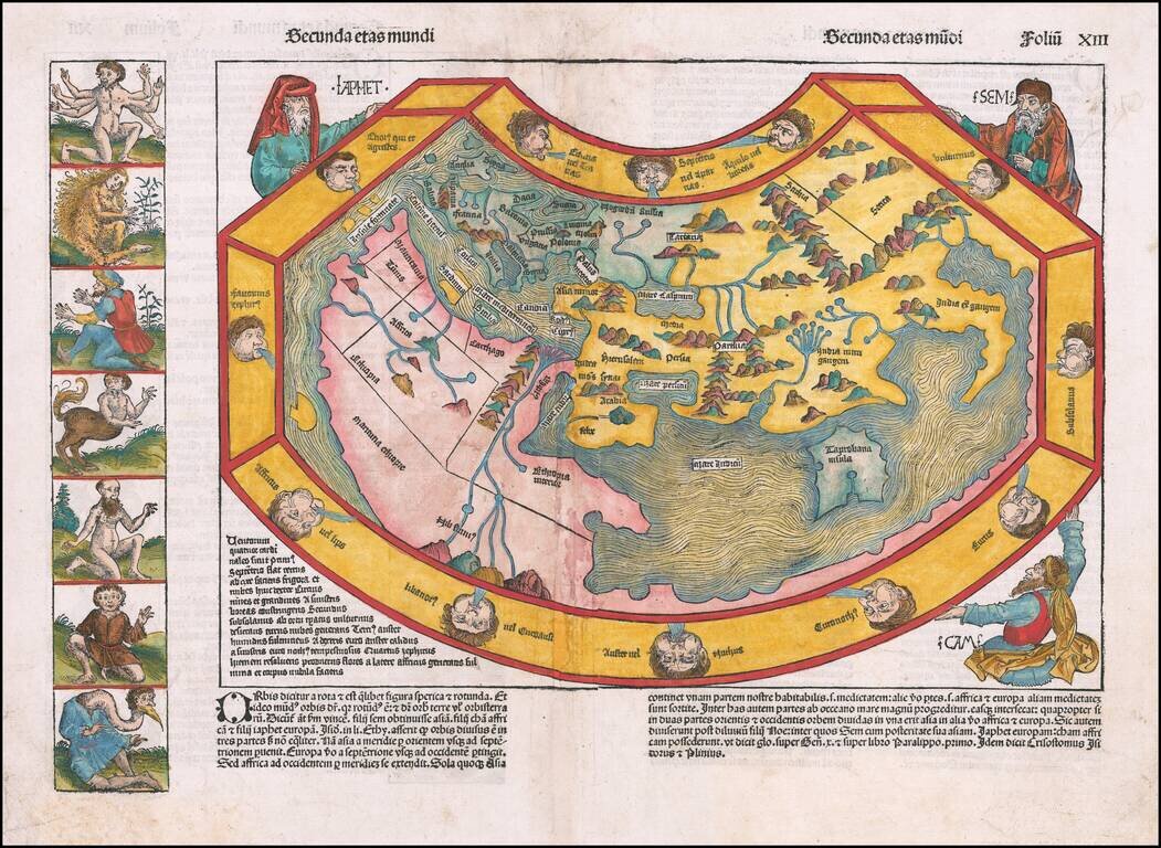
A Map of the World From The Time of Columbus Striking example of the first edition Hartmann Schedel's map of the World, from the Latin edition of his Liber Chronicum. Schedel's map is one of the earliest obtainable World maps, and, visually, one of...
![Lisbona. Olisipo ... vulgo Lisbona Florentissimum Portugalliae Emporiu. [with] Cascale Lusitaniae Opp](/map/small/67935.jpg)
A view of Lisbon and Cascale, which first appeared in Braun and Hogenburg's Civitates Orbis Terrarum. Lisbon is shown as a great port city, with many large ships in its harbor. In the city, castles, churches, port buildings, and citizens can all be...
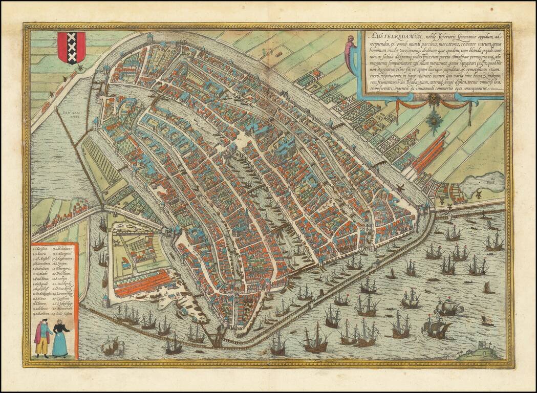
This is a finely colored example of Braun & Hogenberg's first view of Amsterdam, from Part I of their Civitates Orbis Terrarum, first published in Cologne in 1572. Braun & Hogenberg's view is based upon a plan of Amsterdam by Cornelis...
![Posonium [Bratislava]](/map/small/67630.jpg)
An attractive antique view of Posonium [Bratislava] showing the city from the east, from across the Danube. The city is small, with a handful of churches, several neighborhoods, and a castle overlooking the city. The map is delicately colored....
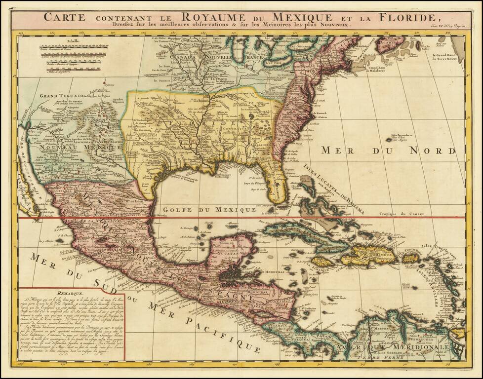
An Early Re-Issue of a Cartographic Landmark Map This is a finely executed map of the southern part of North America by the French mapmaker Henri Chatelain. The map draws its inspiration from the royal mapmaker Guillaume de L'Isle's landmark map of...
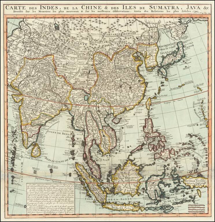
Names the Sea of Korea A large and very detailed map of East Asia, from India and the Indian Ocean in the west to Japan, Korea, and the Philippines. Place names are extensive on this map, both on land and at sea. French text at the bottom describes...
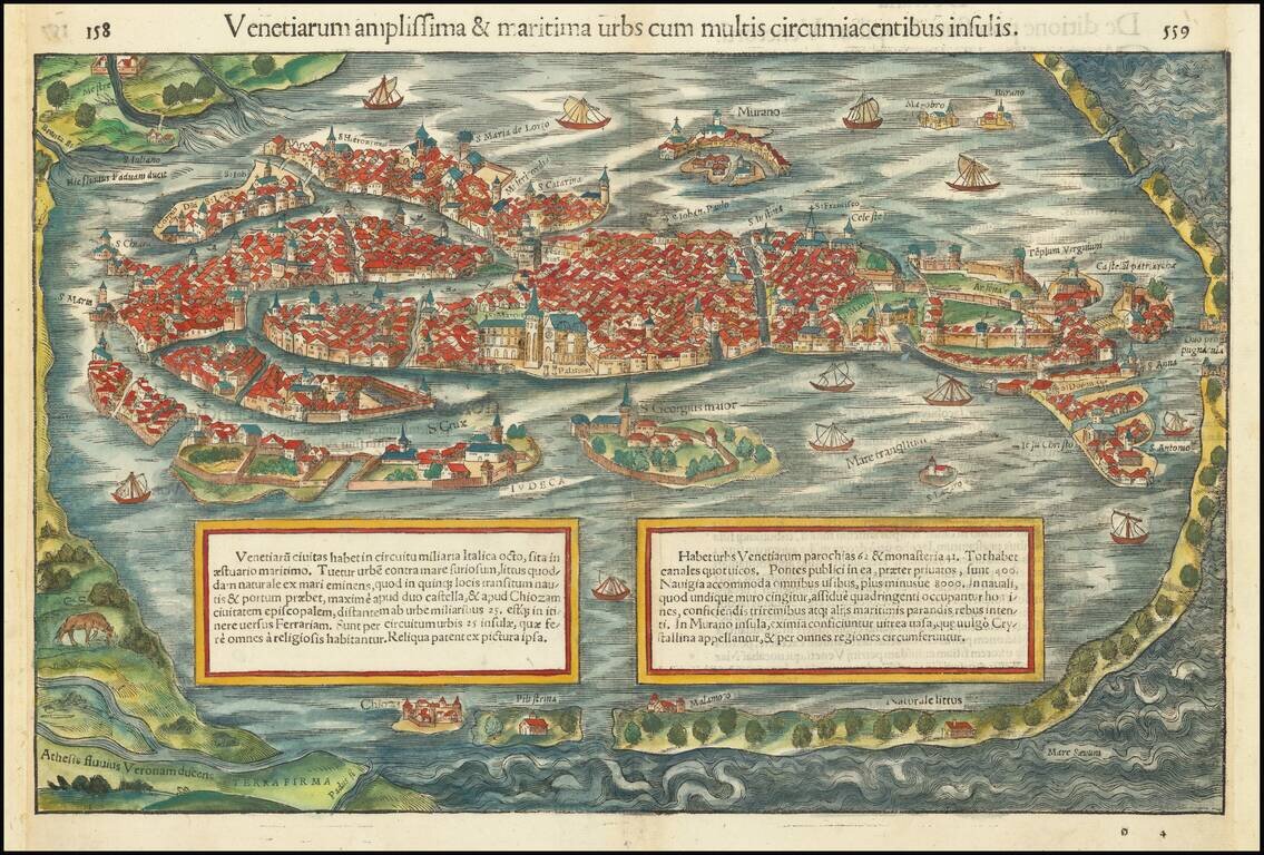
This is a gorgeous full-color example of Munster's view of Venice, from a Latin edition of Munster's Cosmographia, which was one of the most prolific works of the 16th and 17th centuries. This is one of the earliest obtainable birds-eye views of...
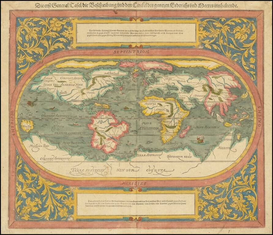
An Updated Map of the World From Munster's Cosmographia. A decorative example of this revised and updated map of the world, based upon Abraham Ortelius' world map, which appeared in Munster's Cosmographia after 1588. The map is...
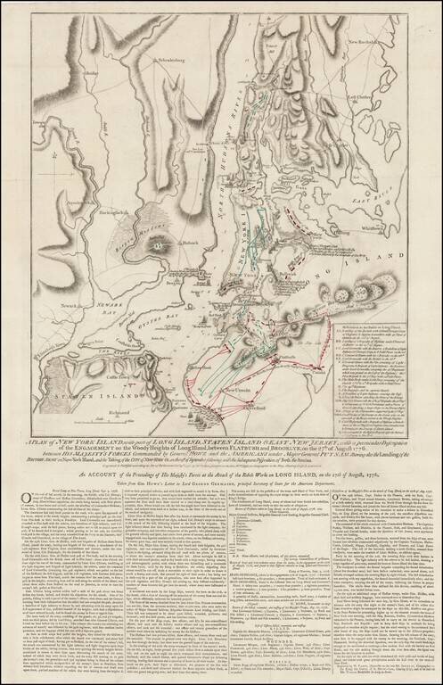
Rare Final State of Faden's Plan of the Battle of New York Fine example of Faden's separately issued broadside map showing the British Invasion of New York City in August and September of 1776. The present example is the final state of the map, with...
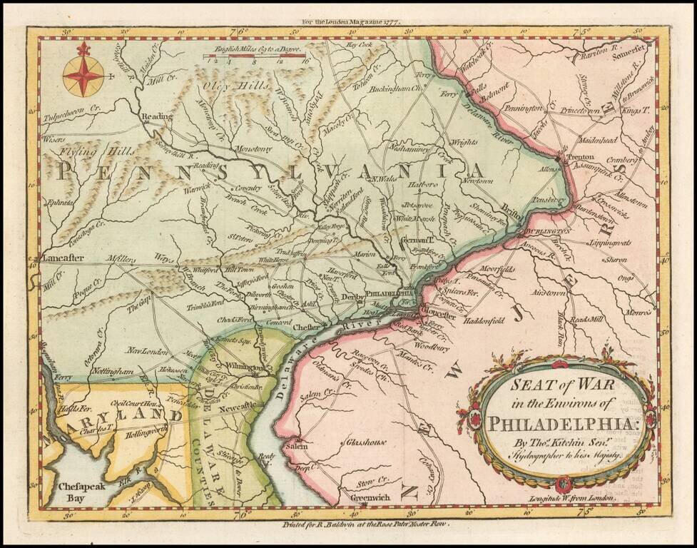
Fine early map showing the Seat of the American Revolutionary War around the Delaware River and Philadelphia, which appeared in the London Magazine in 1777. The map includes the area from Trenton to Lancaster. The road network is shown in detail. It...
![[Long Island Sound from Hampstead Bay to Huntington Bay]](/map/small/51310.jpg)
Rare Des Barres chart of Long Island Sound, covering the coast of the north shore of Long Island roughly from Hampstead Bay to Huntington Bay, and including Oyster Bay and Cold Spring. The present chart constitutes a partial section of Des Barres's...