Map size in jpg-format: 3.58557MiB
Click to open in high resolution (open in new tab).

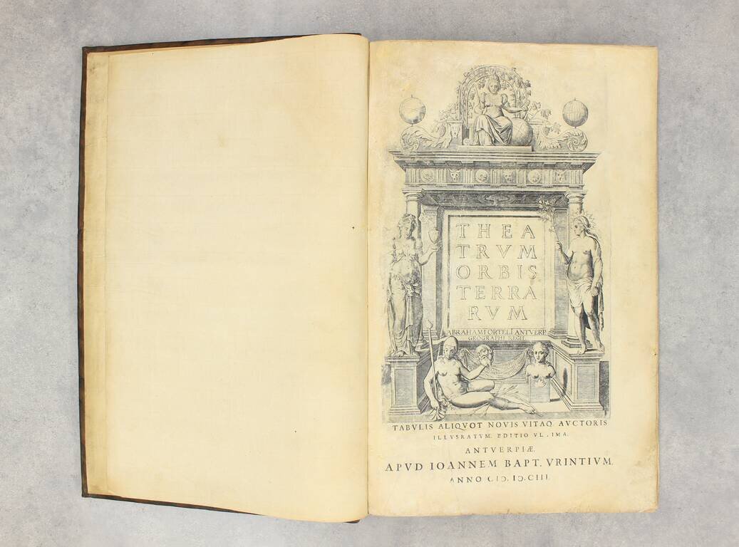
"This is the most advanced Latin edition of the Theatrum published by Vrients." - Koeman (Ort 36)
[A6, including engraved title page], [B6], [C6], [D4], and 118 double-page engraved maps all of which with Latin text on verso. This copy is complete through the Theatrum but is bound without the Parergon or the Nomenclator Ptolemaicus.
Koeman says of this edition:
This is the most advanced Latin edition of the Theatrum published by Vrients. According to the colophon of the Nomenclator this edition was printed by Robertus Bruneau. A number of new maps was added by Vrients. Some of them may have appeared earlier in the 1602 Spanish edition.
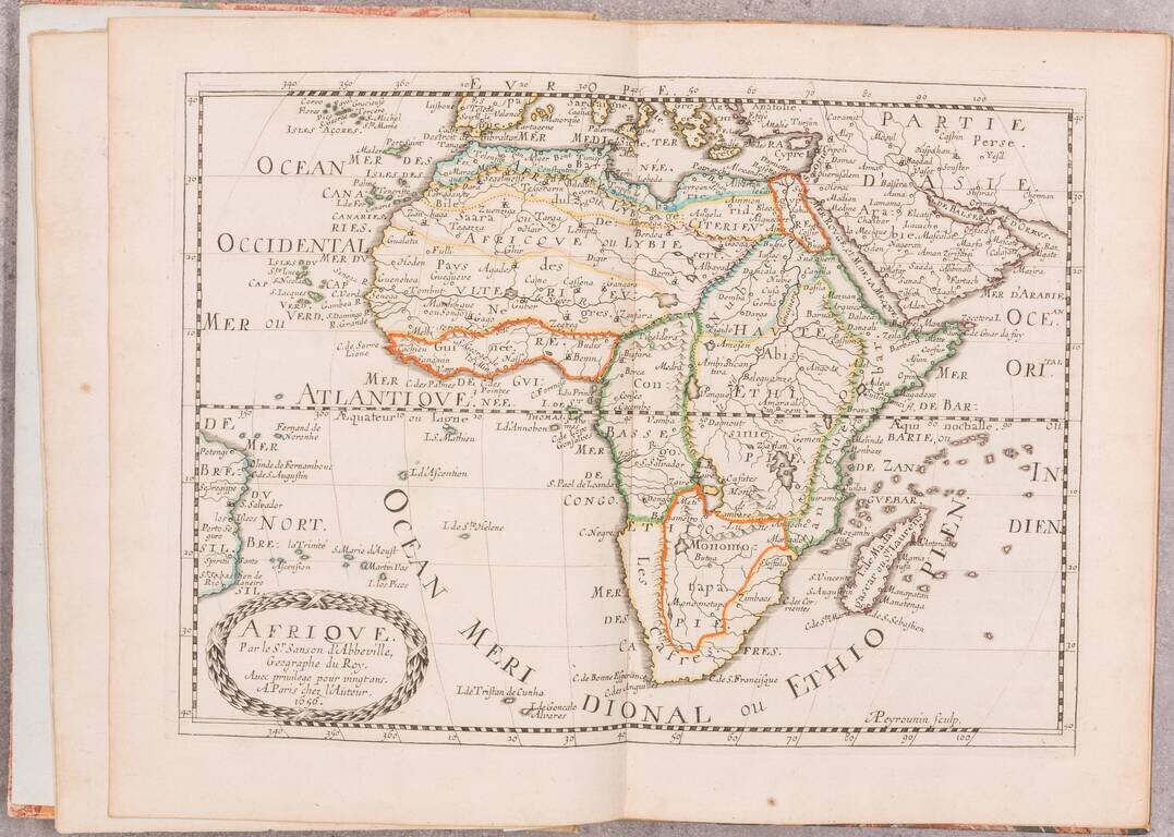
The new maps added by Vrients in 1602/03 include the following:
Van Den Broecke No. 20: Anglia Regnum si quod aliud in toto Oceano ditissimum et florentissimum. Christophorus Saxton describebat 1579. (England after Saxton. In this edition it is map 12.) Van Den Broecke No. 57: Deutschlandt. Germaniae typus. Per Franc. Hogenbergium concinnatus Anno CD.D.LXXVI. D. Constantino a Lijskirchen... (Germany after Hogenberg. In this edition it is map 36.)
Theatrum Orbis Terrarum
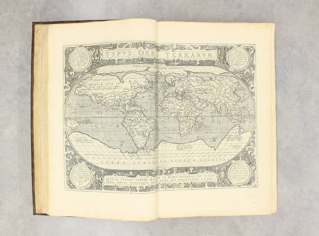
Ortelius's Theatrum Orbis Terrarum (or "Theater of the World") is widely considered to be the first modern atlas, meaning that this was the first published set of uniform maps with supporting text gathered in book form. Previous bound map collections exist, for example the Italian Lafreri atlases, but these were sets of maps selected and bound together on demand. The Theatrum, in contrast, was the best available summary of sixteenth-century cartographic knowledge, covering much of the exploration of the world in the century following the discovery of America.
The atlas was first published in 1570 Antwerp. Ortelius’ atlas outperformed later competing atlases from other cartographic luminaries like the De Jode and the Mercator family. The broad appeal of the work is demonstrated by the array of languages in which the atlas appeared: in addition to Latin, the atlas was published with text in Dutch, French, German, Italian, Spanish, and English. Between 1570 and 1612, at least 31 editions of the atlas were published in seven languages. The editions grew over time, with the first edition having had 53 maps, and the 1612 edition having 167.
At the time of its publication, the Theatrum was the most expensive book ever produced. Ortelius created all maps personally, hand drawing the rough sketches. Those drawings were then interpreted into prints by his engravers Frans Hogenberg, Ambrosius Arsenius, and Ferdinand Arsenius.
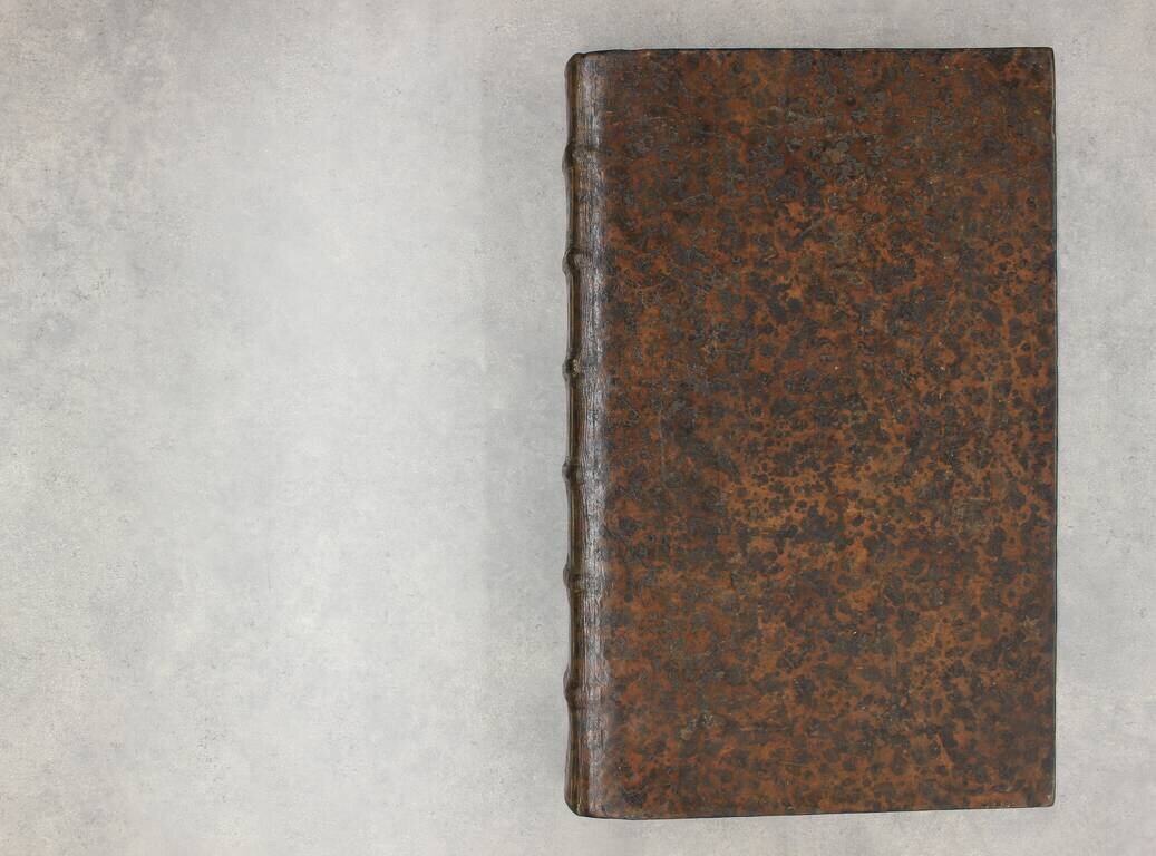
After Ortelius's death in 1598, the copper plates for his atlas passed to his heirs. They, in turn, sold the collection to Jan Baptist Vrients (1522-1612) in 1601. Vrients added new maps and published the atlas until his own death in 1612. Vrients's widow then sold the plates to the Moretus brothers, who were the successors of Christoffel Plantin. Recent research has unearthed examples of the atlas with maps dated to 1640.
If you are a student, write to us in telegram: @antiquemaps and indicate what material you need and for what work you need a map in high detail. We are ready to provide material on special terms. For students only!
![[Blaeu Atlas of America] America, Quae Est Geographiae Blavianae Pars Quinta Liber Unus Volumen Undecimum](/map/small/66852.jpg)