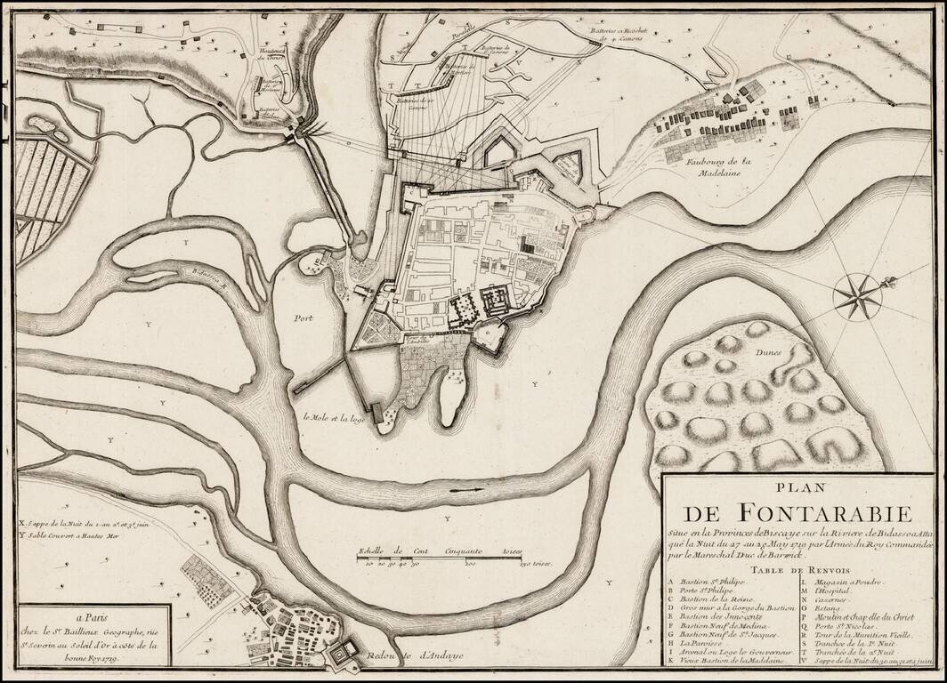
Rare plan of the siege of Fontarabia, published by Gaspar Bailleul in Paris. Fontarabia was attacked by French in May 1719. The main body of the army, in all forty thousand strong, crossed the frontier soon afterwards, and entered upon the blockade,...
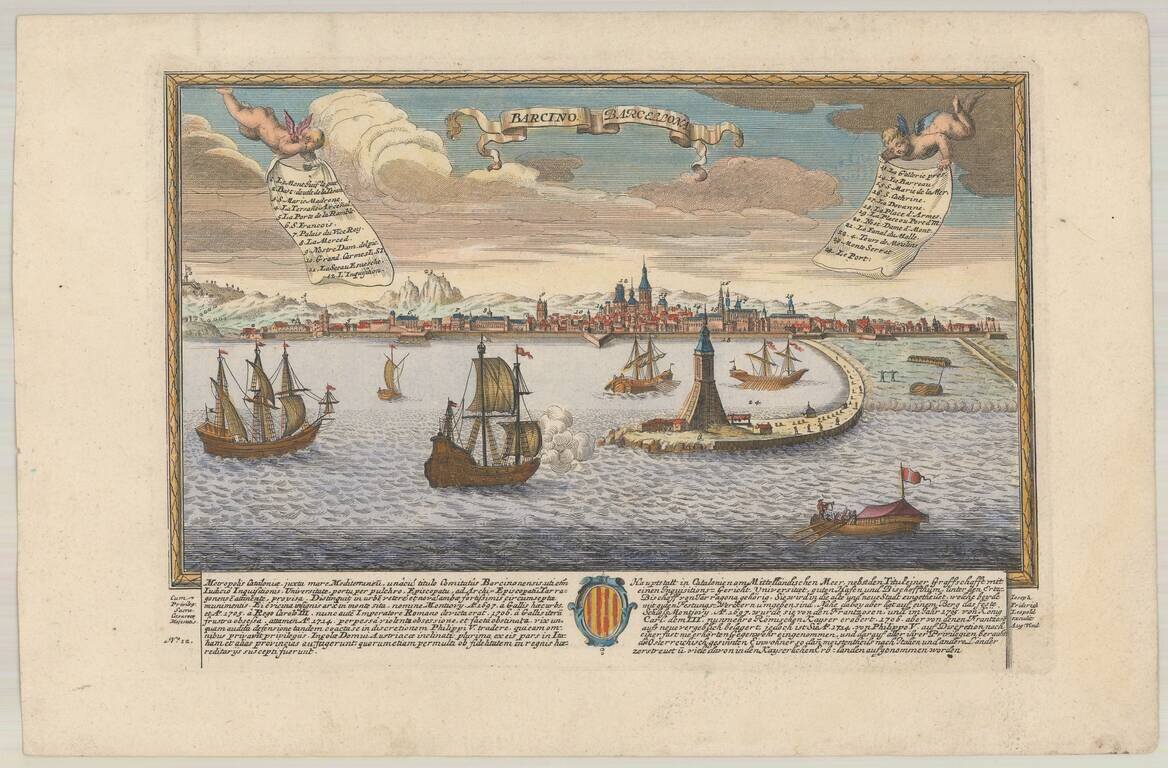
Rare birdseye view of Barcelona, published in Augsburg by Leopold. Includes a decorative coat of arms and a key listing 24 important places within the view. Not in Fauser.
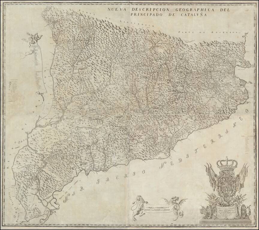
The First and Most Famous Domestically Produced Map of Catalonia of the Eighteenth Century Fine map of Catalonia by Josef Aparici, the first large format map of Catalonia published by a Catalan. The map was first published in 1720, with a second...
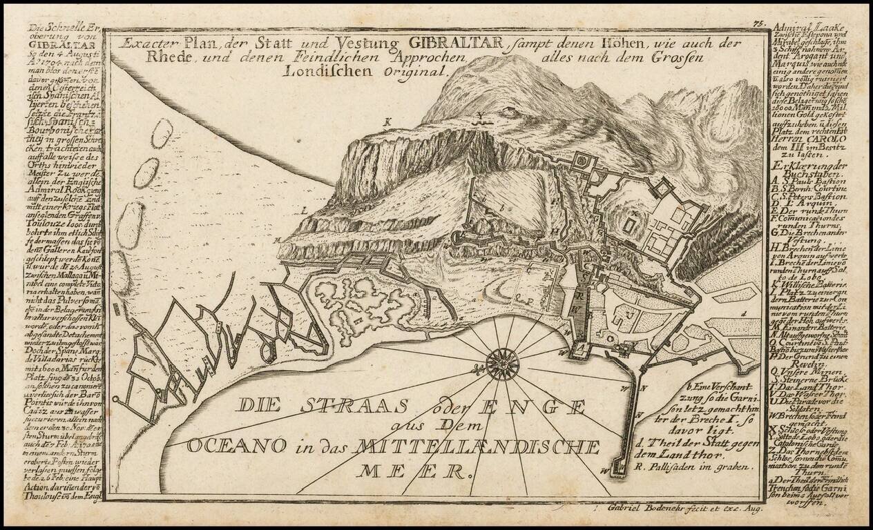
Detailed antique engraved Gibraltar, probably published in Bodenehr's Curioses Staats und Kriegs Theatrum. The plan features a detailed treatment of the topography of Gibraltar, as well as the fortification and major buildings of the famous peninsular...
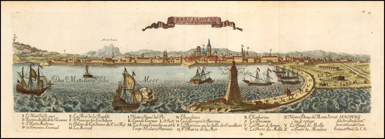
Rare View of Barcelona, Capital of Catalonia. Finely engraved view of Barcelona, published in Augsburg by Johann Stridbeck. Includes a striking harbor view.
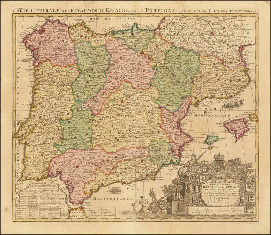
Decorative map of Spain and Portugal, identifying a number of the significant battles fought during the war of Spanish Succession. The map includes a number of battles, including a graphic depiction of the naval Battle of Velez-Malaga (August 24,...
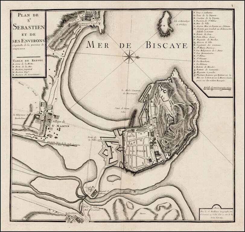
Rare plan of San Sebastien, published by Gaspar Bailleul in Paris. The map shows the bay and fortifications of San Sebastien, St. Martin and environs. The roads and gates between the settlement area also shown. A key locates approximately 30 points of...
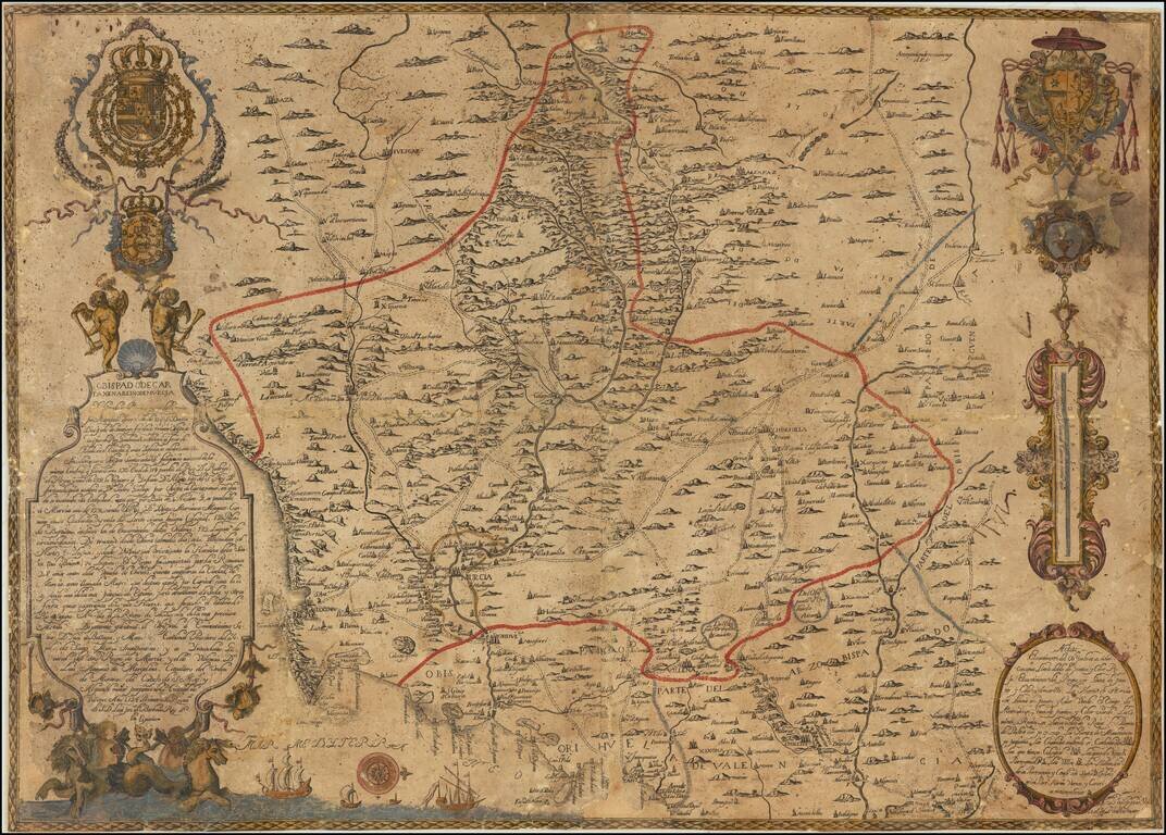
A Spanish Rarity of the Bishoprick of Cartagena and Kingdom of Murcia A very rare engraved map of the Murcia region in southeastern Spain. Oriented with west at the top, the map shows the diocese of Cartagena with the Mediterranean coast from Vera,...
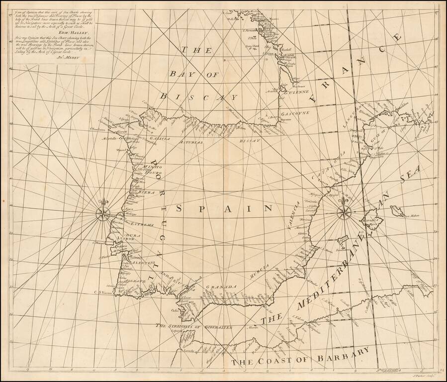
Southern Sheet of Scarce Sea Chart Exhibiting a New Projection Rare chart showing the Iberian Peninsula on a 'globular projection' (i.e. on the same projection as a double-hemisphere map). The charts consists of two sheets, and this is the...
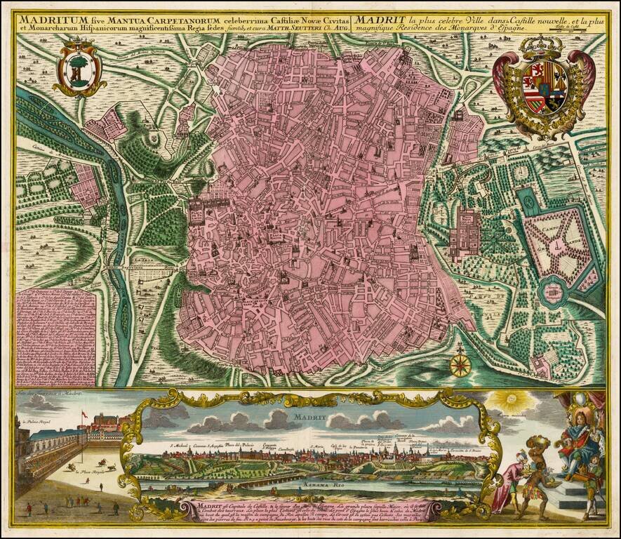
Fine old color example of Seutter's decorative and highly detailed plan of Madrid, with a striking view of the City below. The map includes 2 coats of arms, and a unique view of the City from across the Xarama River, set within a scene on the palace...
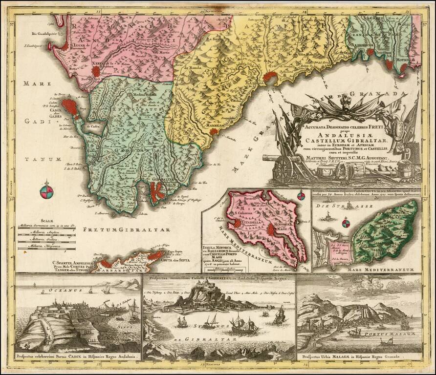
Decorative regional map of the southern parts of Spain, with large inset maps of Minorca, Ceuta, Cadiz, Gibralter and Malaga.
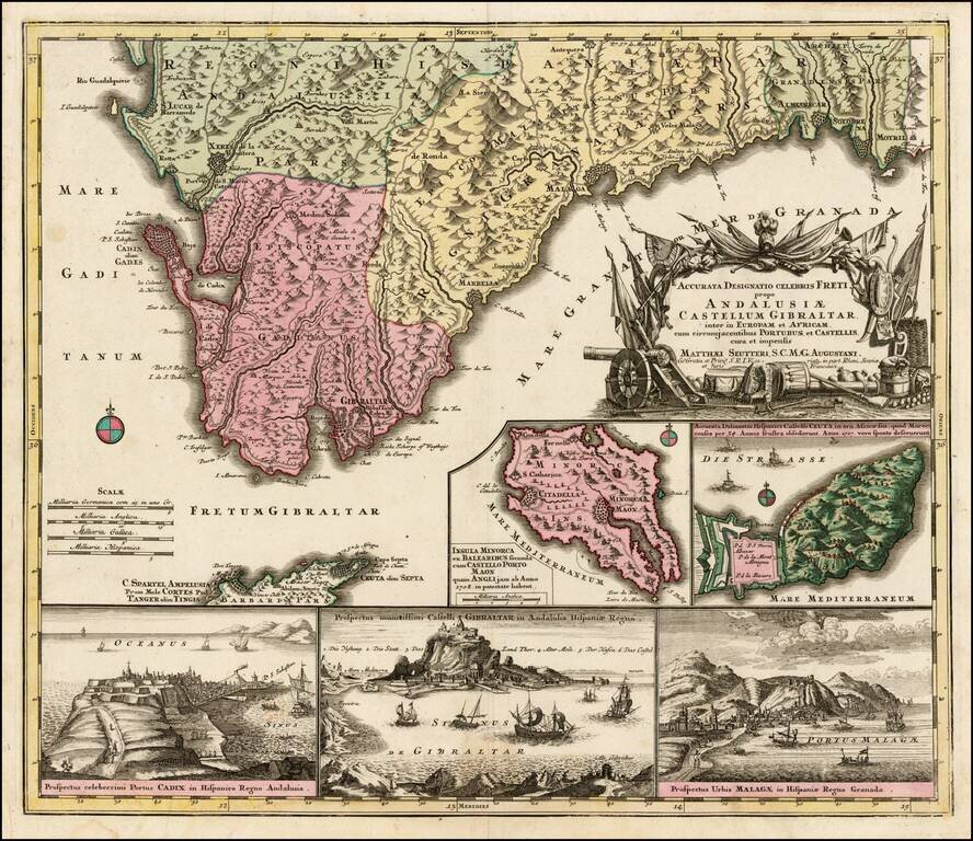
Decorative regional map of the southern parts of Spain, with large inset maps of Minorca, Ceuta, Cadiz, Gibralter and Malaga.
![[Barcelona] Barcino Metropolis Hispanici Principatus Cataloniae in littore Maris Mediterranei, perquam munita, et ab portus como ditatem celeberrimum Emporium cura Impensis . . .](/map/small/58971.jpg)
Fine old color map and view of Barcelona and environs, published by Seutter in Augsburg. At the top, a map-like view of the fortified town and harbor of Barcelona is shown, with a second set of walls on Montjuic (called Mont Juif on the map). Below...
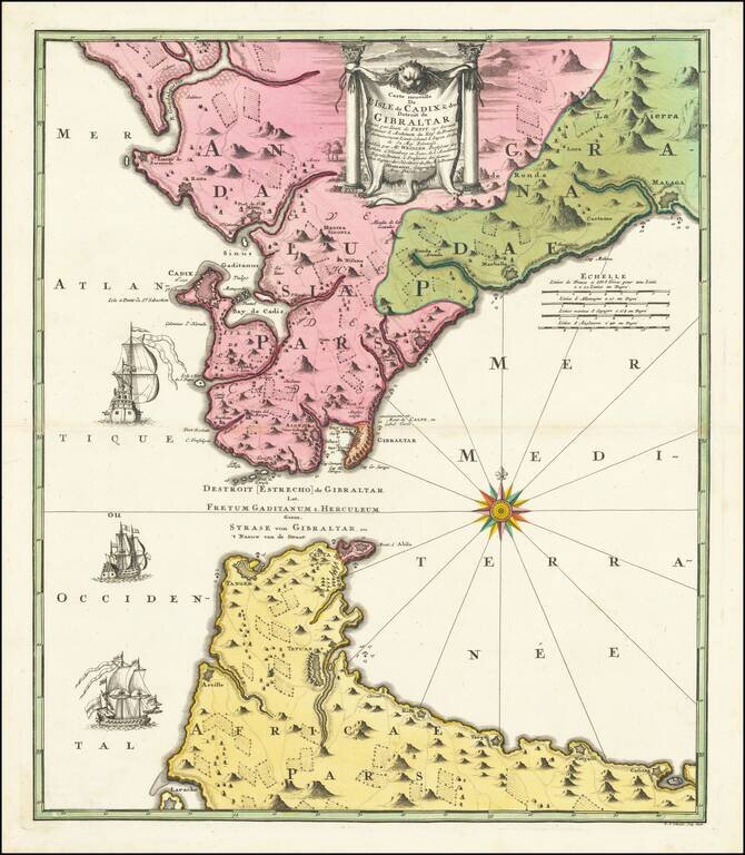
Decorative Johann Baptist Homann engraved map of Strait of Gibraltar, including southern Spain and the northern tip of Morocco, showing Gibraltar, Cadiz, Malaga, Marbella, Algezira, Tetuan, Ceuta, Tangiers, Larache, etc. Highly detailed regional map,...
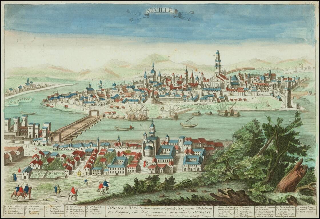
Decorative old color engraved view of Seville, capital of Andalucia in Spain. Bird's eye view of Sevilla, with Triana and some figures in the foreground. Includes a key locating 37 important places within the view. Jean François Daumont (fl....
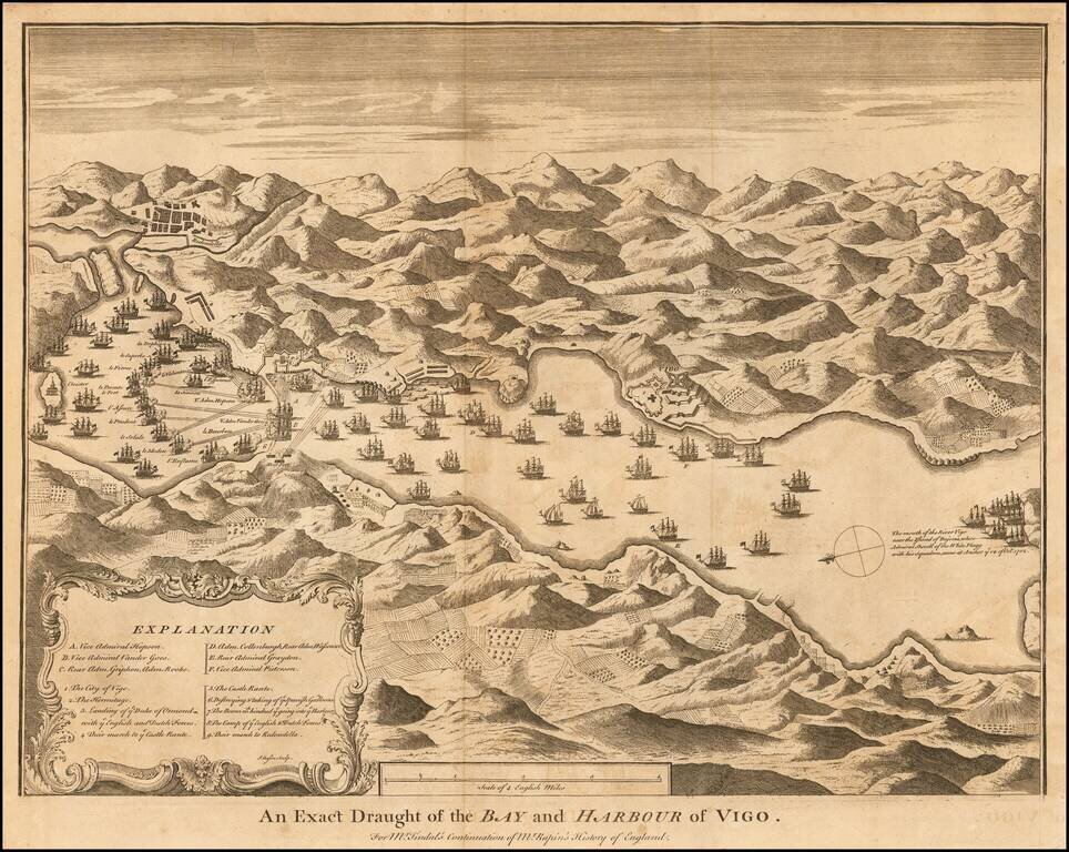
Fine contemporary plan of the Battle of Vigo Bay, in the War of the Spanish Succession, from Rapin & Tindall's History of England. The War was an attempt by the joint Anglo-Dutch forces under Admiral Rooke to capture a Spanish treasure fleet that...