logo

1720. Plan de Fontarabie Situe en la Provinces de Biscaye sur la RIviere de Bidassoa Attaque la Nuit du 27 au 28 May 1719 par l'Armee du Roy Commandee par le Mareschal Duc de Barwick

  • Plan de Fontarabie Situe en la Provinces de Biscaye sur la RIviere de Bidassoa Attaque la Nuit du 27 au 28 May 1719 par l'Armee du Roy Commandee par le Mareschal Duc de Barwick

Plan de Fontarabie Situe en la Provinces de Biscaye sur la RIviere de Bidassoa Attaque la Nuit du 27 au 28 May 1719 par l'Armee du Roy Commandee par le Mareschal Duc de Barwick information:

Year of creation: 
Resolution size (pixels): 
 1954x1410 px
Disk Size: 
 771480B
Number of pages: 
 1
Place: 
 Paris
Author: 

Print information. Print size (Width x height in inches):
Printing at 72 dpi 
  27.14 х 19.58
Printing at 150 dpi 
 13.03 х 9.4
Printing at 300 dpi 
 6.51 х 4.7

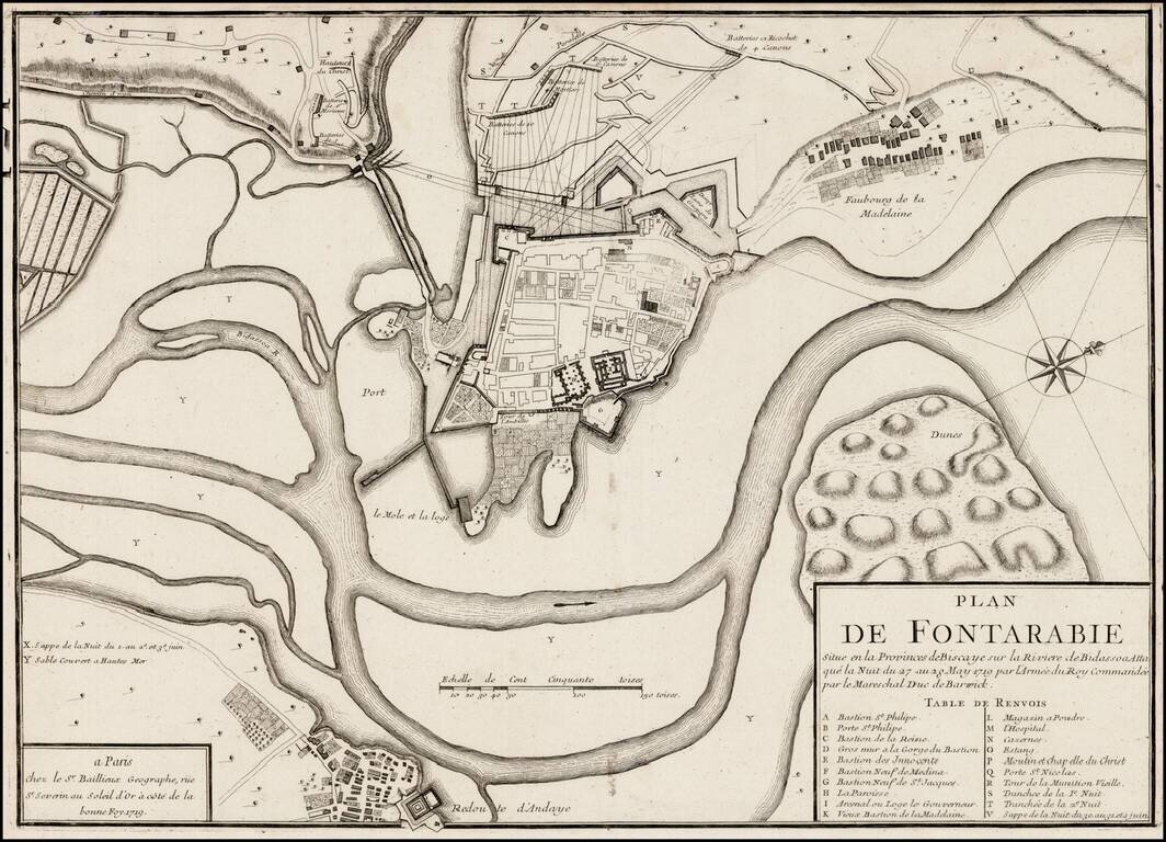
Rare plan of the siege of Fontarabia, published by Gaspar Bailleul in Paris.

Fontarabia was attacked by French in May 1719. The main body of the army, in all forty thousand strong, crossed the frontier soon afterwards, and entered upon the blockade, then the siege of Fontarabia, under the command of Marshal Berwick. Fontarabia capitulated June 16-18.


Special conditions for students!

If you are a student, write to us in telegram: @antiquemaps and indicate what material you need and for what work you need a map in high detail. We are ready to provide material on special terms. For students only!

Item information:

Year of creation:
Size:
1954x1410 px
Disk:
771480B
Number of pages:
1
Place:
Paris
Author:
Gaspar Baillieul.
$9.99

Related item