Strikng full color example of Hondius' map of Brazil, oriented with West at the top. Brazil is divided into Capitanias, with excellent coastal detail and a more speculative detail in the interior parts of the map. Includes inset vignettes of...
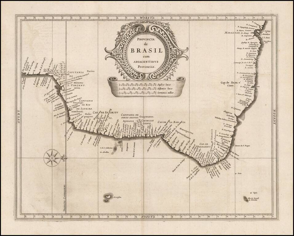
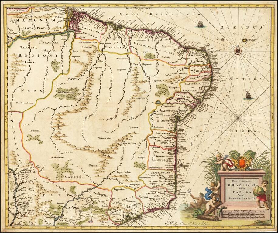
Highly detailed early separately published map of Brazil, published in De Laet's seminial work on America. The map was issued shortly after the Dutch arrival in the region in 1630, which focused on coastal settlements and lasted until about 1654. The...
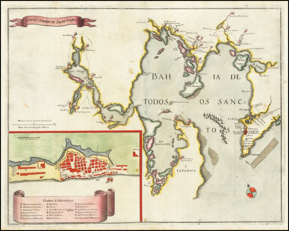
Engraved map of the Bahia De Todos Sanctos in Brazil, published by Matthias Merian in Frankfurt in 1635. The map shows the Bahia De Todos Sanctos with many settlements surrounding it. In the lower-left corner is an inset plan of São Salvador da Bahia...
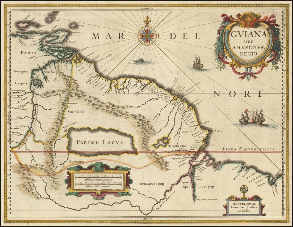
A nice example of Henricus Hondius' map of the coast of South America, between the Orinoco River and the Amazon, centered on Parime Lacus, the rumored home of 'El Dorado'. This attractive map depicts the region of South America, which runs from the...
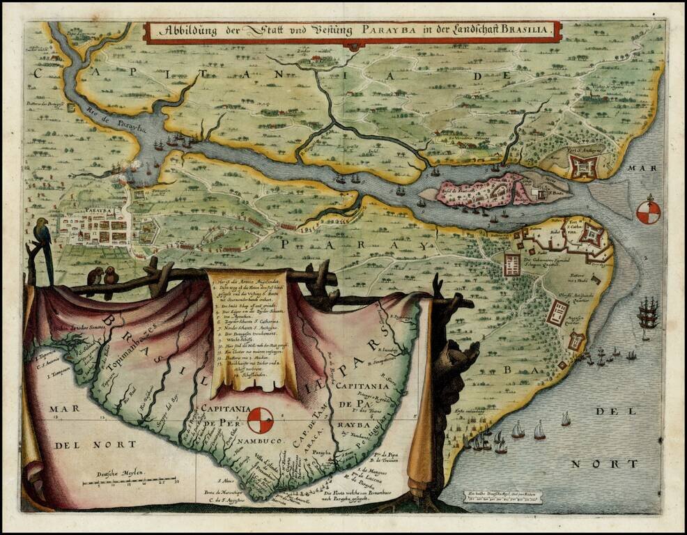
Nice full color example of Merian's scare regional map of the area around Paraiba, Brazil, with a larger regional map showing the Captaincy of Brasilia.
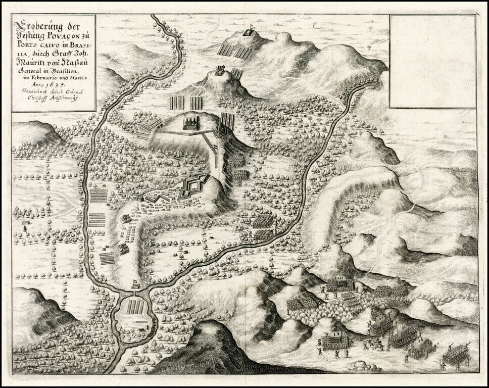
Bird's-eye view of the Dutch capture of the fort at Porto Calvo in 1637, from Merian's Theatrum Europaeum. This bird's-eye view illustrates the Dutch capture of the fort at Porto Calvo in February and March of 1637. The region was a major area of...
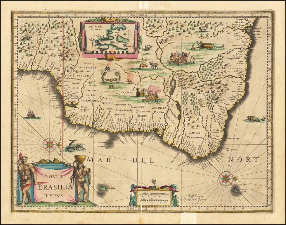
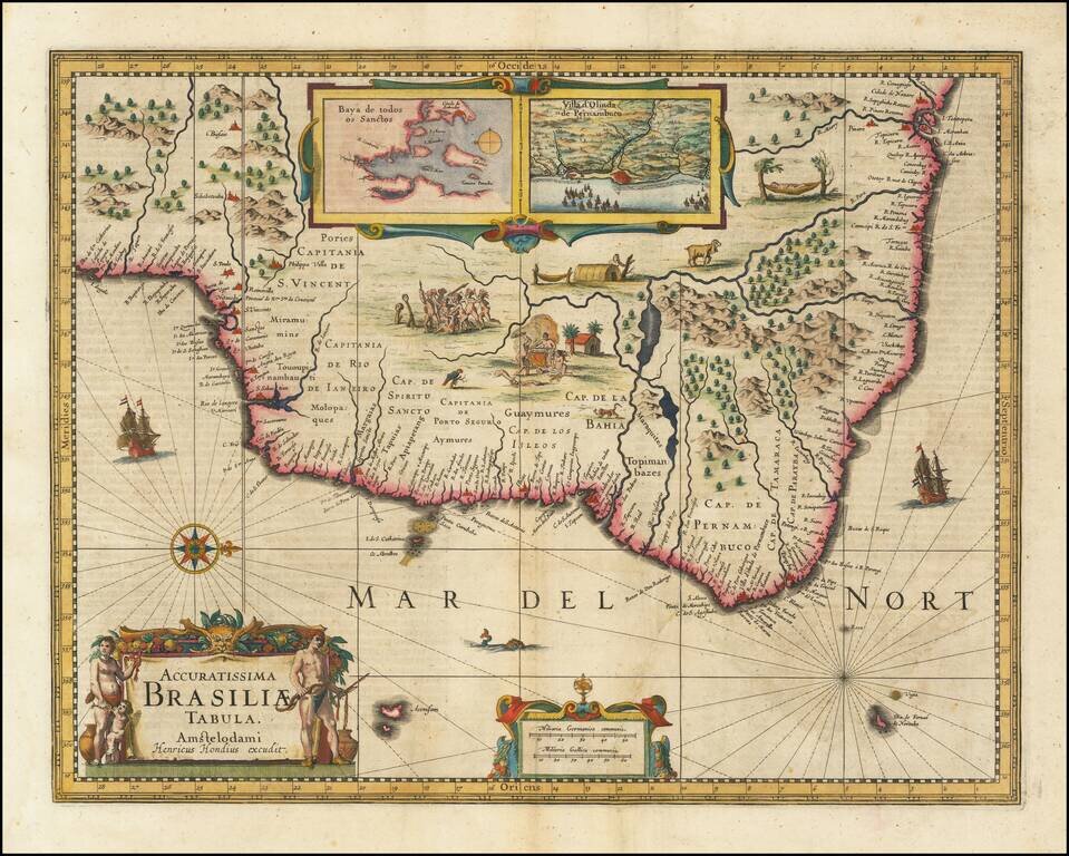
Fine old color example of Blaeu's first map of Brazil, with north oriented to the right. Includes inset map of Baya de todos Santos, elaborate cartouche, 2 compass roses and richly embellished vignettes of native Brazilian life and animals. The...
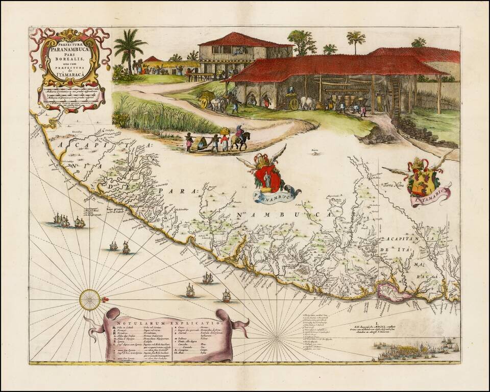
![[Barlaeus / Blaeu Maps of the Coast of Brazil] Praefecturae Paranambucae Pars Borealis una cum Praefectura de Itamaraca [and] Praefecturae De Paraiba, et Rio Grande [and] Praefecturae Paranambucae pars Meridionalis](/map/small/61635.jpg)
Fine old color example of the Blaeu-Barleus maps of the Coast of Brazil. The map was drawn after actual surveys by Georg Markgraf, Elias Herckmanns and others, and was among the first maps of Brazil based on non-Portuguese data. The maps are richly...
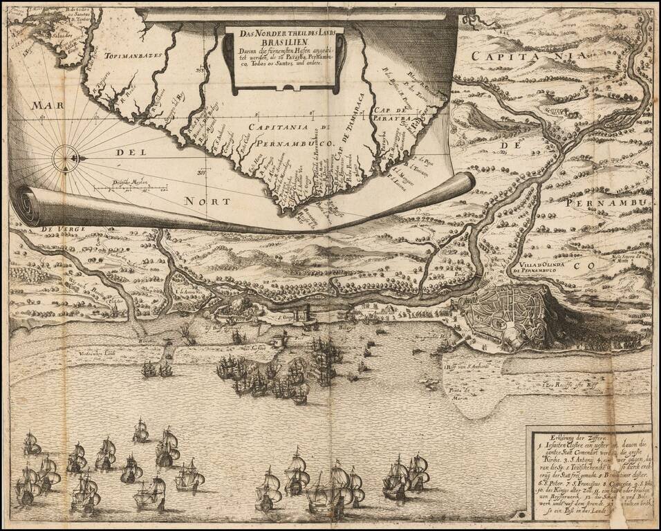
Engraved folding map, with an inset map of the Brazilian coast at the top, and a naval battle around Olinda, Pernambuco, Brazil, at the bottom. This map comes from a later abridgment of De Bry's "Grand Voyages." Johann Ludwig Gottfried (c. 1584 -...
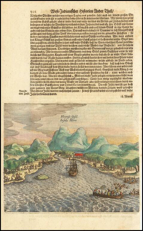
Scarce map of the bay and coast of the South Seas island of Futuna (Hoorn), from the voyage of Le Maire and Schouten. The bay shown was named after the ship Eendrachts (Unity Bay). Willem Cornelisz Schouten (1567-1625) was a navigator for the Dutch...
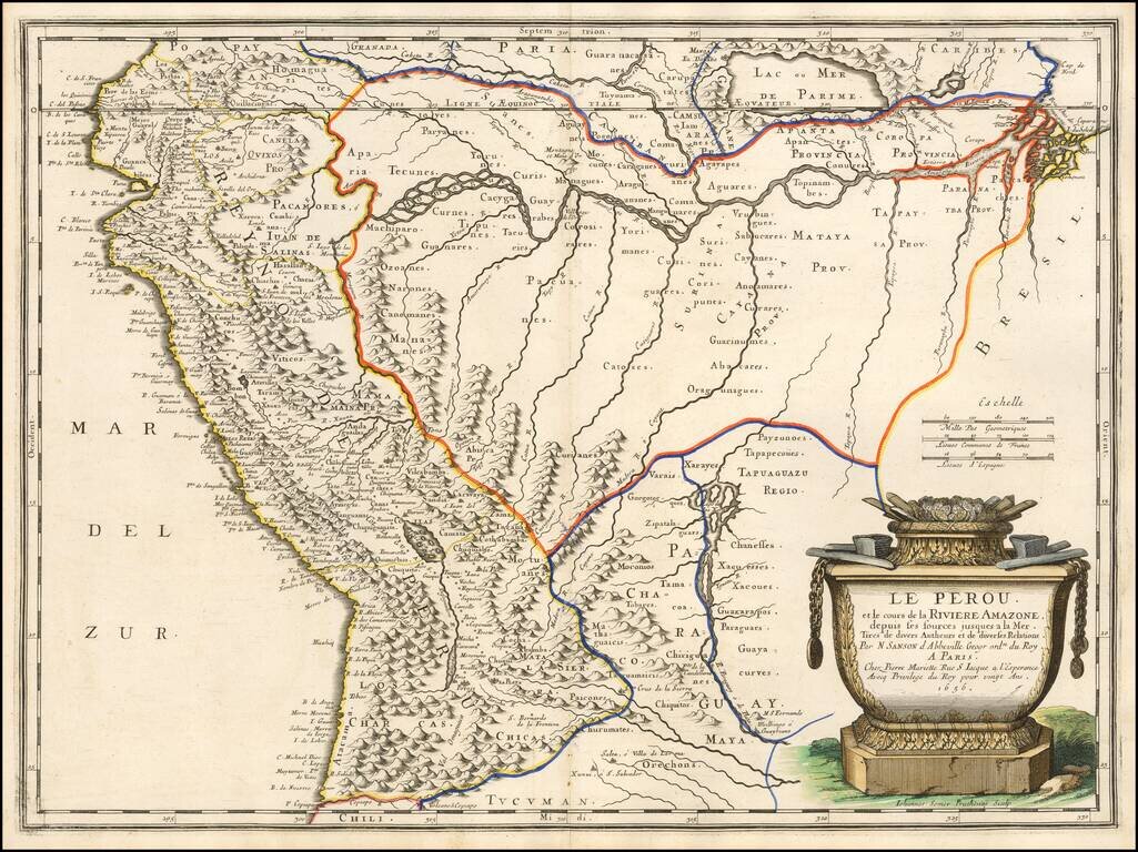
Finely colored example of Sanson's 1656 double-page engraved map of Peru, extending from the Pacific to the mouth of the Amazon River and tracking the Amazon to its sources in the Andes. A massive mythical Lake Parime is shown. The Rio Paraguay o di...
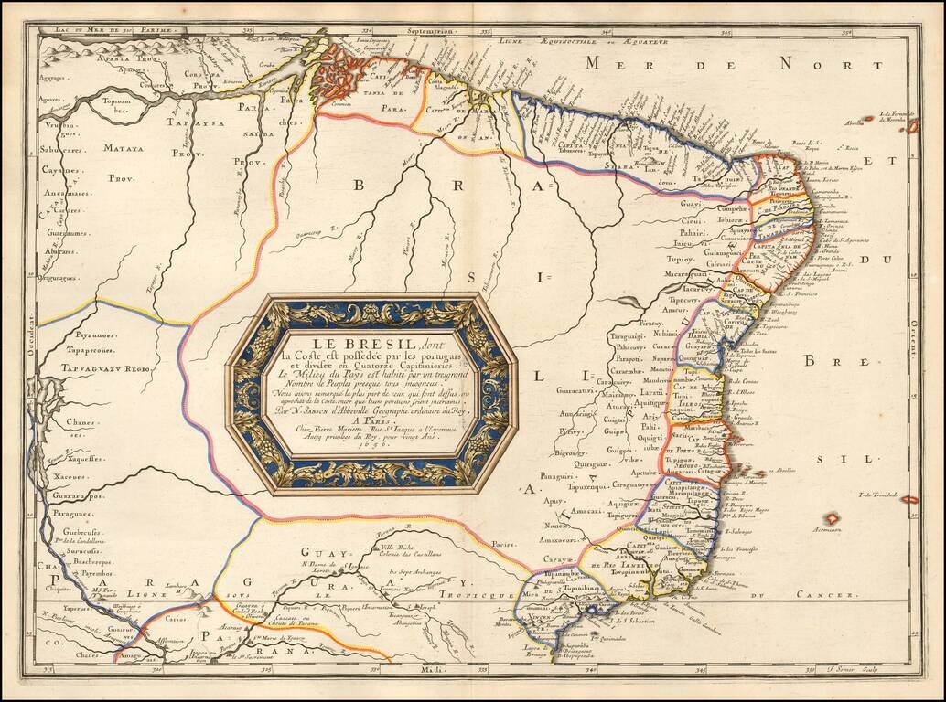
Fine old color example of this early regional map of Brazil, extending from the Amazon to the area just South of Rio de Janeiro and extending west to Tapuaguazo and Lago de R. los Xarayes. The map is colored according to the 14 Captaincies of Brazil,...
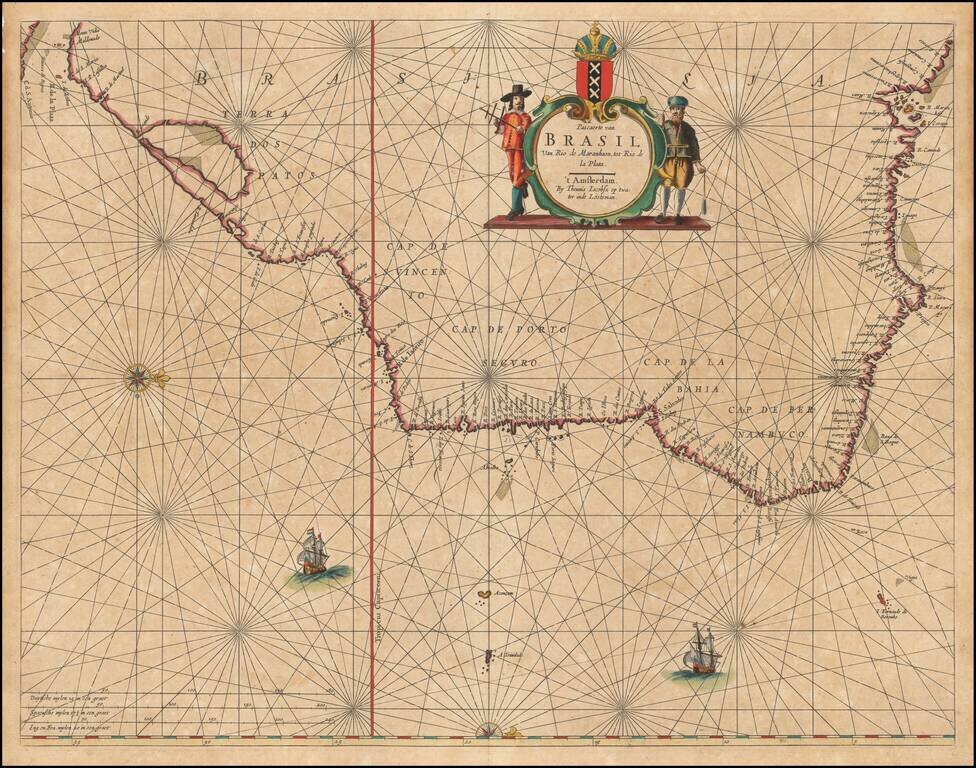
Decorative example of Blaeu's second map of Brazil, oriented with west at the top. Includes 2 cartouches, 3 sailing ships, 2 compass roses, rhumb lines, etc.
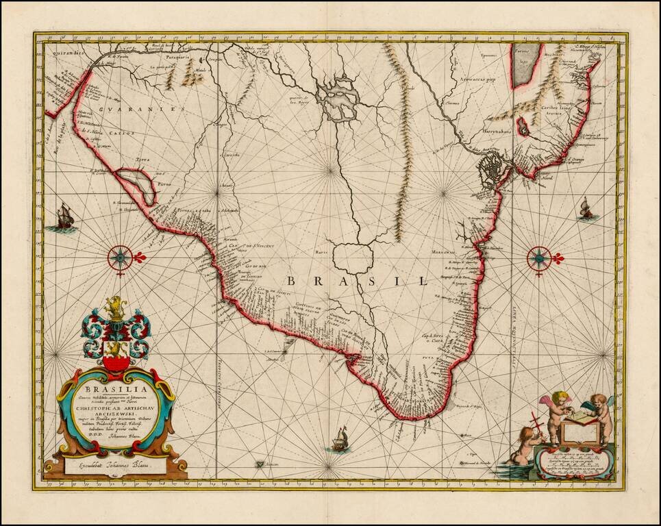
Rare sea chart of Brazil, one of the earliest obtainable Dutch Sea Charts of the region. Extraordinary detail, with rich colors and gold heightened.
Nice example of the Johannes Blaeu edition of Barleus' map of a portion of Brazil, which first appeared in Barleus's from his ervm per Octennivm in Brasilia et alibi nuper gesterum sub Praefectura Illustrissimi Comitis I. Mavritii, Nassoviae,...
Gorgeous full color example of Blaeu's scarce map of Brasil, which first appeared in late editions of Blaeu's Atlas Maior and was later reissued by Pieter Schen, after Schenk acquired what was left of the Blaeu inventory of copper plates. An nice old...