Map size in jpg-format: 742428B
Click to open in high resolution (open in new tab).
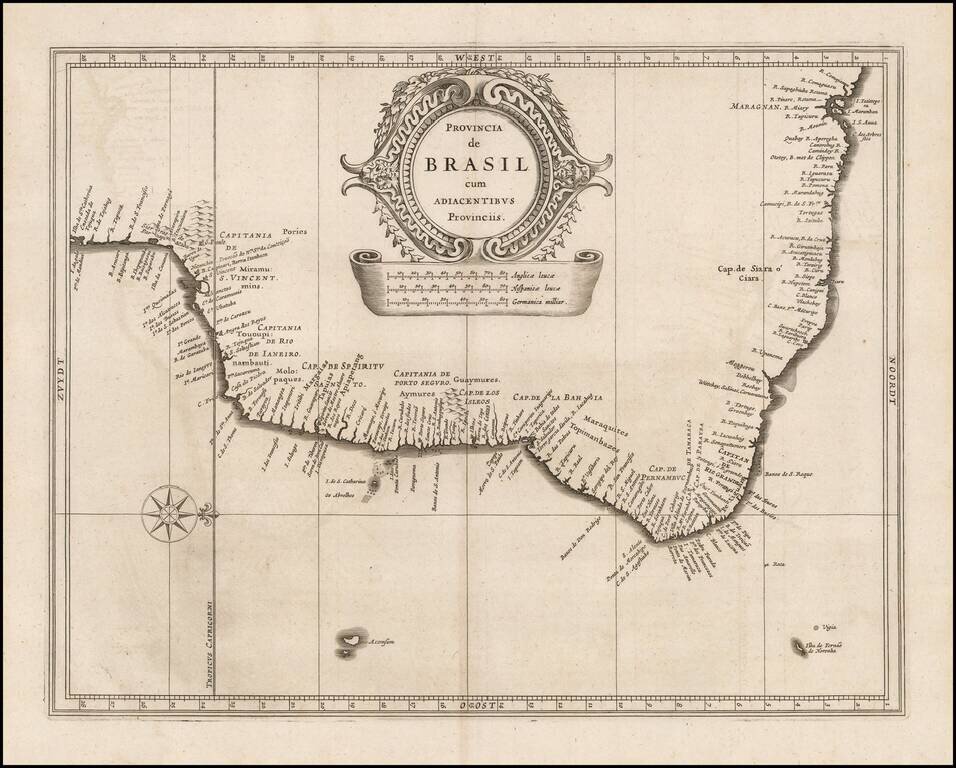
Highly detailed early separately published map of Brazil, published in De Laet's seminial work on America.
The map was issued shortly after the Dutch arrival in the region in 1630, which focused on coastal settlements and lasted until about 1654.
The map is drawn from original maps by Gessel Gerritsz.
If you are a student, write to us in telegram: @antiquemaps and indicate what material you need and for what work you need a map in high detail. We are ready to provide material on special terms. For students only!

![[Wall Map] West-Indische Paskaert waer in de graden der breedde over weder zyden vande middelyn wassende so vergrooten dat die geproportioneert syn tegen hunne nevenstaende graden de lengde.](/map/small/60169.jpg)
