Map size in jpg-format: 1.22189MiB
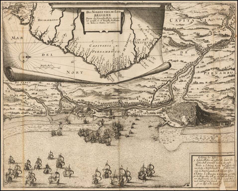
Engraved folding map, with an inset map of the Brazilian coast at the top, and a naval battle around Olinda, Pernambuco, Brazil, at the bottom.
This map comes from a later abridgment of De Bry's "Grand Voyages."
Johann Ludwig Gottfried (c. 1584 - 1633)
Gottfried was a 17th-century German theologian, translator, author, and editor. For a long time, it was thought that Gottfried was merely a pseudonym for Johann Philipp Abelin (d. 1634), however, this has apparently been refuted. Gottfried's most extensive original work is the Gottfriedsche Chronicle.
Newe Welt und Americanische Historien [1655]
The present engraving comes from Johann Ludwig Gottfried's abridgment of De Bry. The illustrations from this work are after Theodor de Bry's and Matthaeus Merian's works in parts 1-12 of the "Grand Voyages". The first edition of the abridgment was published in 1631. The second edition was published by Merian's heirs in Frankfurt in 1655.
If you are a student, write to us in telegram: @antiquemaps and indicate what material you need and for what work you need a map in high detail. We are ready to provide material on special terms. For students only!

![[Wall Map] West-Indische Paskaert waer in de graden der breedde over weder zyden vande middelyn wassende so vergrooten dat die geproportioneert syn tegen hunne nevenstaende graden de lengde.](/map/small/60169.jpg)
