Rare and antique old maps of the North America
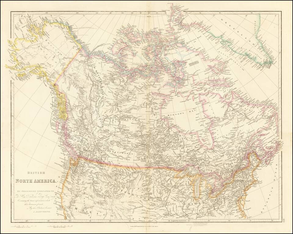
Detailed Map of British Possessions in North America—Rare Late Edition! Highly-detailed state of John Arrowsmith’s map of British possessions in North America, published in multiple editions between 1832 and 1859. This is a late edition, from the...
![[State of Lincoln!] British Columbia and the North West Territory](/map/small/60287.jpg)
Rare separately published map of Western Canada and part of the Northern United States, including the proposed State of Lincoln. The map provides a detailed treatment of the Western part of Canada, along with a very rare appearance of the proposed...
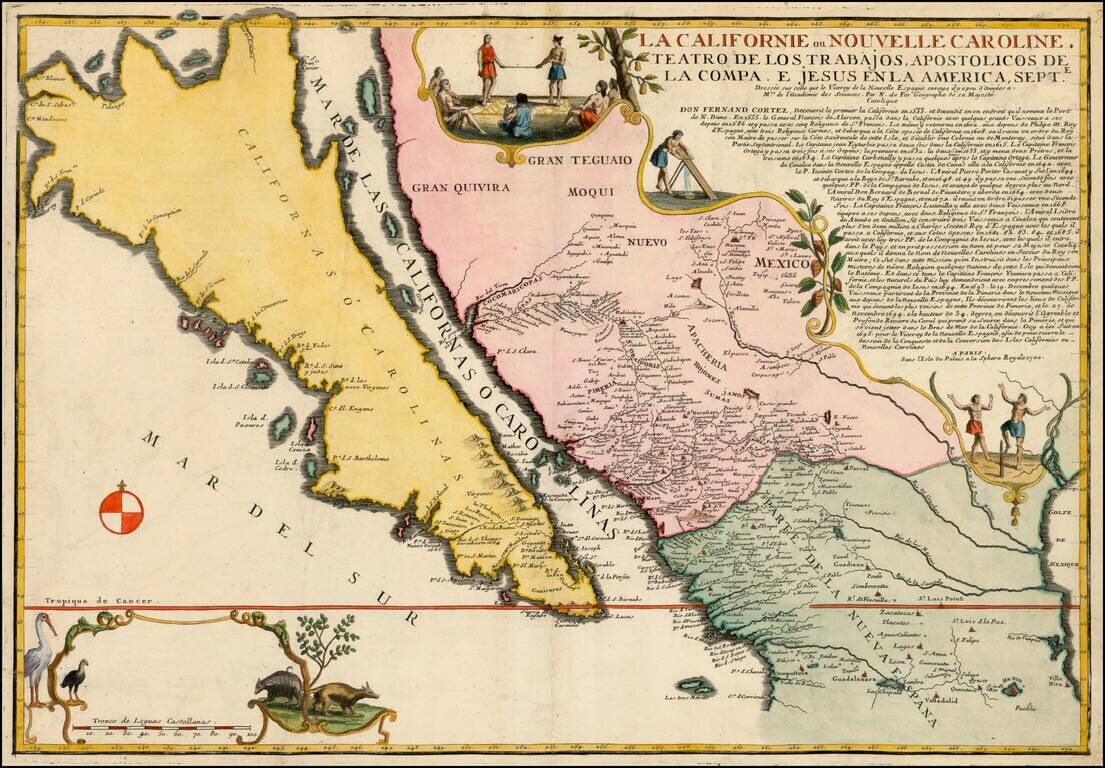
Largest Separate Representation of the Island of California Striking large-format map of the island of California—the largest separate representation of the island of California on a printed map. It is a later representation of the island (1720),...
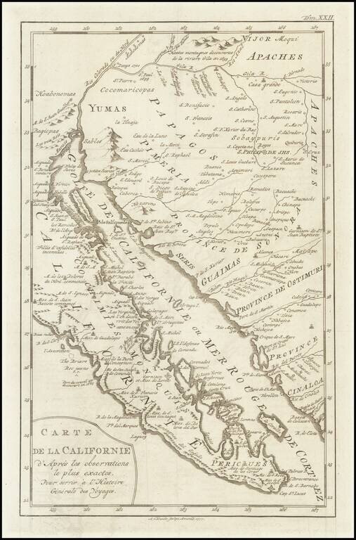
A scarce map of Baja California, northwestern Mexico, and southern Arizona. The map is detailed, showing many settlements, mountain ranges, islands, missions, and much more. California is shown as a peninsula. The California as an Island in its most...
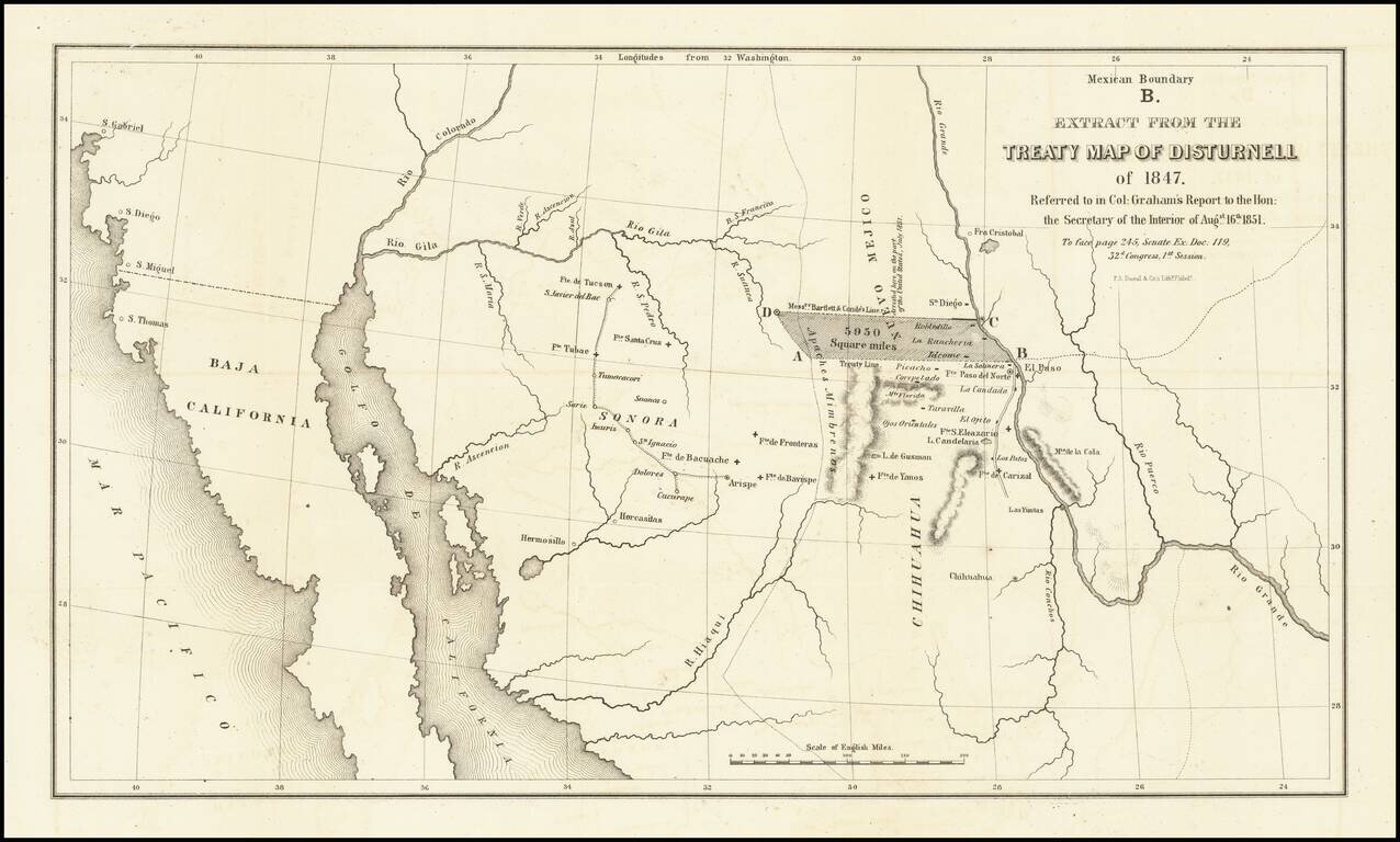
Important map illustrating the region between the Rio Grande and the Colorado River, with forts and towns marked, mainly intended to illustrate the error made by Bartlett in setting the line from the Rio Grande to the Continental Divide too far north,...
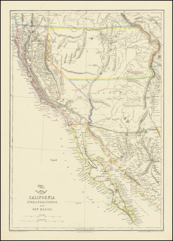
Nice example of the Ettling / Weekly Dispatch map of California and the Southwest, one of first atlas maps published in Europe to focus on the Territories of Utah and New Mexico. The map includes an excellent post Gadsden Purchase treatment of...
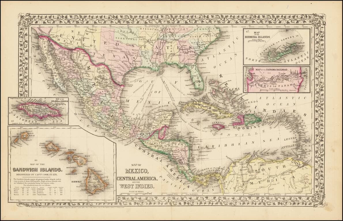
![Map of Mexico, Central America, and the West Indies [Insets of Bermuda, Cuba, Jamaica and Panama Railroad]](/map/small/51948.jpg)
Attractive map of Mexico, the Caribbean and the Gulf Coast, published by SA Mitchell Jr. Includes large insets of Cuba, Bermuda, Jamaica, and the Isthmus of Panama and a small inset of Jamaica. Shows shipping routes from New Orleans to points...
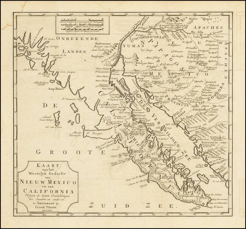
One of the Earliest Obtainable Maps of Southern California and Baja California Fine old color example of this early map of Baja California and parts of Alta California, Arizona and Sonora. Isaac Tirion's map of Baja California is one of the best...
![[Southern California, Arizona, Baja & Sonora] Amer. Sep. No. 53 Partie De La Vielle Californie](/map/small/47400.jpg)
Early mapping of Southern California, southwestern Arizona, northern Baja California and Sonora, published in Brussels. The California Coastline is shown from San Juan Capistrano in the north to the Bay of San Francisco in Baja Norte, centered on San...
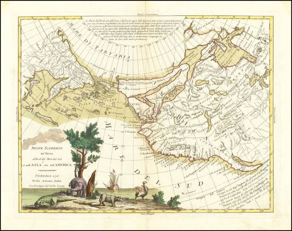
An Ostrich, An Elephant and the Northwest Passage! Striking example of Zatta's map of the northern Pacific Coastal regions and one of the best illustrations of a late rendition of the Northwest Passage, here illustrating two wide passages from the...
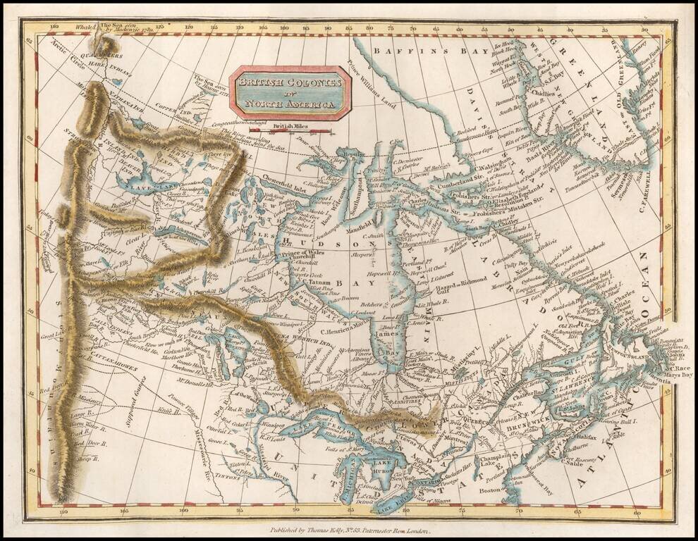
Scarce map of Canada, extending west to the Rocky Mountains and the MacKenzie River. Perhaps the most interesting feature is the depiction of the headwaters of the Missouri River. Here, the map incorporates the reports of Peter Fidler for the Hudson's...
![[Montana, Calgary, Edmonton, Saskatchewan] Amer. Sep. No. 32. Partie De La Nouvelle Bretagne](/map/small/54847.jpg)
Highly detailed map, extending from the area around Kalispell Lake and Flathead Lake, Montana in the southwest, to Calgary and Edmonton to the north and Prince Albert Saskatchewan in the northeast. The map includes a number of early factories of the...
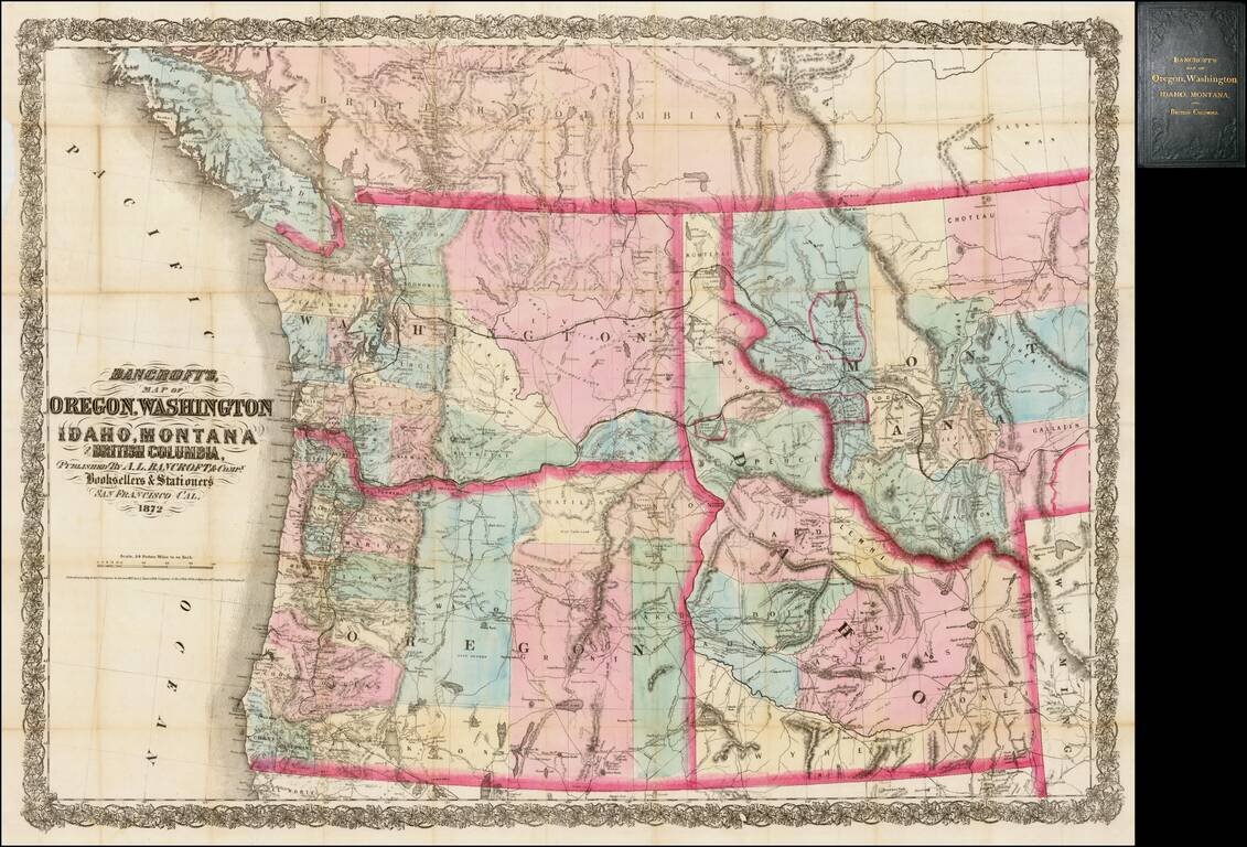
Rare separately issued map of the northwestern United States and British Columbia, issued in 1872 by A.L. Bancroft & Co. in San Francisco. Bancroft's map was first issued by HH Bancroft in 1868. The map was drawn from a section of Bancroft's...
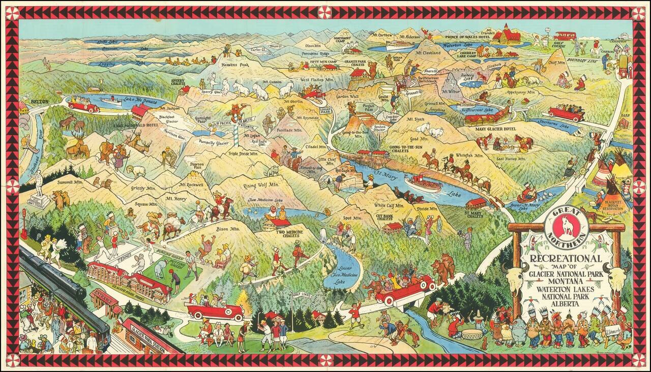
Fine early pictorial map promoting the Great Northern Railway. The map includes a lively offering of park scenes, including Grizzly Bears confronting tourists on a bridge, yacht rides in the major lakes, and another Grizzly Bear dumping Champagne (?)...
![(Nothern Half) [Bancroft's Map of the Pacific States]](/map/small/54924.jpg)
Previously Unkown 1863-64 Second State. "Bancroft's, in scope, was probably the most important map yet produced by a publisher of the Pacific coast." - Streeter (TMW 1061) Two northern sheets of an engraved proof of the previously-unknown 1863 second...
![(Notherneastern Sheet) [Bancroft's Map of the Pacific States]](/map/small/54925.jpg)
Engraved Proof Sheet. "Bancroft's, in scope, was probably the most important map yet produced by a publisher of the Pacific coast." - Streeter (TMW 1061) Engraved proof of the 1867 edition of H.H. Bancroft's Map of the Pacific States. The detail in...