logo

1901. Map of Klondike District and Vicinity. . . .

  • Map of Klondike District and Vicinity. . . .

Map of Klondike District and Vicinity. . . . information:

Year of creation: 
Resolution size (pixels): 
 2943x3787 px
Disk Size: 
 1.74905MiB
Number of pages: 
 1
Place: 
 n.p.

Print information. Print size (Width x height in inches):
Printing at 72 dpi 
  40.88 х 52.6
Printing at 150 dpi 
 19.62 х 25.25
Printing at 300 dpi 
 9.81 х 12.62

An example of detailing the file of this map of in a printable high-resolution:

Click to open in high resolution (open in new tab).
Attention! this is just the central piece (central area 960x960 px) of the map file!
This is an example, so that you can see and study the level of detail of a given map. The entire Map will be fully available after payment!

Map of Klondike District and Vicinity. . . .

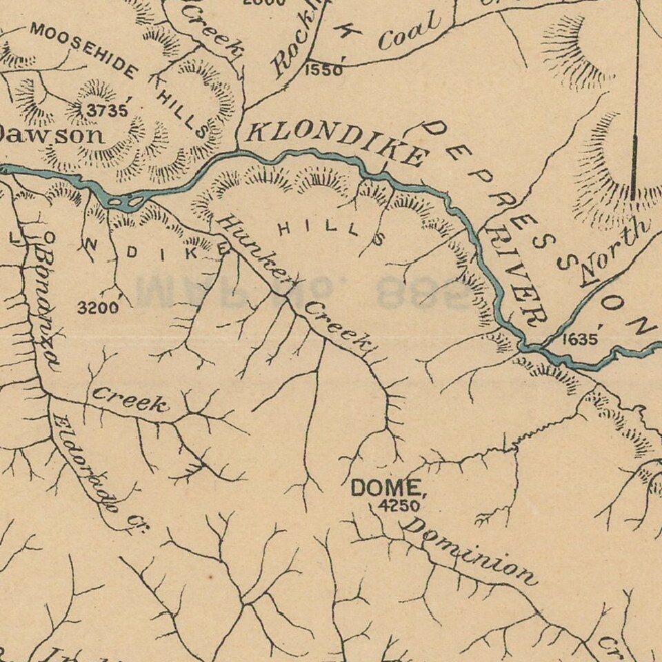
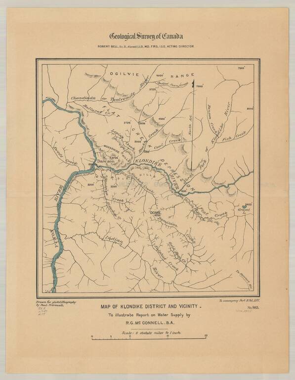
Detailed map of the Klondike Gold Region, centered on Dawson's and the Klondike River.


Special conditions for students!

If you are a student, write to us in telegram: @antiquemaps and indicate what material you need and for what work you need a map in high detail. We are ready to provide material on special terms. For students only!

Item information:

Year of creation:
Size:
2943x3787 px
Disk:
1.74905MiB
Number of pages:
1
Place:
n.p.
Author:
Geological Survey of Canada.
$14.99

Related item