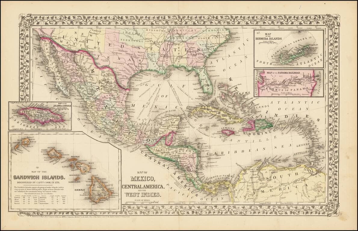
Rare and antique old maps of the North America
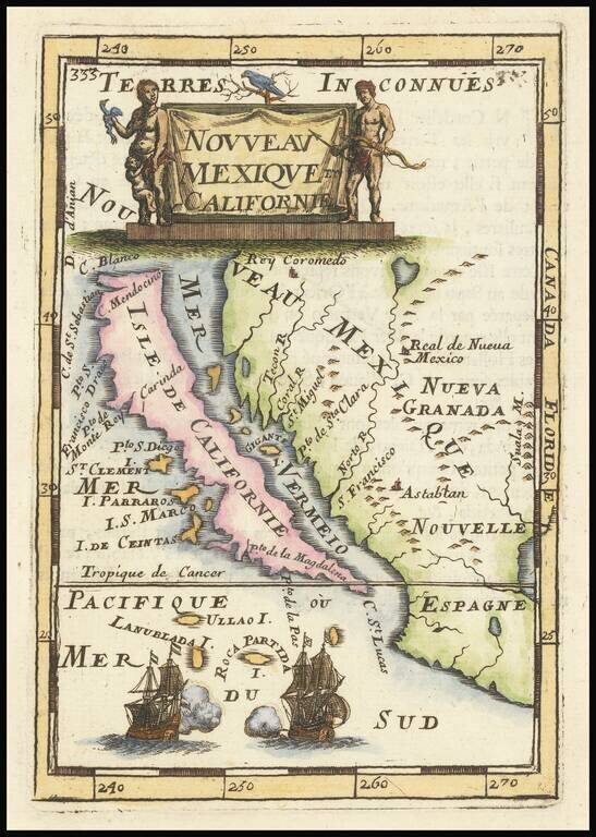
Fine, Distinct Map of the Island of California Striking and exciting map of California as an island, one of the few maps to focus so closely on the California region. First published in Paris in 1683, Mallet’s map is notable because it follows...
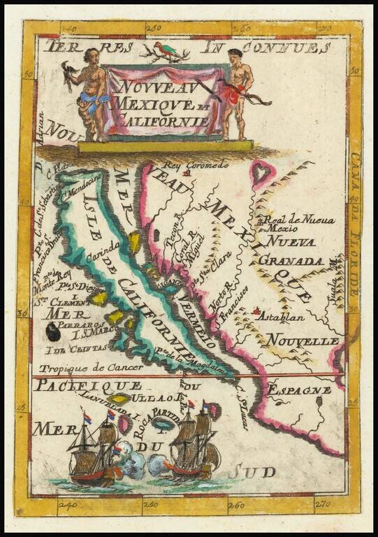
Fine, Distinct Map of the Island of California Striking and exciting map of California as an island, one of the few maps to focus closely on the California region exclusively. First published in Paris in 1683, Mallet’s map is notable because it...
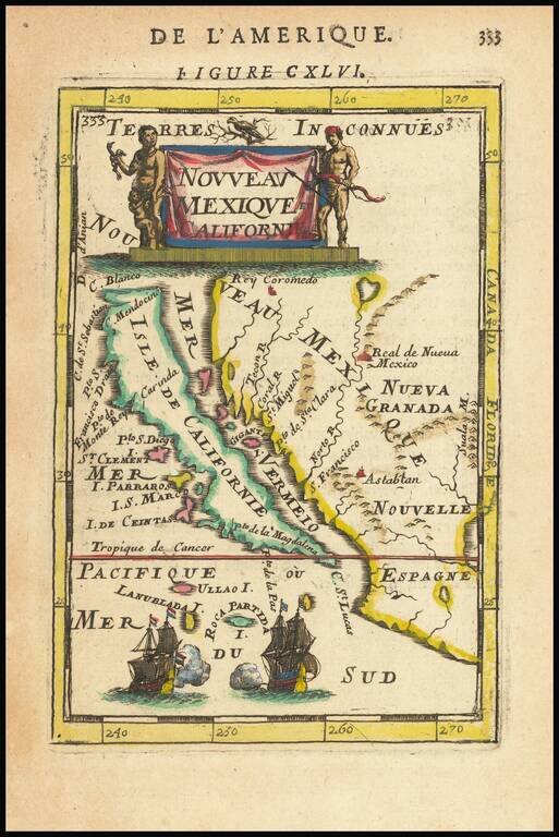
Fine, Distinct Map of the Island of California Striking and exciting map of California as an island, one of the few maps to focus closely on the California region exclusively. First published in Paris in 1683, Mallet’s map is notable because it...
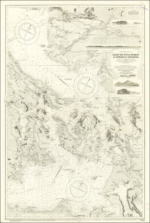
Excellent British Admiralty chart of the Strait of Juan de Fuca, focusing on the San Juan Islands, and also showing Victoria and Vancouver B.C. The chart was originally published in 1882 and was updated numerous times to 1924. Despite the fact that...
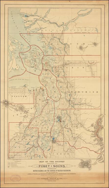
Rare separately published map of "the Puget Sound Country," published by Baker, Balch & Co. Civil, Mechanical and Electrical Engineers and lithographed by A. Zeese & Co. of Chicago. A remarkable advertising map issued to promote settlement,...

Scarce working sea chart of the Strait of Juan de Fuca and contiguous regions, published by the British Admiralty. The map extends from Flores Island and Sydney Inlet in the northwest to Cape Flattery and New Dungeness in the south. with Victoria, and...
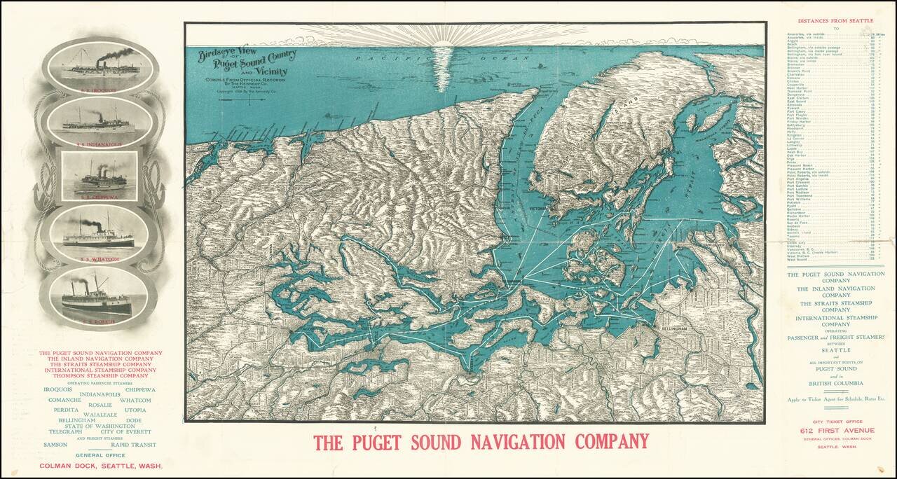
A Puget Sound Navigation Company Promotional View Detailed antique bird's eye view of Puget Sound, the Olympic Peninsula, the San Juan Islands, Vancouver Island, including the major cities of the region, such as Seattle, Tacoma, Vancouver, Olympia,...

Detailed early map of Vancouver. Nice plan of the city including streets, major buildings, railroad lines, etc. Highway map of the state of Washington on the verso.
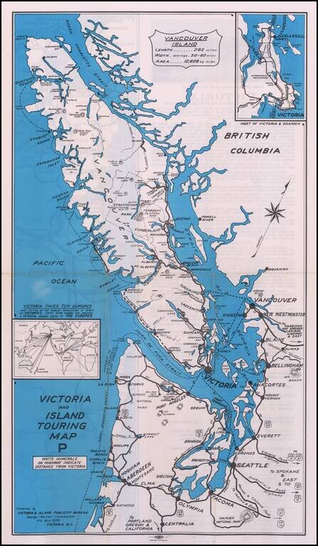
Rare promotional map, showing the roads and cruise ship lines in and around the Vancouver Island area. Promotional advertising on the verso.
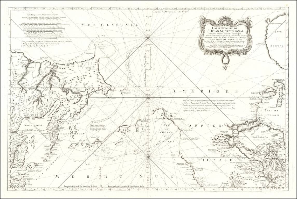
A Cartographic Landmark - The Most Complete Map of the North Pacific to Date and the Beginning of the Scientific Debate of the Sea of the West and Northwest Passage This is a fine example of a first edition of the landmark De L'Isle-Buache map of the...
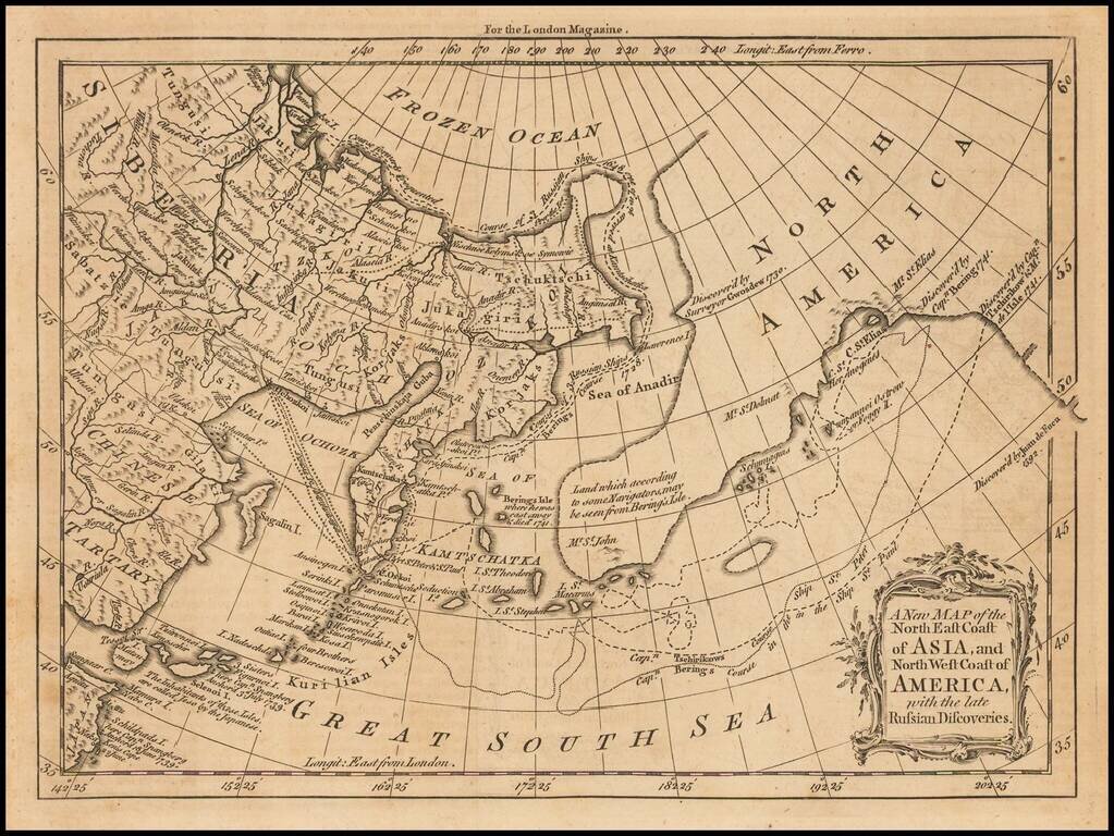
Interesting map of the Northern Pacific, showing the tracks of Captains Behring and Tschirkows Voyages of Exploration on the St. Peter and St. Paul, from Kamtschatka to the NW Coast of America and into the North East Passage, from 1728 to 1741. Vitus...
An Important Early Navigational Chart Which Shows Alaska This is a foundational chart of Alaska, the Pacific Northwest, and the northeastern coast of Asia, published in Paris. The Port of San Francisco is named, three years before the supposed...
![A Map of the Icy Sea in which the several Communications with the Land Waters and other new Discoveries are exhibited [Sea of the West]](/map/small/0031dg.jpg)
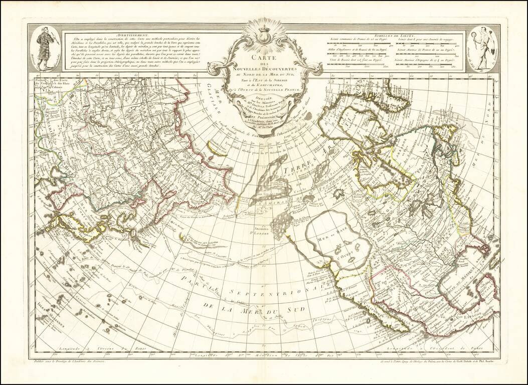
An interesting map on a north hemispheric projection, showing the regions then actively explored by the Russian, French and English. Includes notes on Dutch, Portuguese and English discoveries near the North Pole. The projection is based upon Phillipe...
![A Map of the Icy Sea in which the several Communications with the Land Waters and other new Discoveries are exhibited [Sea of the West]](/map/small/0054dg.jpg)
An interesting map on a north hemispheric projection, showing the regions then being actively explored by the Russians, French and English. The projection is based upon Phillipe Buache's work from the prior decade and illustrates one view of the...
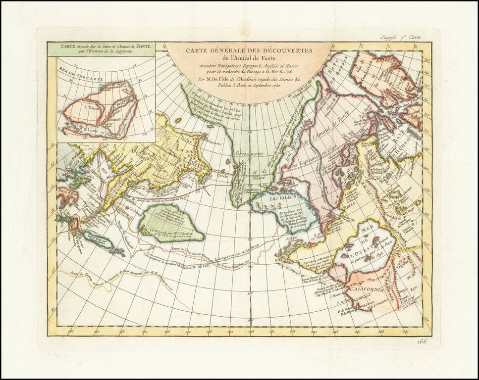
A fascinating map of the Northwest Coast, showing De L'Isle's conjectural northwest coast, based upon De Font and Russian Discoverers, including the Bay of the West. The map is part of the great mid-18th Century debate, spurred by the reports of...
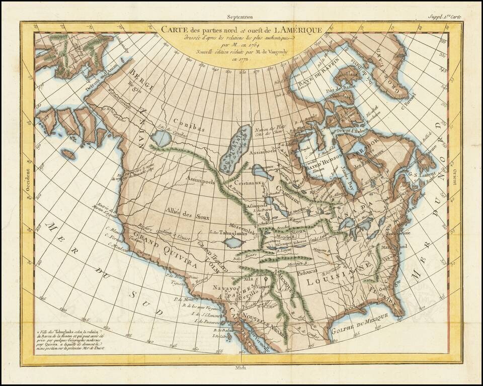
A fascinating map of North America, based upon a map by Thomas Engel. Engel's map of North America was issued in his Memoires Observations Geographiques in 1765, and provides a fascinating look at the watercourses across North America, with no less...