Rare and antique old maps of the North America
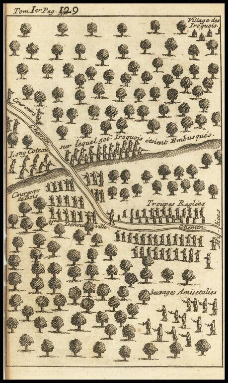
Striking Illustration of an Iroquis Battle Scene from the Work of Lahontan Interesting engraving depicting the forest near an Iroquois village, with several lines of soldiers facing off. Upon a hill, toward the top of the engraving, are Iriquois...
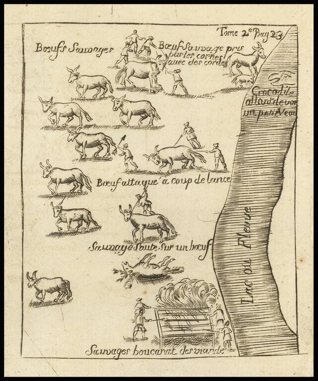
The Crocodile on Baron Lahanton's Longue River This small map was prepared to illustrate a section of Baron Lahontan's imaginary west to east Long River (Riviere Longue), rising in distant western mountains and emptying into the upper Mississippi....
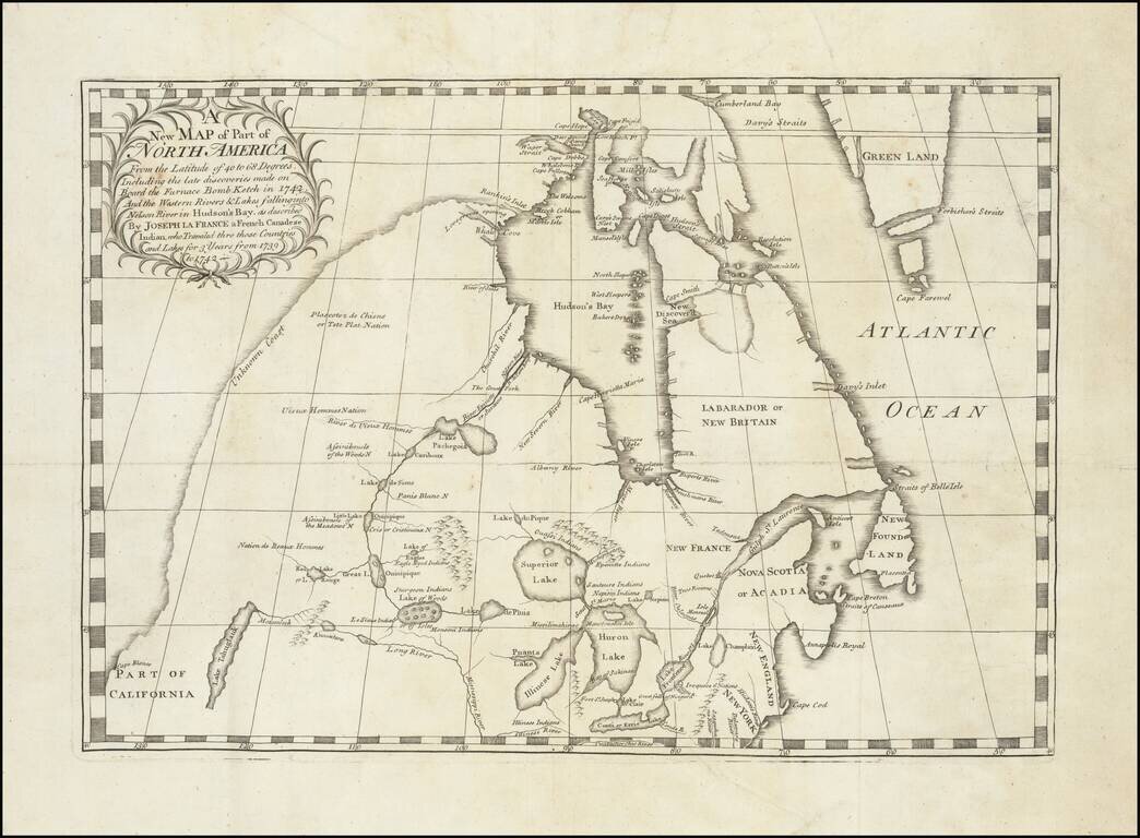
Important early map illustrating the controversy over the Northwest Passage. The map was part of the great Dobbs-Middleton debate concerning British exploration in search of a northwest passage. The present map extends from the Great Lakes, Upper...
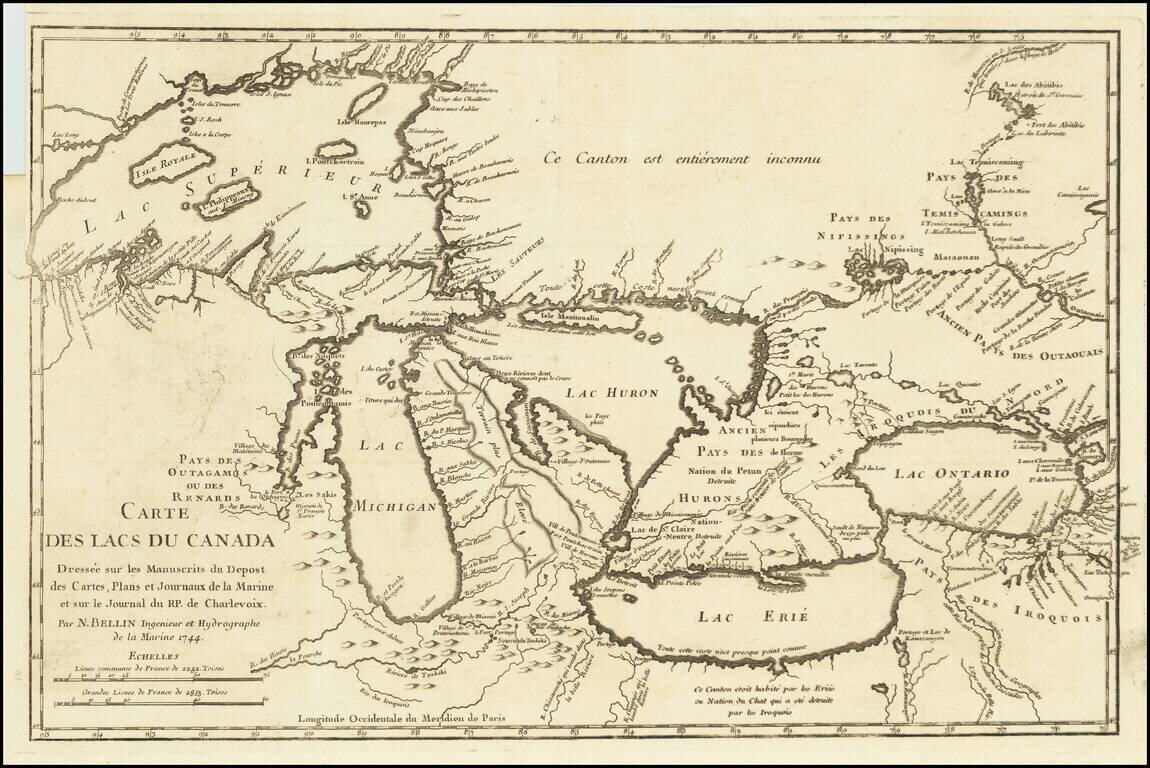
Fine example of Bellin's Landmark map of the Great Lakes region, published in 1744 Bellin's seminal early map of the Great Lakes represented a milestone in the progress of the mapping of the region. It is also one of the earliest appearances of...
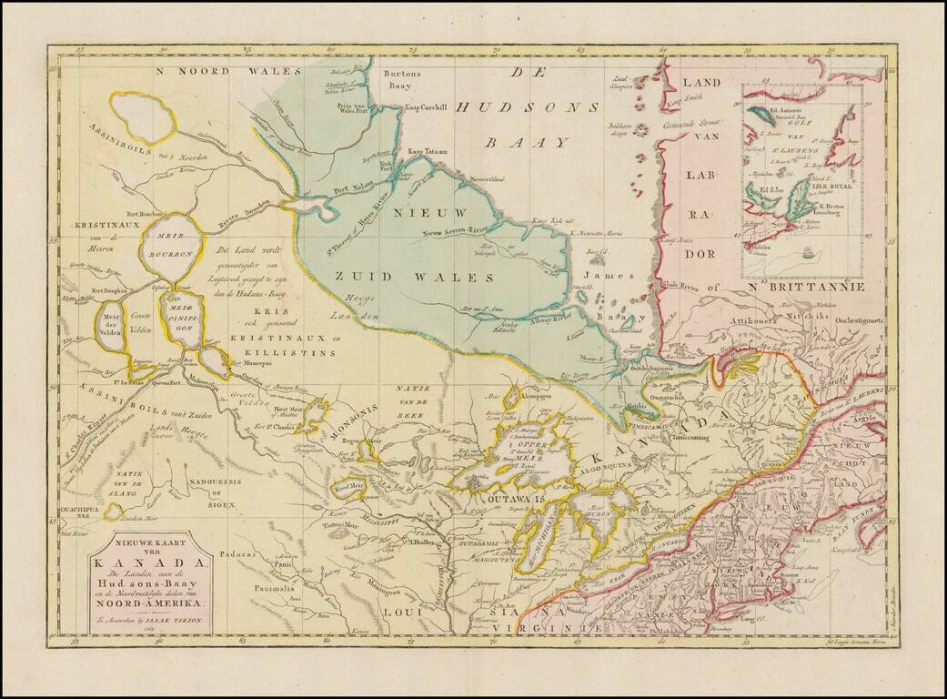
Interesting map of Canada and the Upper Midwest, centered on the Great Lakes and Hudson's Bay, published by Issak Tirion. The map shows the region shortly after the conclusion of the French and Indian War. Included are the Hudson Bay Company forts and...
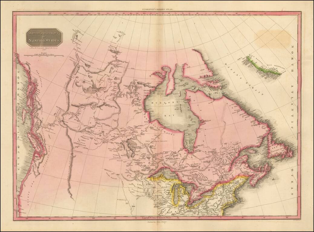
The Pacific Northwest Before Lewis & Clark Fascinating map of British America, Alaska and the Northwest part of America, immediately pre-dating the first incorporations of the details from the Lewis & Clark expeditions, published in 1814....
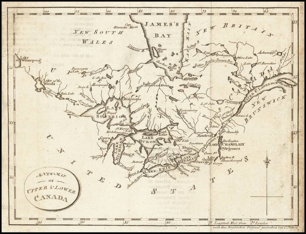
Interesting map of the Great Lakes and Canada, from a German edition of Isaac Weld's Travels Through the States of North America During the Years 1795-97, first published in London in 1798. The map extends from the St. Lawrence to Lake Winnipeg,...
Nice example of Carey & Lea's map of Canada and the Great Lakes. The map covers Upper and Lower Canada and the Great Lakes, extending west to the Lake of the Woods and Red Land House and the Severn River, showing nice Indian details. The map is...
![Canada [with Great Lakes]](/map/small/53469.jpg)
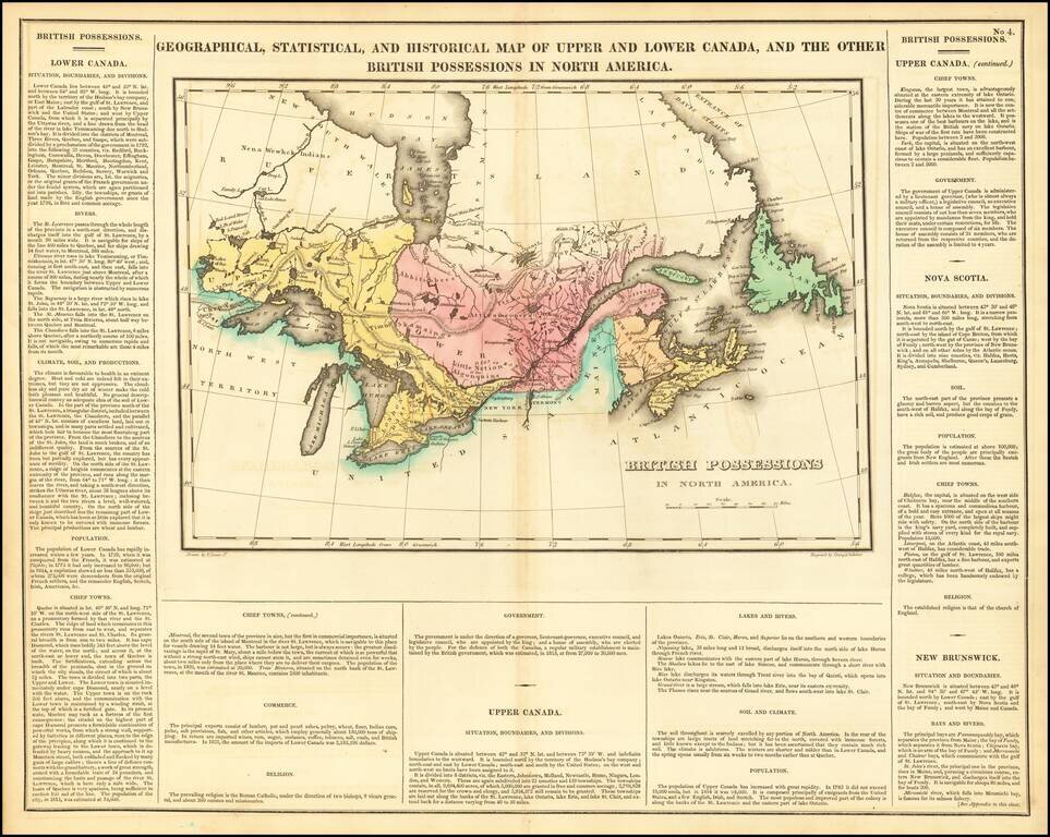
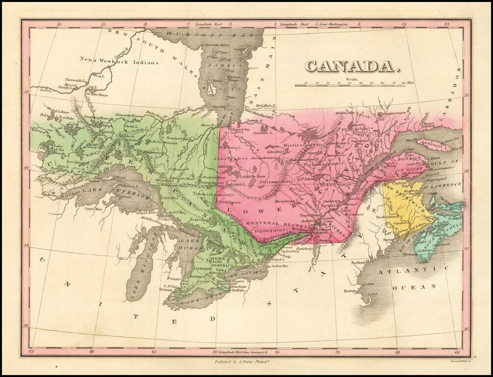
Striking map of Canada, colored by territories. The map shows towns, rivers, lakes, mountains, etc. Fielding Lucas produced the best engraved an most attractive of all general atlases published in America (the 1823 Tanner and 1825 Finley being...
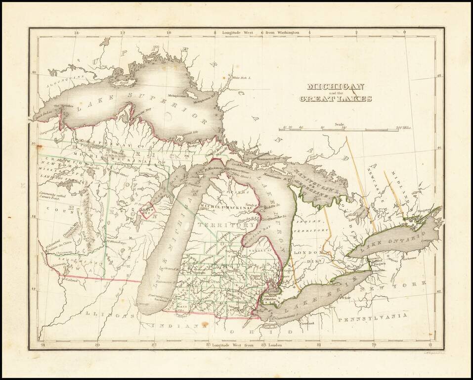
Detailed map of the Great Lakes and Eastern Canada, colored by regions and showing towns, rivers, lakes, islands, bays ,etc. Early roads are also shown.
![Amer. Sep. No. 33. Partie De La Nouvelle Bretagne (Upper Missouri River, Lake Winnepeg, Lake of the Woods and Saskatehawan River]](/map/small/41687.jpg)
Large format map of the region, centered on Lake Winnepeg and showing Riviere Skatehawan ou Fleuve Bourbon in the Northwest, the Missouri River and Assinniboines in the Southwest, Nenawecouhen and Lake Pike in the Northeast and the Lake of the Woods...
Nice example of this early map of Michigan Territory and adjoining regions (including what would become Wisconsin), published by S.A. Bradford. Michigan proper is shown with counties in the southern half, the north being Ottawa and Michilmackinac...
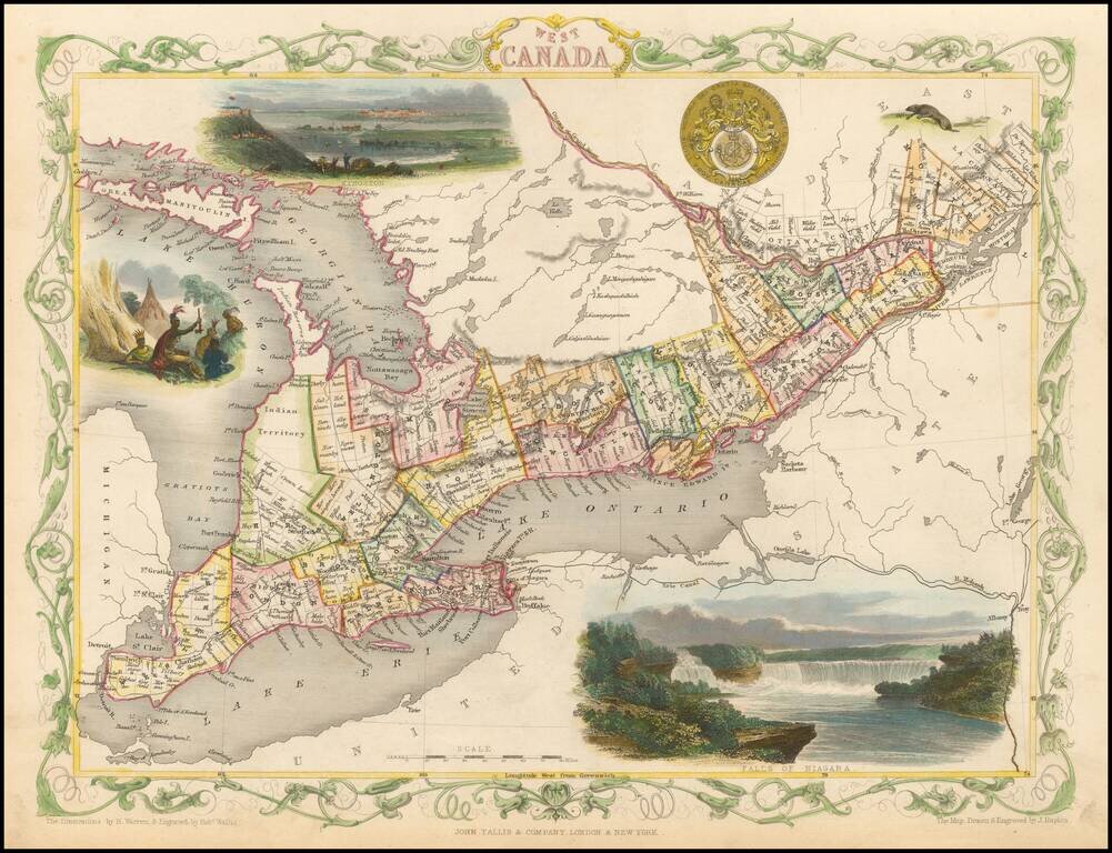
Interesting and highly detailed map of the Great Lakes region, showing counties and townships, Lake Huron, Lake Ontario and Lake Erie, as well as the Erie Canal and Mohawk River. Vignettes of Kingston, Niagara Falls and Indians in an encampment, along...
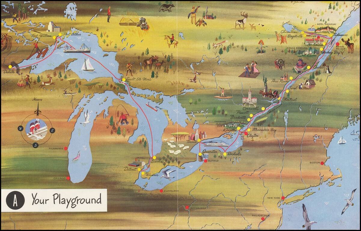
Interesting pictorial map, advertising for Canada Steamship Lines. The route shown goes from Duluth, Fort William and Port Arthur to Sault Ste Marie, Darnia, Detroit and Windsor, with a second route from Buffalo and Toronto to the mouth of the St....

Fine map of the northern part of North America, intended to illustrate the probability of a water course from Hudson's Bay to the Northwest Coast, across the interior of North America. The map was prepared to illustrate the report of Meares expedition...
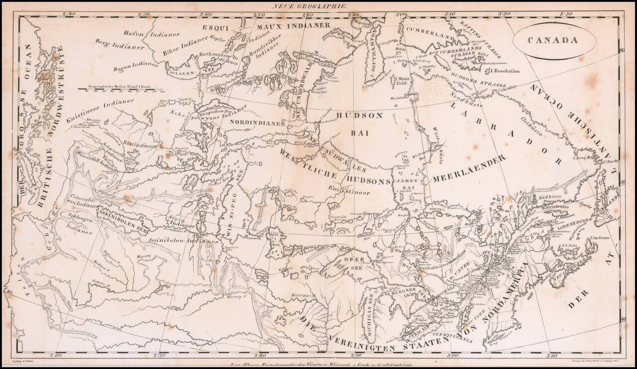
Rare early 19th Century map of Canada, from coast to coast, published in Germany. The map focuses on the drainages of the various rivers and lakes, centered on the Win-ni-peg See. Includes excellent treatment of the Lakes and Rivers. The map extends...