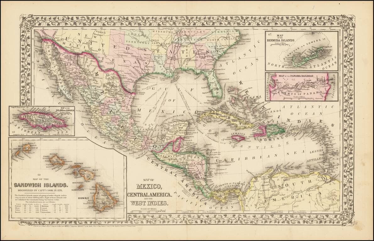
Rare and antique old maps of the North America
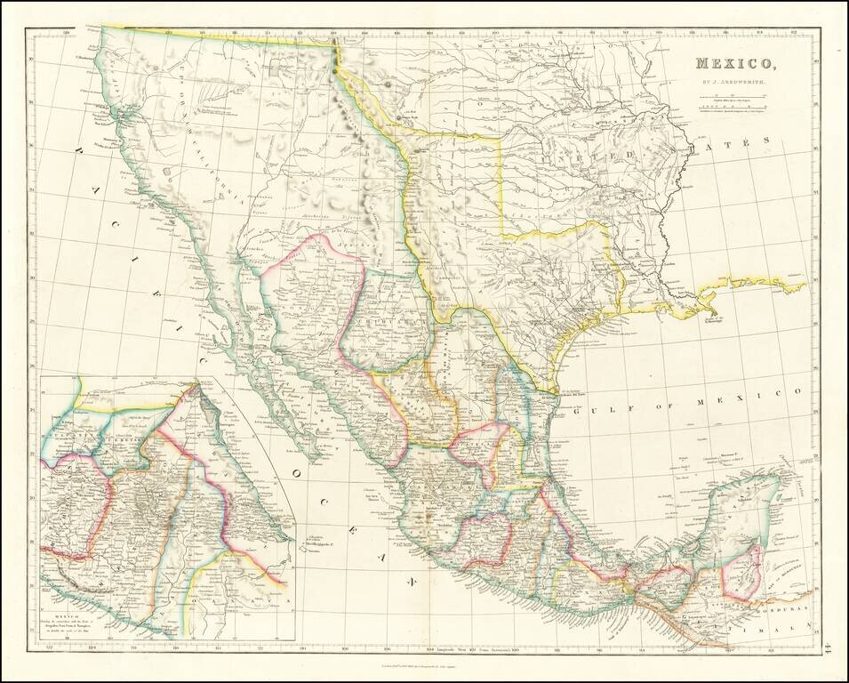
Mexico & The Republic of Texas Striking example of Arrowsmith's Map of Mexico, from the London Atlas, including the Republic of Texas in its largest configuration. The map provides a fantastic example of the Republic of Texas in earliest Republic...
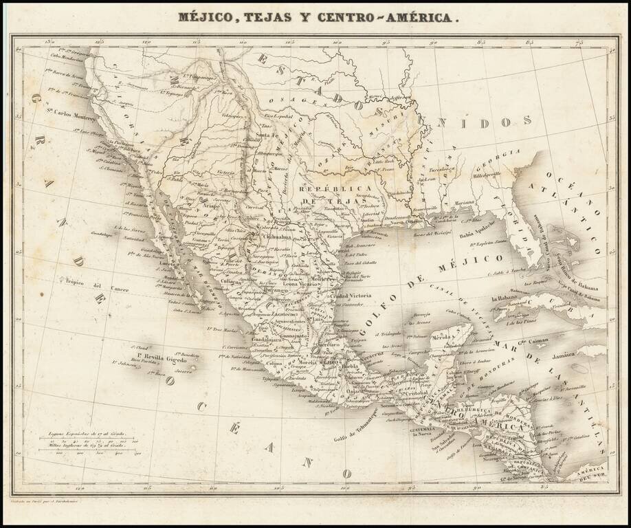
![Mexique par Th. Duvotenay…1843 [Republic of Texas]](/map/small/67925.jpg)
Detailed map of Texas, Upper California, the Plains and Mexico, published in Paris. The map prominently shows the Republic of Texas, a mythological Lake Teguayo and pre-Fremont Western United States. Western border of Texas includes an odd eastern...
Rare map showing the Republic of Texas (República de Tejas), one of only a few maps to specifically refer to Texas as "Republic of Texas," during the period between 1836 and 1845. The map was originally published in Sanchez de Bustamante's Nuevo...
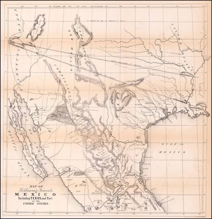
Transcontinental Railroad Routes To San Francisco in 1846! Scarce map of Texas, Upper California, Mexico and the Southwestern United States, prepared for Gilliam's Travels over the Table Lands and Cordilleras of Mexico during the Years 1843 and 44....

Excellent map of California, Mexico, Texas and the Southwest, published by A&C Black. The map covers all of Upper California and shows the missions, early forts and information immediately prior to the discovery of gold. Several settlement and...
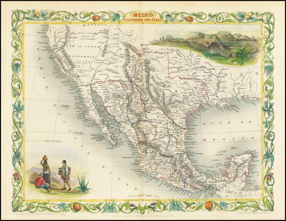
Rare variant edition of this decorative regional map of the Texas, California and the Southwest, featuring Texas in its Republic configuration, with Stovepipe reaching to Wyoming and Colorado. Upper California is shown with the Gold Regions...
Rare second edition of the so-called Rosa map of Mexico, first published in Paris in 1837 and re-issued in 1851, at the request of the Congress of Mexico. Rosa's map is perhaps the rarest of the so-called Treaty Map sequence, which shaped the original...
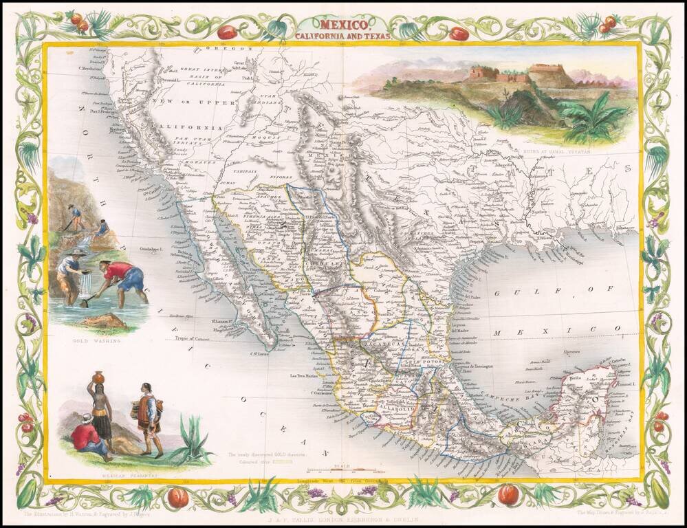
Decorative regional map of the Texas, California and the Southwest, featuring Texas in its Republic configuration, with Stovepipe reaching to Wyoming and Colorado. This is the second edition of the map, which includes the Gold Washing vignette not...
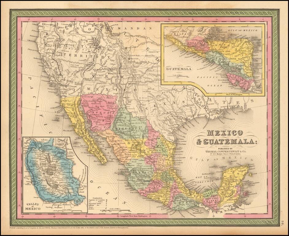
Detailed map of Mexico and the Southwest. Many of the early place names in Texas still appear. Pre-Gadsden Purchase border with Mexico. Large insets of the Valley of Mexico, Isthmus of Tehuantepec, Isthmus of Nicaragua and Guatemala.
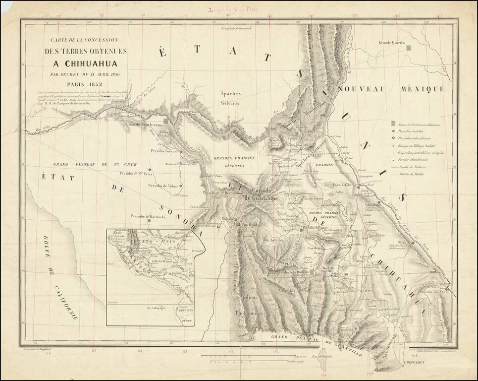
A French European Colony In Sonora and Chihuahua To Resist US Expansionism Scarce map of the borderlands between the United States and Mexico, illustrating the colonization scheme of Frenchman Hippolyte du Pasquier de Dommartin. The map provides a...
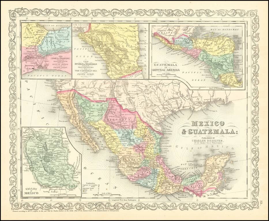
Scarce Charles Desilver map of Mexico and the Southwest. Many of the early place names in Texas still appear. Pre-Gadsden Purchase border with Mexico. Large insets of the Valley of Mexcio, Ithmus of Tehuantepeci, Isthmus of Nicaragua and Guatemala.
![[Arizona below New Mexico] Mexique d'apres le grand Atlas Dresse Par A.H. Dufour Grave par ch Dyonet Pubie par A. Le Chevalier . . . 1863](/map/small/64395.jpg)
Scarce map of Mexico and the American Southwest, etc., published in Paris. The map provides nice detail in Texas and along the Rio Grande, with emphasis on the roads and towns. The French Colony In Texas (Col. Francaise) is shown, along with a number...
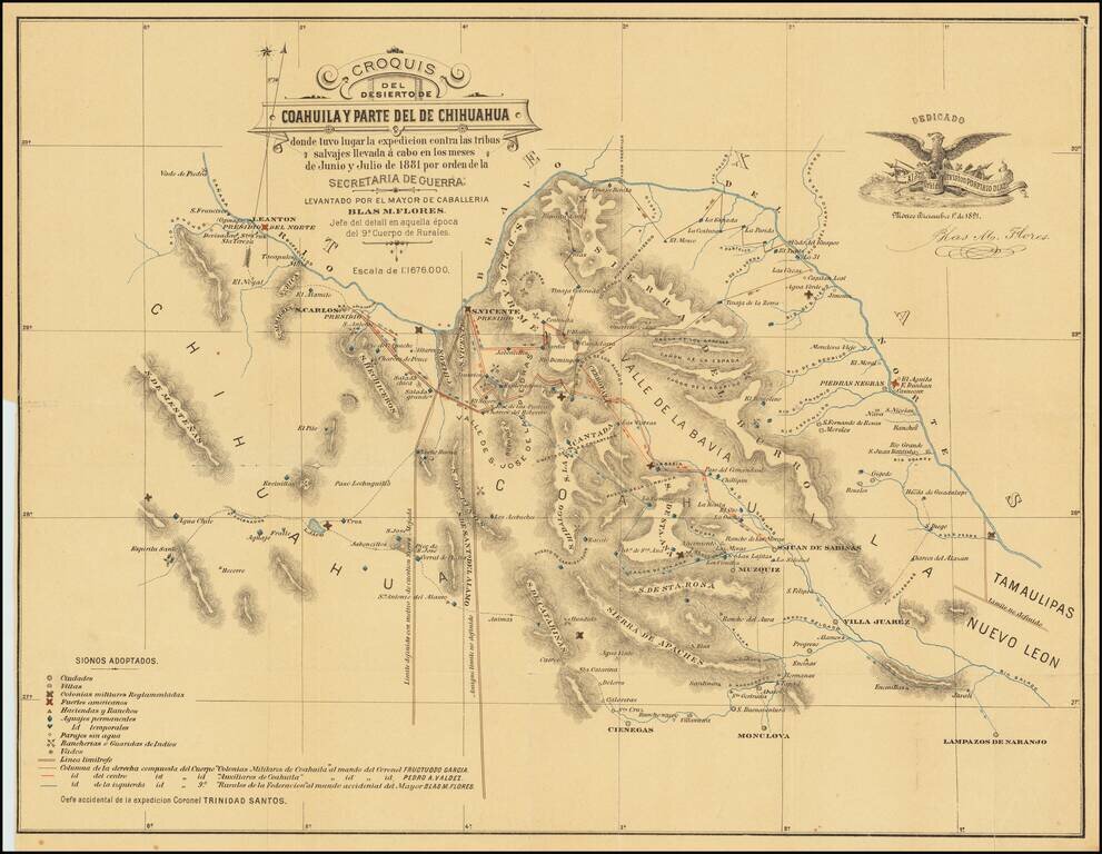
Extermination of the Lipan Indians in Northern Mexico Finely executed map of part of Coahuila and Chihuahua, illustrating the theater of war between the Mexican Cavalry and the Lipan Indians. At the direction of President Porfirio Diaz in 1881, the...
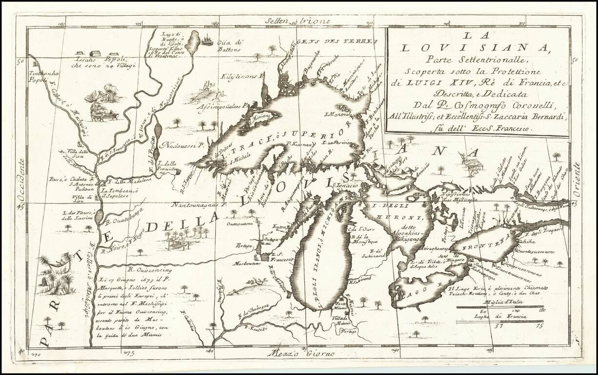
Important 17th Century Map of the Great Lakes and Upper Mississippi River Nice example of Coronelli's highly important map of the Great Lakes and Upper Mississippi region. Coronelli's map is widely regarded as one of the most important maps of the...
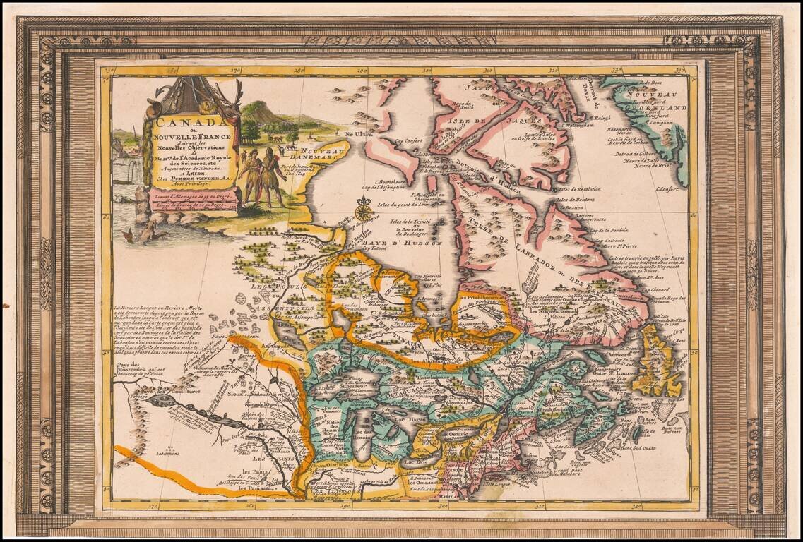
Decorative example of Vander Aa's map of Canada and the Great Lakes. Nice example, with the picture frame border, which appeared in Vander Aa's Nouvelle Theatre Du Monde, published in 1713. The map extends south to the Chesapeake and west to the...
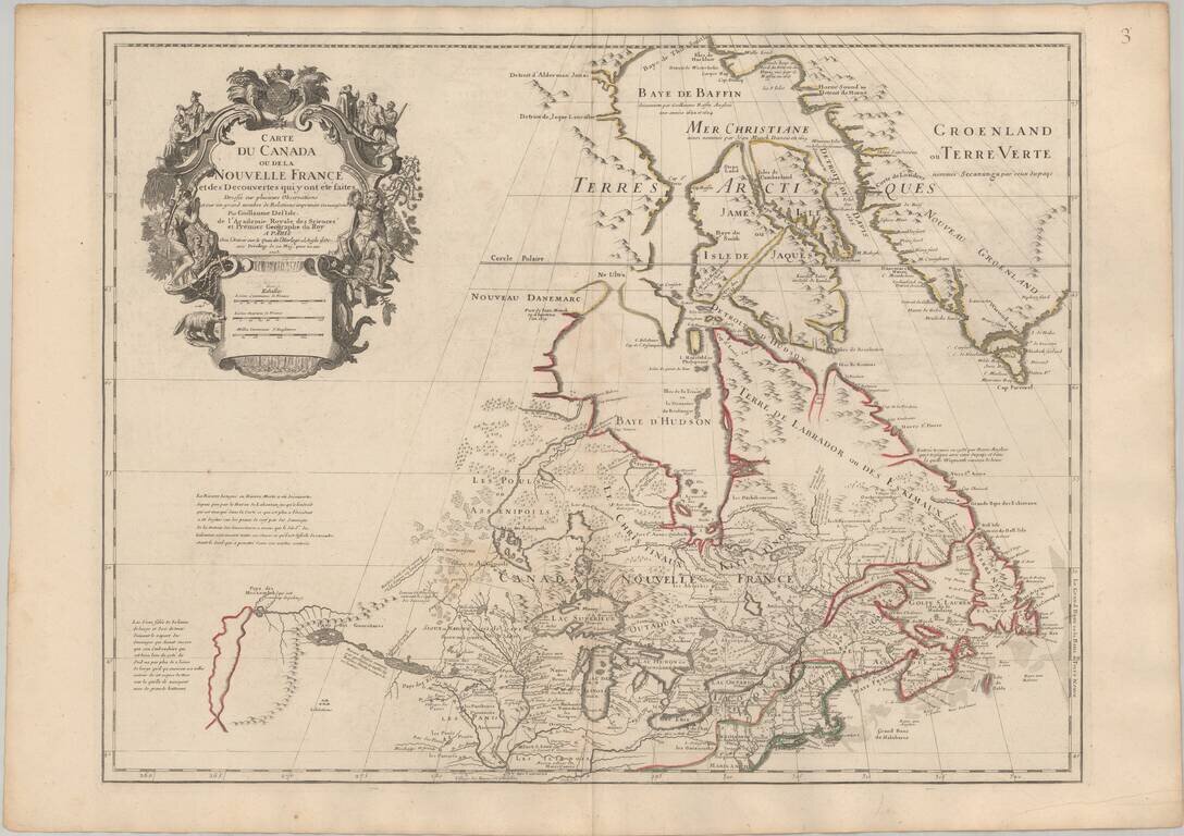
Seminal Early Map of Canada & The Great Lakes -- One of The First Maps To Reference The Rocky Mountains Nice example of Guillaume De L'Isle's map of Canada, the Great Lakes and Upper Midwest, one of the most important and influential maps of...