Rare and antique old maps of the North America
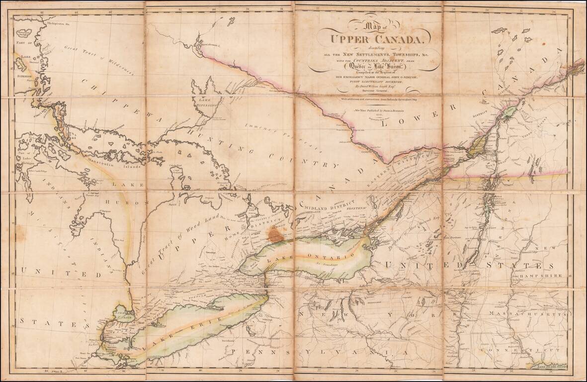
An Early Upper Canada Rarity - Sent To Thomas Jefferson During the War of 1812 Extremely rare separately published map of Upper Canada, Lake Huron, Lake Erie, Lake Ontario and contiguous parts of New York, Michigan, Vermont and Pennsylvania, published...
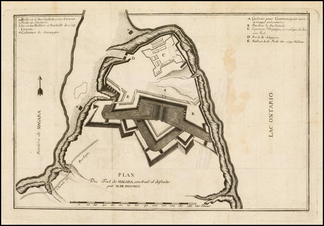
Rare French & Indian War era map of the fortifications at Fort Niagara, from Pierre Pouchot's Memoires sur le derniere guerre de L'Amerique Septentrionale. The map identifies in fine detail the construction and fortification of Fort Niagara, by...
![Attaques Des Forts De Chouaguen en Amerique. . . . 1756… [French & Indian War Battle Plan--Fort Oswego, Fort Ontario and Fort George]](/map/small/57191.jpg)
Rare French & Indian War Battle Plan, showing the fortifications and battles fought at the mouth of the Chouaguen (Oswego) River in 1756. The key at the bottom of the battle plan explains the various activities of the French, English and Indians,...
![Attaques Du Fort William-Henri…1757 [French & Indian War Battle Plan--Fort William Henry]](/map/small/57193.jpg)
Rare French & Indian War Battle Plan, showing the fortifications and battles fought at Fort William Henry on Lake George. The key at the bottom of the battle plan explains the various activities of the French, English and Indians, including...
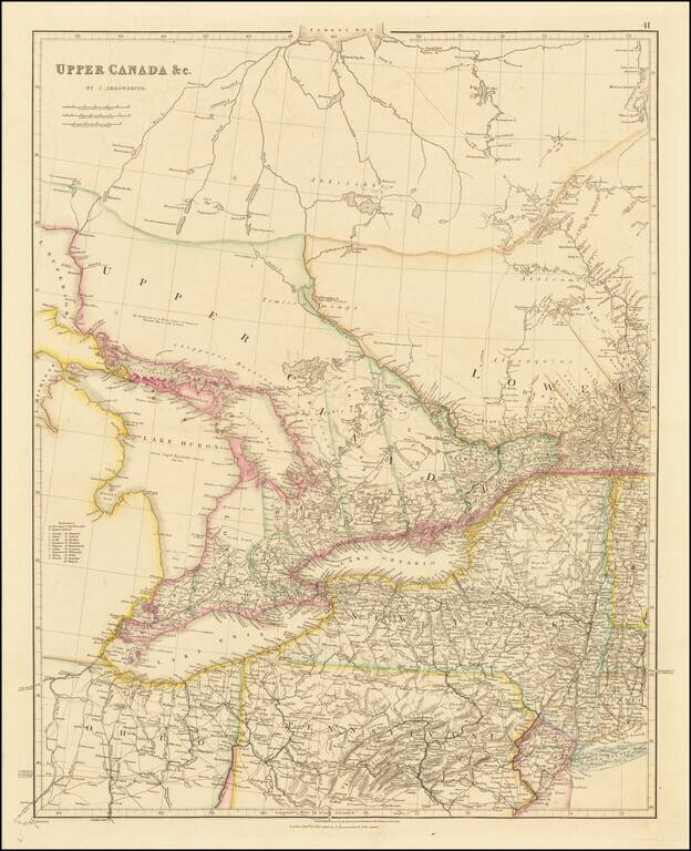
Early state of John Arrowsmith's map of Upper Canada and the Eastern Great Lakes, including Lake Huron, Lake Erie and Lake, Ontario, with parts of Lake Michigan and Lake Superior. The present map is drawn directly from the work of James Chewett and...
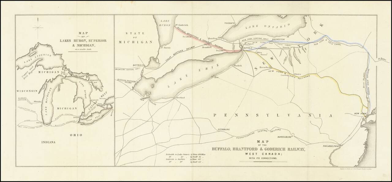
Interesting map of the Buffalo, Brantford and Goderich Railway, likely published either in its earliest incarnations in 1852 or at the time of its reorganization in 1856. The Buffalo, Brantford & Goderich Railway operated between 1852 and 1856,...
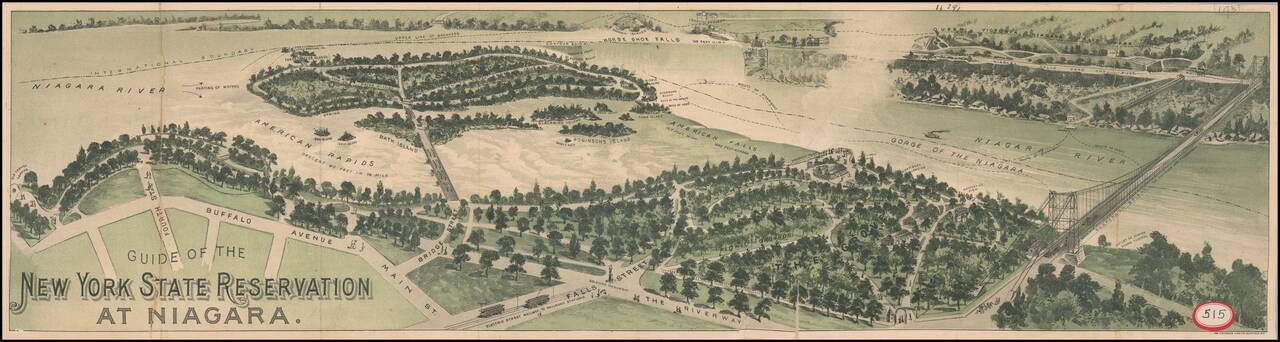
Interesting promotional birdseye view style guide map, illustrating the area around Niagara Falls, looking across from Buffalo Avenue and Falls Street to Goats Island, Horseshoe Falls and the Canadian side of the falls. The map illustrates the major...

Detailed road map of the Great Lakes Region, constructed by Canada's Department of the Interior. Includes Provincial Routes, Federal Routes and State Routes.

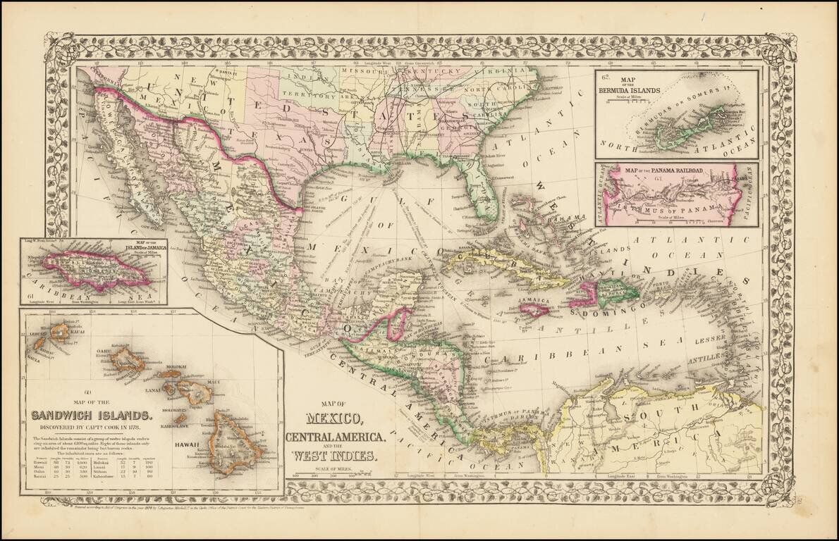
A highly decorative and important sea chart showing Florida, the Gulf Coast, Caribbean, Central America and the region from south of the mouth of the Delaware River. This fine separately published map was first engraved around 1650, but is based...

The First Sea Chart Focused on the Coast of California Rare first edition of the earliest map to focus on the California Coast, published in Florence by Robert Dudley. The map appeared in Dudley's landmark sea atlas, the Arcana del mare, the first...

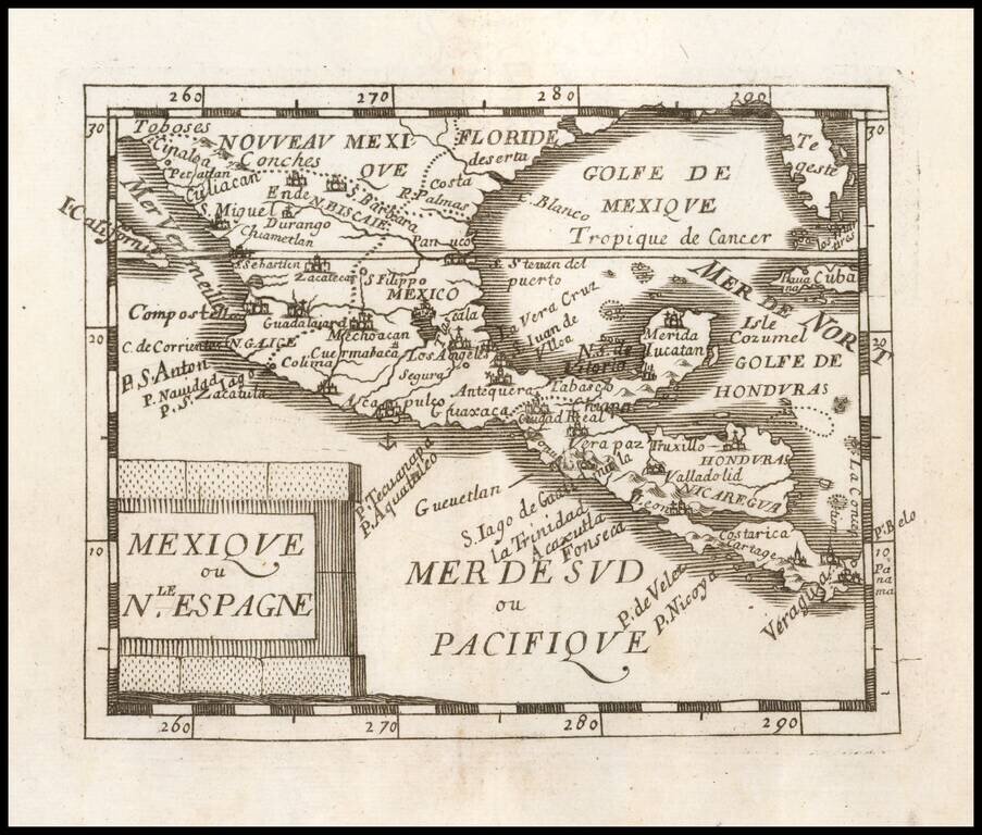
Fine example of Nicolas Sanson's double-page engraved map of Mexico and Central America south to the Gulf of Panama. The map also includes a nice treatment of Southern Florida, including Bahia de Tamap, Bahia De Carlos, B. de Juaon Ponta, Cabo de...
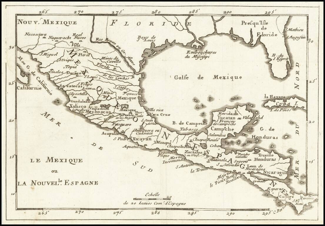
Nice example of Du Val's map of New Spain, extending from the American Southwest and Florida to Costa Rica and Panama.

Scarce chart of the Caribbean, Florida, Gulf Coast and Southeastern part of North America, with inset of the north coast of Cuba. Goos based his general chart of the West Indies, Gulf Coast and Southeast on the manuscript maps of Hessel Gerritsz,...

Mexico and Southwestern Rarity Rare English map of New Spain, published by Sir Jonas Moore. Extends to Baja California, Southern Florida, Texas and the Southwest. The map appeared in Moore's A New Geography. Many of the plates in the work were...
![[Florida Panhandle to Yucatan] Pas-Kaart Van de Golff van Mexico . . .](/map/small/23053.jpg)
The Earliest Obtainable Sea Chart of the US Gulf Coast Unrecorded variant edition of Van Keulen's chart of the Gulf Coast, from the Yucatan to Florida and centered on Texas, the earliest obtainable sea chart to focus this closely on Texas and the...
Rare map of Florida, the Gulf Coast, Texas, Central America and the Caribbean. Florida extends to the Rio Grande River. Only a few settlements shown in Florida and none on the Gulf Coast, apparently pre-dating New Orleans. Reminiscent of De Fer's map...