Map size in jpg-format: 4.32028MiB
Click to open in high resolution (open in new tab).

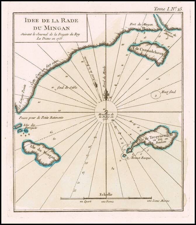
The French Fur Trading Fort at Mingan
An excellent map of Harbor at Mingan and coastal islands, from Bellin's Petit Atlas Maritime.
The map shows a section of the coast of Quebec, at the mouth of the Gulf of St. Lawrence, just north of the Island of Anticosti, Canada.
The map is based upon a survey conducted by the French Frigate Diane in 1755.
Mingan is the homeland of the Innu people, who utilized the region in the summers to fish for salmon, hunt for whale, have family meetings, and trade with each other. In 1661, the French established the Mingan Seignory, as European settlement increased, as did a fur trade in the region.
In the 19th Century, North West Company and then the Hudson's Bay Company maintained trading posts at Mingan to trade with the Innus.
If you are a student, write to us in telegram: @antiquemaps and indicate what material you need and for what work you need a map in high detail. We are ready to provide material on special terms. For students only!
![[The First Maps in a la poupée Printed Color] Cartes en Couleur des Lieux Sujets aux tremblements de Terre Dans toutes les parties du Monde Selon le Sisteme de l’impulsion Solaire](/map/small/52293op.jpg)

