
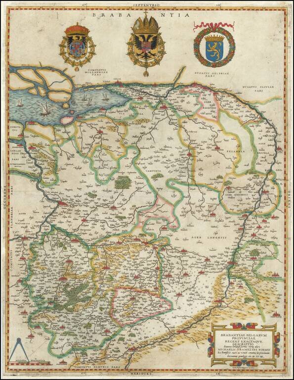
Extremely rare example of the first Lafreri School edition of Jacob van Deventer's groundbreaking survey of Brabant, the earliest surviving example of a map based upon a modern trigonometric survey. The present map represents the synergy of fine art...
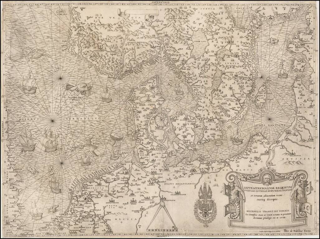
The most important modern map of Scandinavia and the Baltic Regions published in the mid-16th century. Rare and highly important early map of Scandinavia, the Baltic Sea and the North Sea by Michael Tramezini, based upon Cornelis Anthoniszoon's lost...
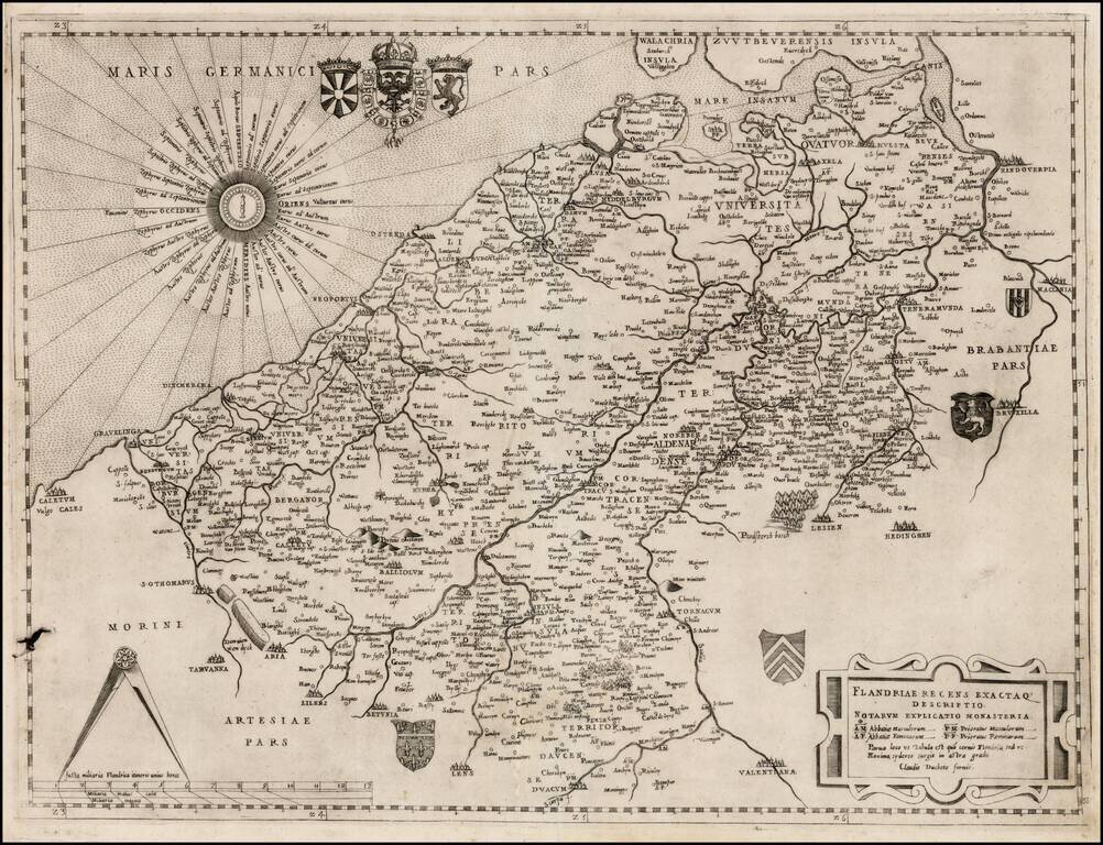
Nice example of Claudio Duchetti's map of northwestern Belgium and the southwestern part of the Netherlands. Duchetti's map is based upon Jacobus Bossius's map of the same title, published in Venice in 1555, by Michaelis Tramezini. The Bossius's map...
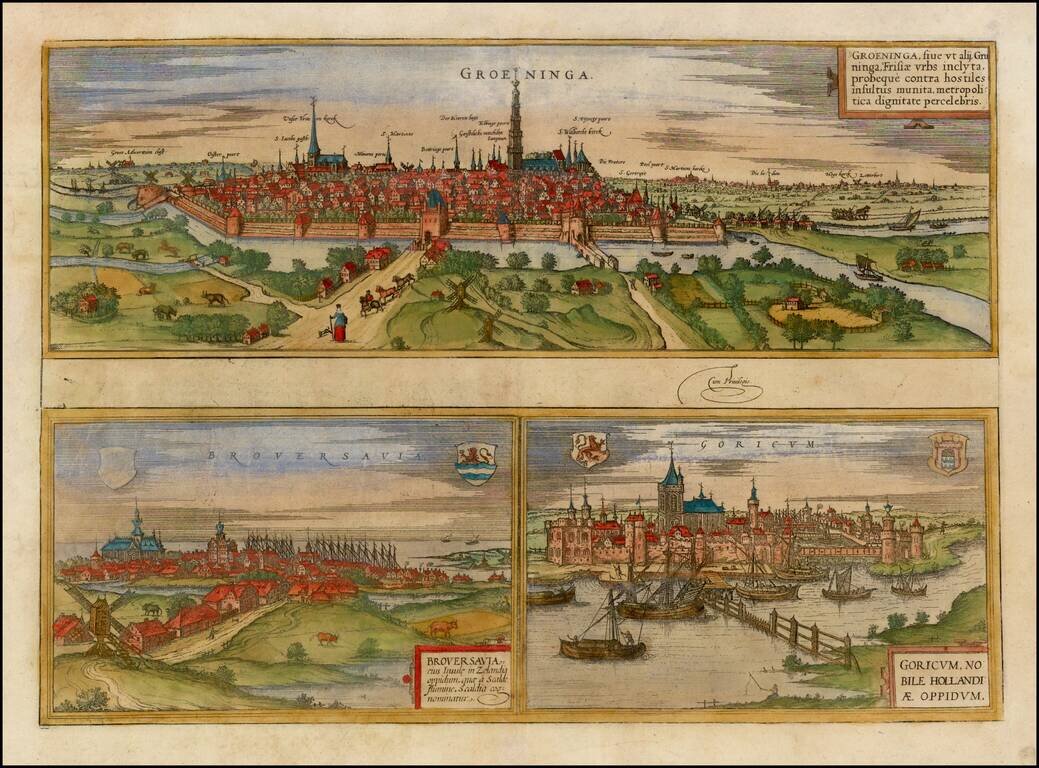
Decorative early views of Groeningen, Gork and Brovershaven. Bird's-eye view of the 3 towns with details of surrounding fields, farms and structures. From Braun & Hogenberg's Civitatus Orbis Terrarum, the most important book of town plans and...
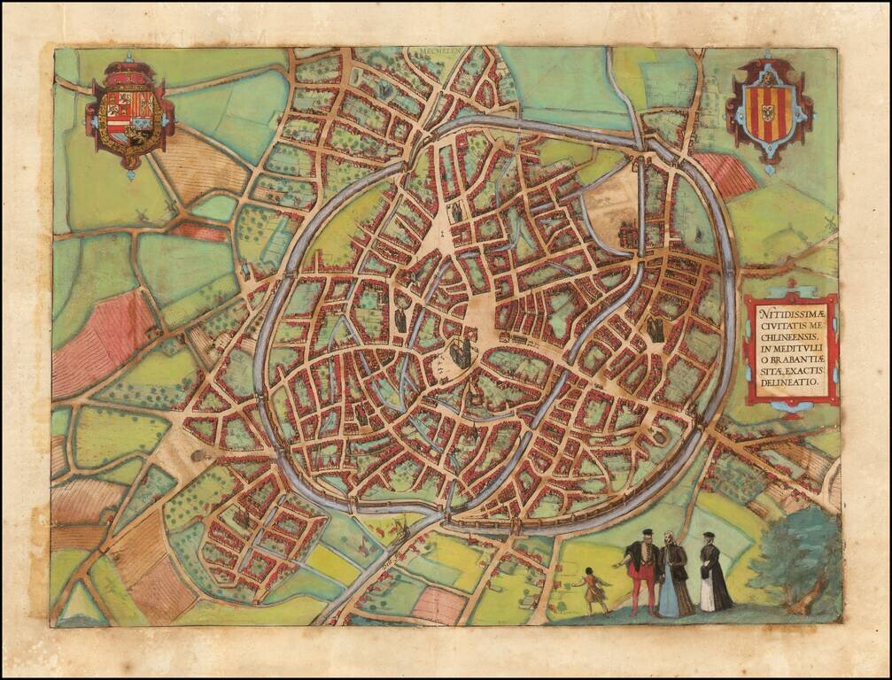
Decorative early views of Mechelen in Brabant. From Braun & Hogenberg's Civitatus Orbis Terrarum, the most important book of town plans and views published in the 16th century.
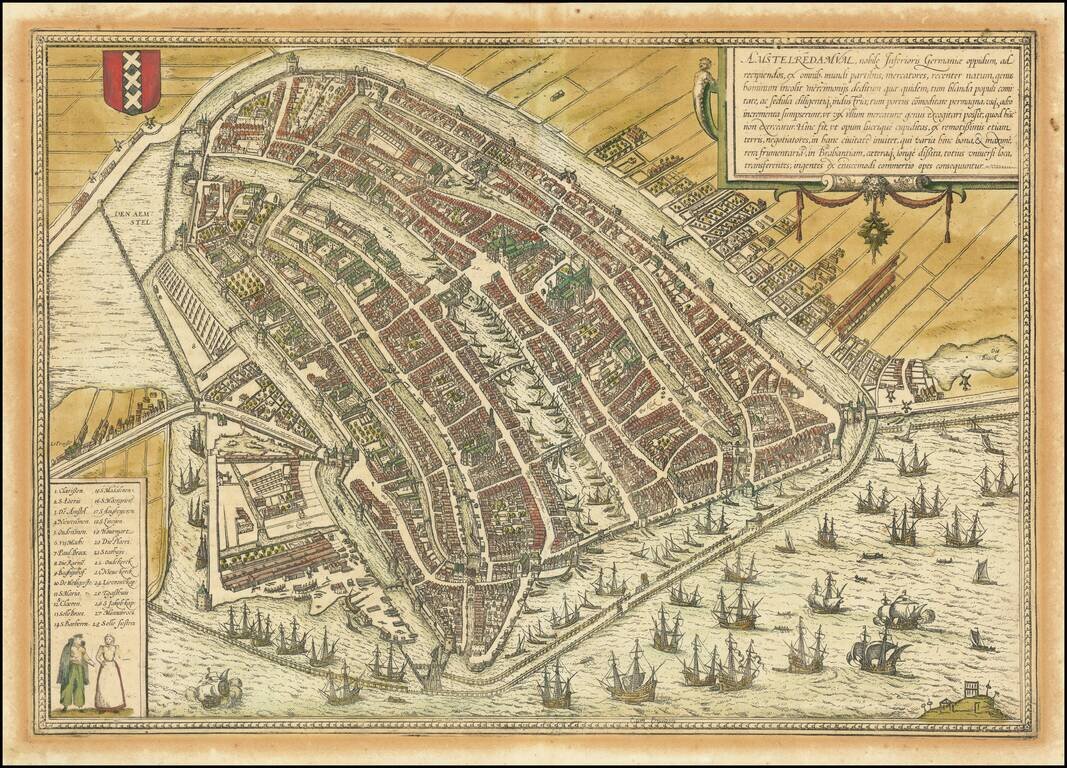
This is a finely colored example of Braun & Hogenberg's first view of Amsterdam, from Part I of their Civitates Orbis Terrarum, first published in Cologne in 1572. Braun & Hogenberg's view is based upon a plan of Amsterdam by Cornelis...
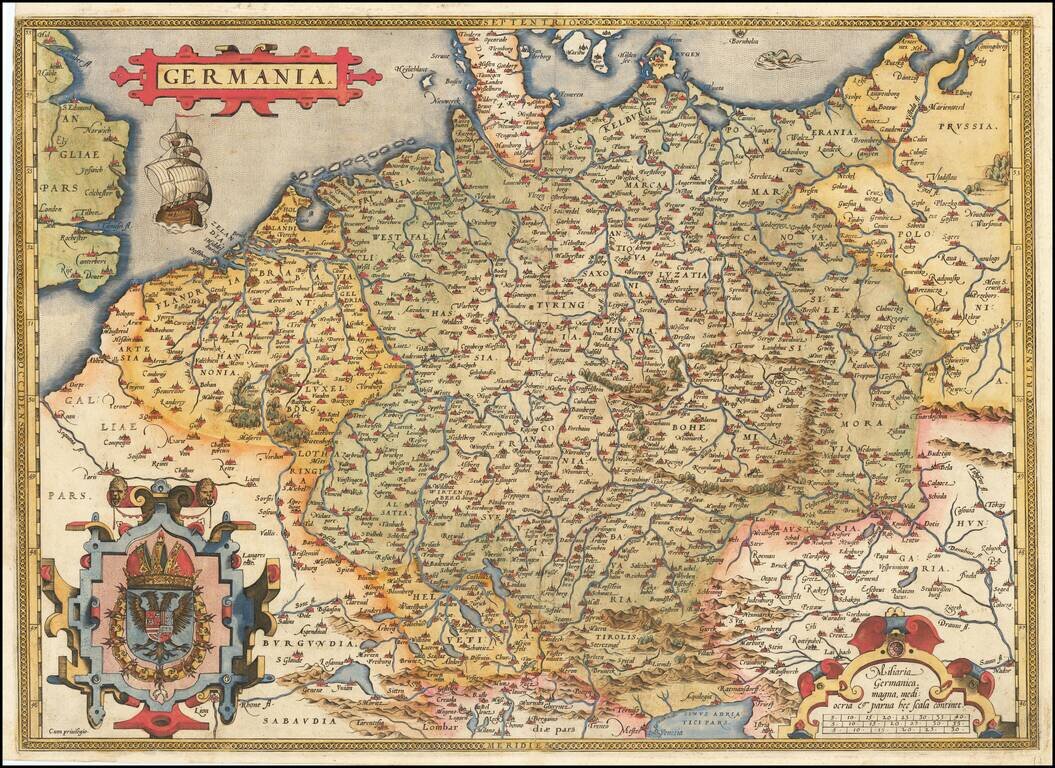
Fine old example of Ortelius' map of the German Empire, from his Theatrum Orbis Terrarum, the first modern atlas of the world. The map extends from The English Channel to the Baltic, the Vistula and Poland in the northeast, Budapest, Venice and the...
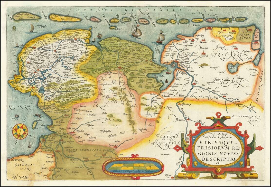
A nice old color example of Ortelius' map of Friesland, including a larger compass rose, sailing ships and an elaborate cartouche. The map appeared in Ortelius' Theatrum Orbis Terrarum, the first modern Atlas, first issued in 1584.
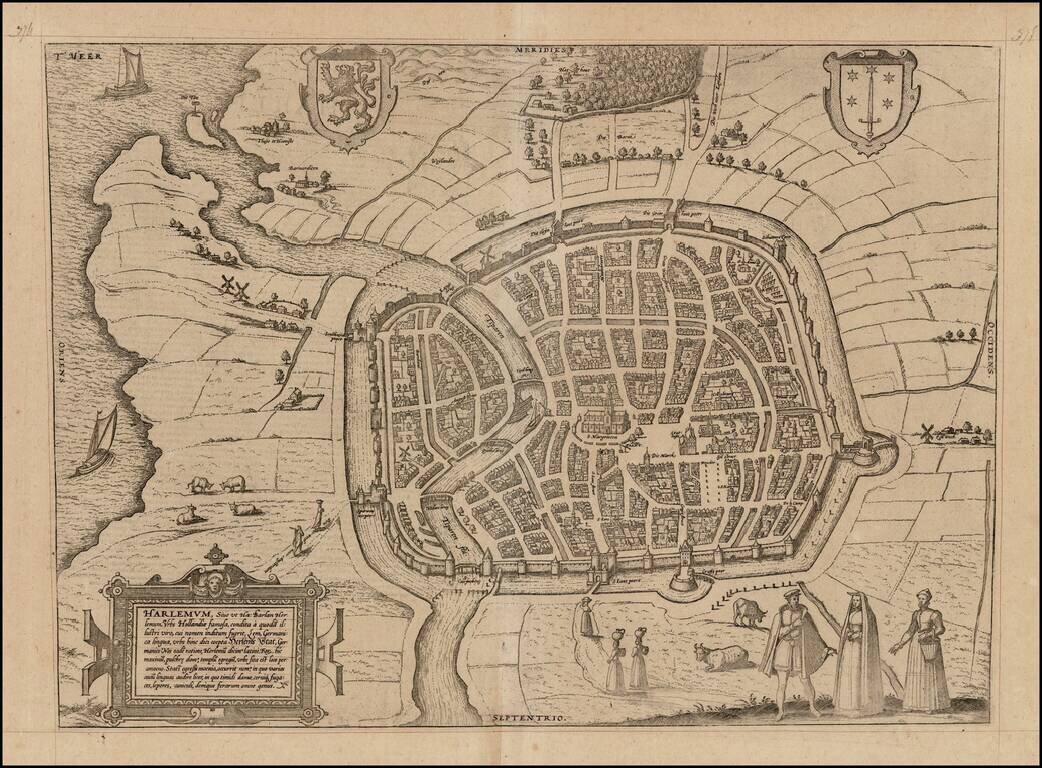
Detailed early plan of Haarlem. The translation of the title cartouche is as follows: Harlemum, or, as Hadrianus Barlandus writes, Herlemum, a renowned Dutch city, founded by an illustrious man who had the German name Lem; the city was therefore...
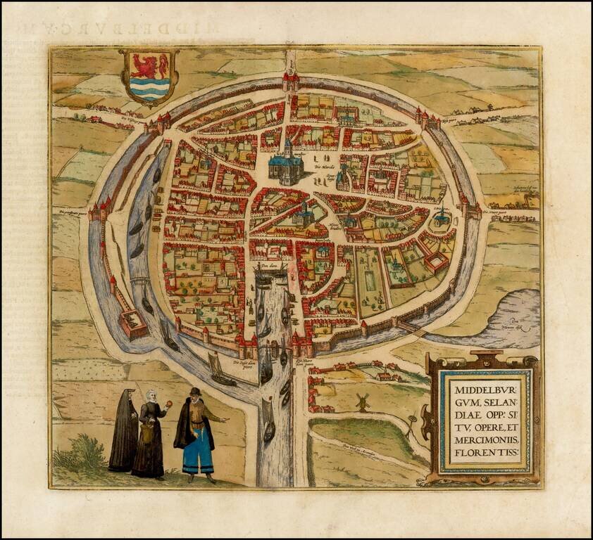
Fine early birdseye view of the Island of Middelburg. From Braun & Hogenberg's Civitatus Orbis Terrarum, the most important book of town plans and views published in the 16th century. This bird's-eye view from the southeast shows the capital of...
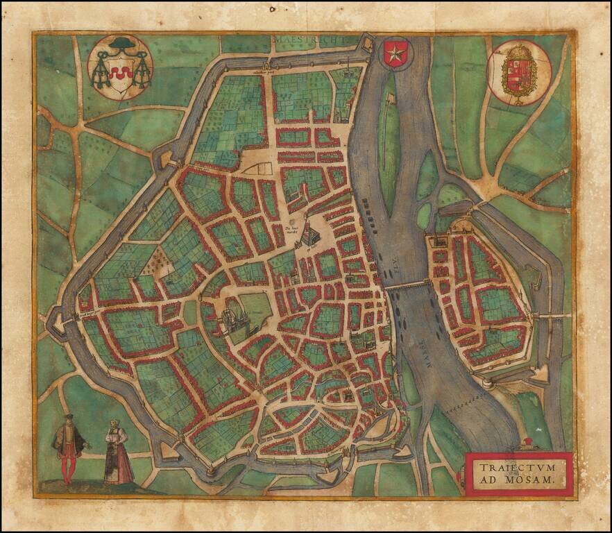
Detailed plan of Maastricht on the Maas (Meuse River). The title translates as Crossing over the Maas River. From Braun & Hogenberg's Civitatus Orbis Terrarum, the most important book of town plans and views published in the 16th Century.
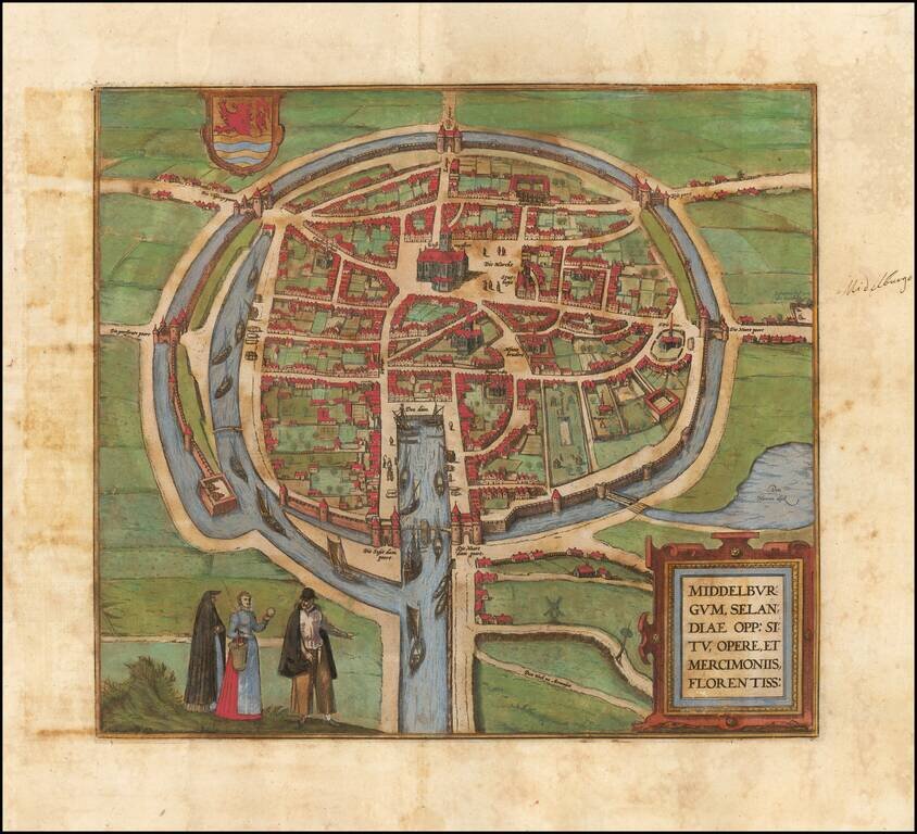
Fine early birdseye view of the Island of Middelburg. From Braun & Hogenberg's Civitatus Orbis Terrarum, the most important book of town plans and views published in the 16th century. This bird's-eye view from the southeast shows the capital of...
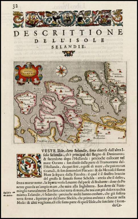
Fine early map of Zeeland, from Porcacchi's L'Isole Piu Famose Del Mondo… Map of islands of southern Dutch coast before dykes were built and land reclaimed.
Old color example of the rare first edition of Gerard De Jode's map of the Netherlands from the 1578 edition of De Jode's Speculum Orbis Terrarum. De Jode was a contemporary of Ortelius and Mercator. The firs edition of his Speculum Orbis Terrarum was...
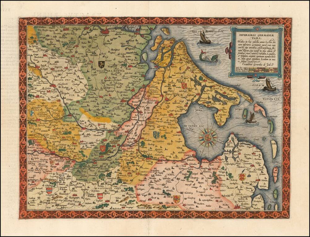
Flawless example of the first edition of De Jode's highly desirable map Germania Inferioris, from the first edition of De Jode's Speculum Orbis Terrarum. In the second, the title outside to top border was deleted. Covers the whole of the Northern...
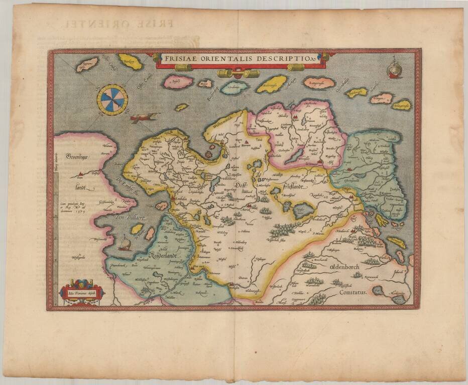
Nice example of Ortelius' map East Friesland, from his Theatrum Orbis Terrarum, the first modern atlas of the world. Includes a curious compass and three sailng vessels.