
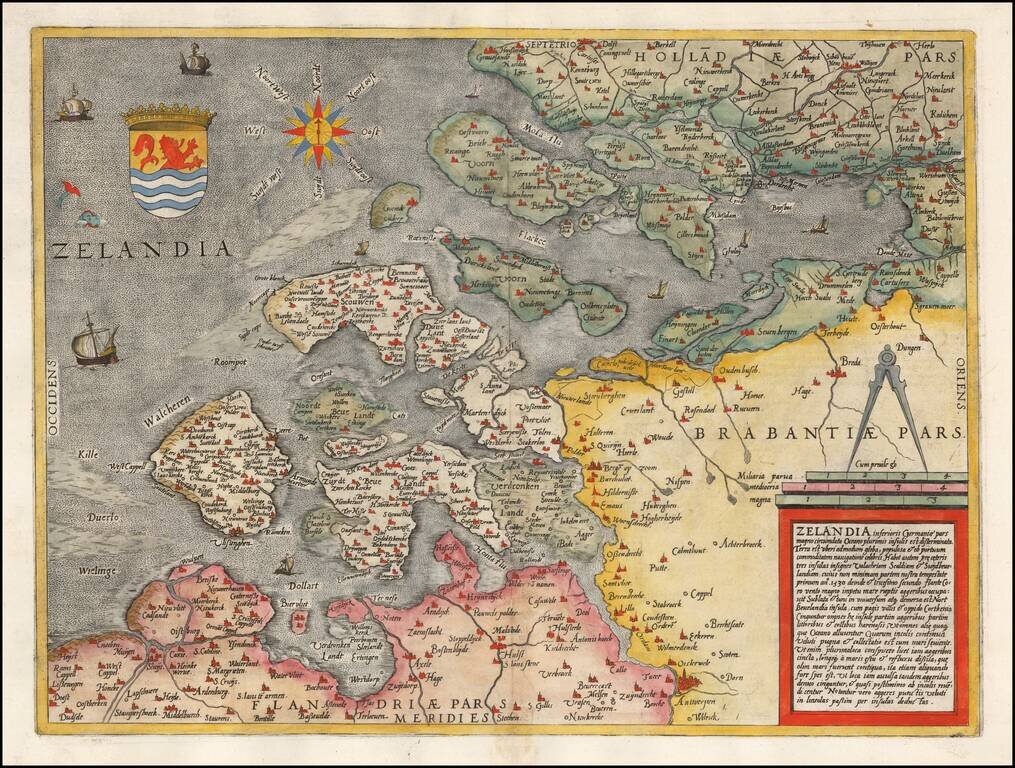
Rare early map of Zeeland, published by De Jode and engraved by Jan Van Doetecum. One of the earliest separate maps of Zeeland published in the Low Countries.
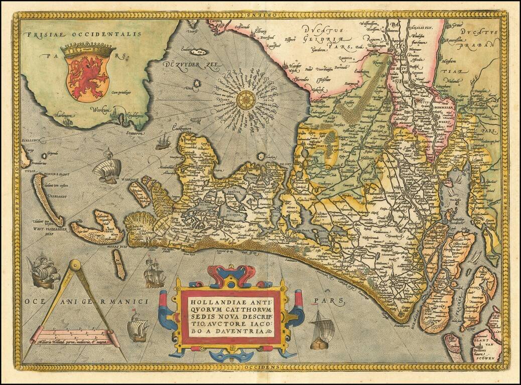
A nice full color example of Ortelius' map of Holland, drawn from Jacaob van Deventer's maps. The map is oriented with east at the top of the map. Elaborately embellished with a compass rose, sailing ships, coat of arms, etc. Nice dark impression and...
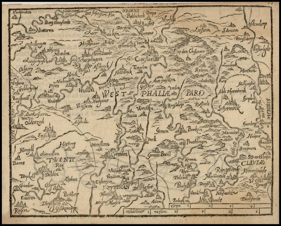
Rare 16th Century map of the region centered on Wesphalia, published by Zacharias Heyns in his rare Le Miroir du Monde, ou, Epitome du Theatre d'Abraham Ortelius, published in Amsterdam in 1598. Zacharias Heyns was the son of Peter Heyns, who wrote...
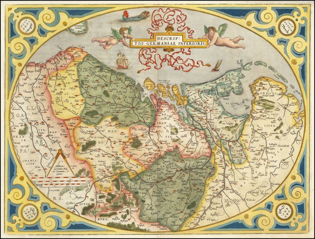
Old color example of the Low Countries set in an ornate decorative border, from Ortelius' Theatrum Orbis Terrarum, the first modern atlas of the world. Two cherubs hold an ornate banner cartouche aloft, with sailing ships and a sea monster. Koeman...
Striking regional map of the Low Countries from Ortelius' Theatrum Orbis Terrarum, the first modern atlas of the world. Includes a large cartouche, war ship and scale of miles.
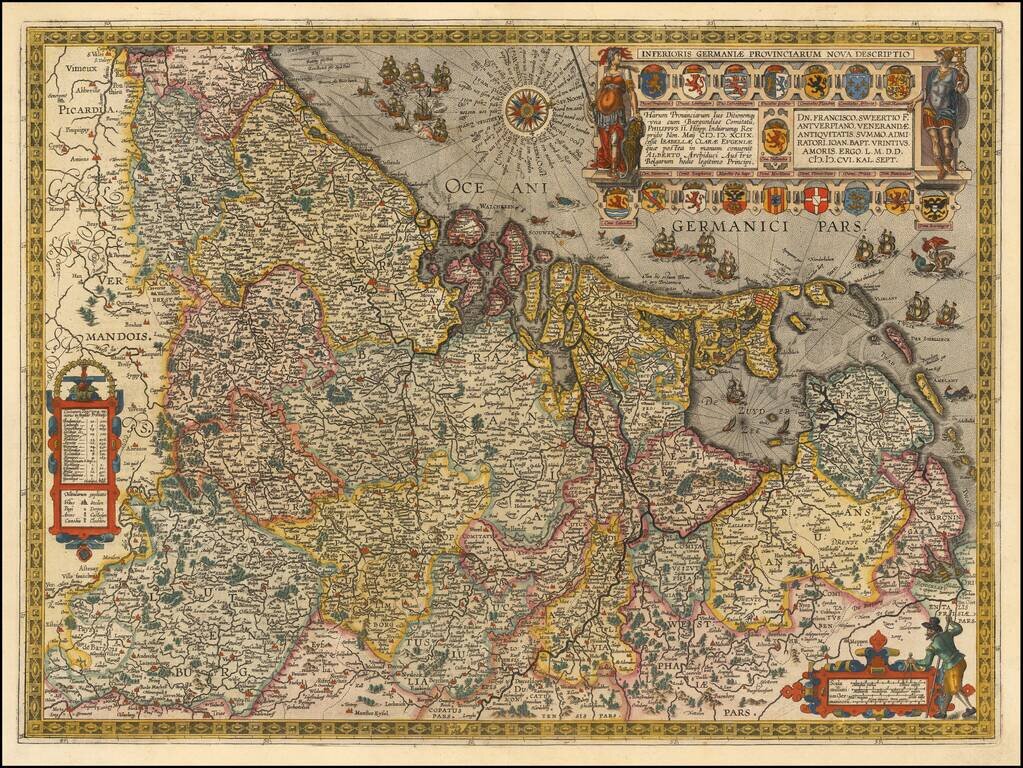
Fine example of Jan Baptiste Vrients map of the Low Countries and environs, which first appeared in the 1608 edition of Abraham Ortelius' Theatrum Orbis Terrarum, the first modern atlas of the world. The map is based upon a wall map of Philip Galle,...
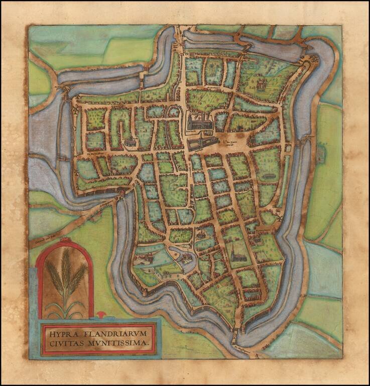
Nice old color example of of Braun & Hogenberg's view of Ieperen.
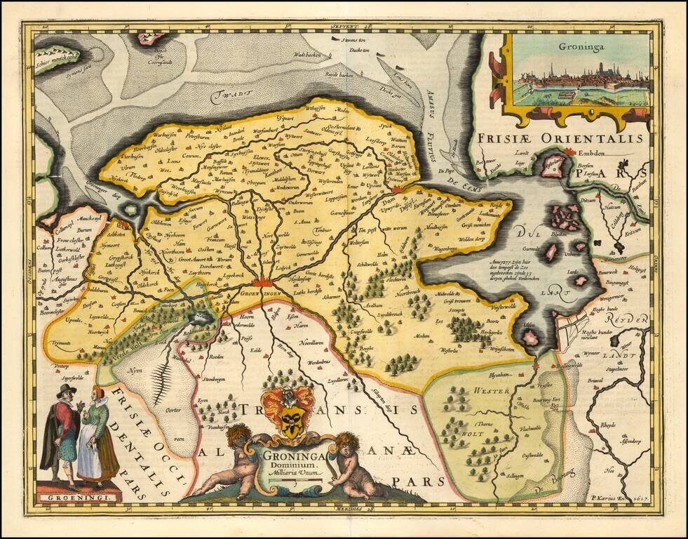
A fine early map of the the Groningen region, which appeared in Petrus Kaerius's (Peter Van der Keere) Germaniae Inferior id est, XVII Provinciarum ejus novae et exactae Tabulae Geographicae, first published in Amsterdam in 1617. Van der Keere's atlas...
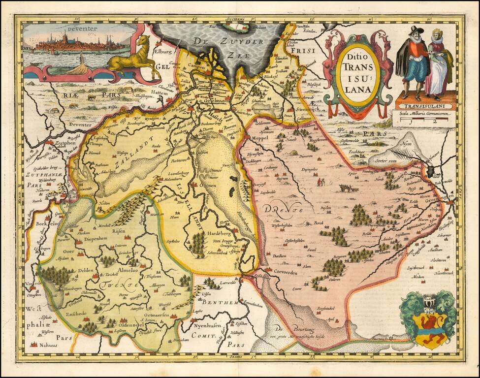
A fine early map of the Deventer region, which appeared in Petrus Kaerius's (Peter Van der Keere) Germaniae Inferior id est, XVII Provinciarum ejus novae et exactae Tabulae Geographicae, first published in Amsterdam in 1617. Van der Keere's atlas was...
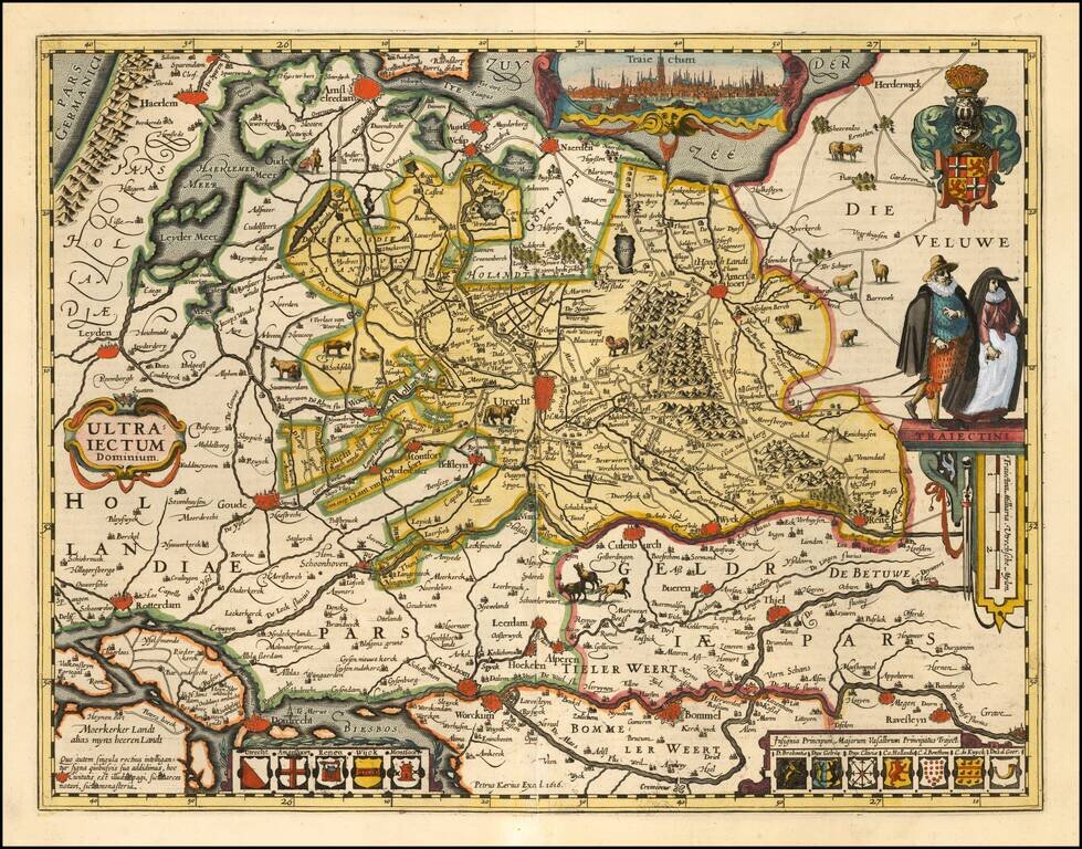
A fine early map of the Utrecht region, which appeared in Petrus Kaerius's (Peter Van der Keere) Germaniae Inferior id est, XVII Provinciarum ejus novae et exactae Tabulae Geographicae, first published in Amsterdam in 1617. Van der Keere's atlas was...
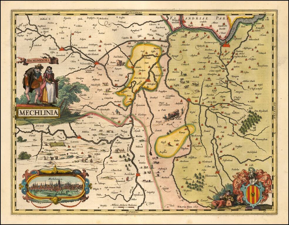
A fine early map of the the Mechelen region, which appeared in Petrus Kaerius's (Peter Van der Keere) Germaniae Inferior id est, XVII Provinciarum ejus novae et exactae Tabulae Geographicae, first published in Amsterdam in 1617. Van der Keere's atlas...
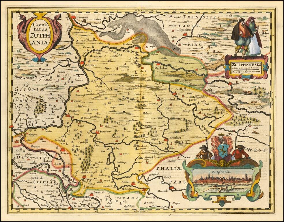
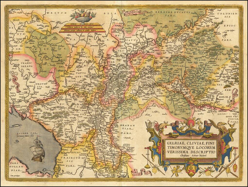
A fine early map of the part of Gelderland, in the region then controlled by the Counts of Zuthpen, which appeared in Petrus Kaerius's (Peter Van der Keere) Germaniae Inferior id est, XVII Provinciarum ejus novae et exactae Tabulae Geographicae, first...
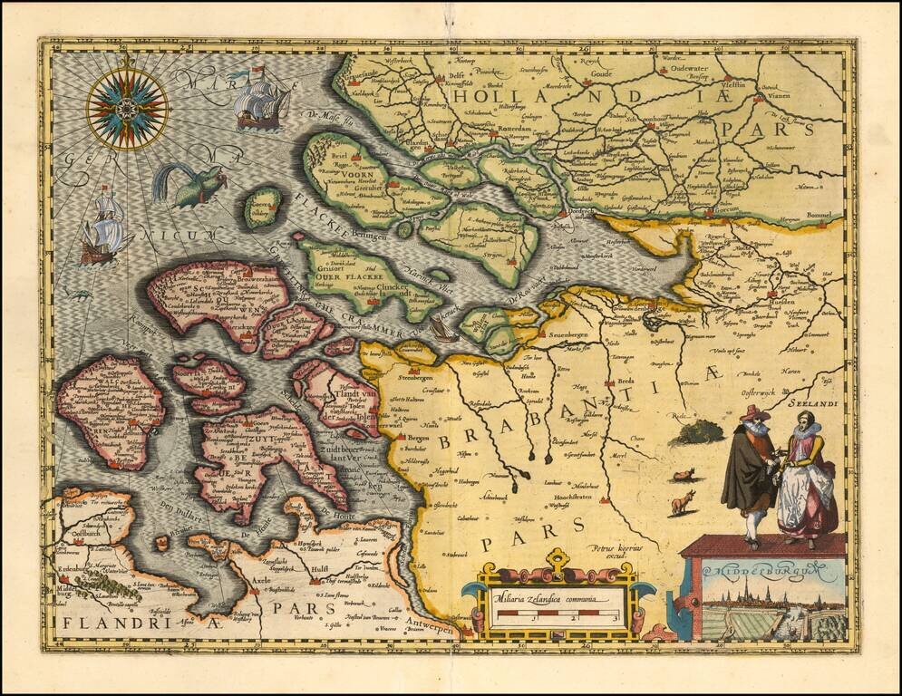
A fine early map of Middelburg which appeared in Petrus Kaerius's (Peter Van der Keere) Germaniae Inferior id est, XVII Provinciarum ejus novae et exactae Tabulae Geographicae, first published in Amsterdam in 1617. Van der Keere's atlas was the first...
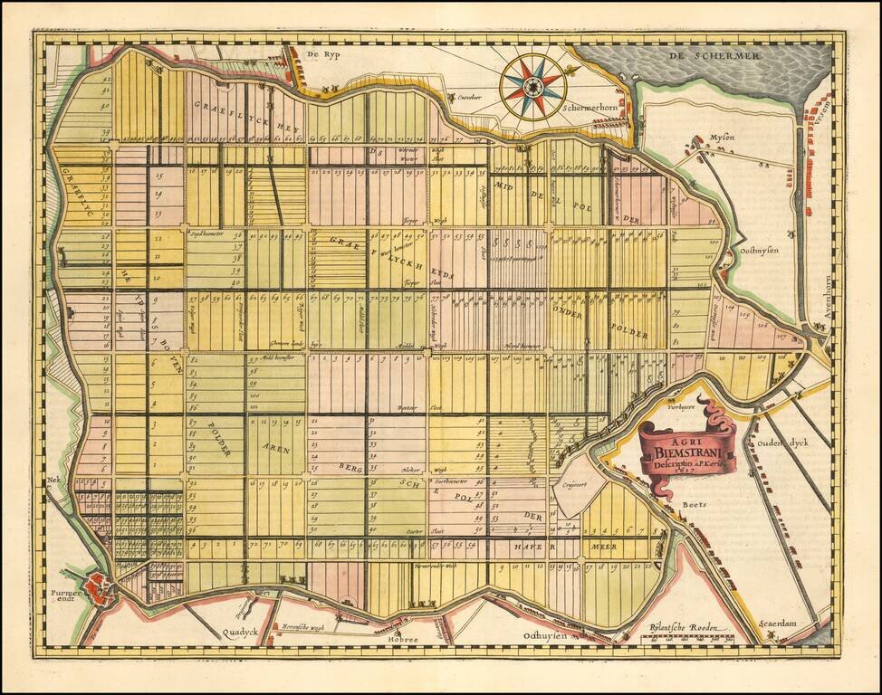
The Oldest Area in the Netherlands Reclaimed from the Sea. Fine map of the polder Beemster in Noord Holland, including the towns of Purmerend, De Ryp, Oudendijk, etc. The map appeared in the first separately issued atlas of the Low Countries which...
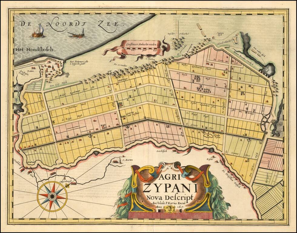
A fine early map of the Zijpe region of North Holland, which appeared in Petrus Kaerius's (Peter Van der Keere) Germaniae Inferior id est, XVII Provinciarum ejus novae et exactae Tabulae Geographicae, first published in Amsterdam in 1617. Van der...
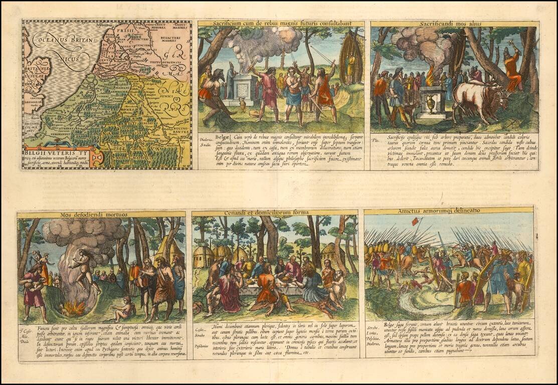
Daily Lives of Ancient Celts Nice example of the Peter van der Keere (Petrus Kaerius) map of the Low Countries in Ancient Times. The map is augmented with scenes showing the daily lives of ancient Belgian Celtic Tribes. The additional images show...