
![[Nymmegen] Novimagium sive Noviromagum vulgo Nijmmegen . . . .](/map/small/44358.jpg)
Nice old color example of this early birdseye view of Nijmegen. From Braun & Hogenberg's Civitatus Orbis Terrarum, the most important book of town plans and views published in the 16th Century. A bird's-eye view of the city, where the royal...
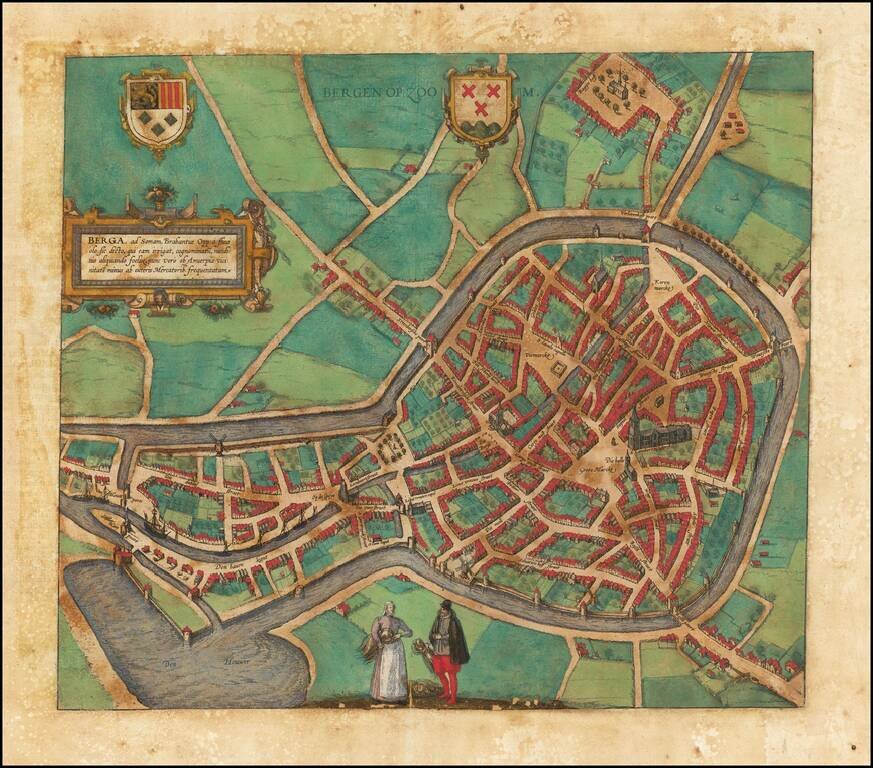
Fine early birds-eye view of Bergen Op Zoom. From Braun & Hogenberg's Civitatus Orbis Terrarum, the most important book of town plans and views published in the 16th century. The verso translates as follows: Bergen is a beautiful and very...
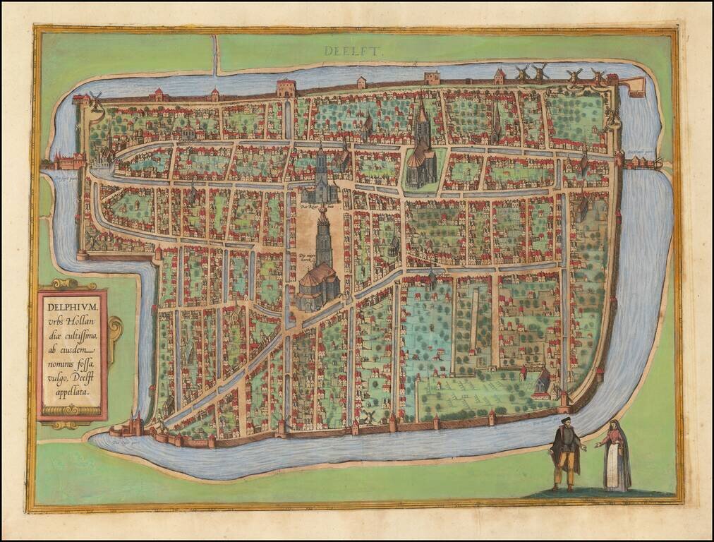
Nice old color example of the first state of Braun & Hogenberg's view of Delft. The first state includes a simple lettered title cartouche and an the name "Deelft" at the top. The later state adds a more elaborate script in both the title and the...
![[Nymmegen] Novimagium sive Noviromagum vulgo Nijmmegen . . . .](/map/small/55515mp2.jpg)
Nice old color example of this early birdseye view of Nijmegen. From Braun & Hogenberg's Civitatus Orbis Terrarum, the most important book of town plans and views published in the 16th Century. A bird's-eye view of the city, where the royal...
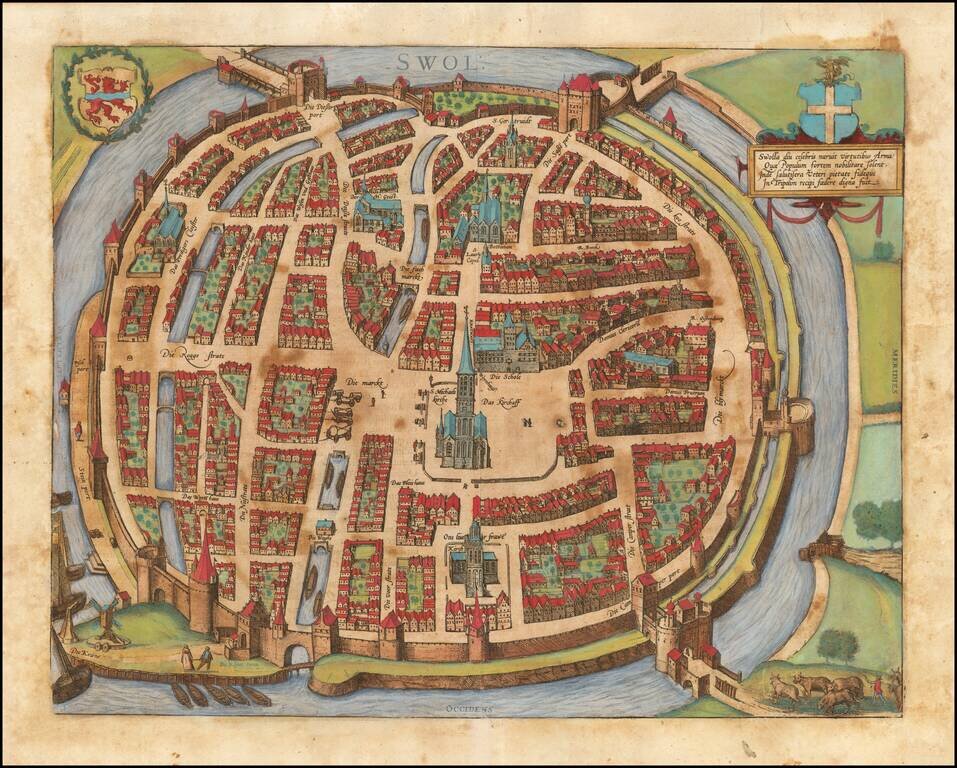
Fine early birds-eye view of Zwolle, the capital city and municipality of the province of Overijssel. From Braun & Hogenberg's Civitatus Orbis Terrarum, the most important book of town plans and views published in the 16th century.
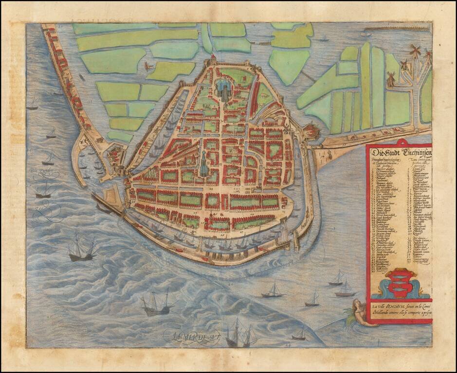
Decorative early view of Enkhuizen, from Braun & Hogenberg's Civitatus Orbis Terrarum, the most important book of town plans and views published in the 16th century.
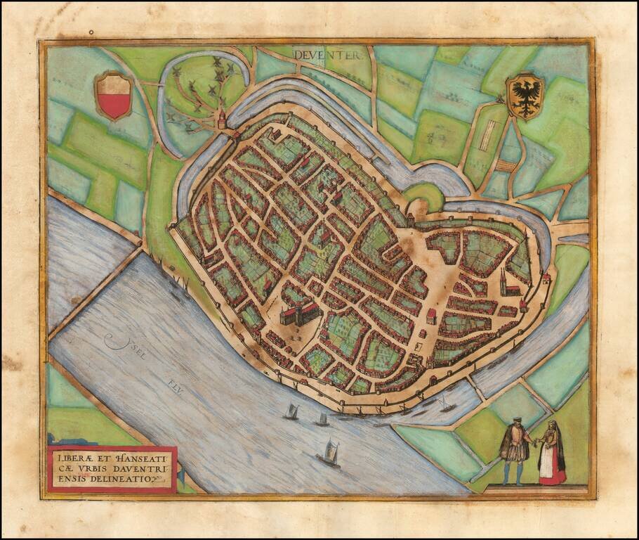
Fine early birds-eye view of Deventer. From Braun & Hogenberg's Civitatus Orbis Terrarum, the most important book of town plans and views published in the 16th century.
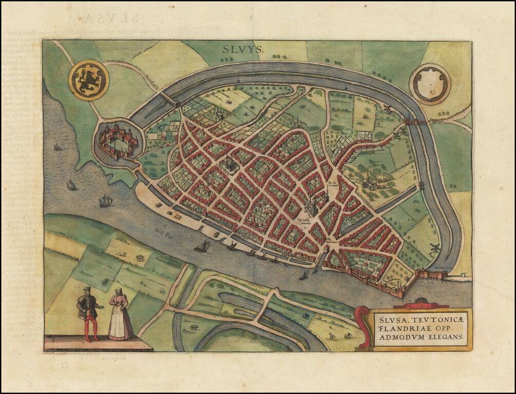
Fine early plan of Sluis, in Zeeland, published by Braun & Hogenberg. The town received city rights in 1290. In 1340, the Battle of Sluis was fought nearby at sea. In 1587, during the Eighty Years' War, the town was captured by Spanish troops...
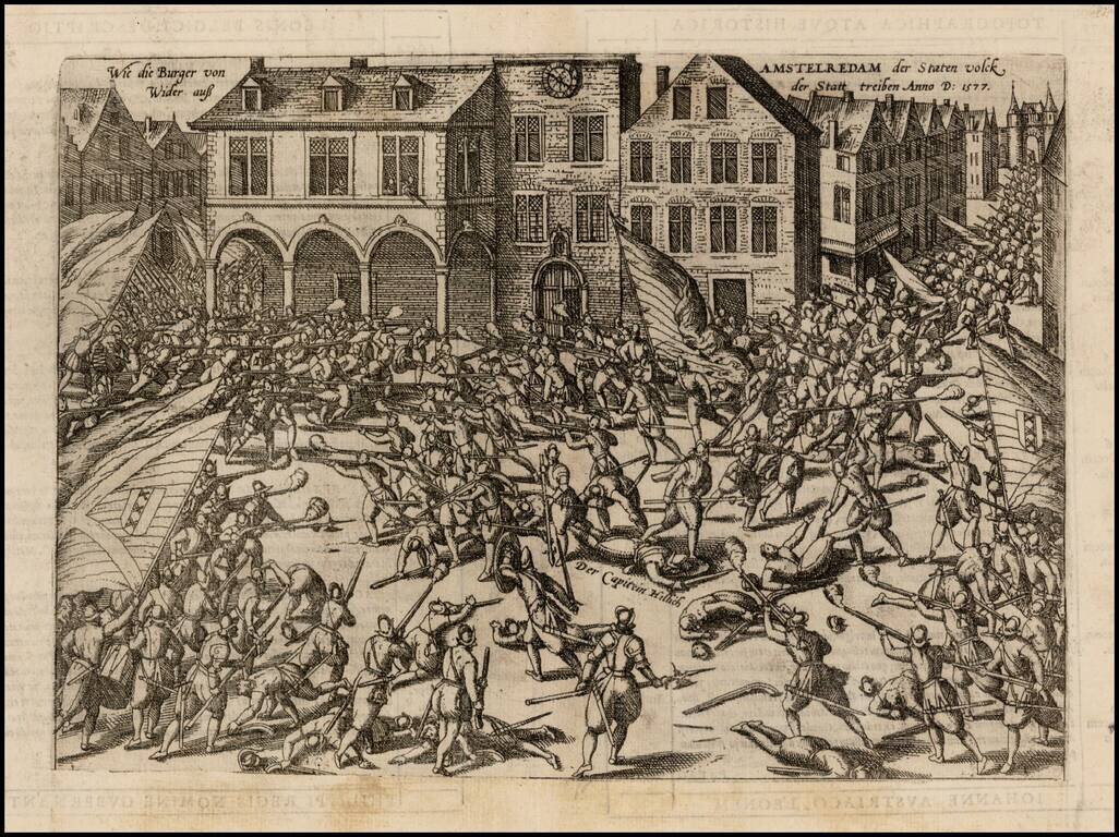
A dramatic antique engraving by Frans Hogenberg showing the troops of William of Orange battling with the citizens of Amsterdam, 23 November 1577. Captain Herman Helling is shown dead at the center of the fracas. This was an event during the Eighty...
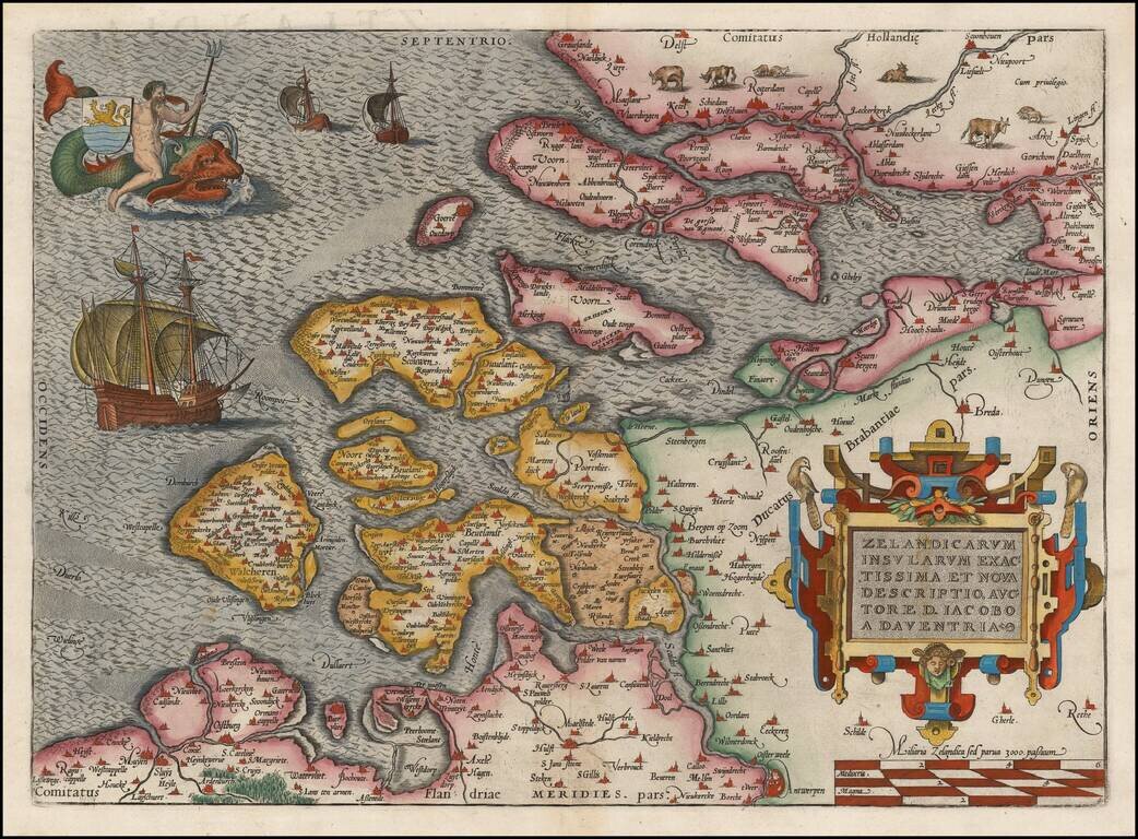
Nice full color example of this early state of Oretlius' decorative map of Zeelandia, including ornate cartouche, sailing ships and Triton riding a sea monster and carrying the coat of arms of the province. From Ortelius' Theatrum Orbis Terrarum, the...
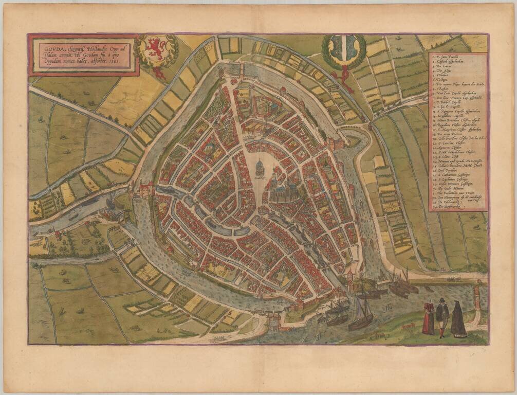
Nice old color example of Braun & Hogenberg's map of Gouda. This is a bird's-eye view of the city from the south. In the foreground is the confluence of the Gouwe and the IJssel. Prominent features are the town hall (Stadthuys) and the Gothic...
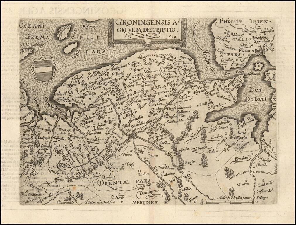
Nice example of this scarce map of Groningen, published in Cologne. The present map was produced by two of the primary Cologne School mapmakers, Johann Bussemacher and Matthias Quad. The Cologne School of cartography, was perhaps the only group of...
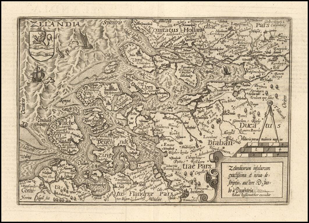
Nice example of this scarce map of Zeland in the Netherlands, published in Cologne. The present map was produced by two of the primary Cologne School mapmakers, Johann Bussemacher and Matthias Quad. The Cologne School of cartography, was perhaps the...
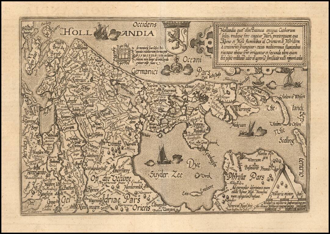
Nice example of this scarce map of Holland, oriented with west at the top, published in Cologne. The map was engraved by Henreich Nagel. The present map was produced by two of the primary Cologne School mapmakers, Johann Bussemacher and Matthias...
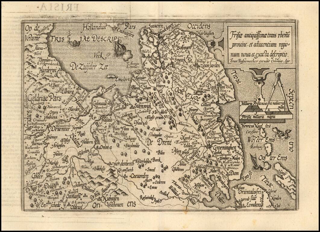
Nice example of this scarce map of Friesland, published in Cologne. The map is oriented with west at the top and extends to Drenth, Groeningen and part of Gelderland The present map was produced by two of the primary Cologne School mapmakers,...
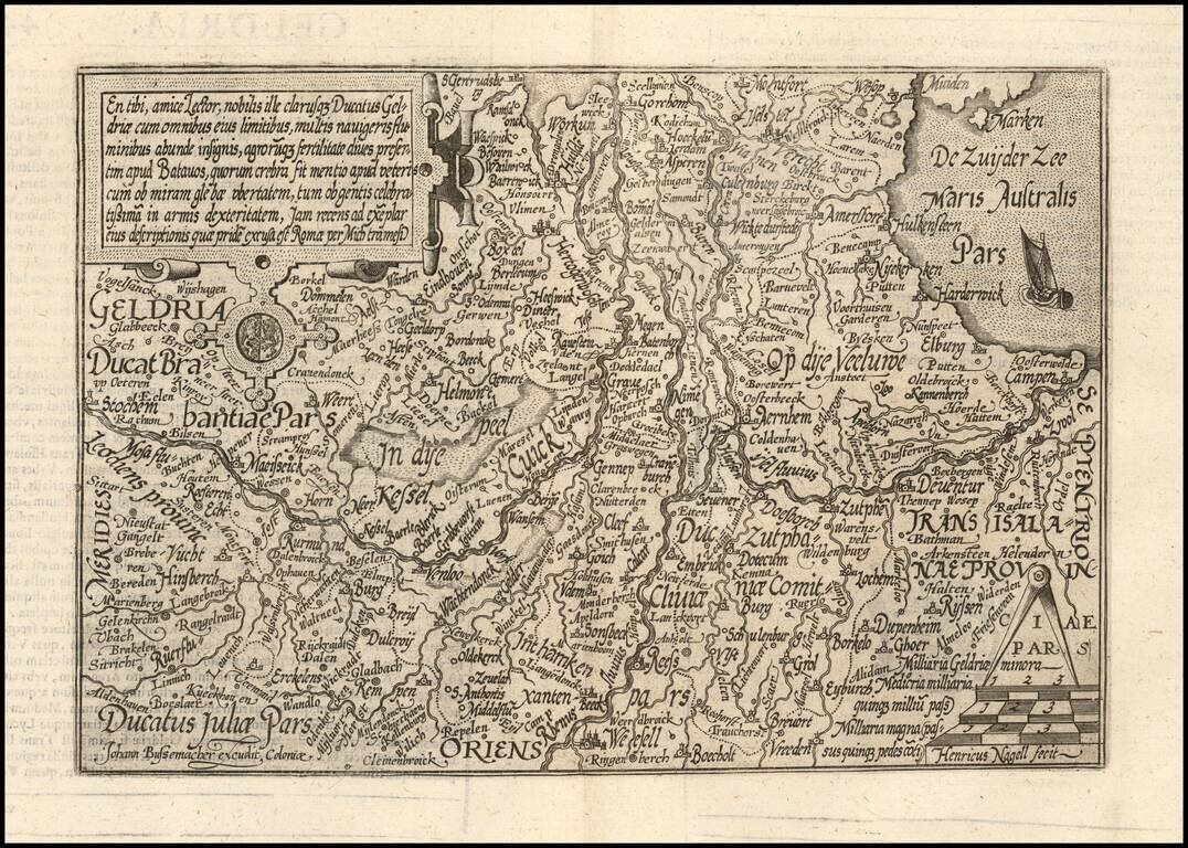
Nice example of this scarce map of Geldria, published in Cologne. The map is oriented with west at the top. The present map was produced by two of the primary Cologne School mapmakers, Johann Bussemacher and Matthias Quad. The Cologne School of...